Church Farm
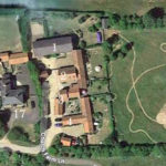
This was the most significant farmstead in the middle of the village. Historically, it was probably the centre of the Brewis manorial demesne and might have ended up called Manor Farm. The manor house, a substantial dwelling, lay not far away just to the north or north-west of the Church. The Brewis manor coalesced with other lands to become the major estate in the parish, generally known as the Manor of Steeple Morden, Browis & Odsey. It was acquired by the Earl of Hardwicke from the Leheup family in March 1755 and remained part of the Wimpole Estate until 1892.
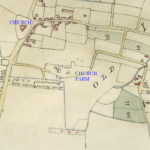
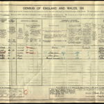
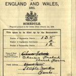
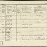
Apart from its proximity to the Church, no specific religious connection has been found for the farm, which probably owes its modern name to its geographic relationship with the Church?. In 1839 in the Tithe Apportionment it was designated Town Farm, which is akin to Manor Farm. However, a couple of years later on 31 December 1841 in the Rowley, Son & Royce records is a description and valuation of the farming stock etc of Samuel Strickland deceased of Church Farm, Steeple Morden {given as Guilden in error in the record]. In the 1841, 1901, 1911 Censuses and 1939 Register it is recorded as Church Farm. In other years, as was common, a general address of Church Street was shown.
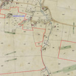
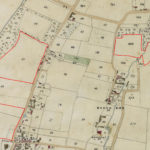
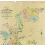
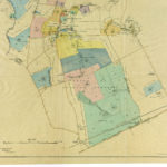
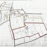
Below two portions of the Tithe Map have been marked up to show the lands forming Church Farm in 1839. They formed a block to the south of the farmstead, otherwise they were rather dispersed. In total there were 232 acres 0 roods and 20 poles and below is the land schedule from the Tithe Apportionment. The Plan numbers are as marked on the two portions of the Tithe Map. In the 1851 Census the farm is given as 230 acres employing 10 men and 3 boys. In 1861 230 or 250 acres employing 9 men and 9 boys. In 1871 234 acres and employing 9 men 6 boys and 4 women. Finally, in 1881 236 acres employing 4 men and 4 boys. Would be interesting to know why numbers employed dropped by 50% in 1881. Mechanisation with the steam engine? In other years, no acreage or employment details are given.
Tithe Apportionment 1839 Owner Earl of Hardwick Occupier Samuel Strickland
| No on Plan | Description | Cultivation | Acres | Roods | Perches |
| 15 | Town Farm Homestead | 1 | 1 | 37 | |
| 16 | Cinquefoil Close | Pasture | 4 | 1 | 33 |
| 40 | Lordship Grounds | Arable | 5 | 2 | 4 |
| 41 | Lordship Grounds | Pasture | 8 | 3 | 23 |
| 42pt | Lordship Grounds | Arable | 3 | 0 | |
| 47 | Gerrards Grove | Wood | 3 | 4 | |
| 51 | Lordship Ground | Arable | 13 | 1 | 37 |
| 113 | Coles Mead | Arable | 3 | 20 | |
| 135 | Bush Andrews | Arable | 6 | 3 | 19 |
| 136 | Slipes | Arable | 4 | 0 | 23 |
| 137 | Pond Close | Pasture | 8 | 3 | 10 |
| 138 | Rick Yard | 1 | 33 | ||
| 139 | Grass Field | Arable & Pasture | 9 | 2 | 20 |
| 140 | First Church Field | Arable | 27 | 0 | 4 |
| 141 | Mocha Field | Arable | 24 | 1 | 12 |
| 142 | Symonds Ponds | Arable | 19 | 0 | 20 |
| 143 | Second Church Field | Arable | 18 | 3 | 21 |
| 242 | Near Litlington Field | Arable | 21 | 2 | 29 |
| 243 | Far Litlington Field | Arable | 22 | 1 | 31 |
| 267 | Browis | Arable | 18 | 1 | 13 |
| 282 | Cranes | Pasture | 2 | 2 | 33 |
| 284 | Cranes | Arable | 4 | 1 | 19 |
| 286 | Cranes | Pasture | 4 | 1 | 35 |
| Tithe Free | 2 | 2 | 20 | ||
| Total Area | 232 | 0 | 20 |
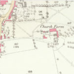
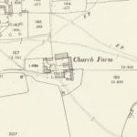
The extent of the farm is not shown by the Enclosure Award and Map 1816, but interestingly the farm buildings and house are depicted in similar configuration as on the Tithe Map 1839. Subsequently, all the farm buildings were destroyed by two incendiary fires in 1843. The 1887 and 1903 OS Maps show the post fire layout of the buildings, as seen in modern times. The house survived the fires, but appears to have been rebuilt in brick about 1860. Also of note from the Enclosure Map is Church Farm is shown as also accessed on the east from Cheyney Street and The Green via what is now a footpath – Black Lane. This would appear to have then been a more substantial thoroughfare and Church Farm would have been effectively on a through route joining Cheyney Street and The Green to Church Street.
The Bennetts
There is no ready record of the tenants of Church Farm, although it is possible to identify the “Church Farm” holding with John Bennett as the tenant in the 1755 Deed transferring ownership of the Manor from the Leheup family to Hardwicke and below is a transcript.
Messuage or farmhouse and land occupied by John Bennett 1755
| Description | Name | Area |
| Close | Browis Close | 6a |
| Close | Browis | 7a |
| Pightle | Browis Grove | 2a |
| Pightle | Browis Grove | 1a 2r |
| Close | Bush Andrew Close | 7a |
| Close | Pond Close | 6a |
| Pightle | Church Dean Grove | 2r |
| Pightle | Pond Close Grove | 1a |
| Close | Saint Foin Close | 5a |
| Pightle | Lying by The Green | 2r |
| Land | In Church Field | 58a |
| Land | In Middle Field | 59a 3r |
| Land | In Field Next Litlington | 50a 2r |
| Total Area | 204 3r |
John Bennett married Jane Smith at Steeple in 1713, so may have taken the farm on then? He died 1769 and his prime beneficiary was his nephew John, who may have succeeded his uncle at the Farm. John junior is not well recorded, but may have died in 1806.
The Stricklands
It is uncertain, when the Bennetts were succeeded as tenants by the Stricklands. The Samuel Strickland shown as tenant in 1839 was Samuel 1763-1841, who appears to have been the first of that family, to take on the farm. This may have been in 1786, when Samuel got married or possibly later in 1806. He appears in the Land Tax records, which survive from 1810. When Samuel senior died in 1841 he was followed as tenant by his son also Samuel 1784-1873.
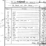
Samuel Strickland, presumably junior rather than executors, held a farm and household sale on 14 October 1842, which appears to have been a tidying up sale, rather than a full dispersal. It was bulked up with lots from five other vendors and the Strickland lots represented 75% of value sold. There was little by way of farm tools and machinery, which is probably to be expected as son Samuel was continuing to farm. Interestingly, 73 sheep, 4 cows, 37 pigs and 4 horses were sold. The full schedule of the sale is to be found here.
The Hunts & Frohocks
After Samuel junior died childless in 1873, Frederick James Hunt, who was son of a farming family at Shingay, took the tenancy and in the 1881 Census was living alone at the farm. He subsequently married and raised a family there. He moved to Rectory Farm, Guilden Morden between 1901 and 1911 and Charles and Thomas (father & son) Frohock from Willingham took on Church Farm. They appear to have specialised in sheep, potatoes and Hackney horse breeding. After Thomas died in 1917, the Frohocks gave up the tenancy in September 1918, when a dispersal sale was held.
The Parrishs
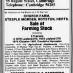
From 29 September 1918 Francis William Bertram Parrish from Home Farm, became tenant. Subsequently he bought the farmhouse and a small quantity of the land at the 1933 auction sale by the Executors of John Jarman of Kneesworth. Bert Parrish, as he was known, died in 1939 and his widow Minnie in 1949. The farming enterprise was taken over by the youngest son James Graham, who had been living since 1937 with his wife Marjorie in a house named Gravenhurst, which had been built for them on a plot of farm land in Church Farm Lane. They moved to the main house in 1950 and Gravenhurst was sold. Graham died in 1965 leaving Marjorie to run things with the support of Ben Briers of Hillside Farm. A farm equipment dispersal was held in 1980. Finally, after the death of Marjorie in 1992 the Parrish family trust sold the farmhouse, farm buildings and immediate land in 1994 and that was finally the end of Church Farm, as a working farm.
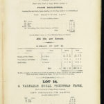
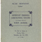
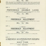
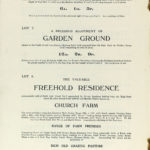
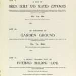
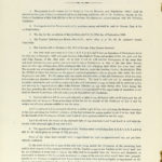
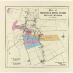
Church Farm had been sold as part of the Wimpole Estate auction sale on 31 December 1892 and bought, along with Moco Farm and Lower Gatley Farm, by John Jarman of Kneesworth, who continued to let the farms, rather than farm them in hand. The 1892 conveyance lists the plots belonging to Church and Moco Farms in Schedule 1. After John Jarman’s death, his trustees sold the Church & Moco Farms at auction on 12 July 1933, described as 230 acres in total, but split across ten lots for purposes of sale. Details of this and prior sales are recorded as Memoranda and a Note on the original 1892 conveyance and are summarised here.
31 December 1892 Conveyance of Church, Moco and Lower Gatley Farms
Hardwicke Estate Trustees to John Jarman Purchase Price £12,976 19s 7d
Described as: All those two freehold farms known as Moco Farm and Church Farm, both situate Steeple Morden and the farmhouses cottages buildings lands and hereditaments containing 235a 21p described in first schedule and delineated on plan edged in yellow now occupied by F James Hunt Secondly all that freehold farm known as The Lower Gatley End Farm with the farmhouse buildings lands and hereditaments containing 261a 7p and now in occupation of William Westrope described in second schedule and delineated on plan in pink John Jarman to have right of way to parcel 184 through parcel 186 retained by Hardwicke Trustees
Memorandum By Indenture 7 January 1921 between 1 Exors of John Jarman, 2 Mary Jarman and 3 Frederick Thomas Parrish The Lower Gatley End Farm conveyed to Frederick Thomas Parrish
Memorandum By Indenture 21 May 1921 between 1 Exors of John Jarman 2, Mary Jarman and 3 Melbourn Rural District Council a piece of land containing 1a 2r part of parcel No 188 conveyed to Melbourn RDC
Memorandum By Deed 22 July 1933 a piece of land (part of Church Farm) containing a frontage to the High Street from Ashwell to Potton towards the east of twenty feet and a depth of forty feet was conveyed to the North Metropolitan Electric Power Supply Company
Memorandum By Conveyance 5 October 1933 between 1 Exors of John Jarman and 2 William South 31a 0r 35p of land on West side of road leading from Steeple Morden to Guilden Morden being Lot 1 at sale by auction 12 July 1933 conveyed to William South
Memorandum By Conveyance 5 October 1933 between 1 Exors of John Jarman and 2 Ernest Wilfred Pepper 31a 1r 38p of land on East side of road leading from Steeple Morden to Ashwell and Morden Station being Lot 2 at sale by auction 12 July 1933 conveyed to Ernest Wilfred Pepper
Memorandum By Conveyance 3 October 1933 between 1 Exors of John Jarman and 2 George Frederick Jarman 67a 0r 31p of land and buildings known as Moco Farm being Lots 5 and 6 at sale by auction 12 July 1933 conveyed to George Frederick Jarman
Memorandum By Conveyance 3 October 1933 between 1 Exors of John Jarman and 2 Francis William Bertram Parrish 25a 3r 12p of land known as Church Farm with dwelling house and outbuildings being Lot 8 at sale by auction 12 July 1933 conveyed to Francis William Bertram Parrish
Note Lots 3, 4 and 7 at sale by auction 12 July 1933 containing together 73a 2r 22p were sold to the Cambridgeshire County Council which as the largest purchasers for value are entitled to the within written indenture
LINKS TO CONNECTED PAGES: Modern Church Farm House Modern Church Farm Barns 1 Church Farm Lane
3 Church Farm Lane 5 Church Farm Lane 9, 11 & 13 Church Farm Lane
Click on any image below to view. Click again to enlarge. Drag to view entire image.
Photographs & Maps
Wimpole Estate Sale 1892
Jarman Sale Particulars 1933 & Parrish Dispersal Sale 1980
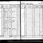
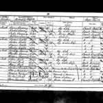
Census Returns Church Farm 1841-1939
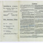
Fire Insurance Policy 1927
Last Updated on February 6, 2026

