Franklin’s Farm
This farmstead is at the north end of Hay Street on the east side and has been out of use for many years.
Later also known as Green Man Farm for its proximity to the Green Man PH on corner of Hay Street and Bogs Gap.
Franklin’s Farm was originally named after the tenant John Franklin, who lived at Brook End, in the house that today is Glendale, 9 Brook End. He was variously a farm labourer, dealer, poultry dealer and then in the 1881 Census he was a farmer with 64 acres employing 2 labs and 2 boys and continued as farmer in the 1891 Census. In the Trade Directories 1883-1900 his trade is given as farmer and in the 1904 Directory as fruit grower. In the 1901 Census he had become a market gardener and in the 1911 Census John age 70 with wife Mary Ann age 87, daughter Mary Ann age 45 and son William age 43 are all bracketed together with occupation given as market gardeners working as J Franklin & Son.
Click for more about the Franklin family.
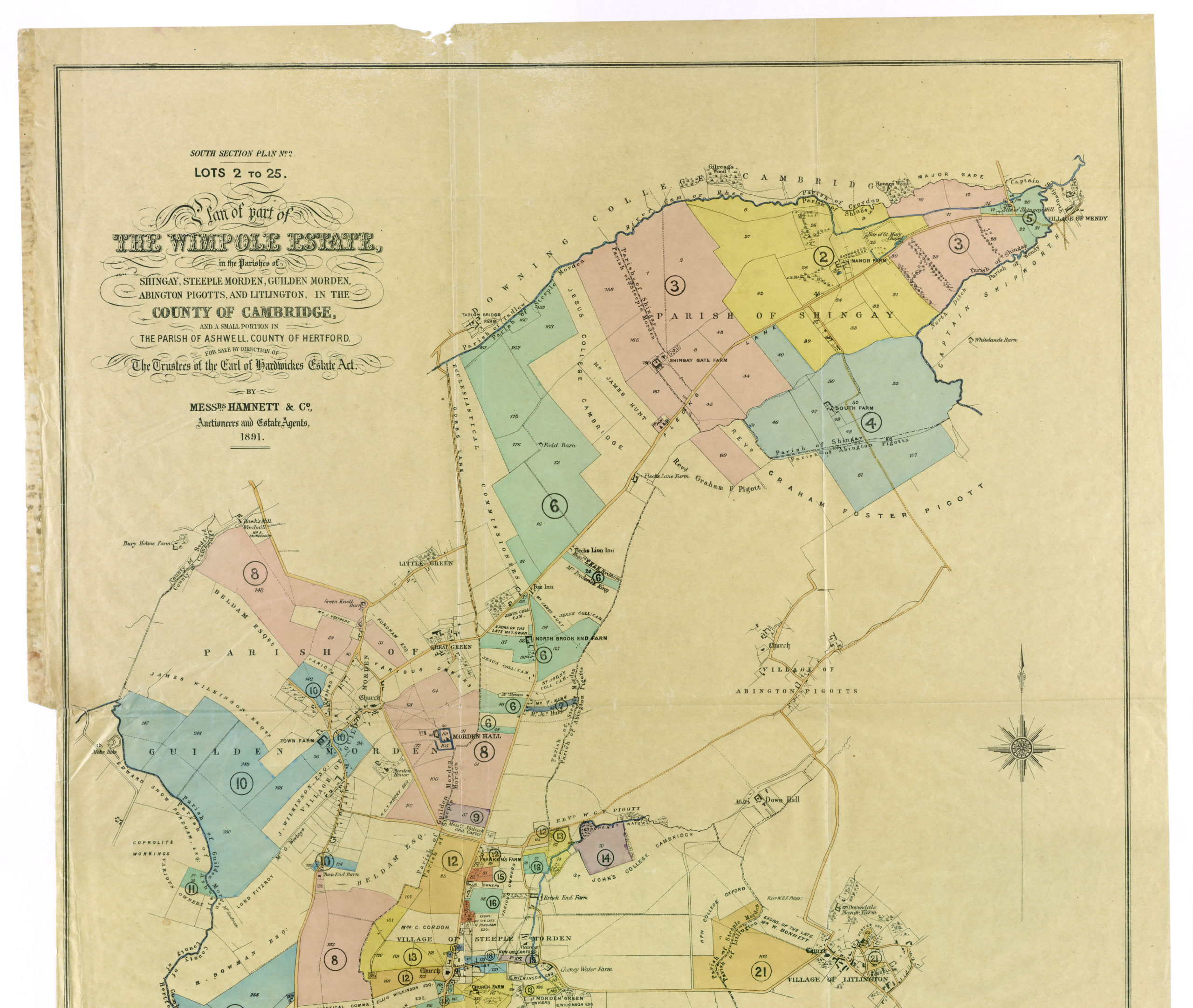
The eponymous farm was a small assemblage of various pieces of land owned by the Wimpole Estate, which in the 1870s were let to John. The land involved is shown marked up on the 1839 Tithe Map and it totalled then 51a 2r 1p, of which 12a 2r 2 was in hand, 19a 0r 14p let to James Christmas, 6a 1r 28p to Benjamin Christmas and 13a 1r 37 to Samuel Strickland of Church Farm. The letting to John Franklin as one holding represented a comprehensive consolidation of those several holdings.
Franklin's Farm lands marked in red on the 1839 Tithe Map
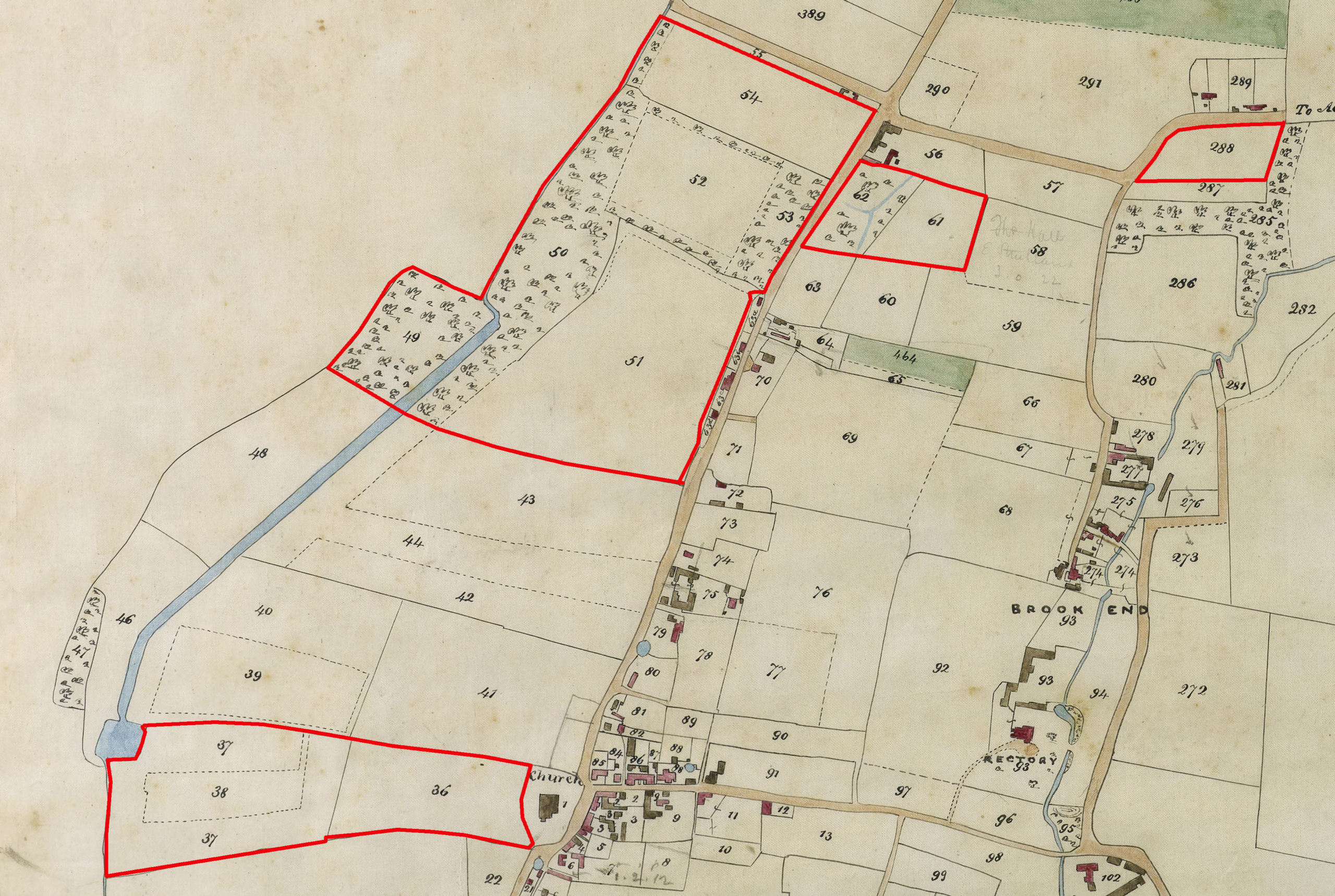
The small block of land number 62 on the map to the east of Hay Street is where a new farmstead with barns, stables and animal pens was constructed about 1880. The farmstead still stands today, although dilapidated. On the map in 1839 it is shown as woodland.
Sale of Franklin’s Farm 1892 and 1948
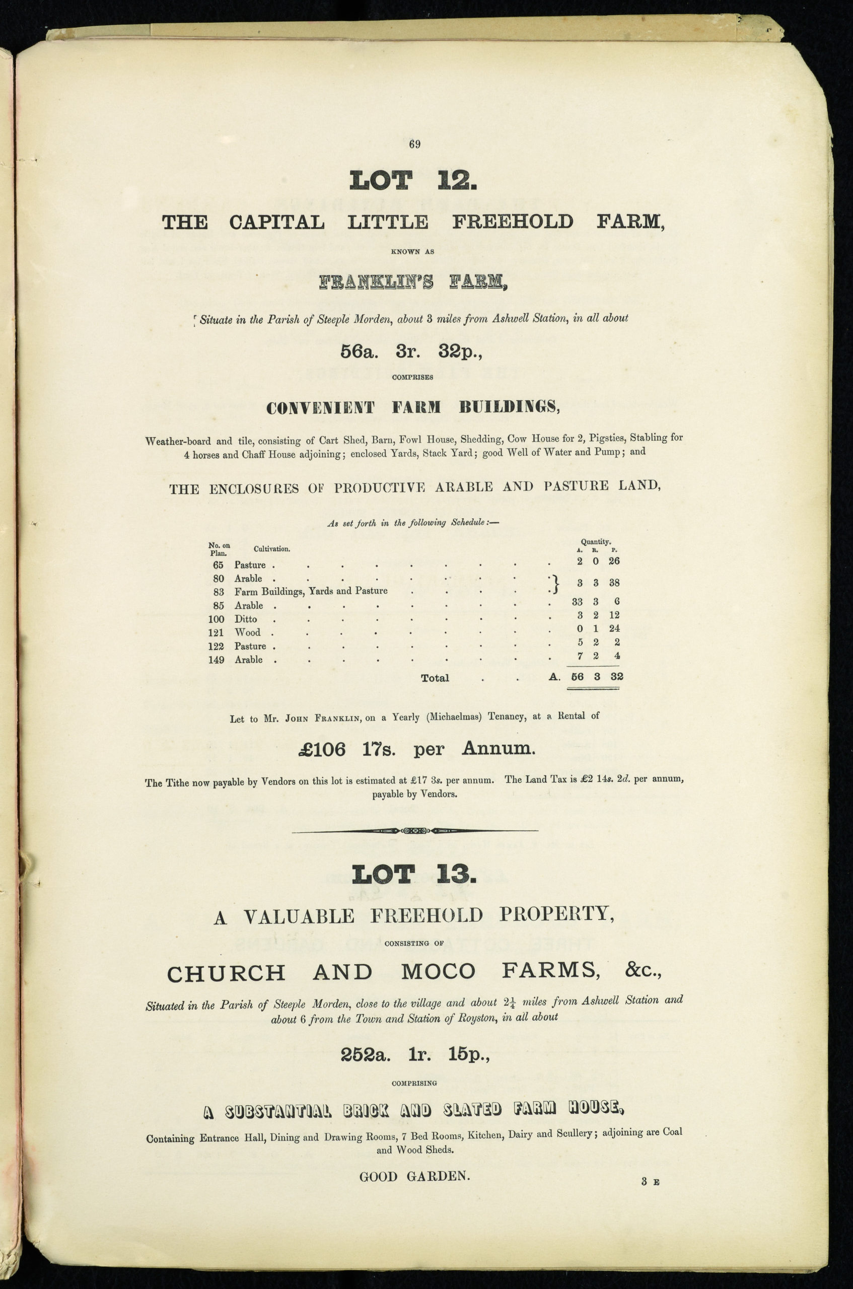
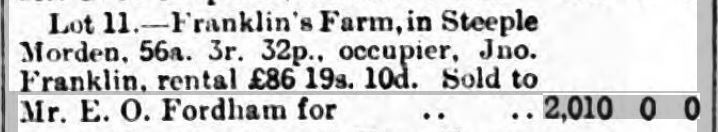
At the dispersal sale of the Wimpole Estate in 1892 Franklin’s Farm was bundled up as one lot – Lot 12 in the 1891 particulars and map and Lot 11 for the actual sale in 1892. The total extent was given as 56a 3r 32p. The lot was bought by E O Fordham on behalf of the Steeple Morden Benefit Society for £2010. Subsequently the land was split and let to various tenants. On two plots fronting the west side of Hay Street two pairs of cottages were built. In 1948, when the Benefit Society was wound up all the land and cottages were sold in multiple lots and generally bought by local men. The dispersal of the land in this way ultimately resulted in the building of new dwellings along the west side of Hay Street.
Click on any image below to view. Click again to enlarge. Drag to view entire image.
Maps & Sale Particulars

Last Updated on September 17, 2025