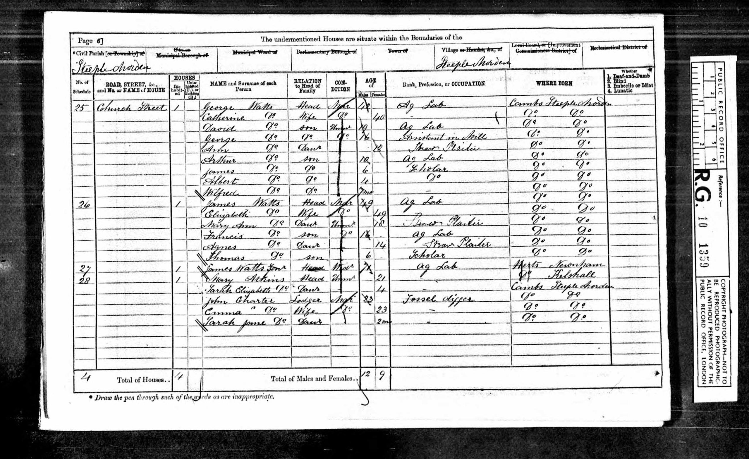
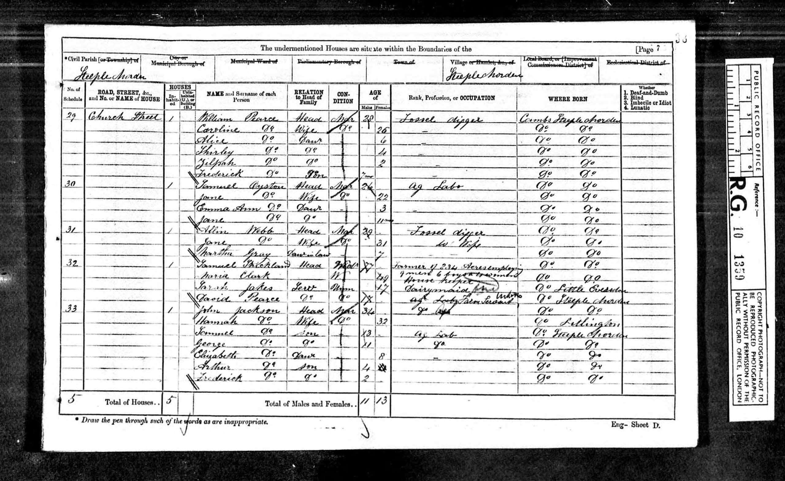
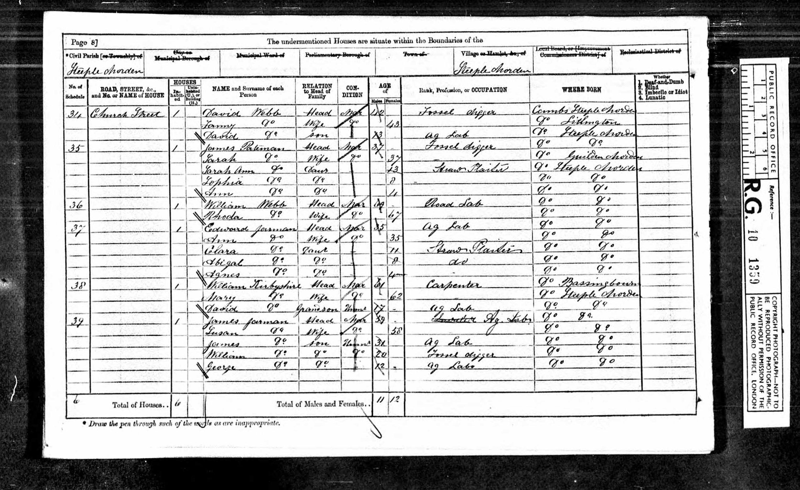
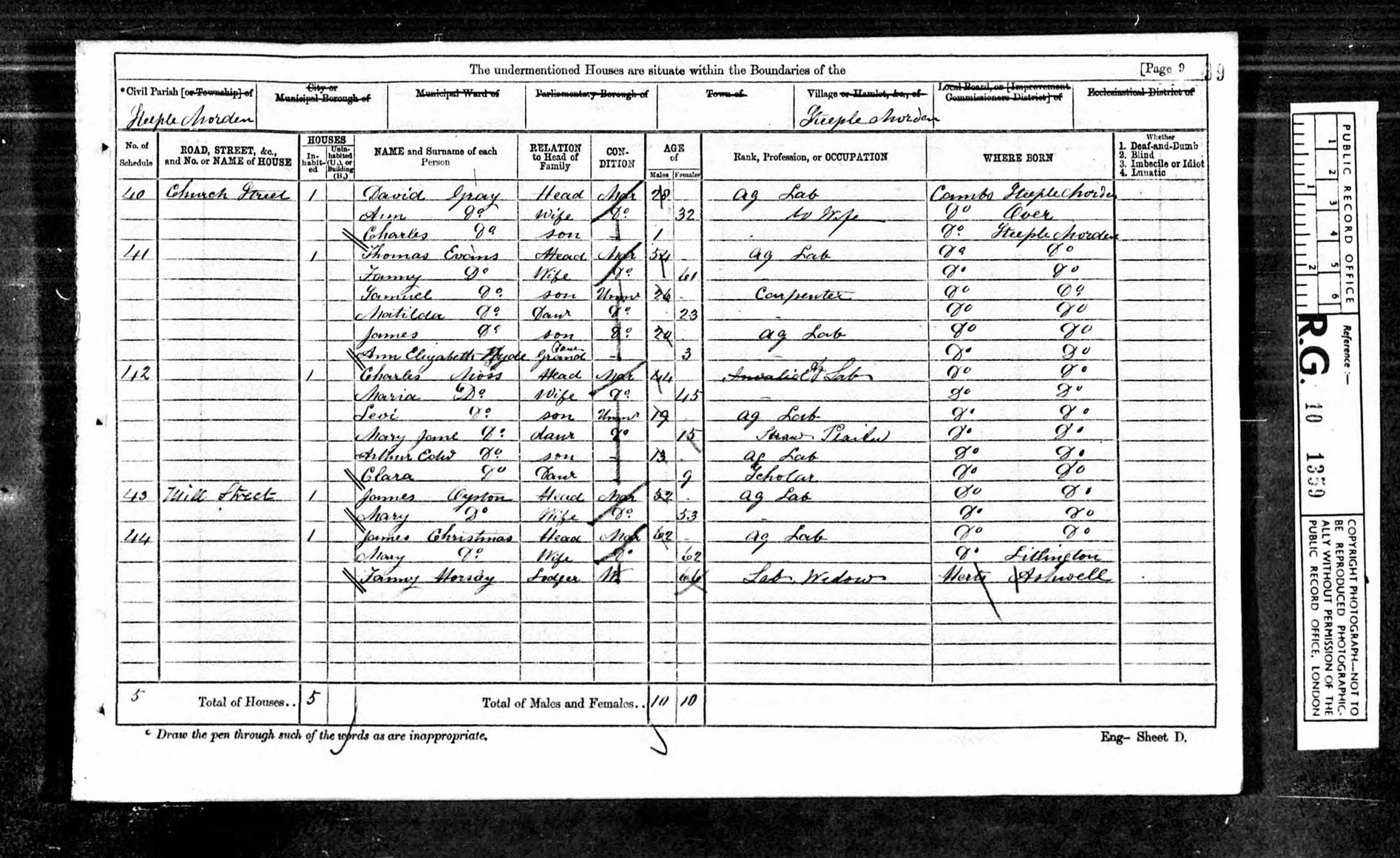
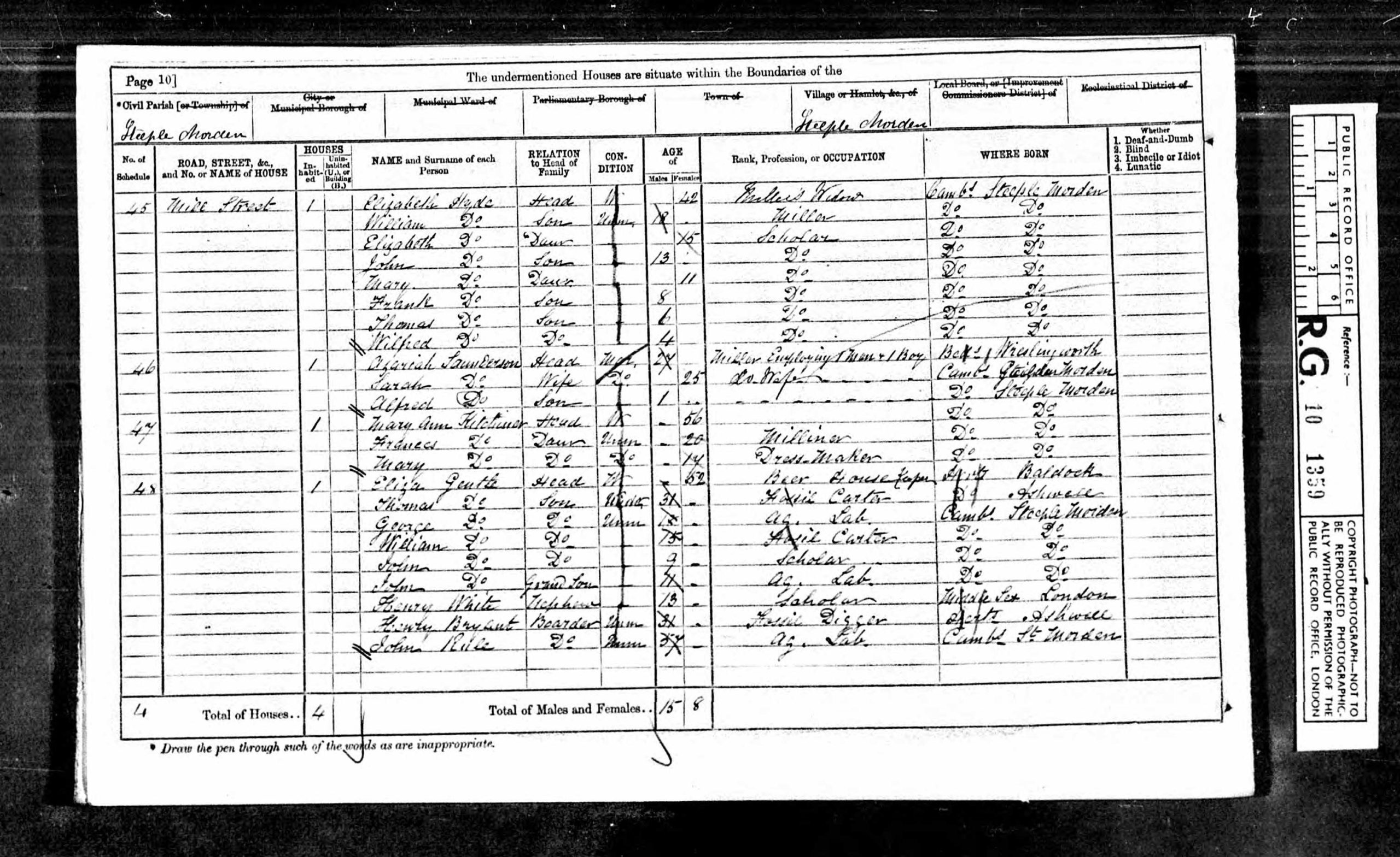
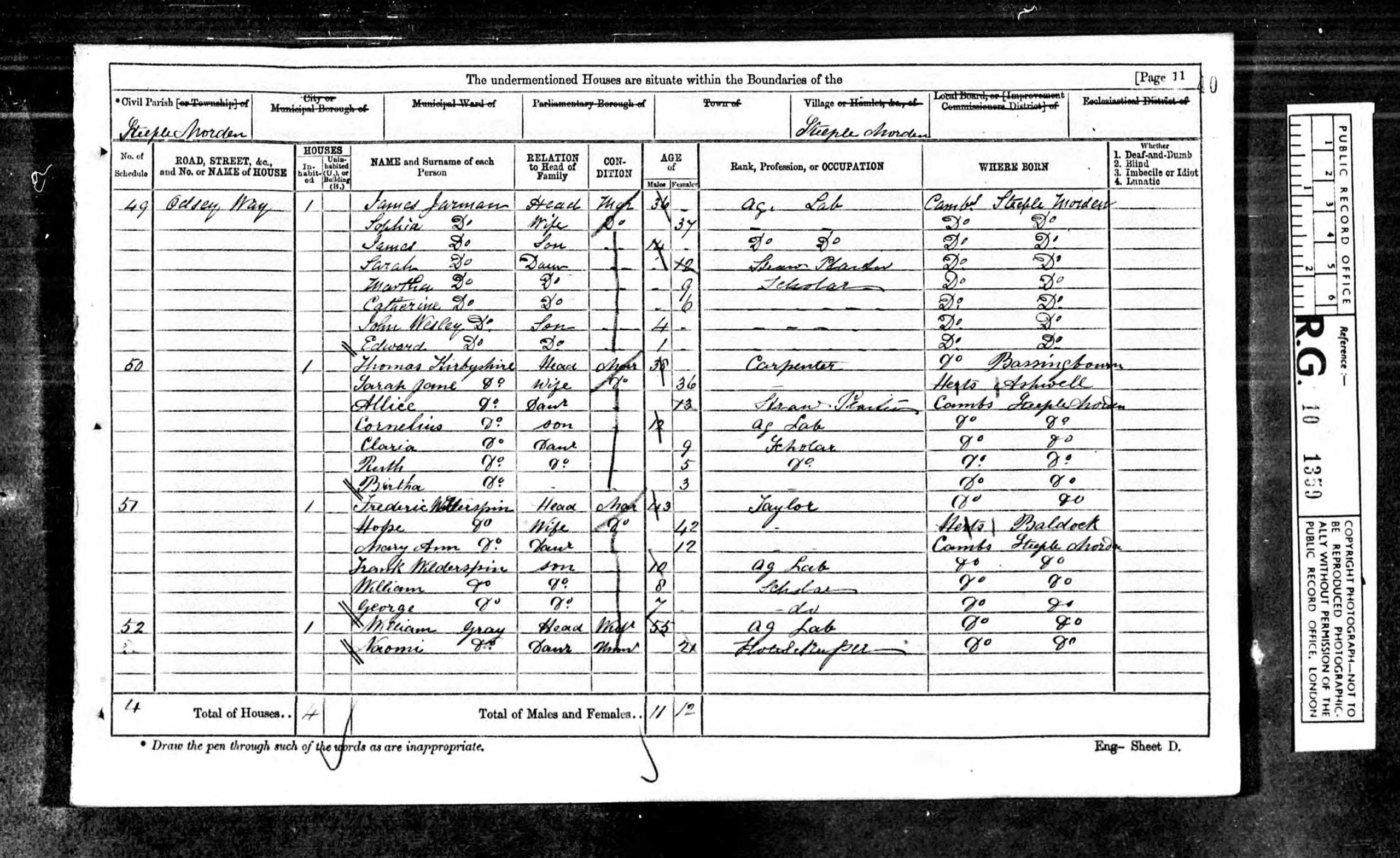
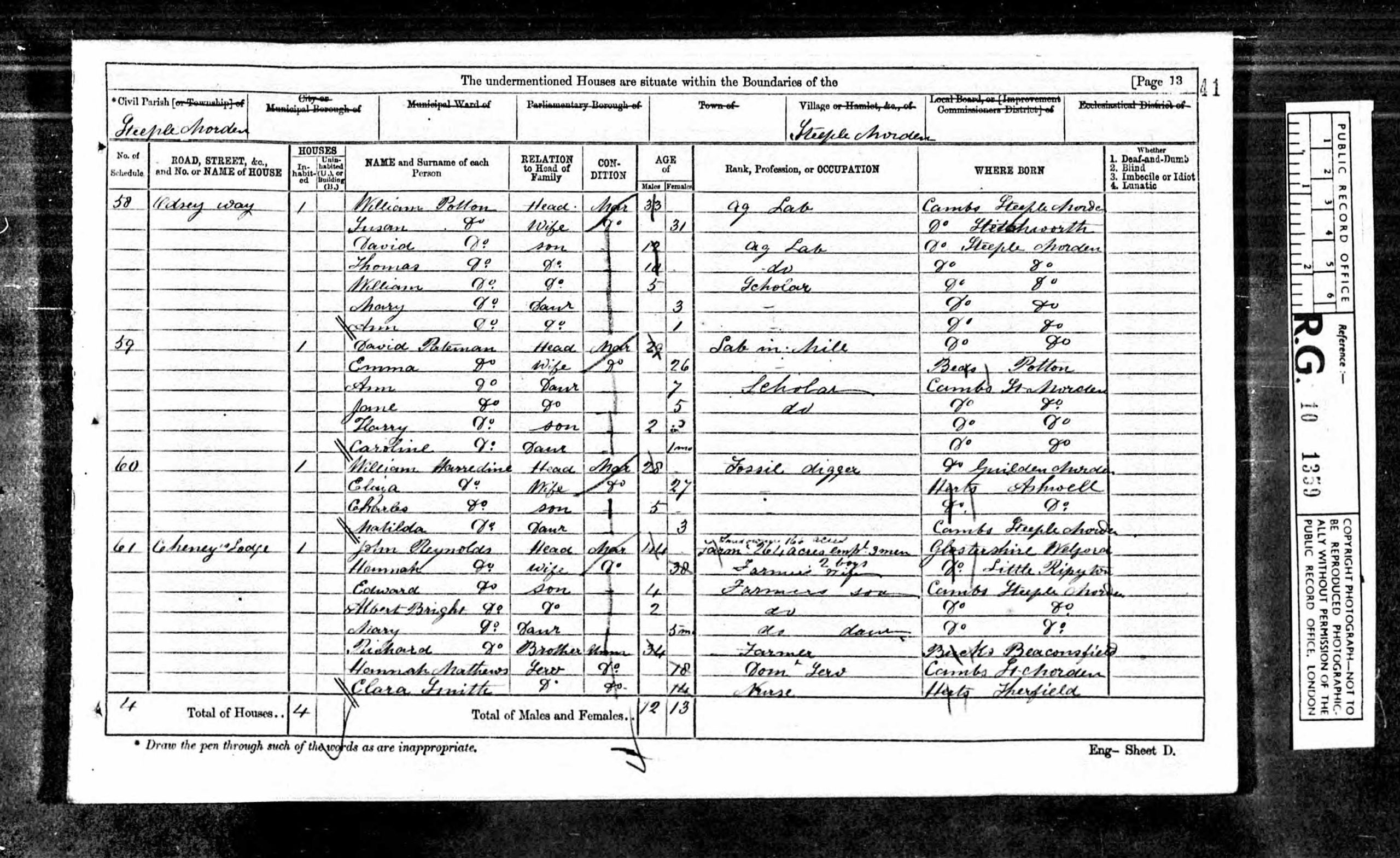
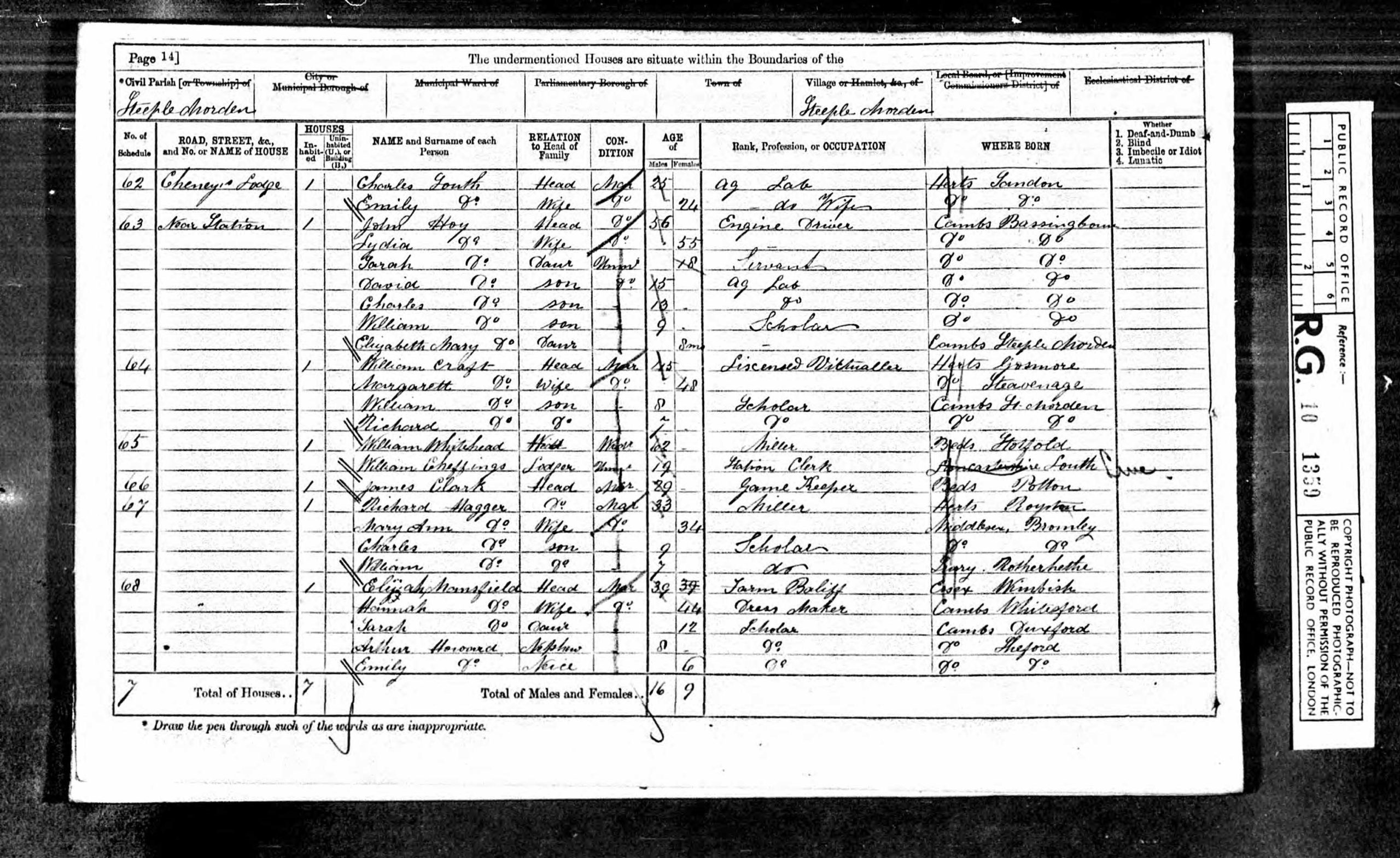
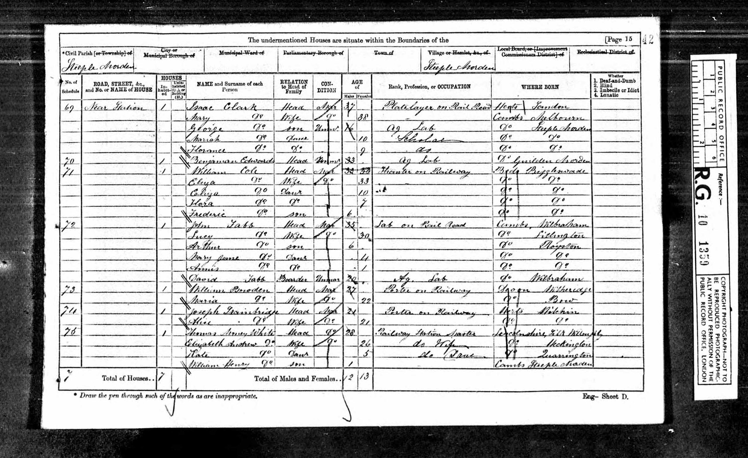
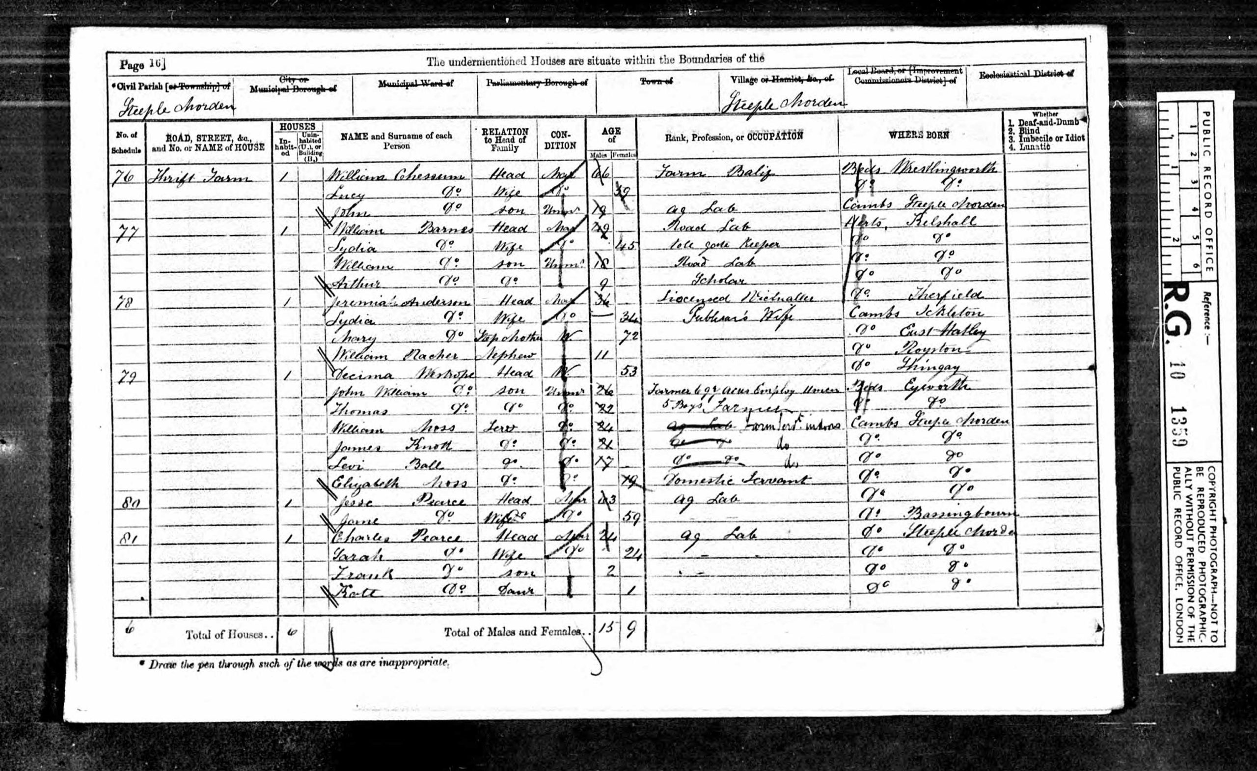
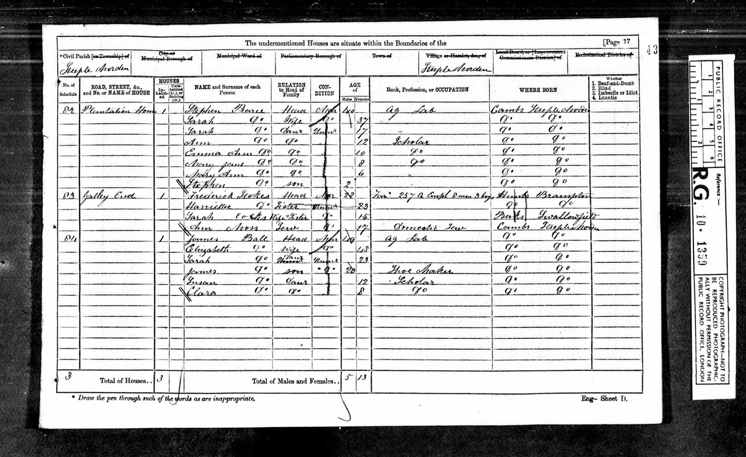
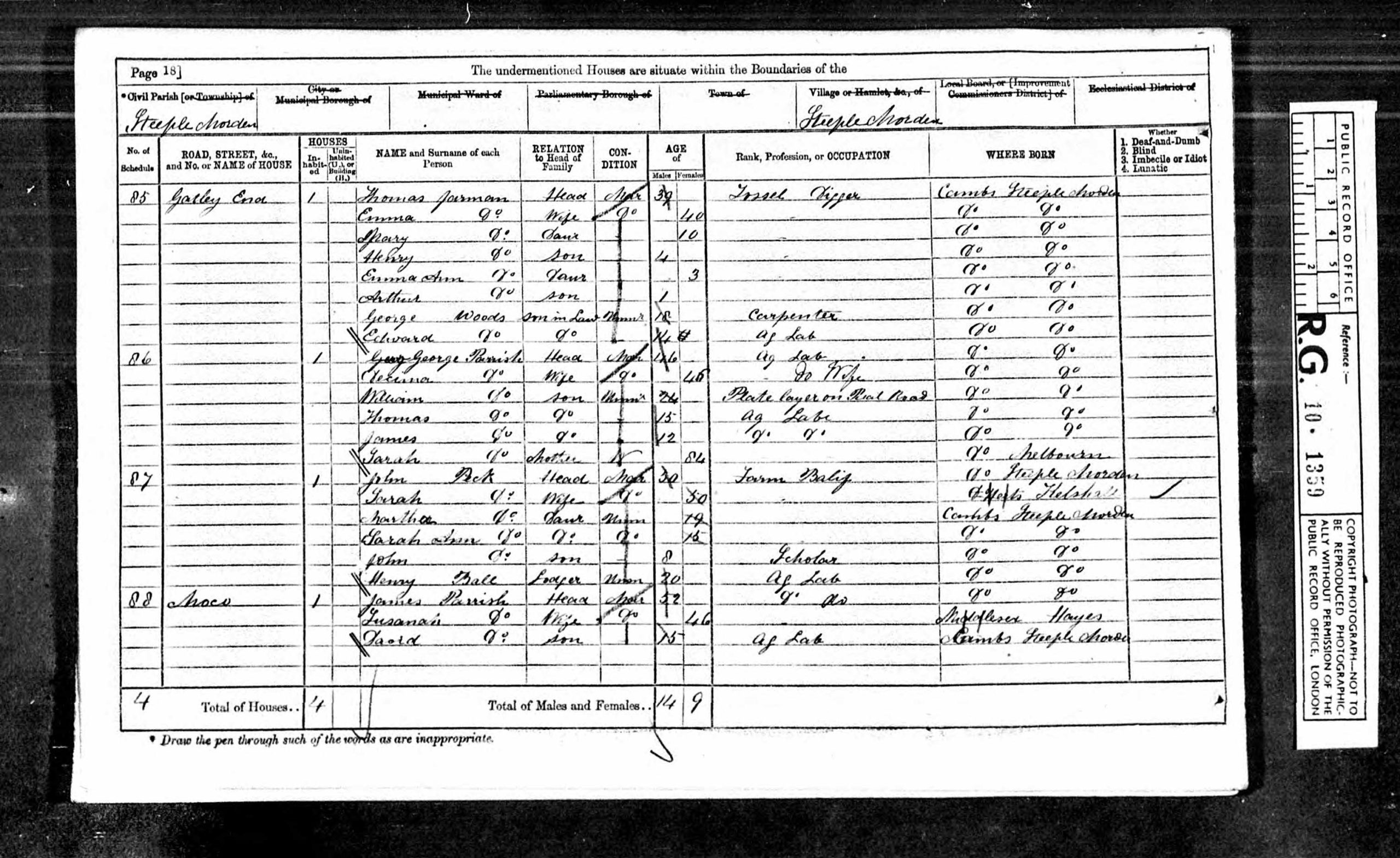
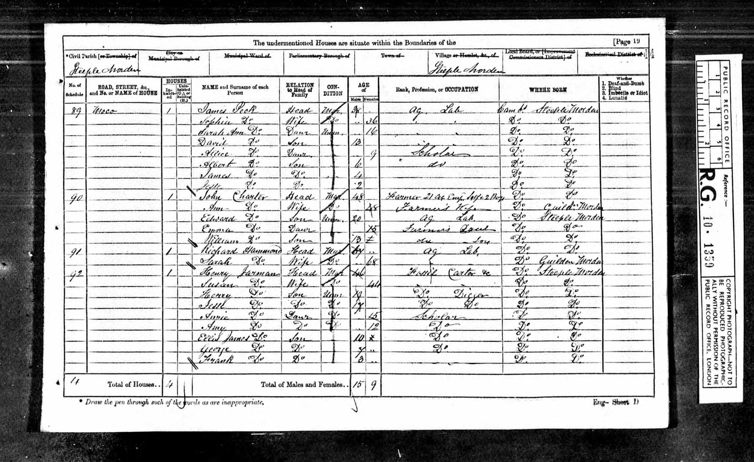
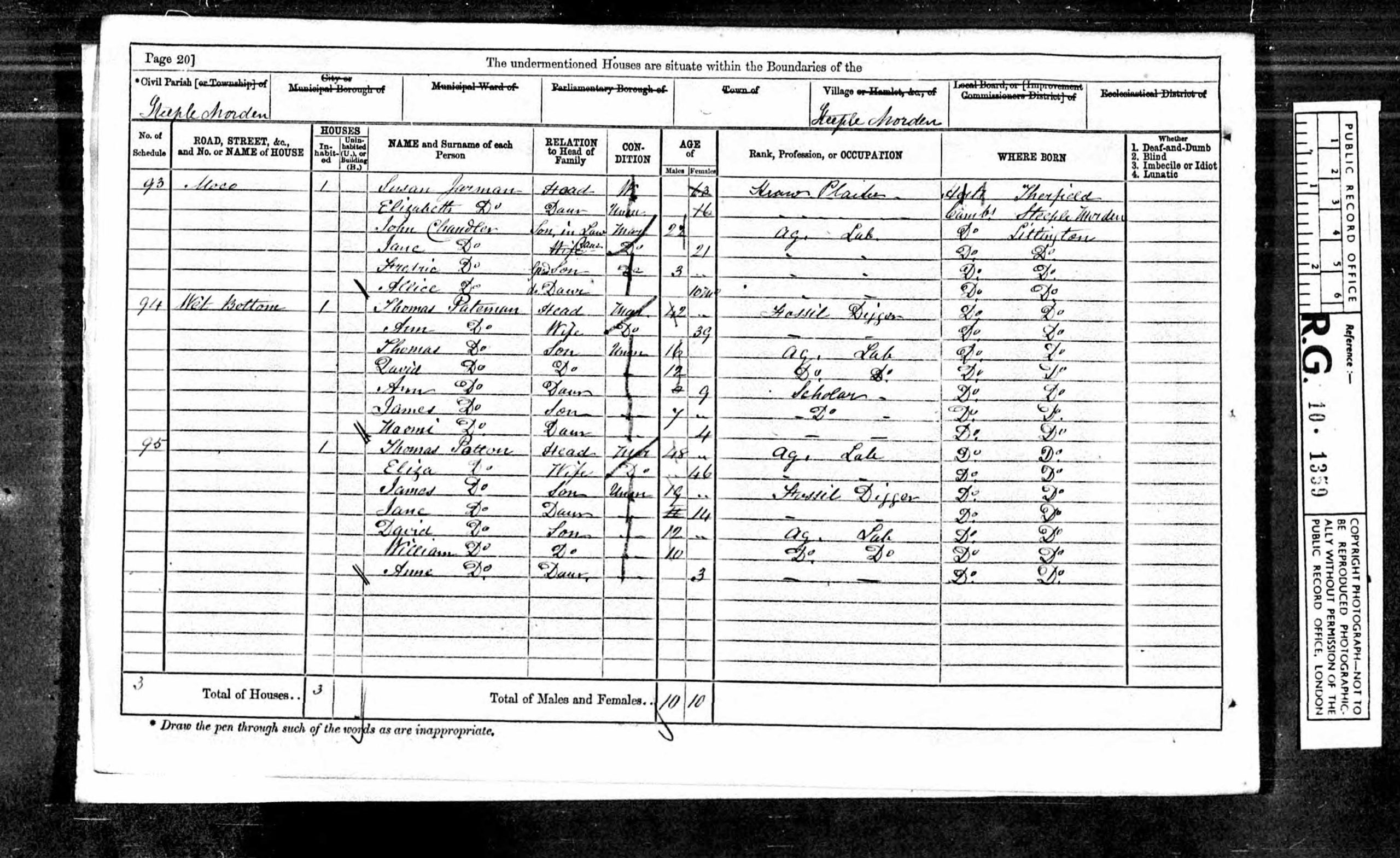
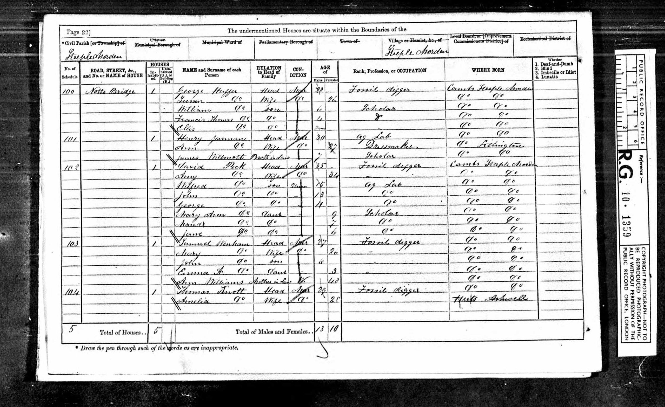
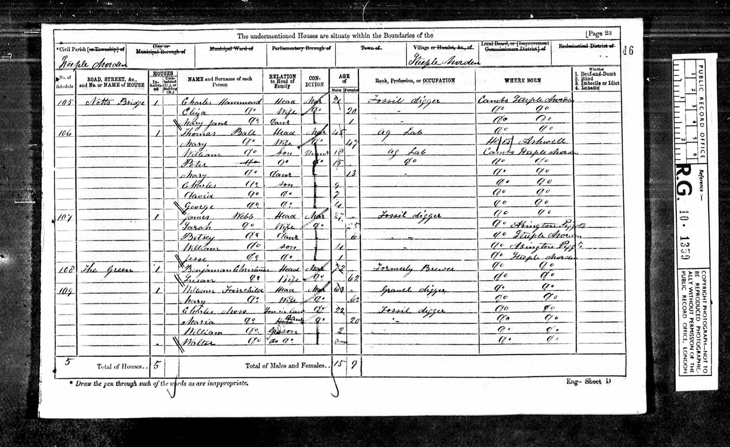
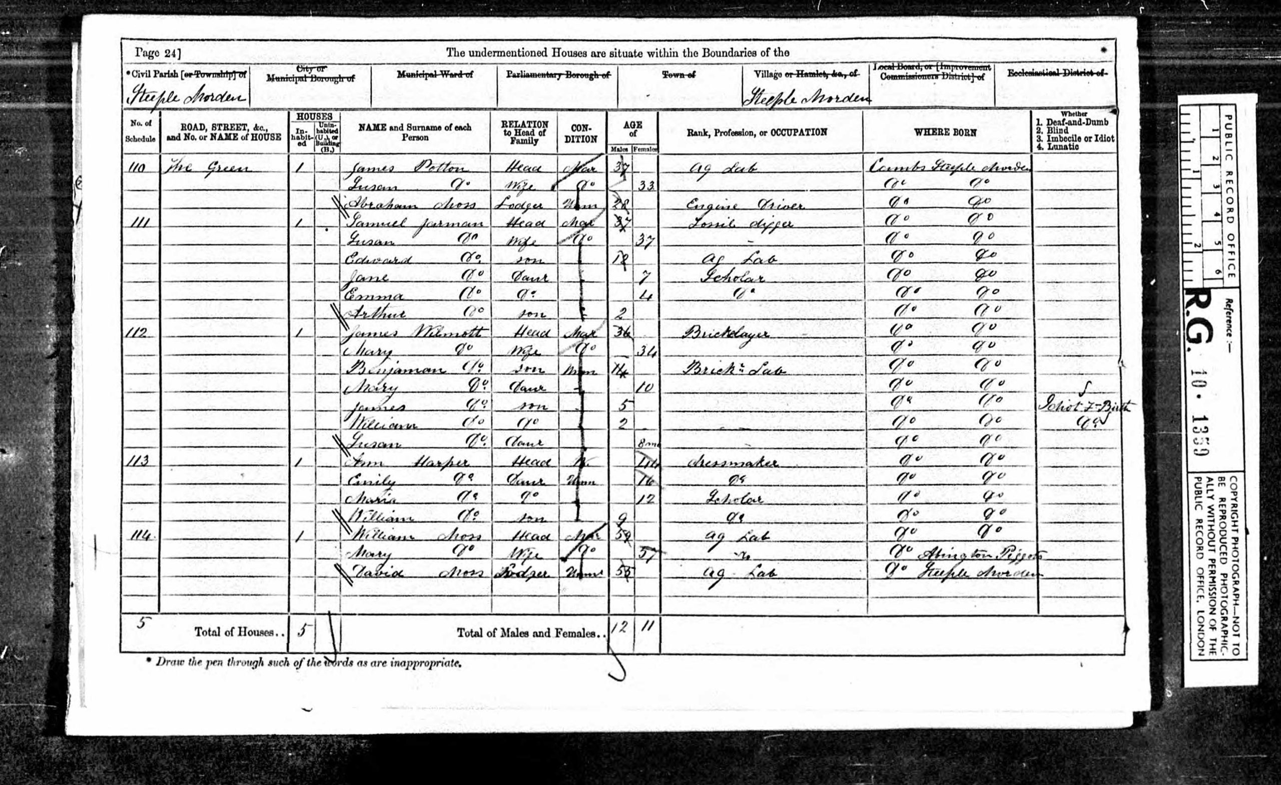
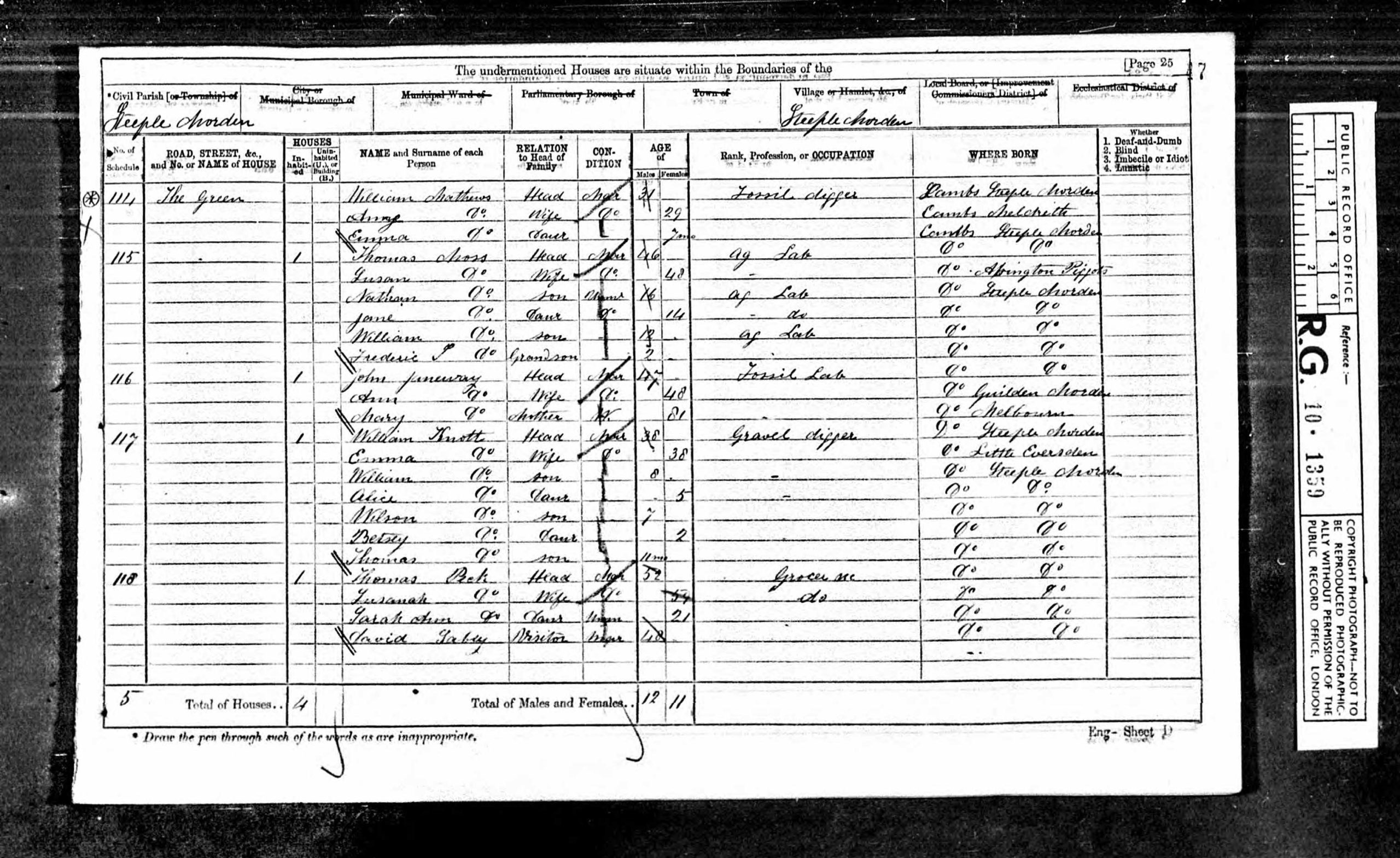
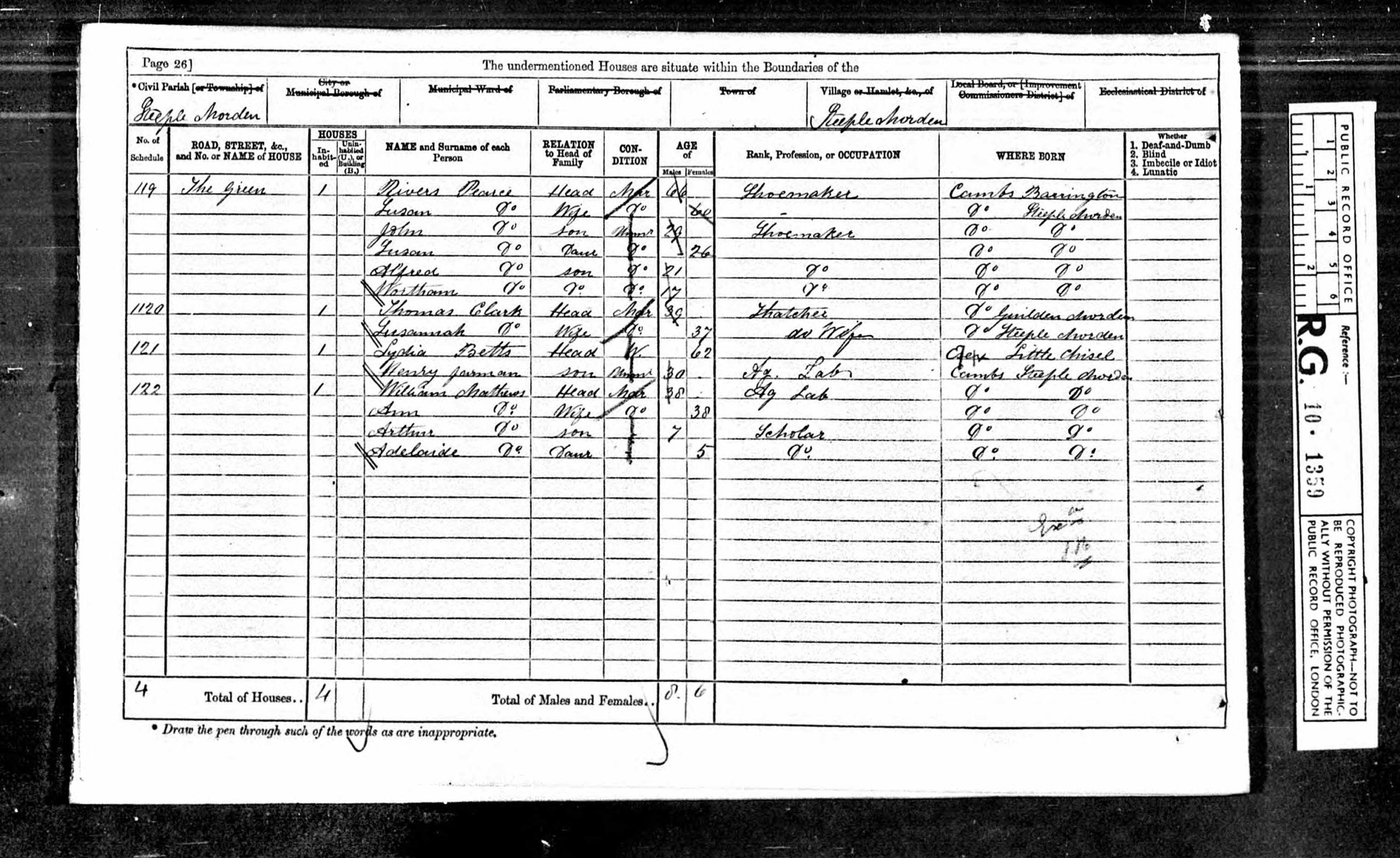
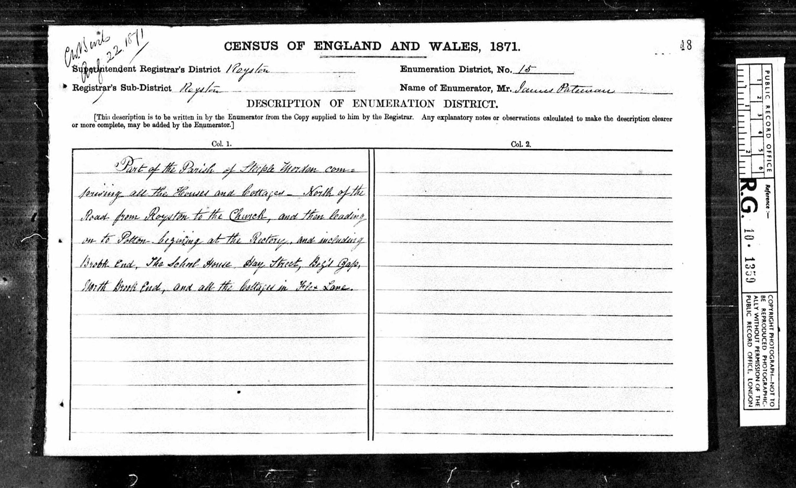
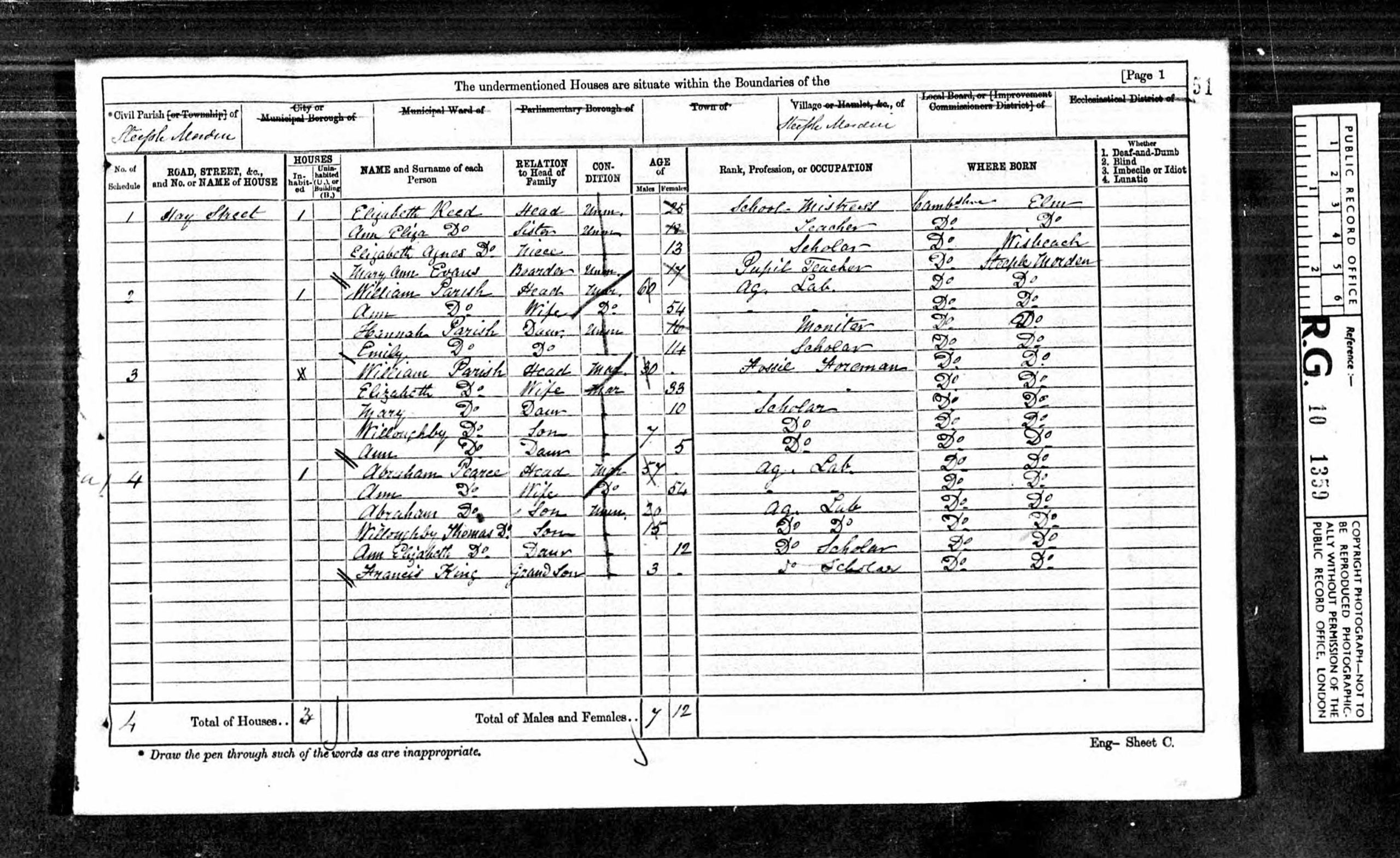
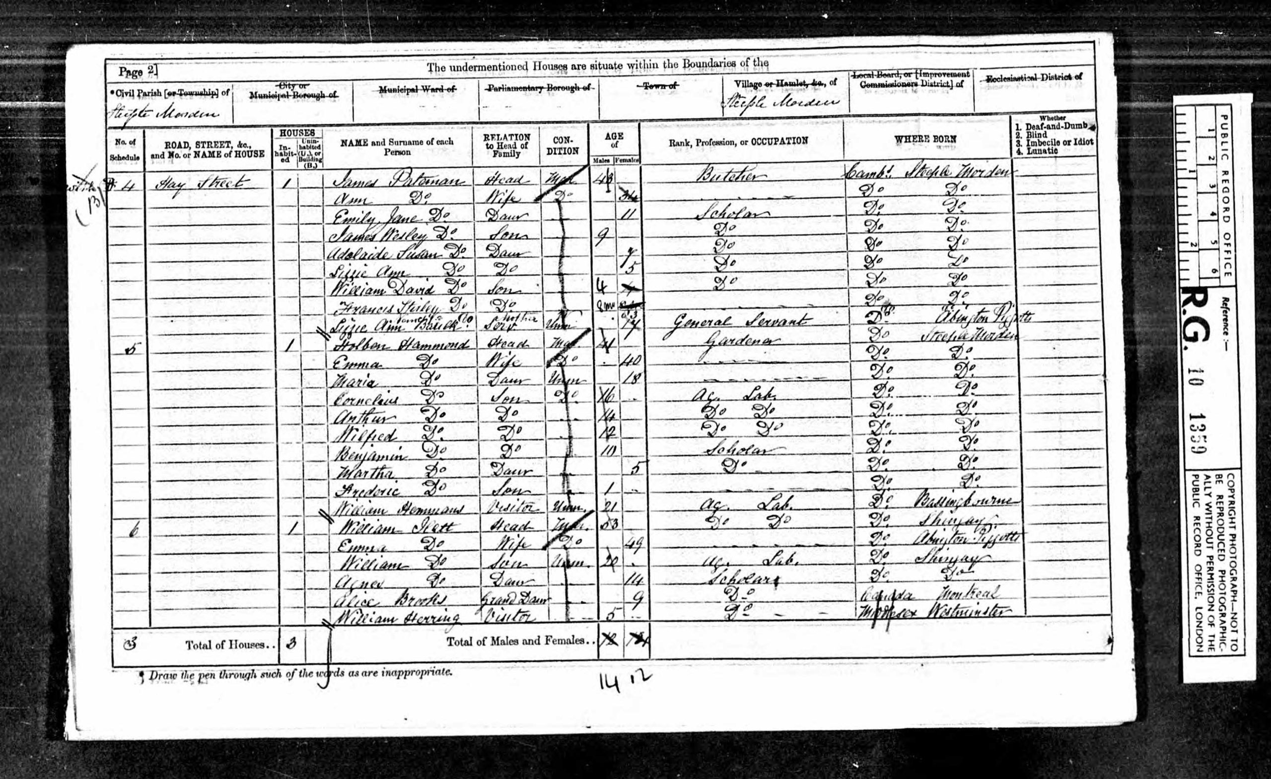
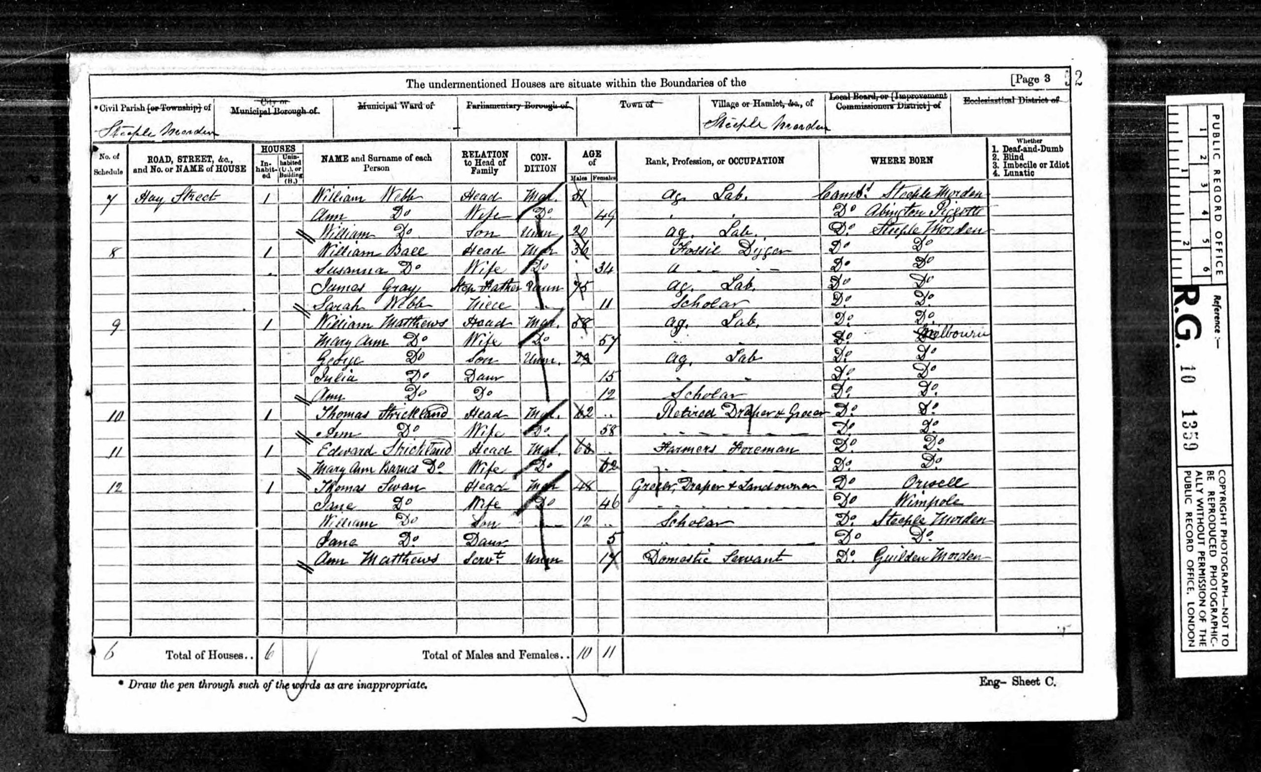
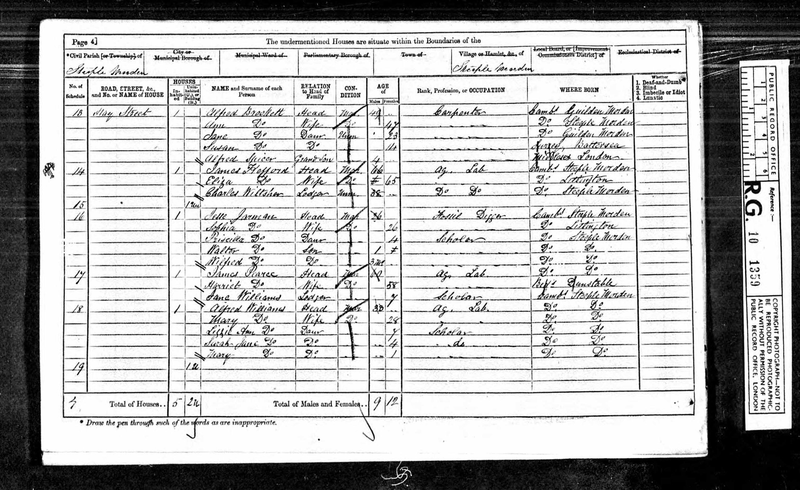
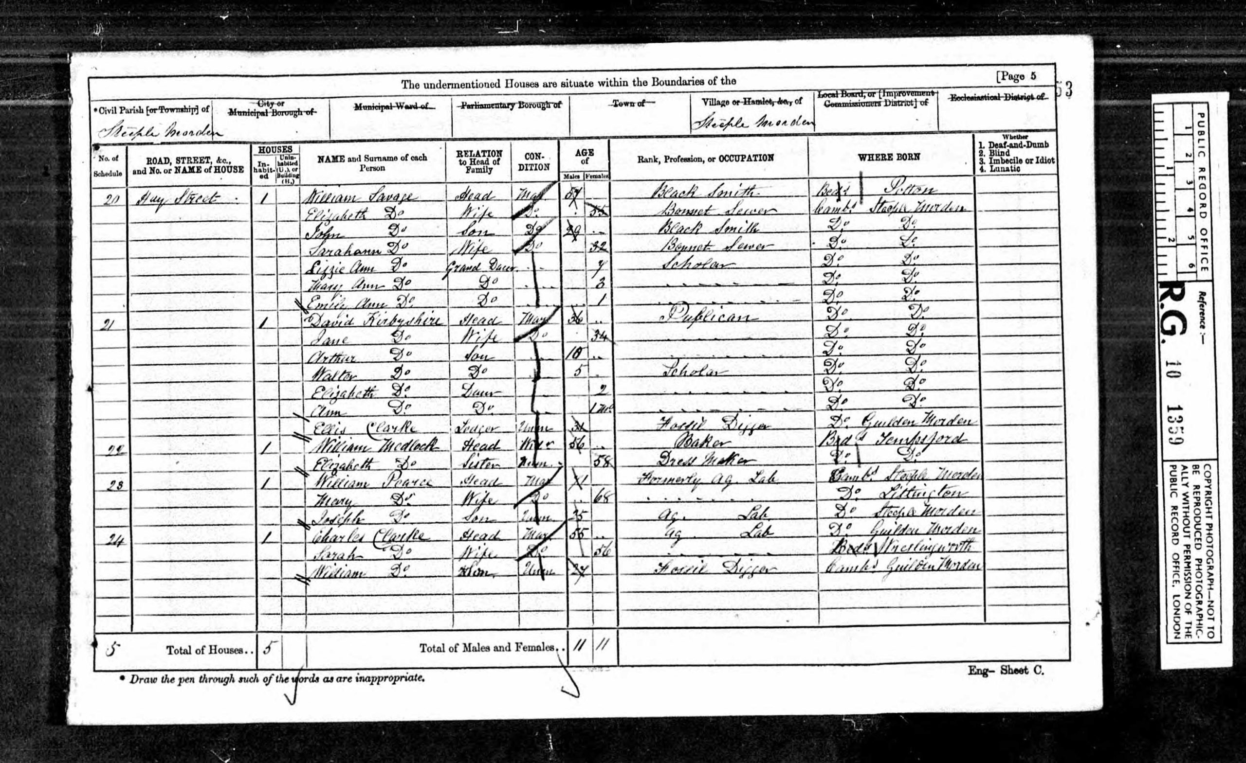
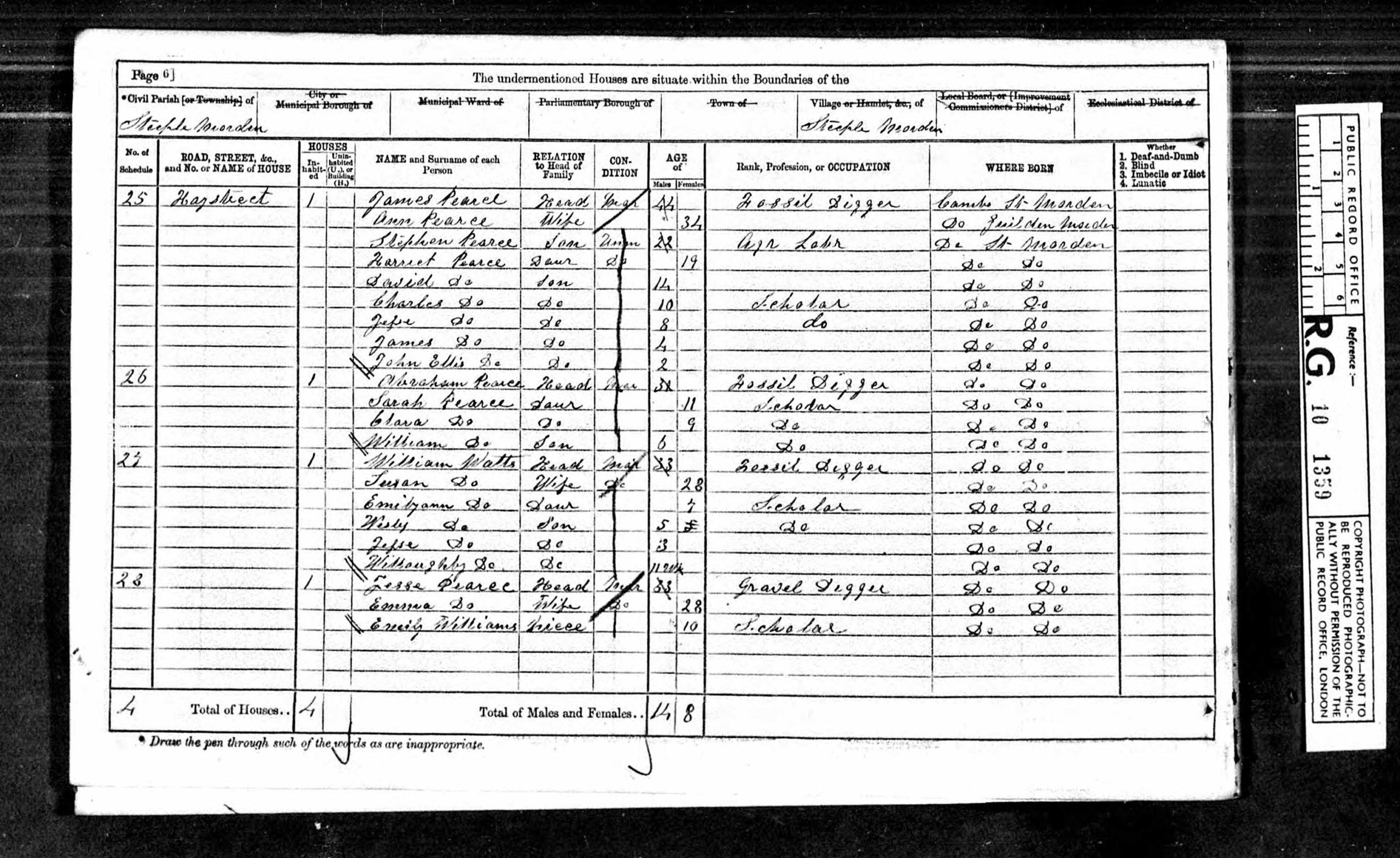
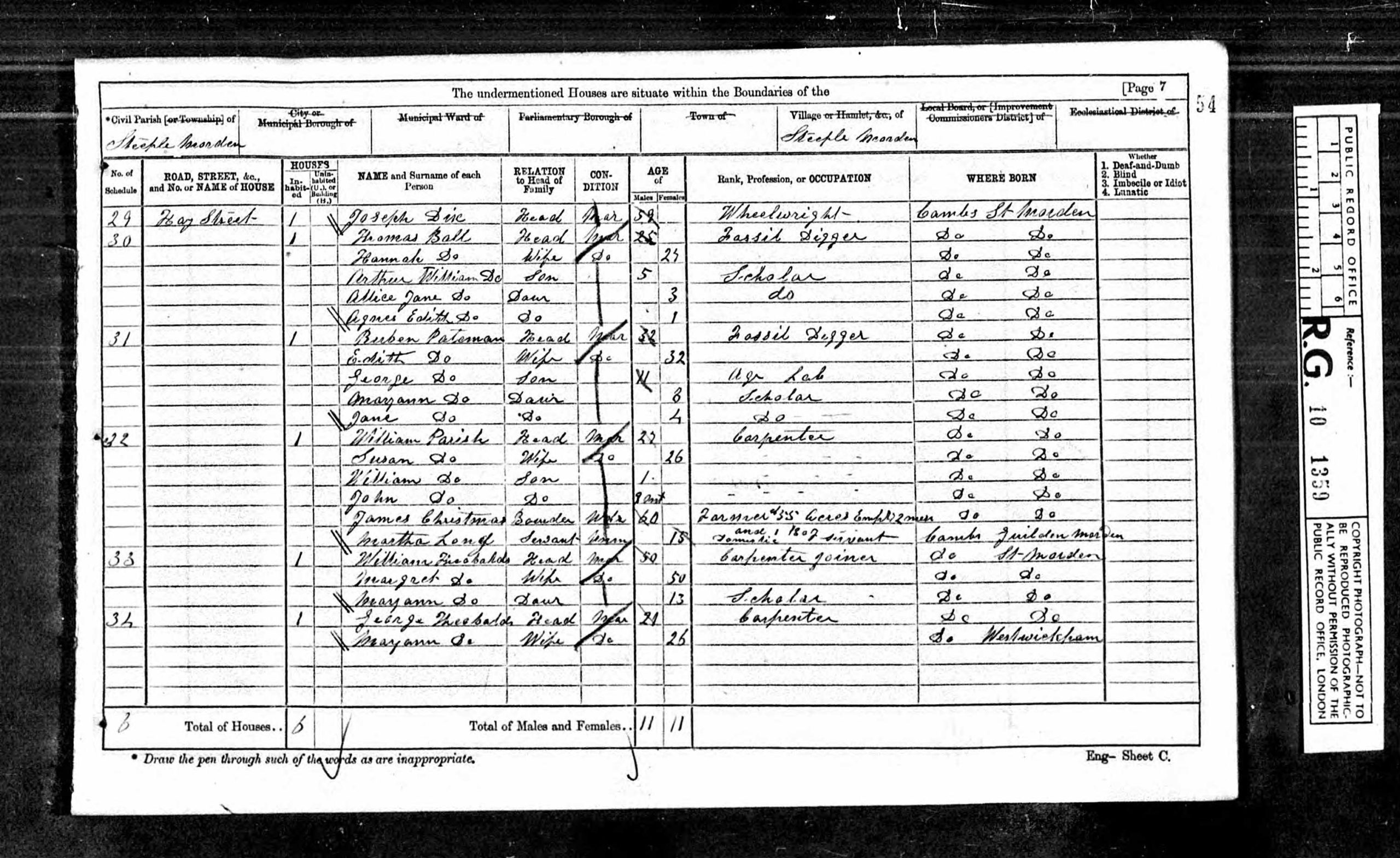
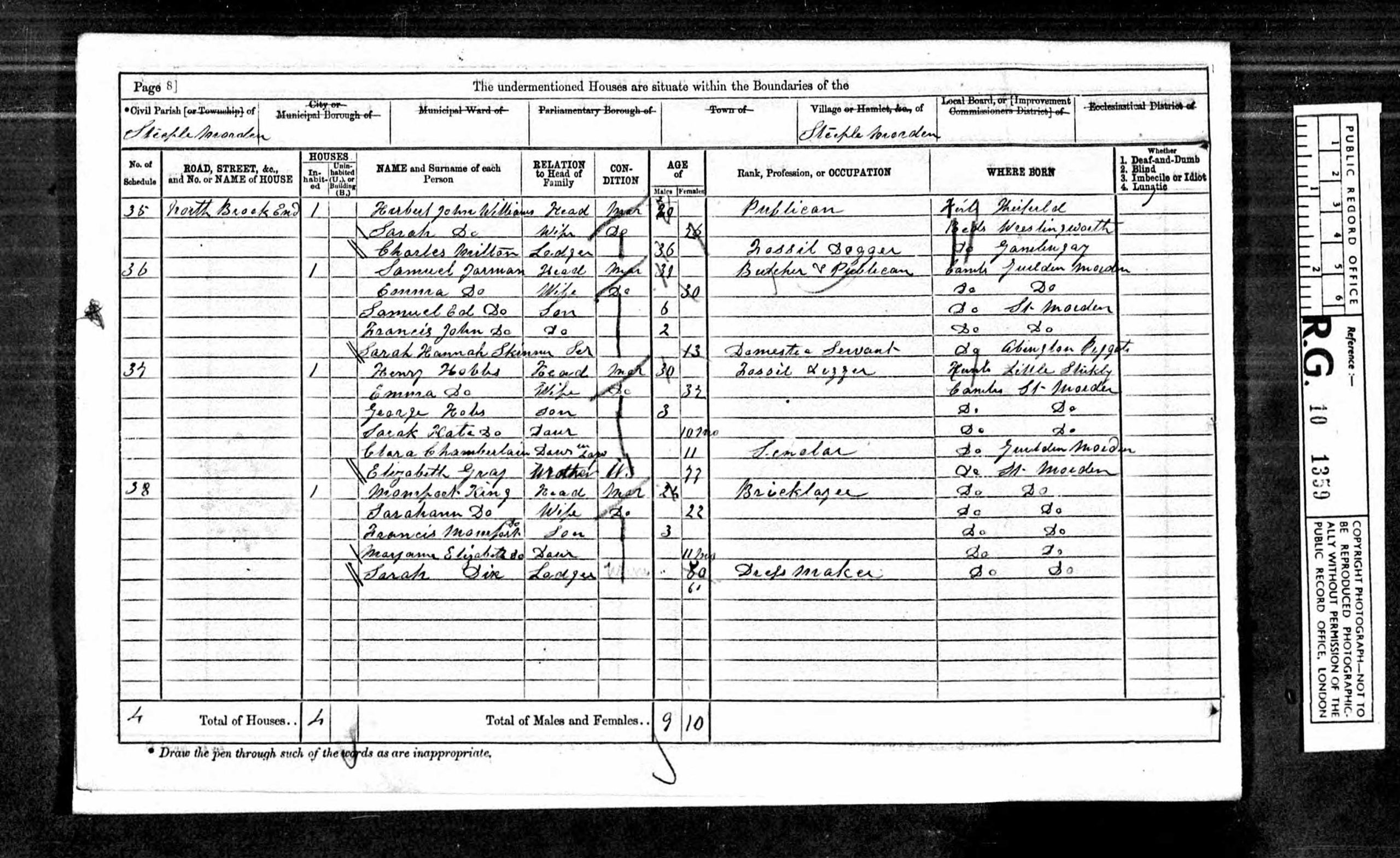
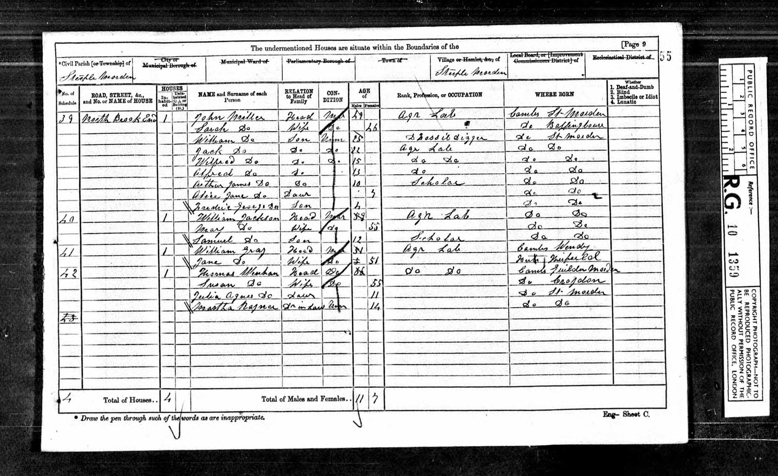
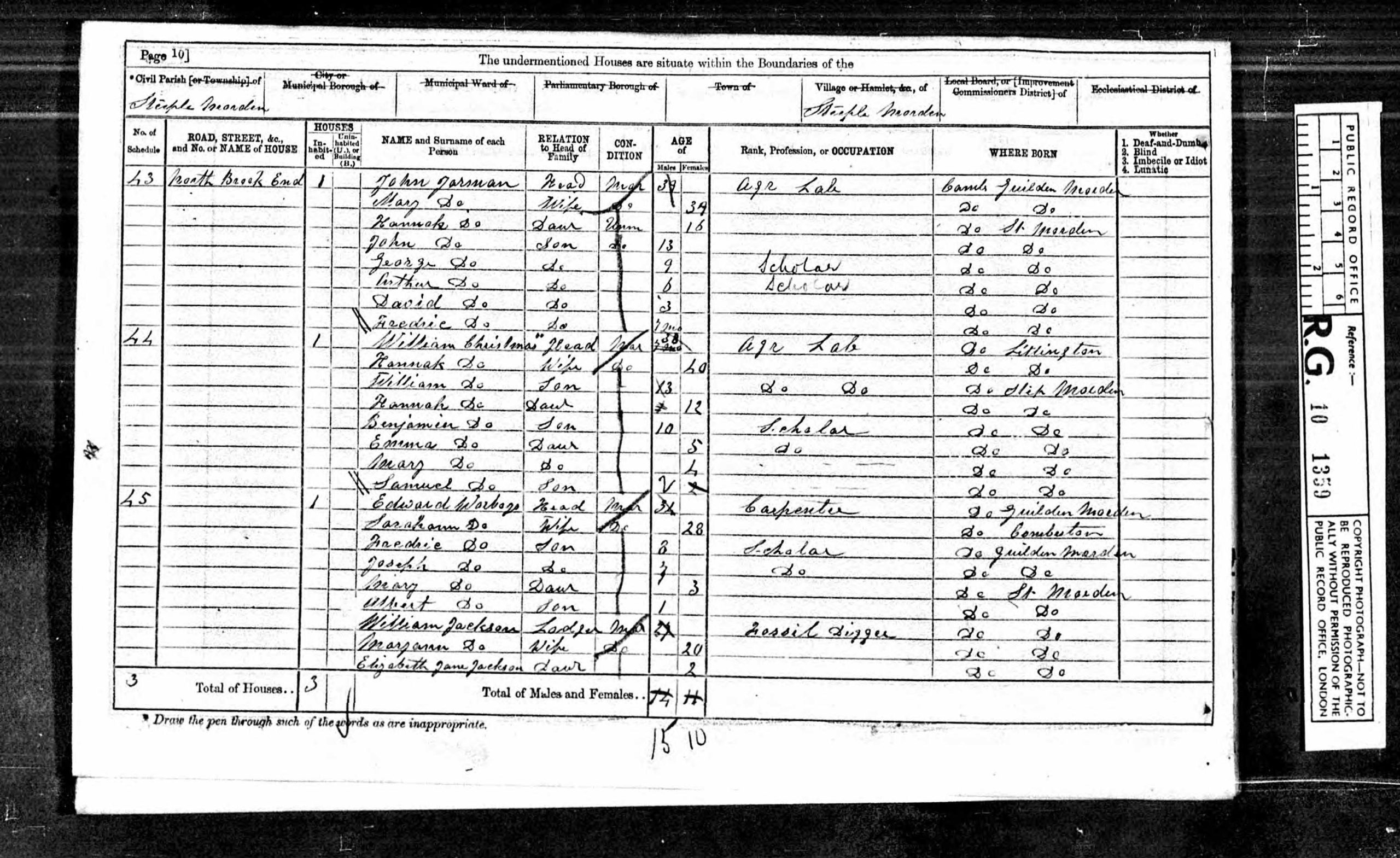
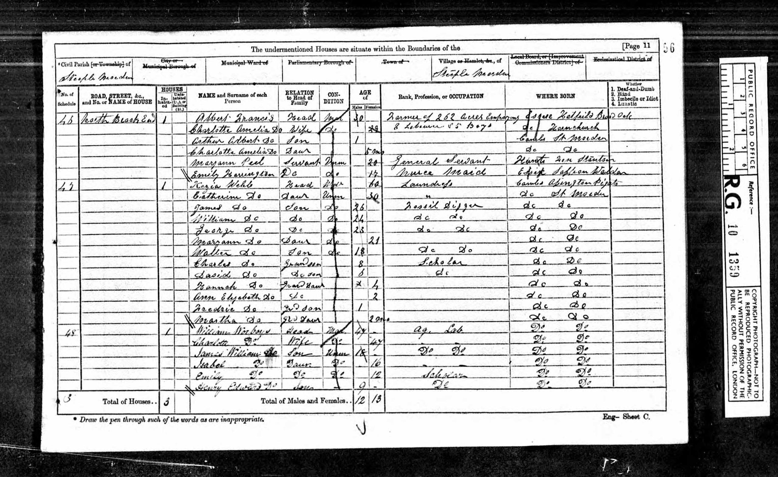
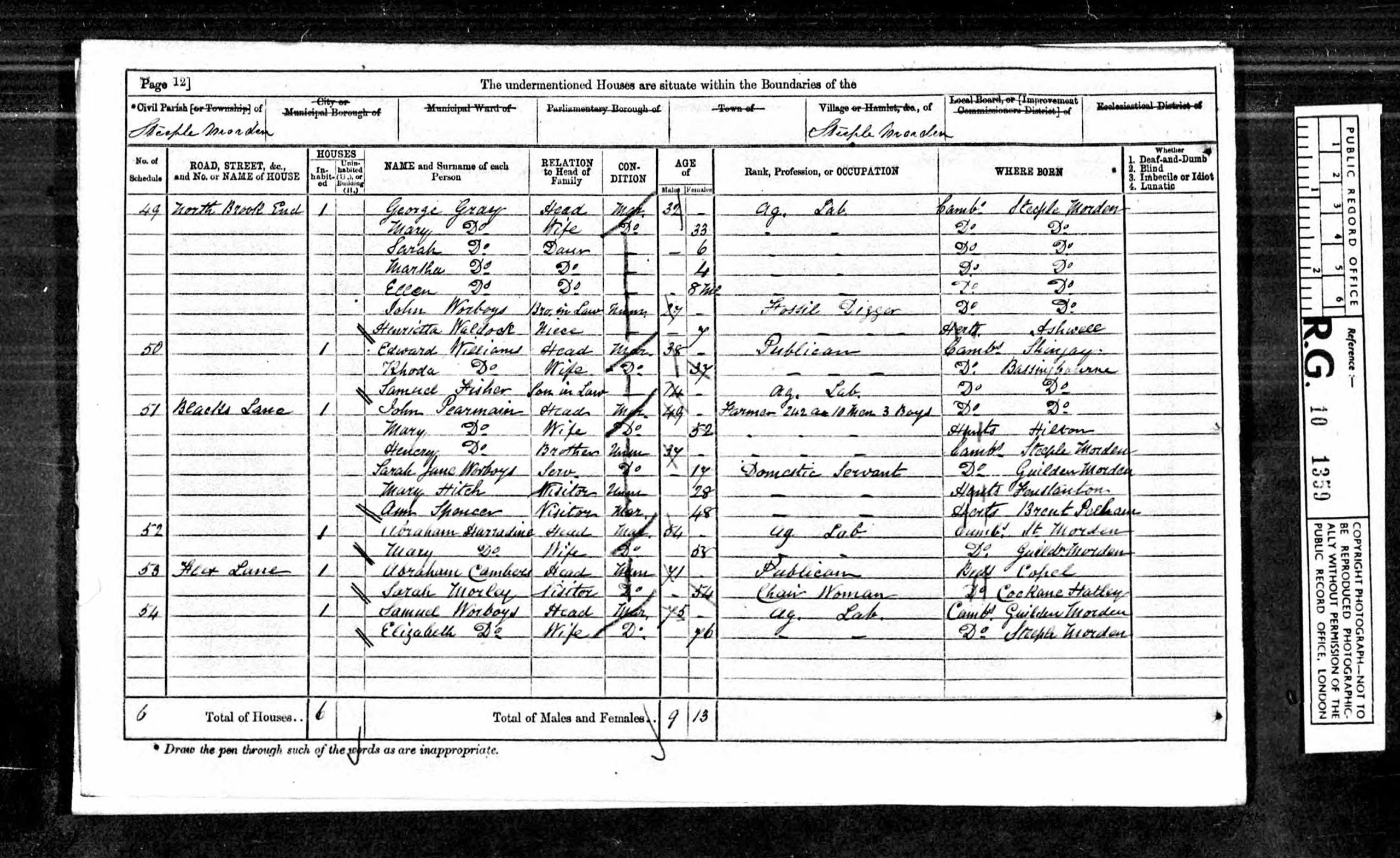
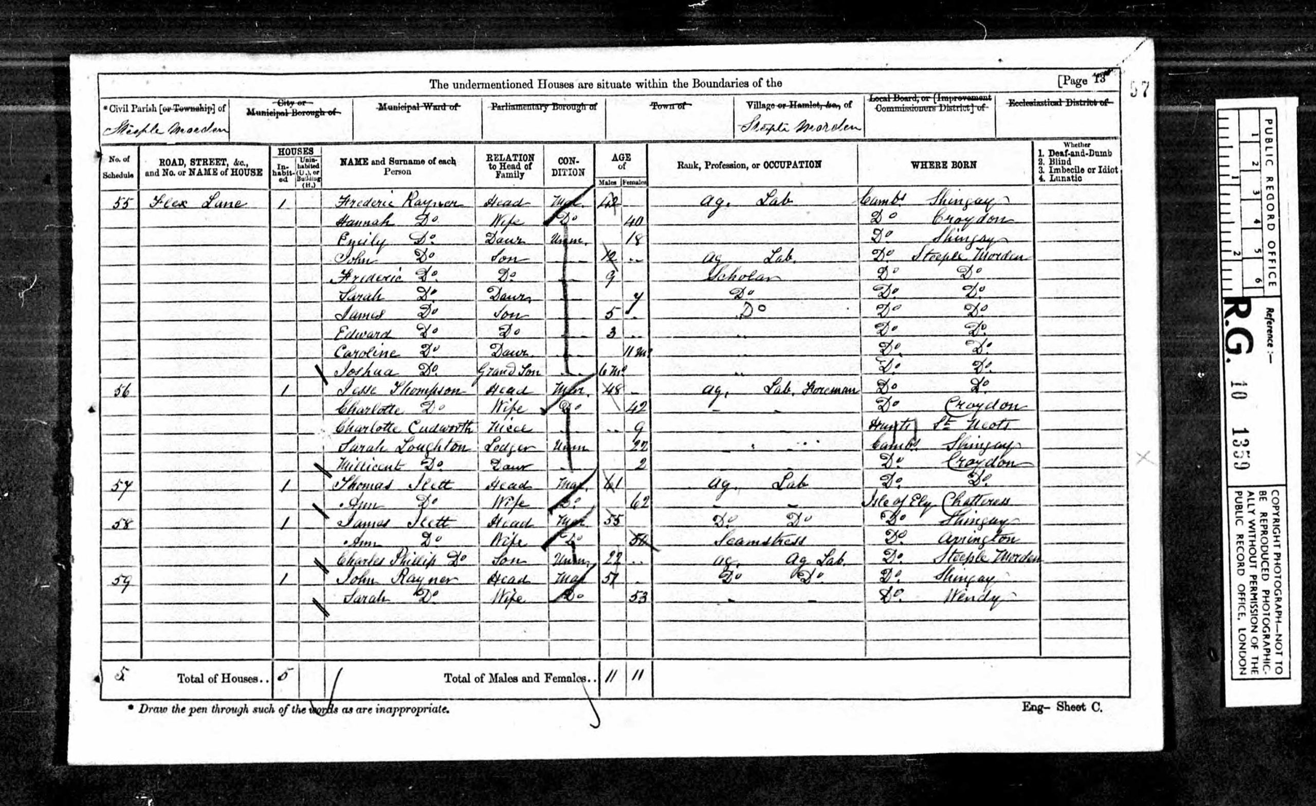
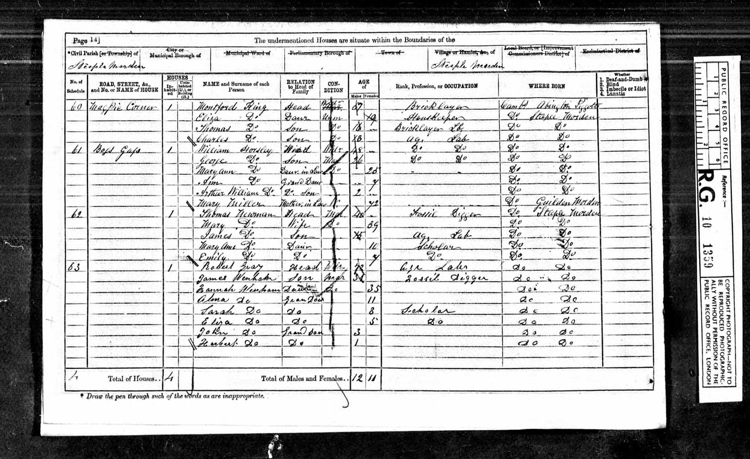
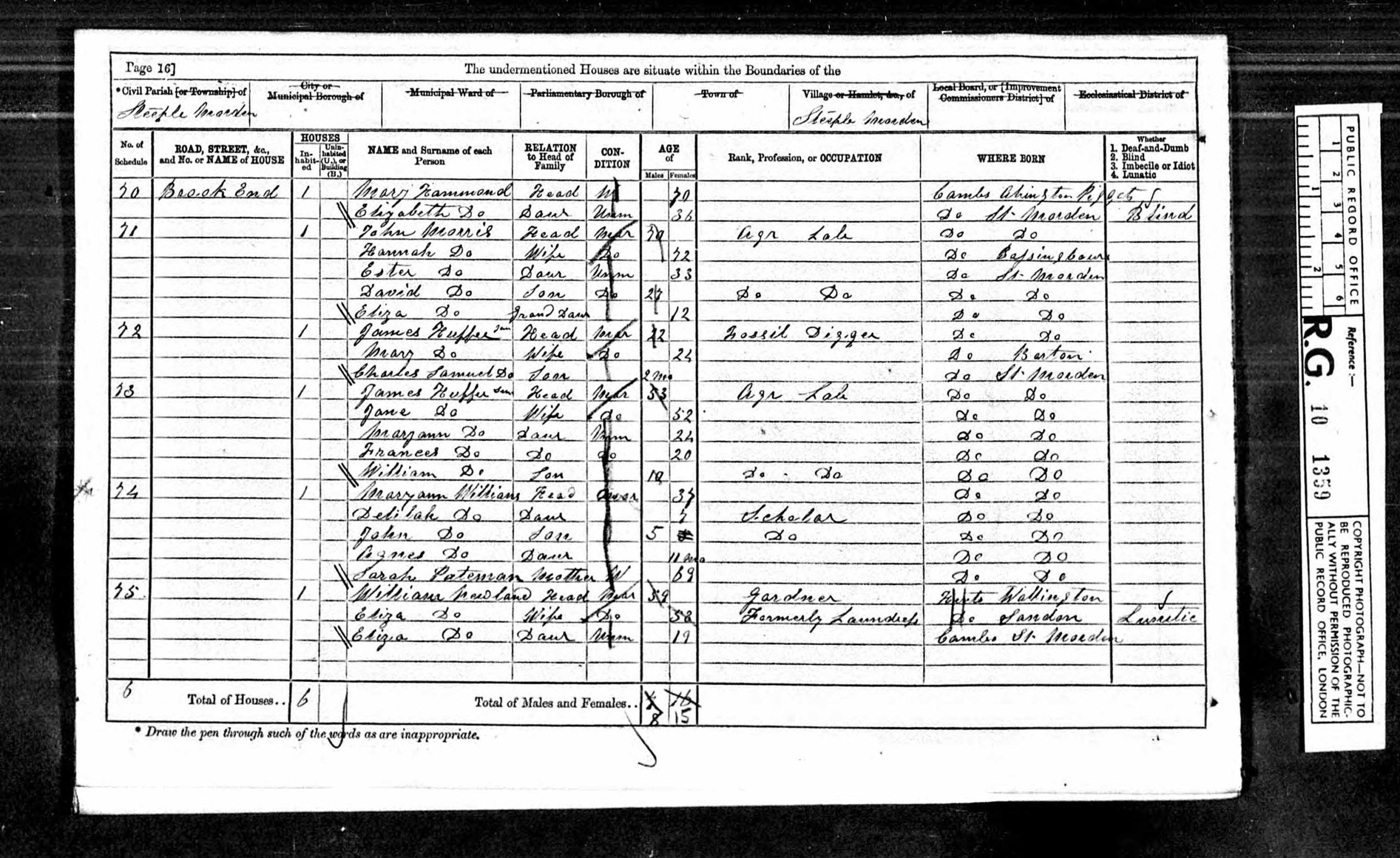
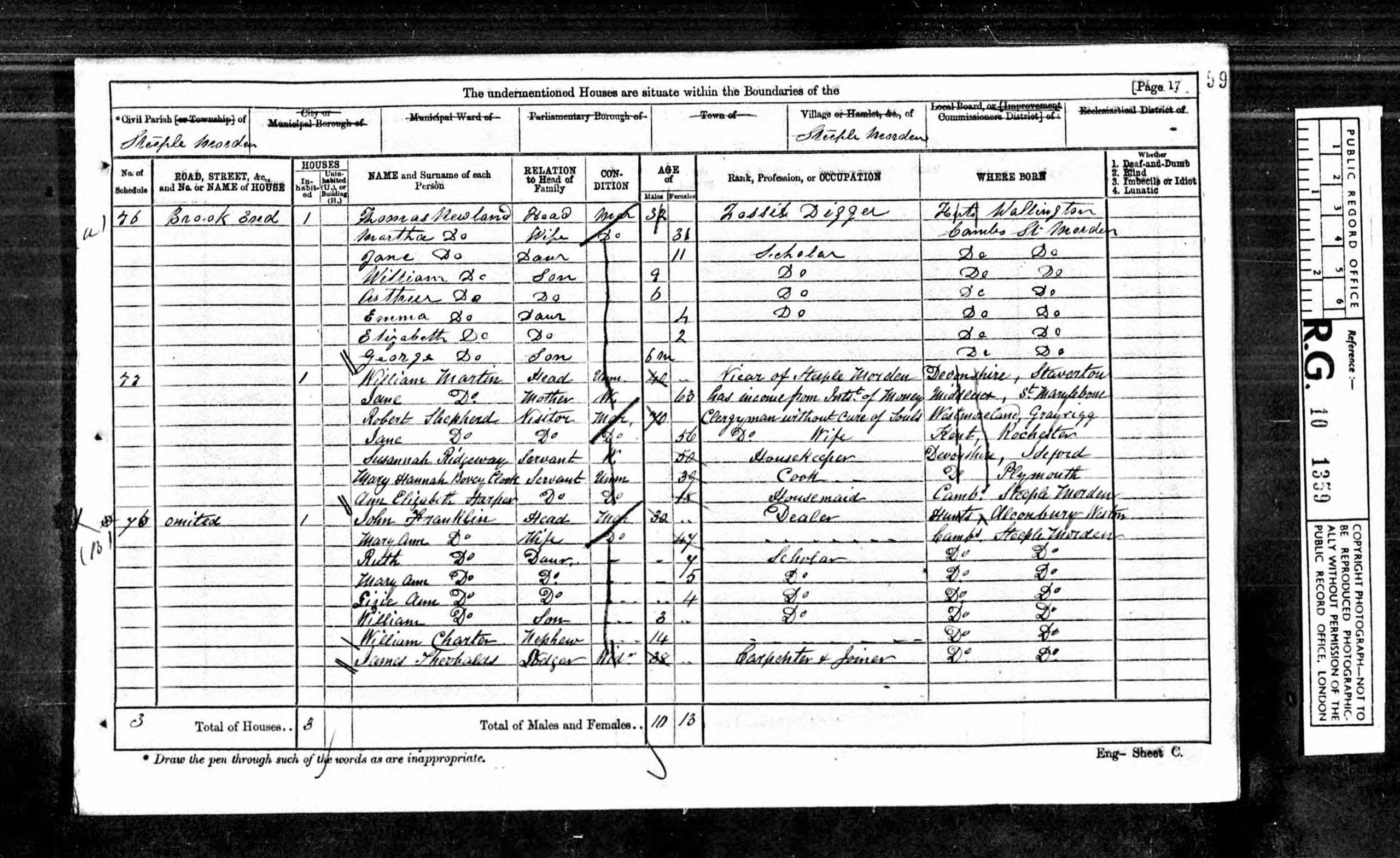
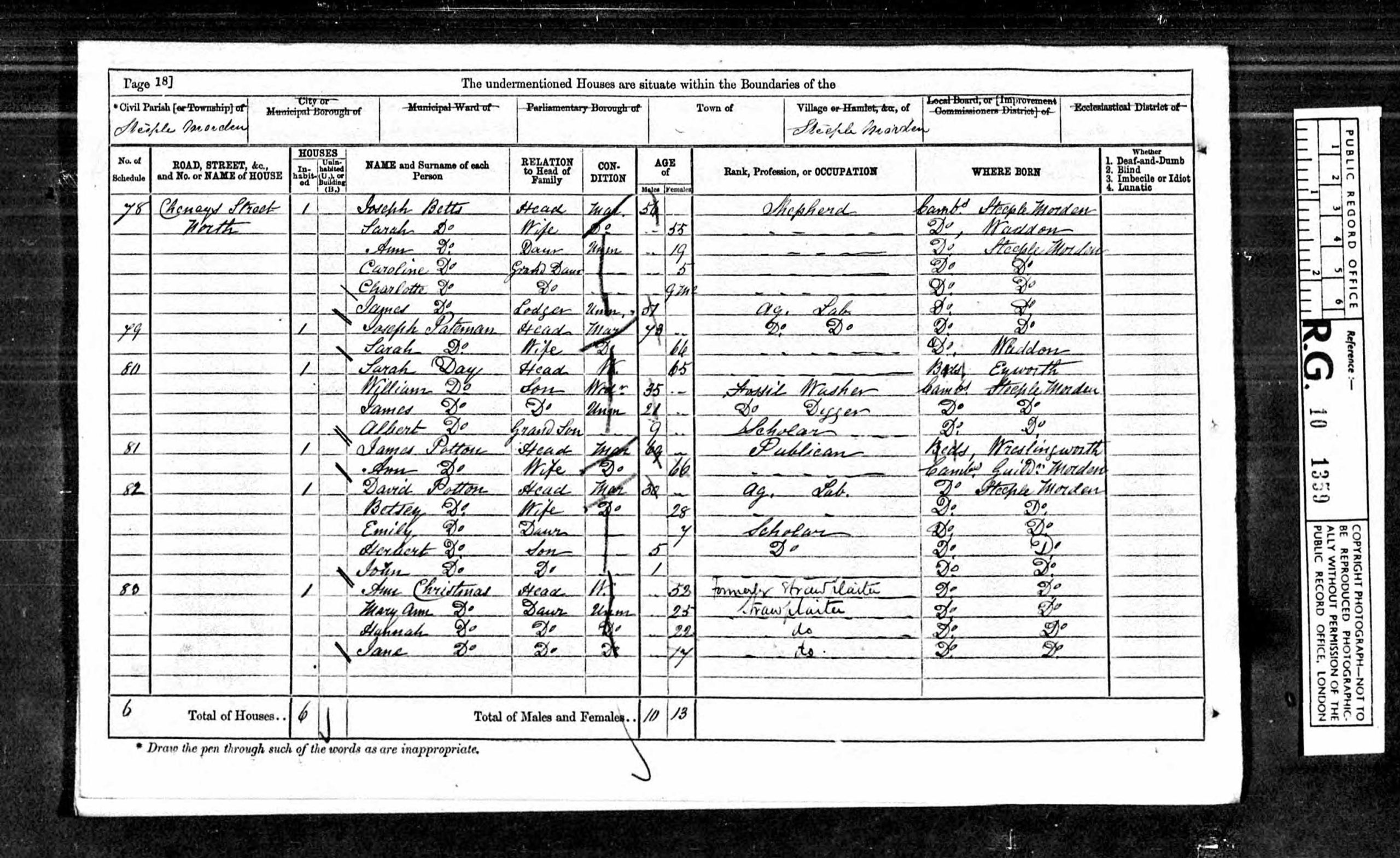
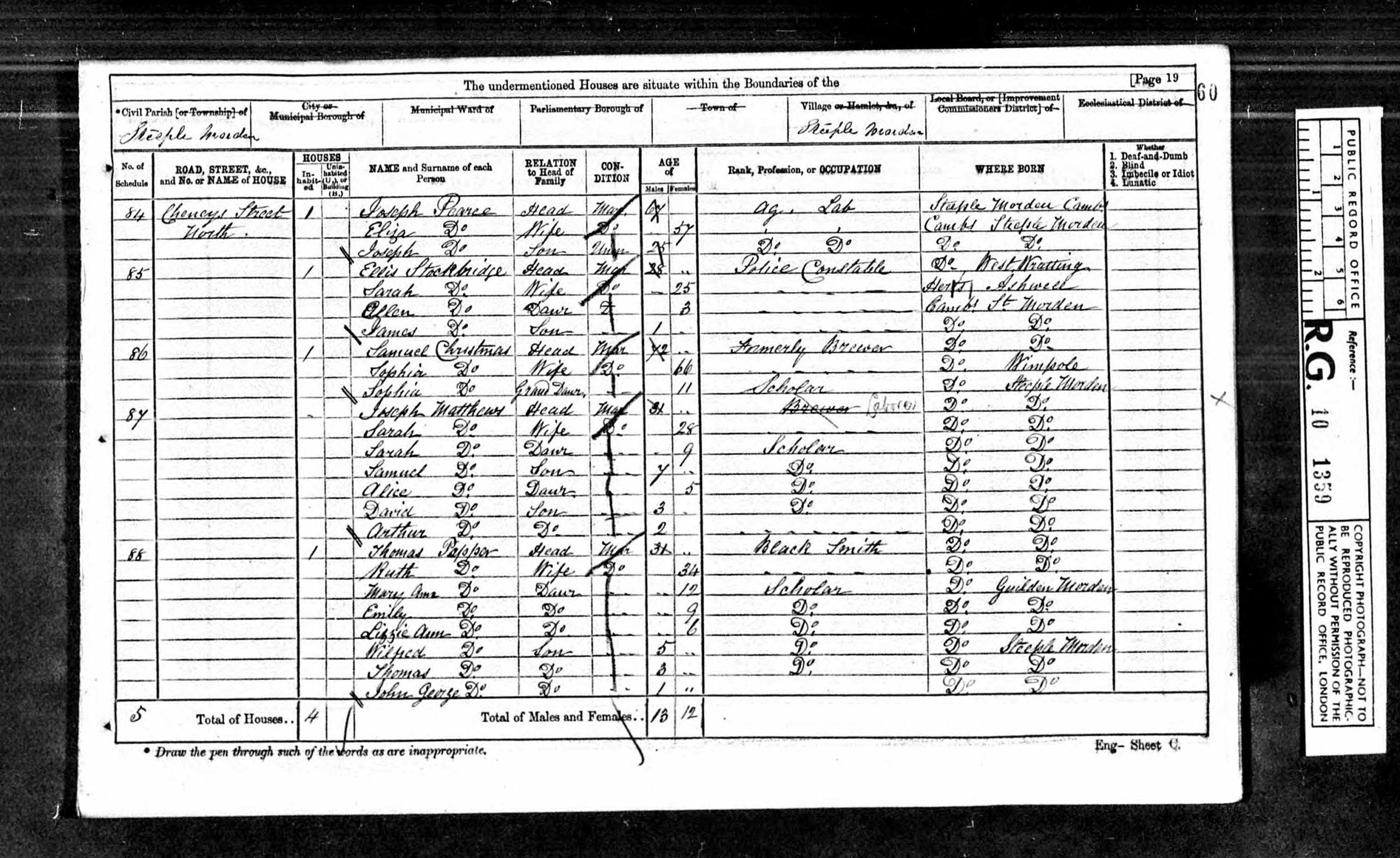
Census 1871
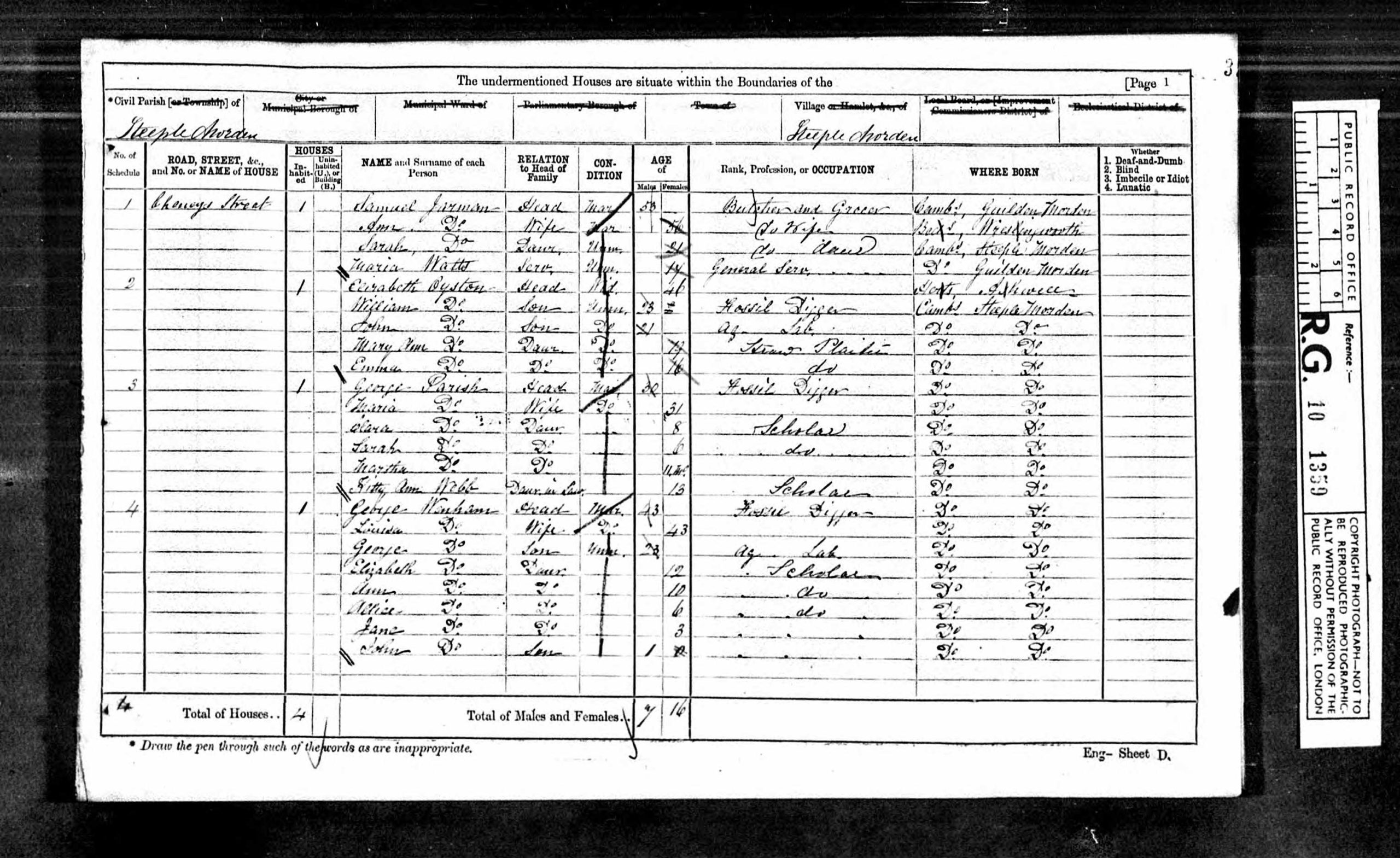
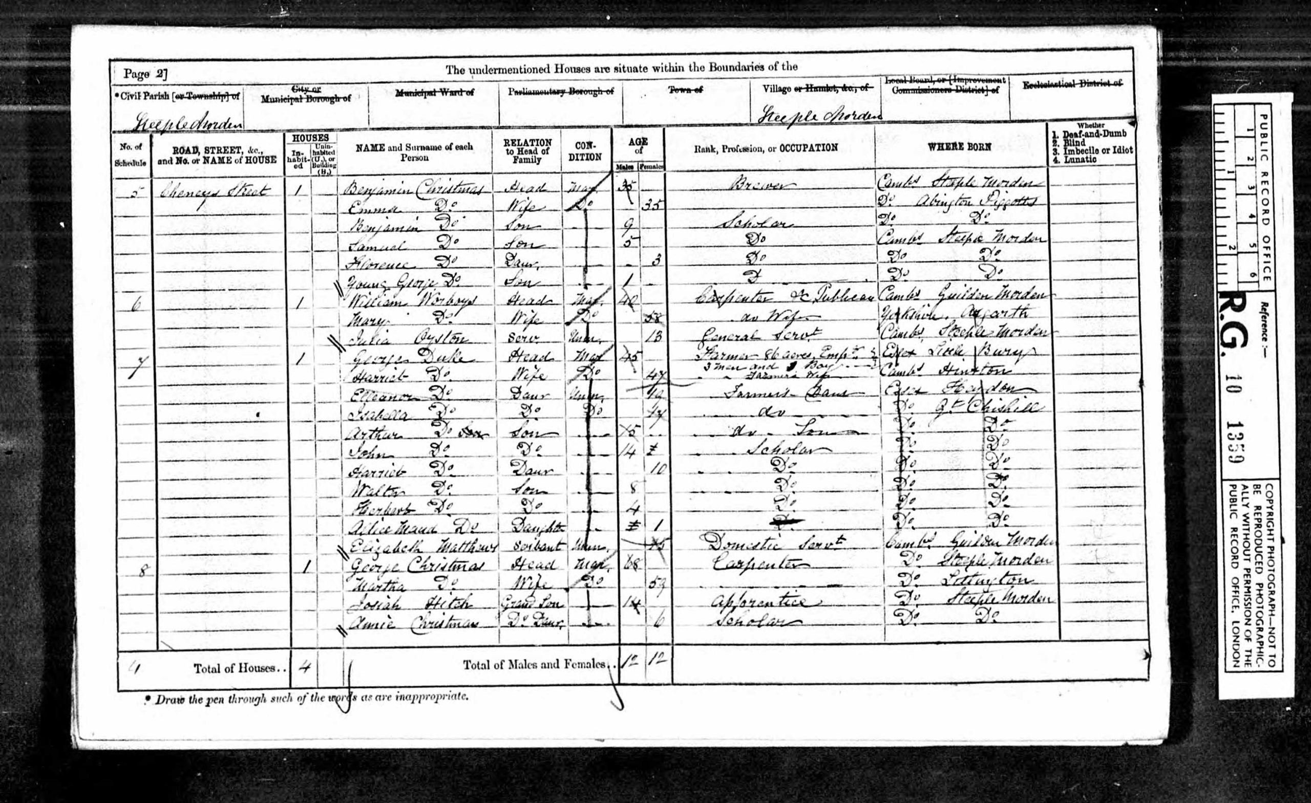
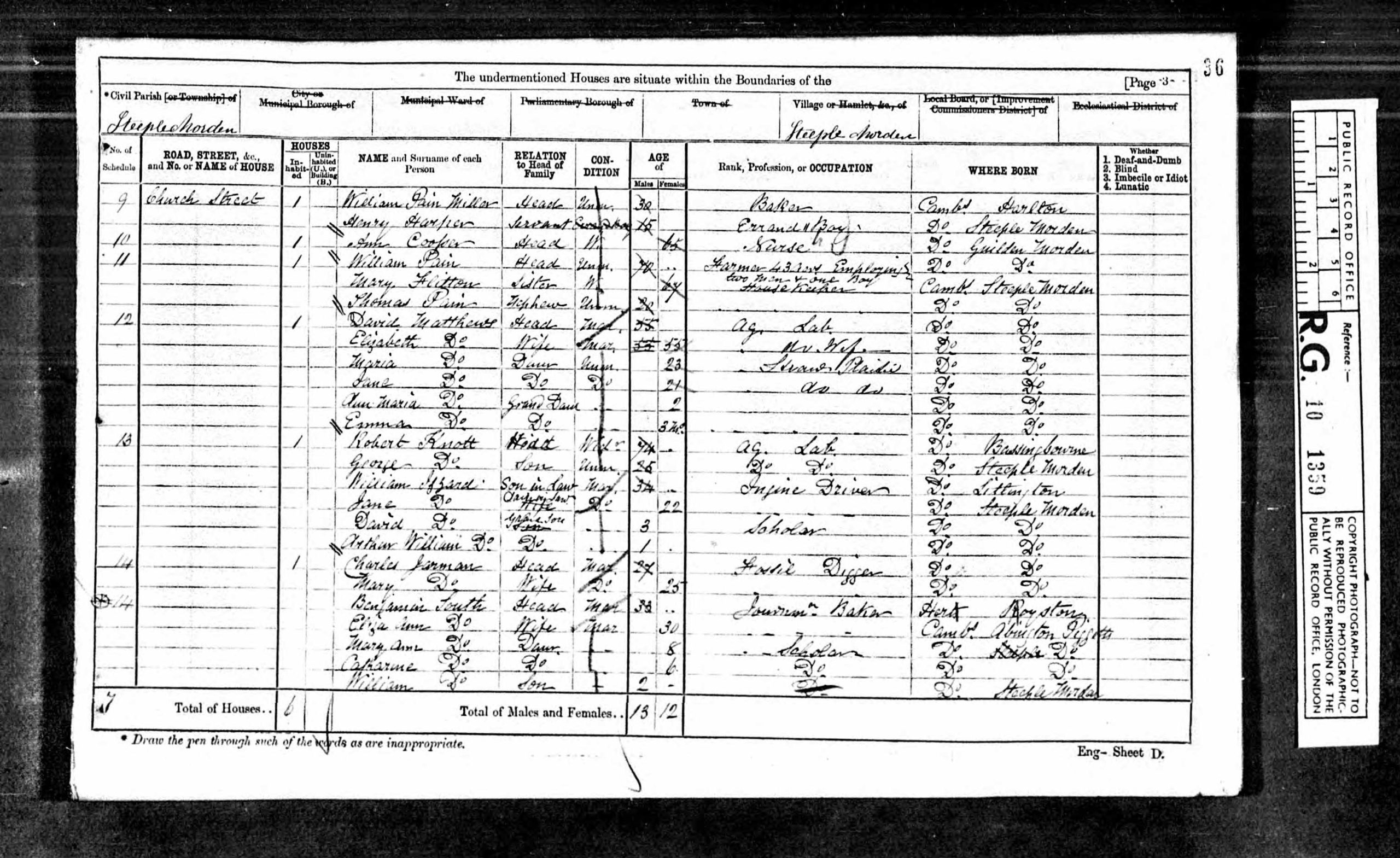
These are the actual enumerators’ schedules, completed after they had walked the parish recording all those in Steeple Morden on the night of 2 April 1871.
The parish was split into two parts, with an enumerator for each.
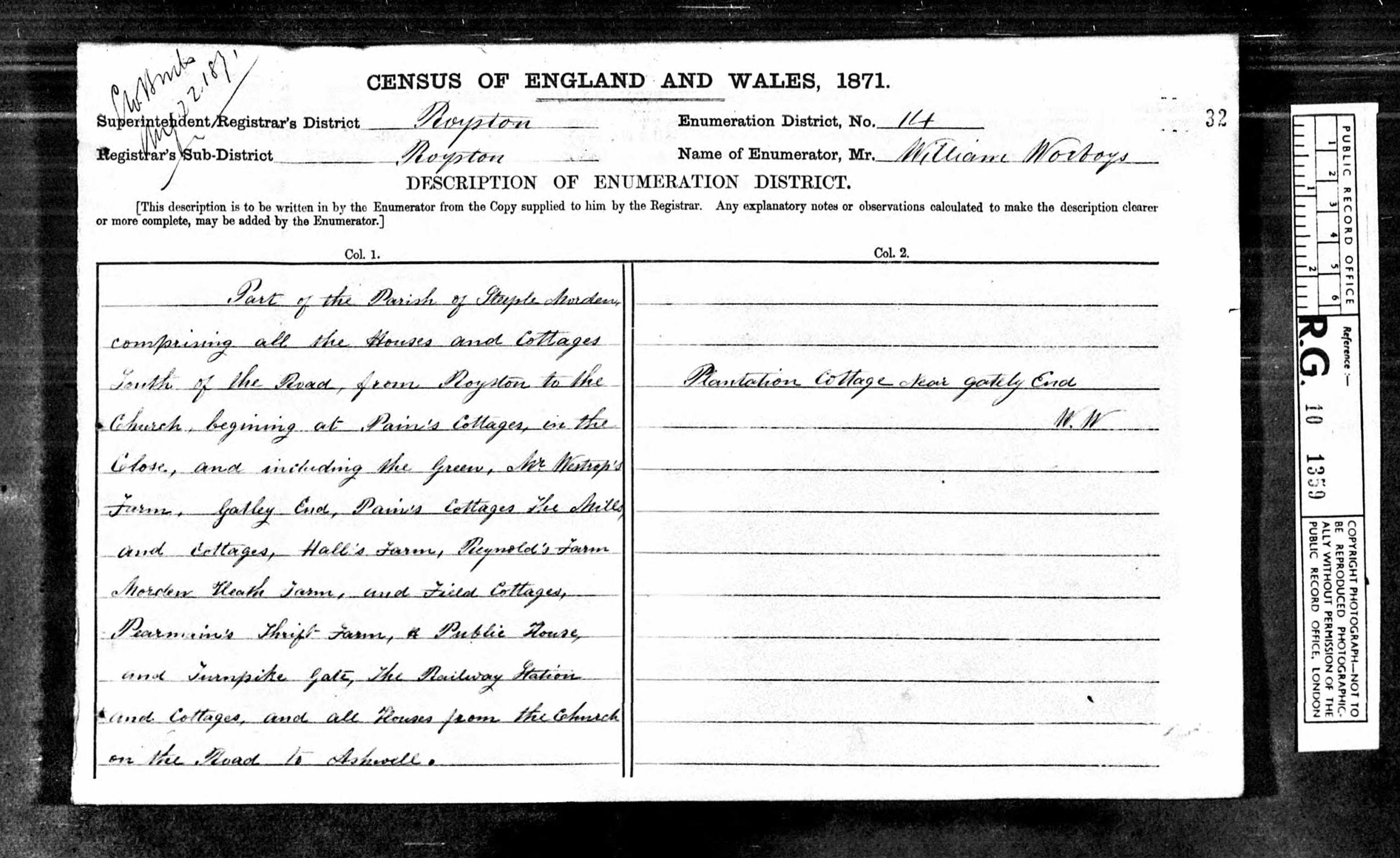
The southern part was described as “Part of the Parish of Steeple Morden comprising all the Houses and Cottages South of the Road from Royston to the Church, beginning at Pain’s Cottages, in the Close, and including the Green, Mr Westrop’s [sic] Farm. Gatley End, Pains Cottages, The Mill and cottages, Hall’s Farm, Reynold’s Farm, Morden Heath Farm, and Field Cottages, Pearmain’s Thrift Farm, & Public House and Turnpike Gate, The Railway Station and Cottages and all Houses from the Church on the Road to Ashwell. Plantation next Gately [sic] End.”
The northern part was described as “Part of the Parish of Steeple Morden comprising all the Houses and Cottages North of the Road from Royston to the Church, and then leading onto Potton beginning at the Rectory and including Brook End, The School House, Hay Street, Bog’s [sic] Gap, North Brook End, and all the Cottages in Flex Lane.”
Click on any image below to view. Click again to enlarge. Drag to view entire image
The Schedules


Last Updated on August 3, 2025