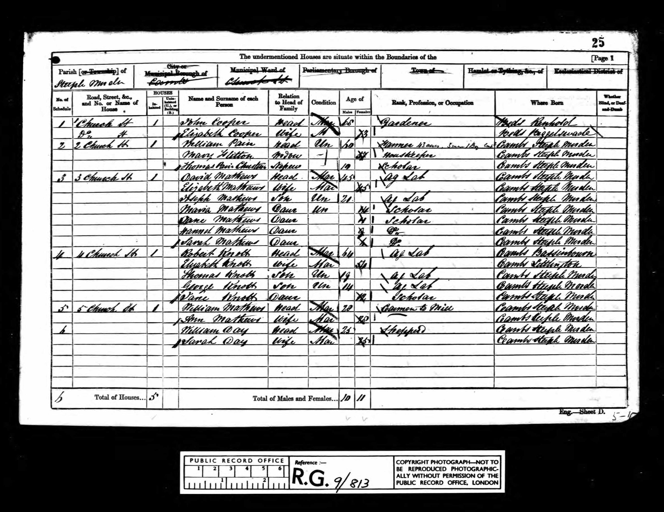
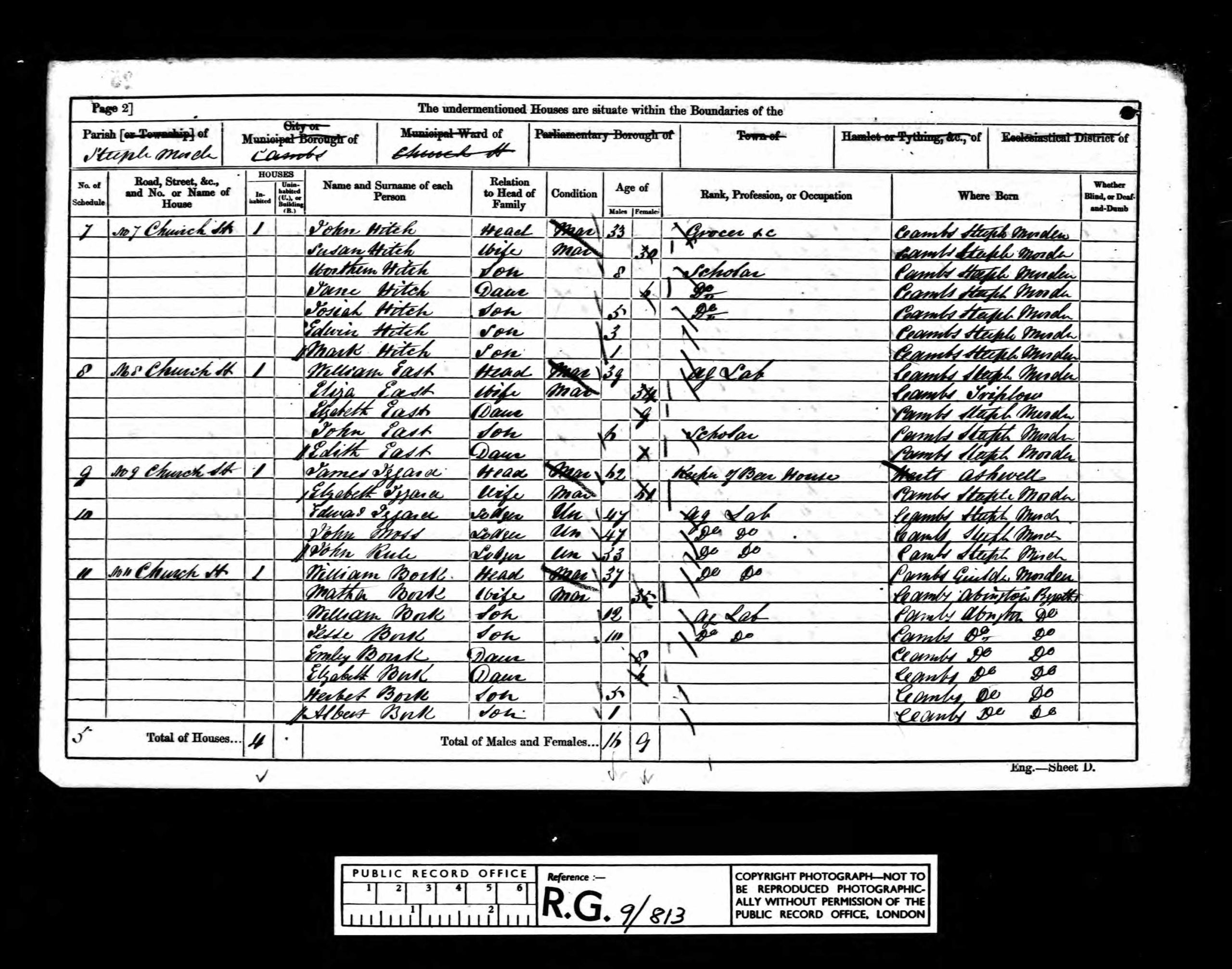
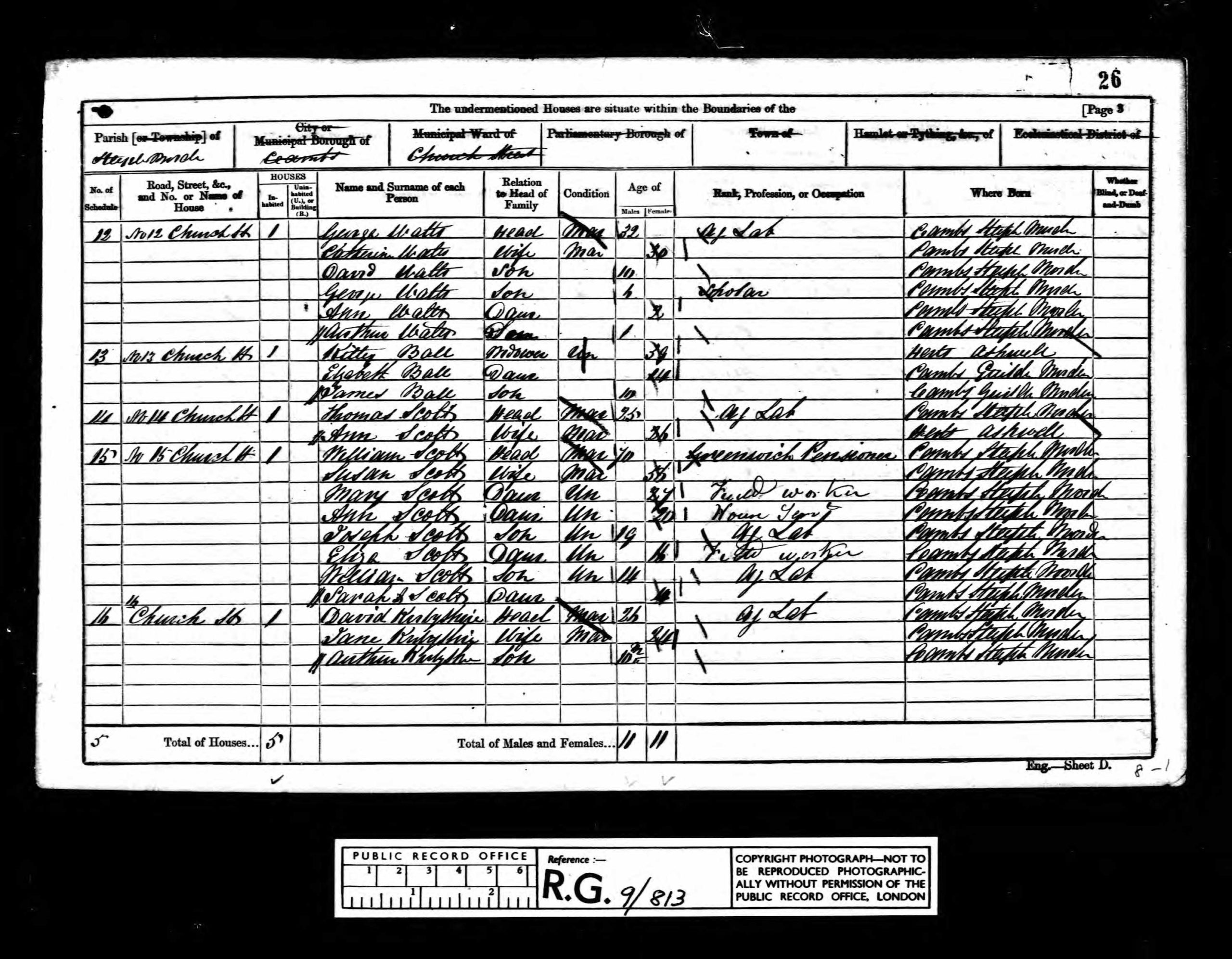
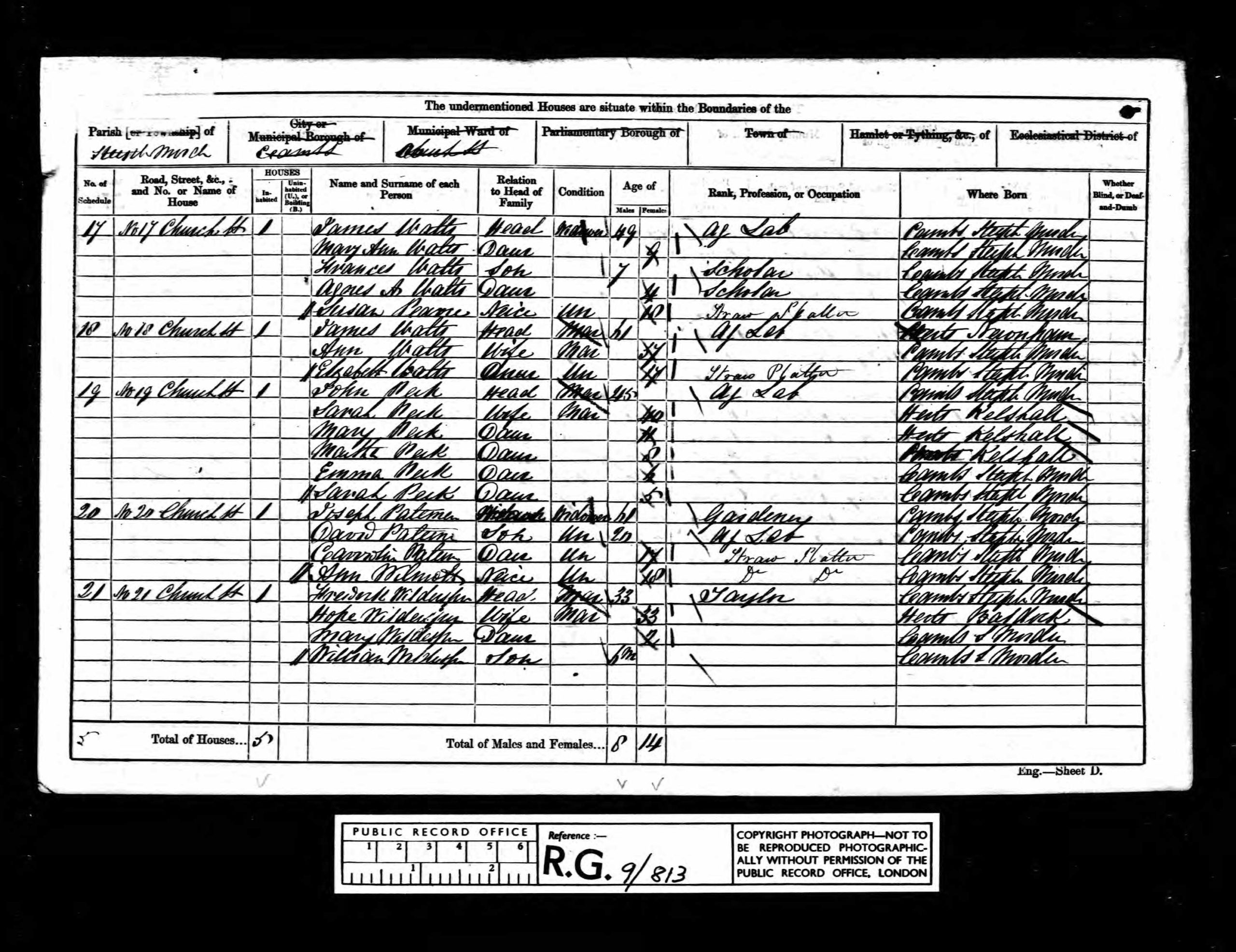
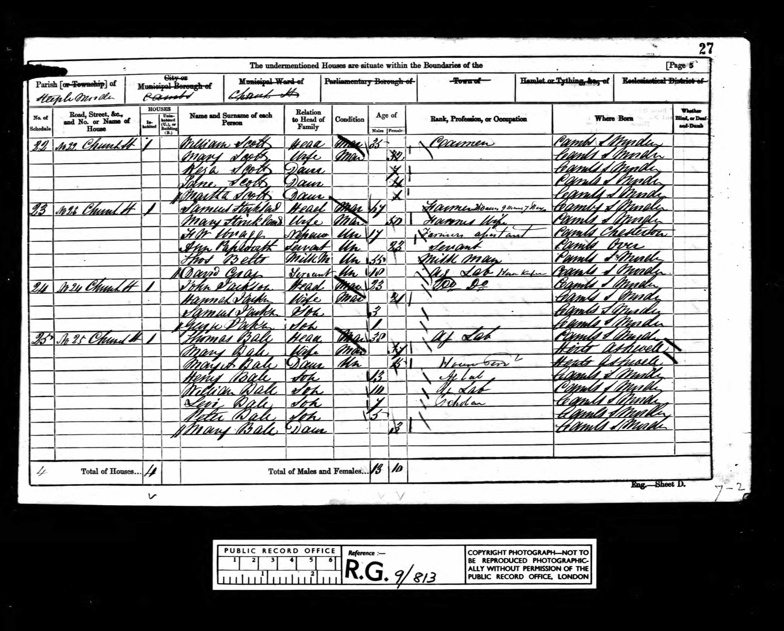
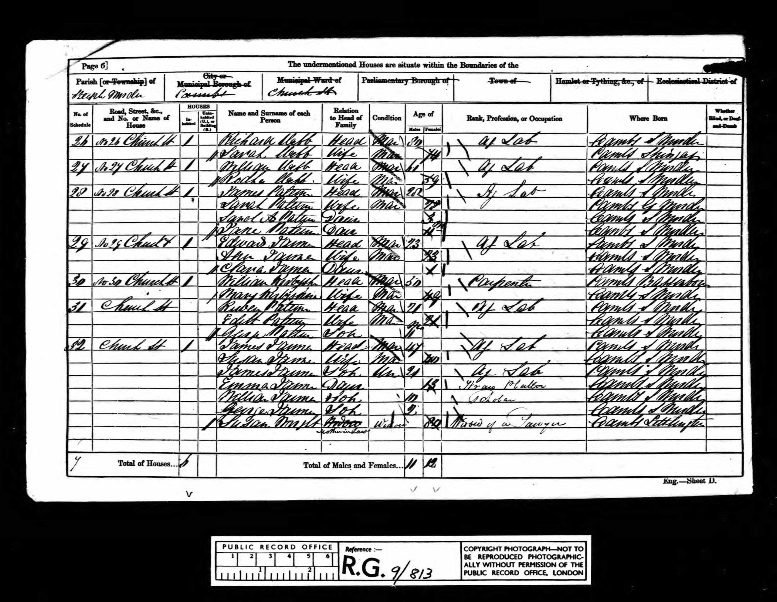
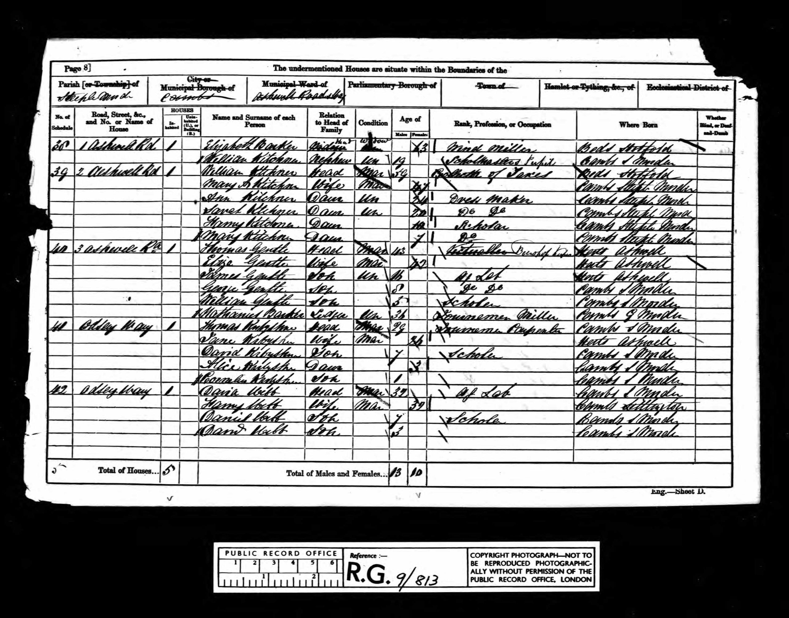
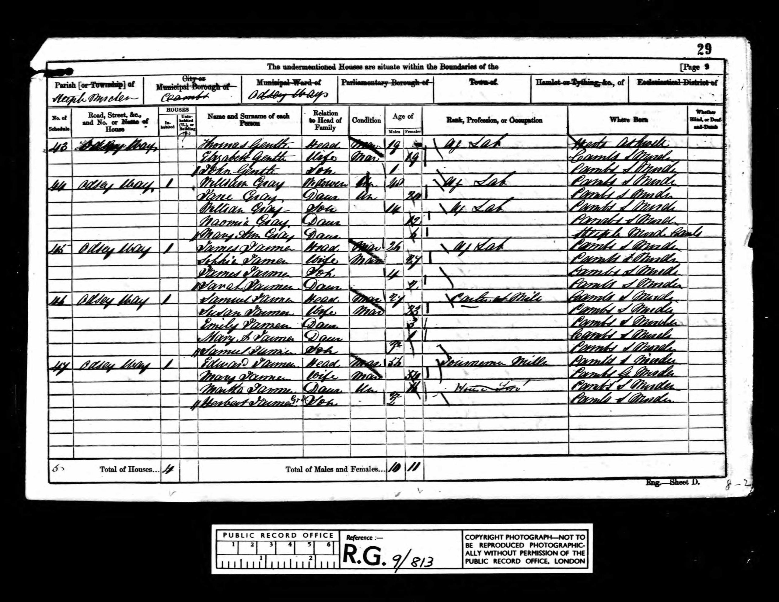
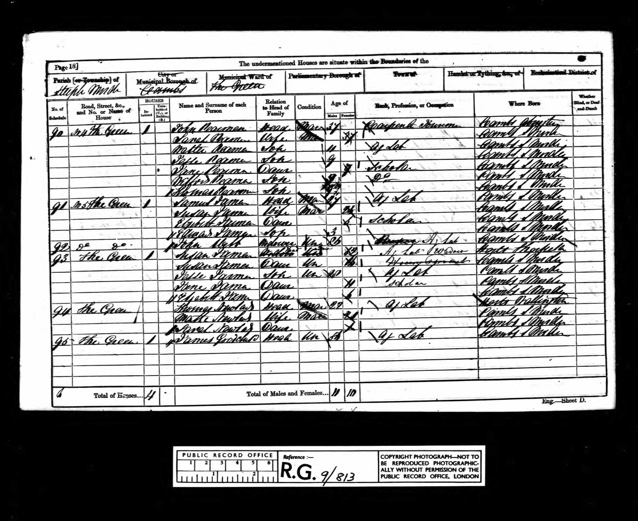
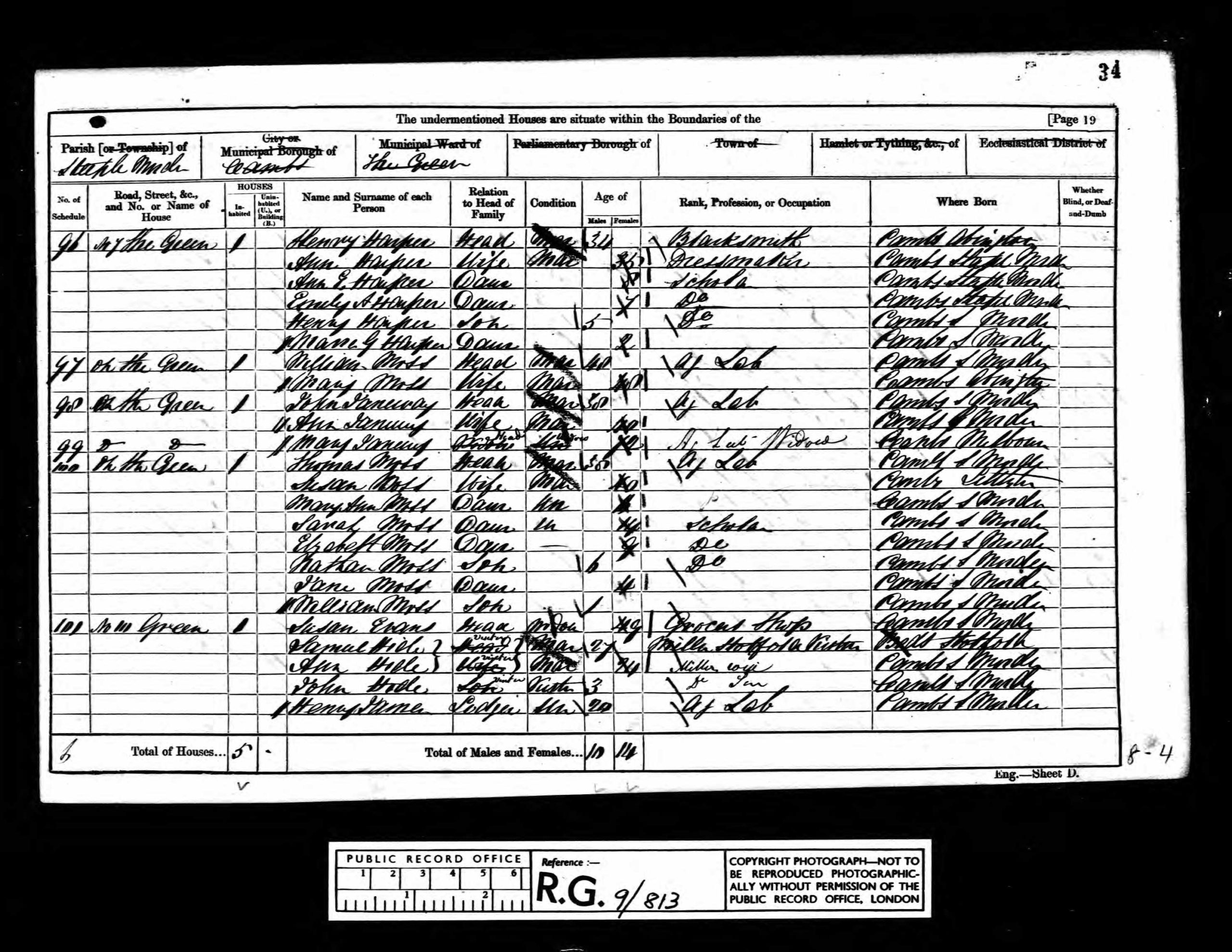
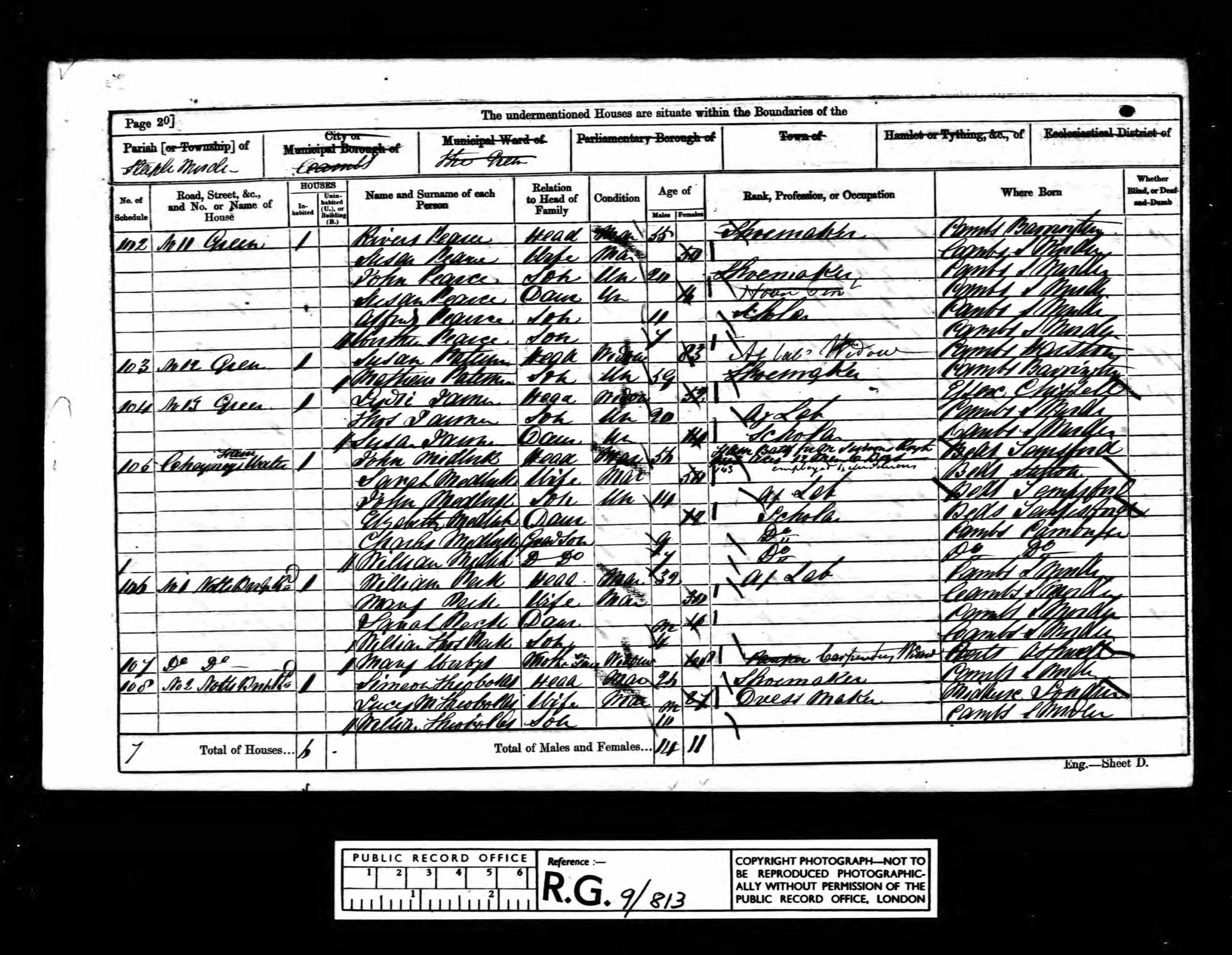
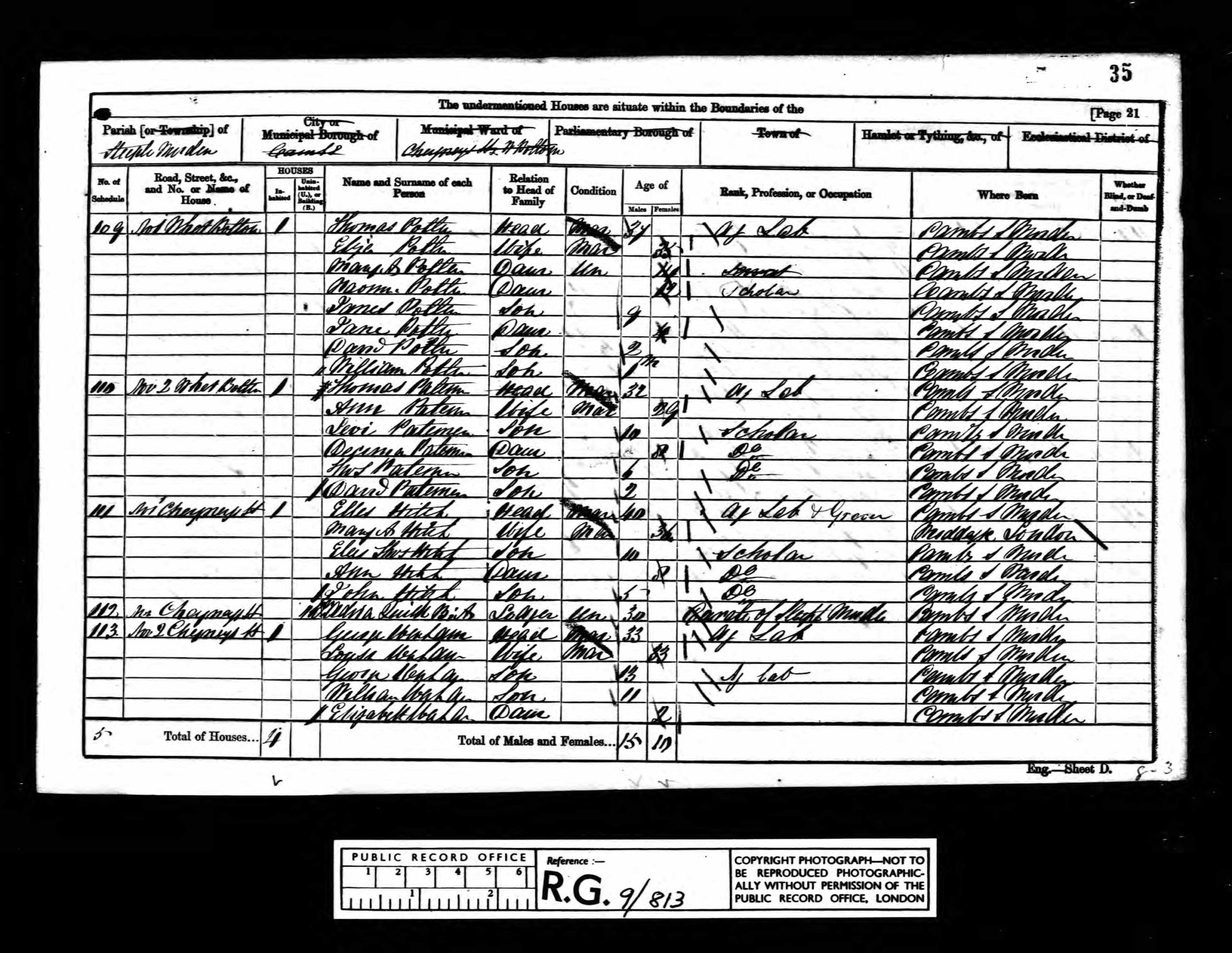
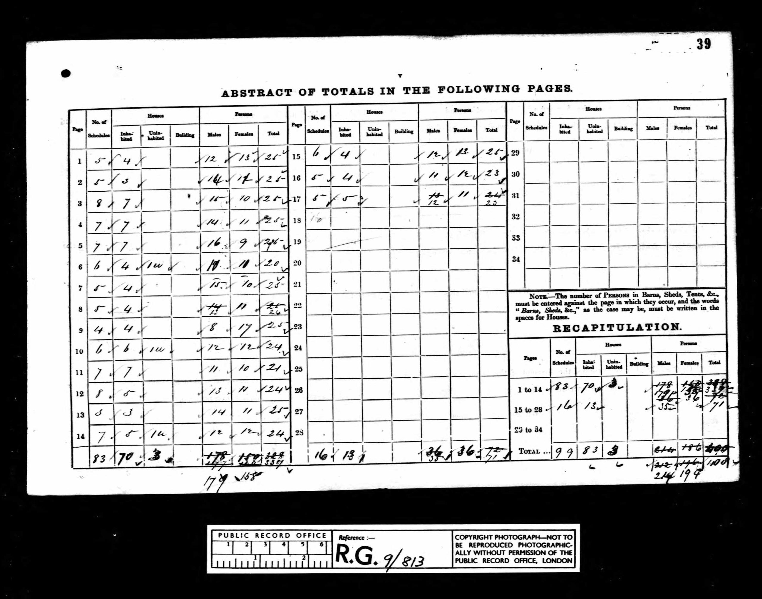
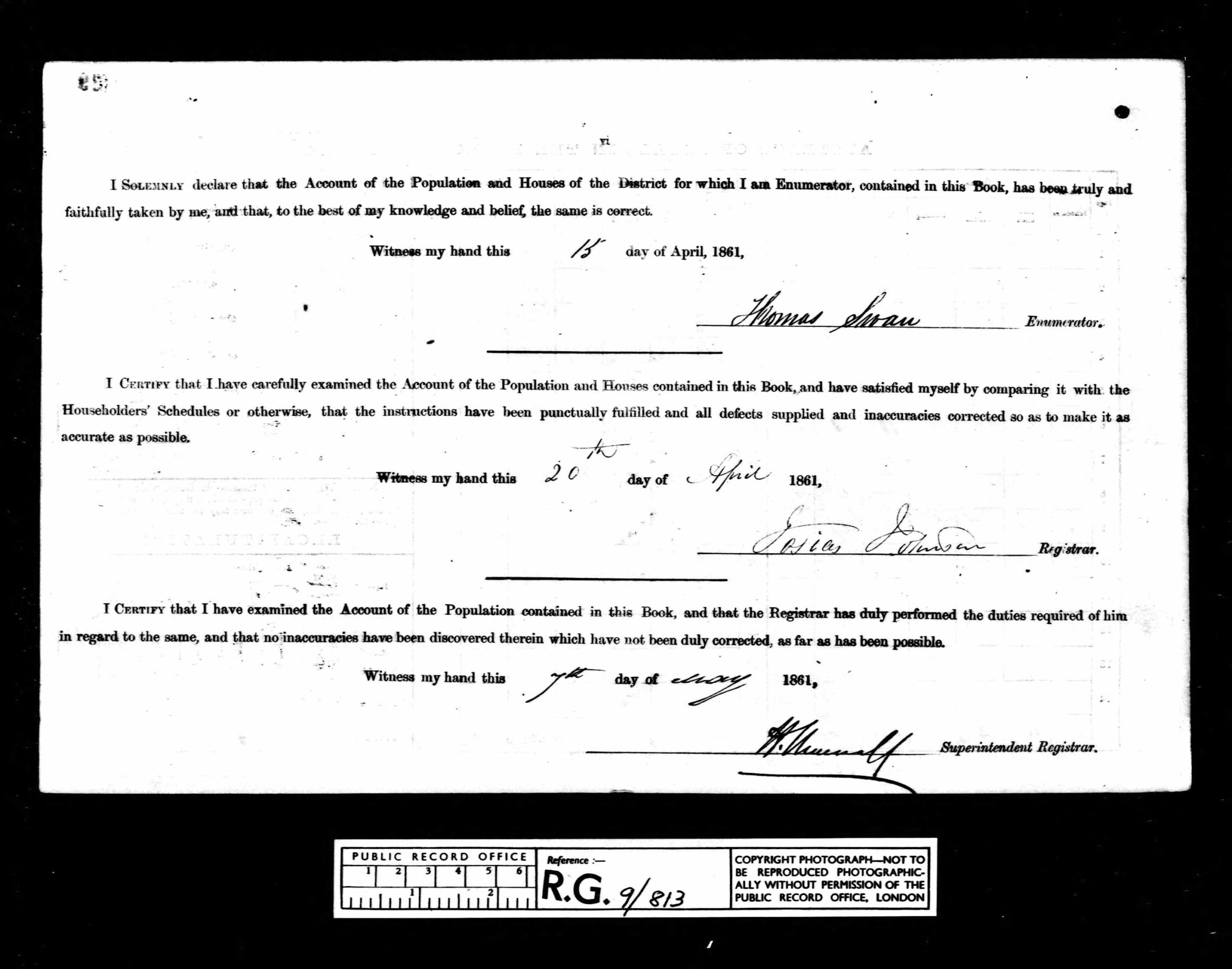
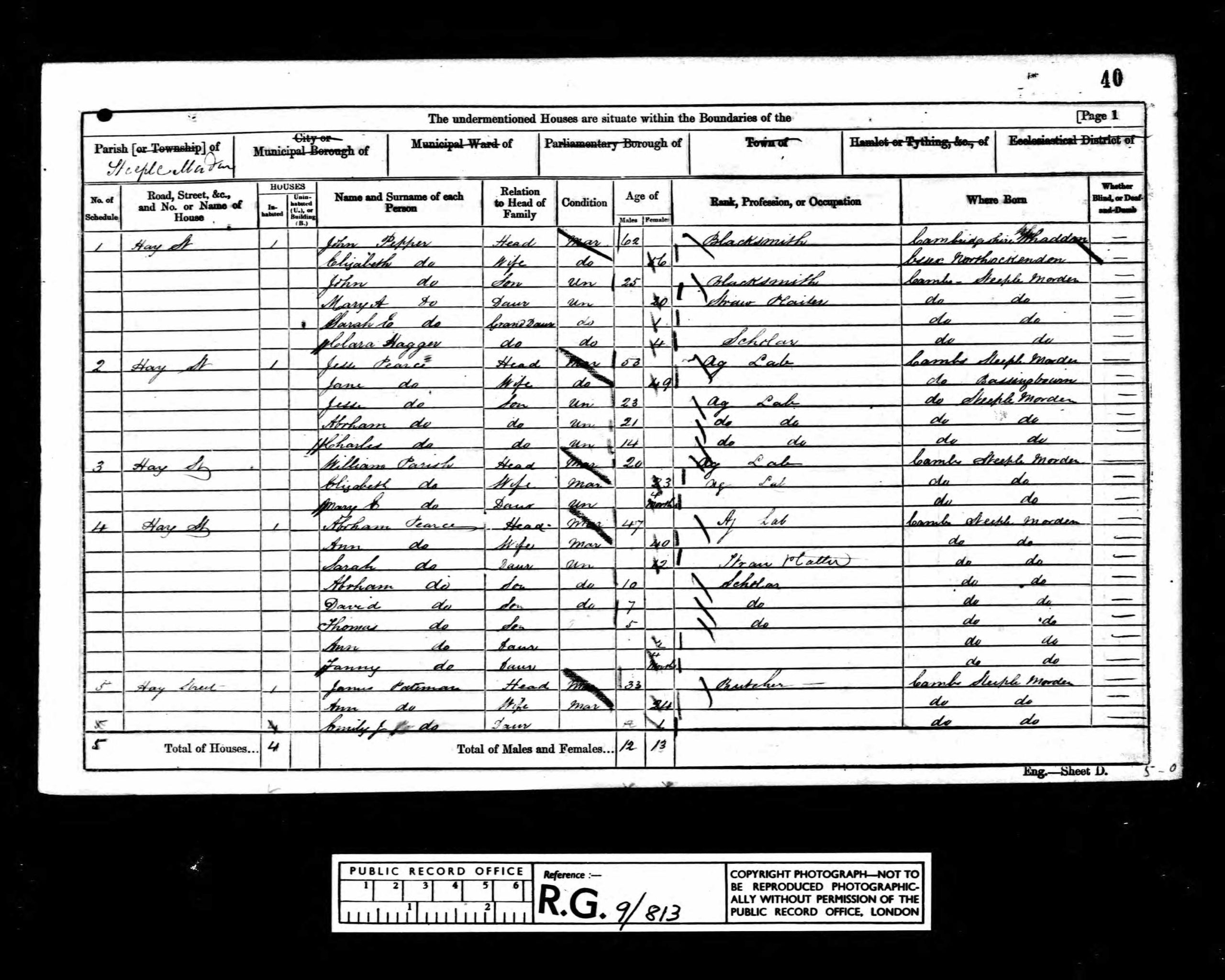
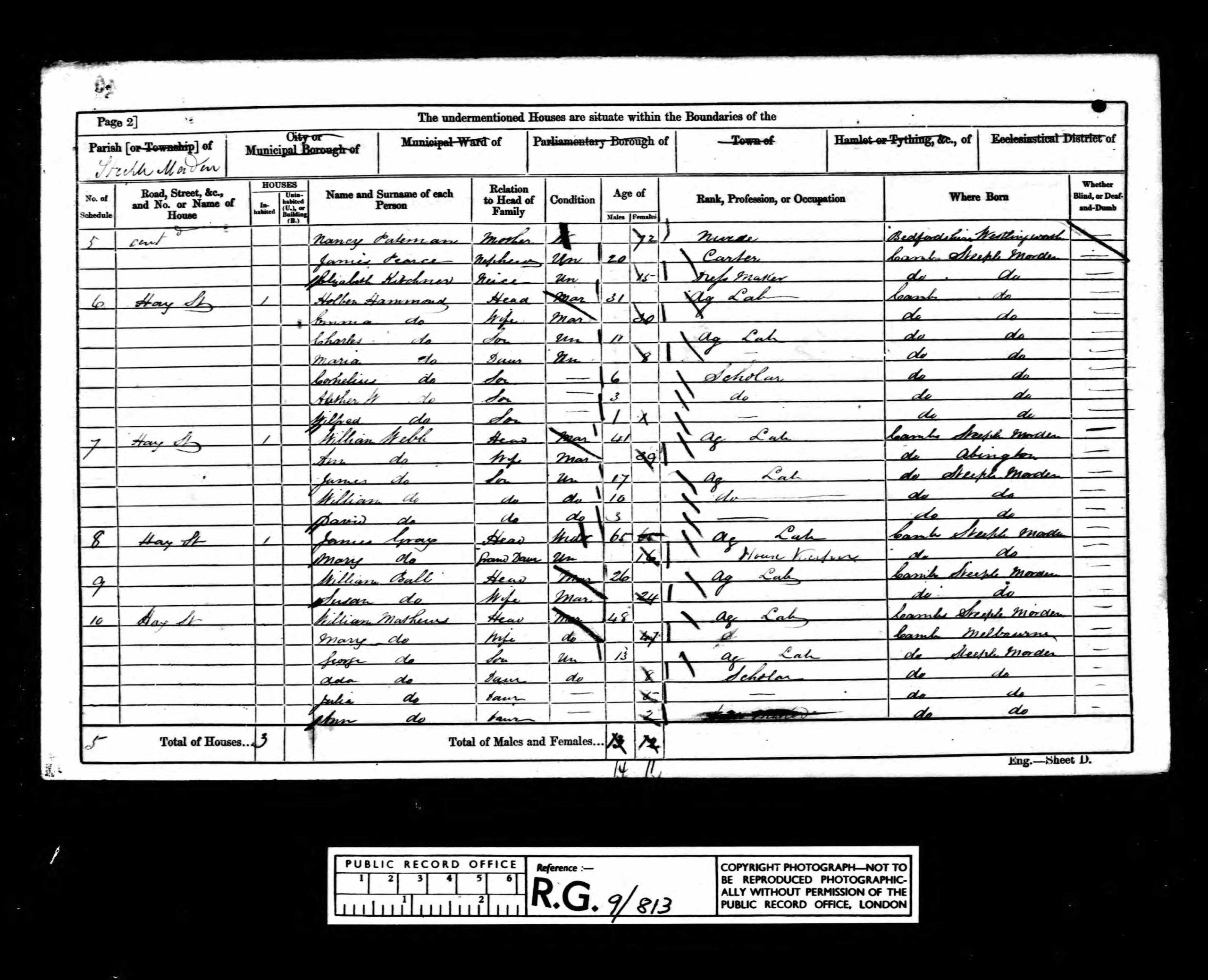
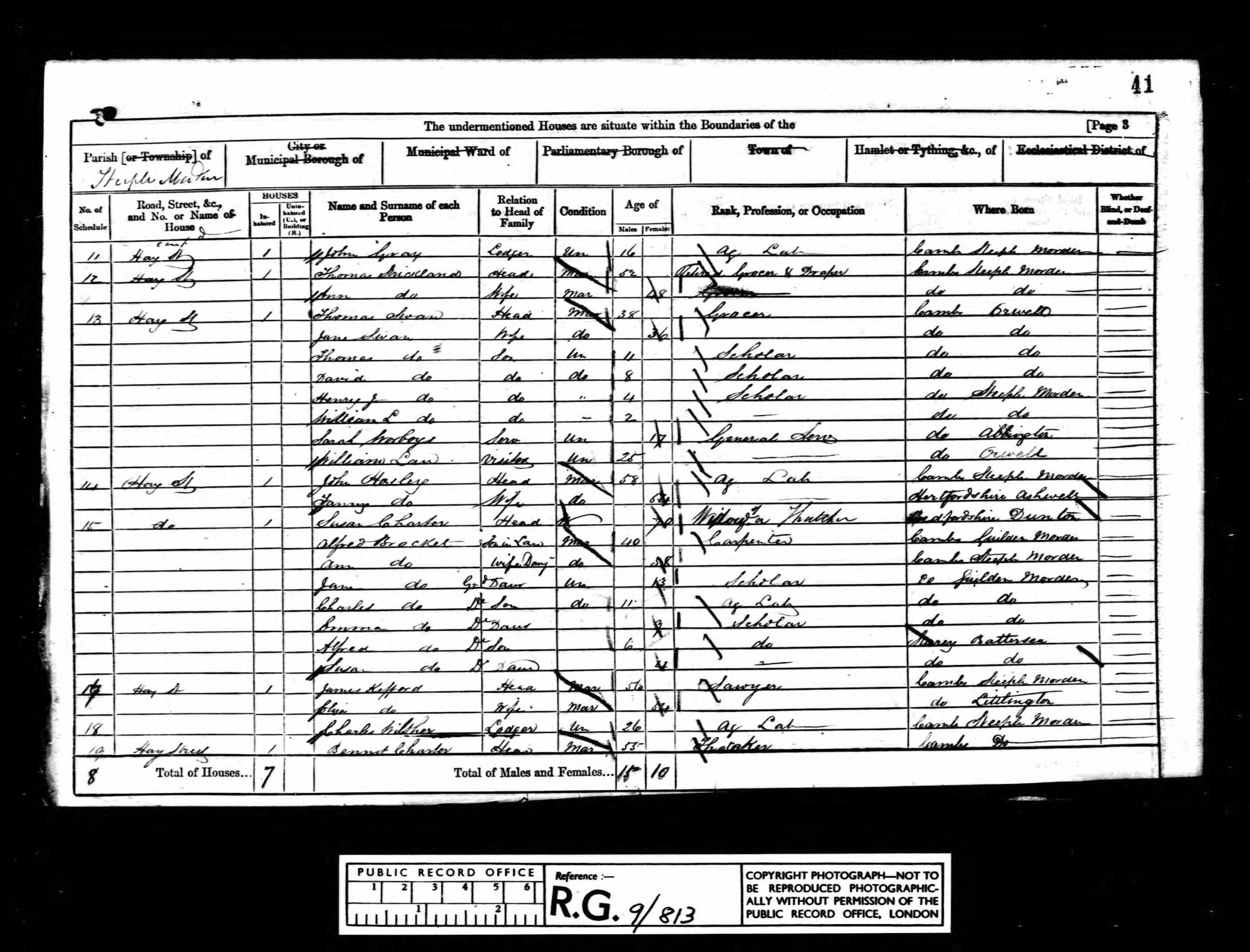
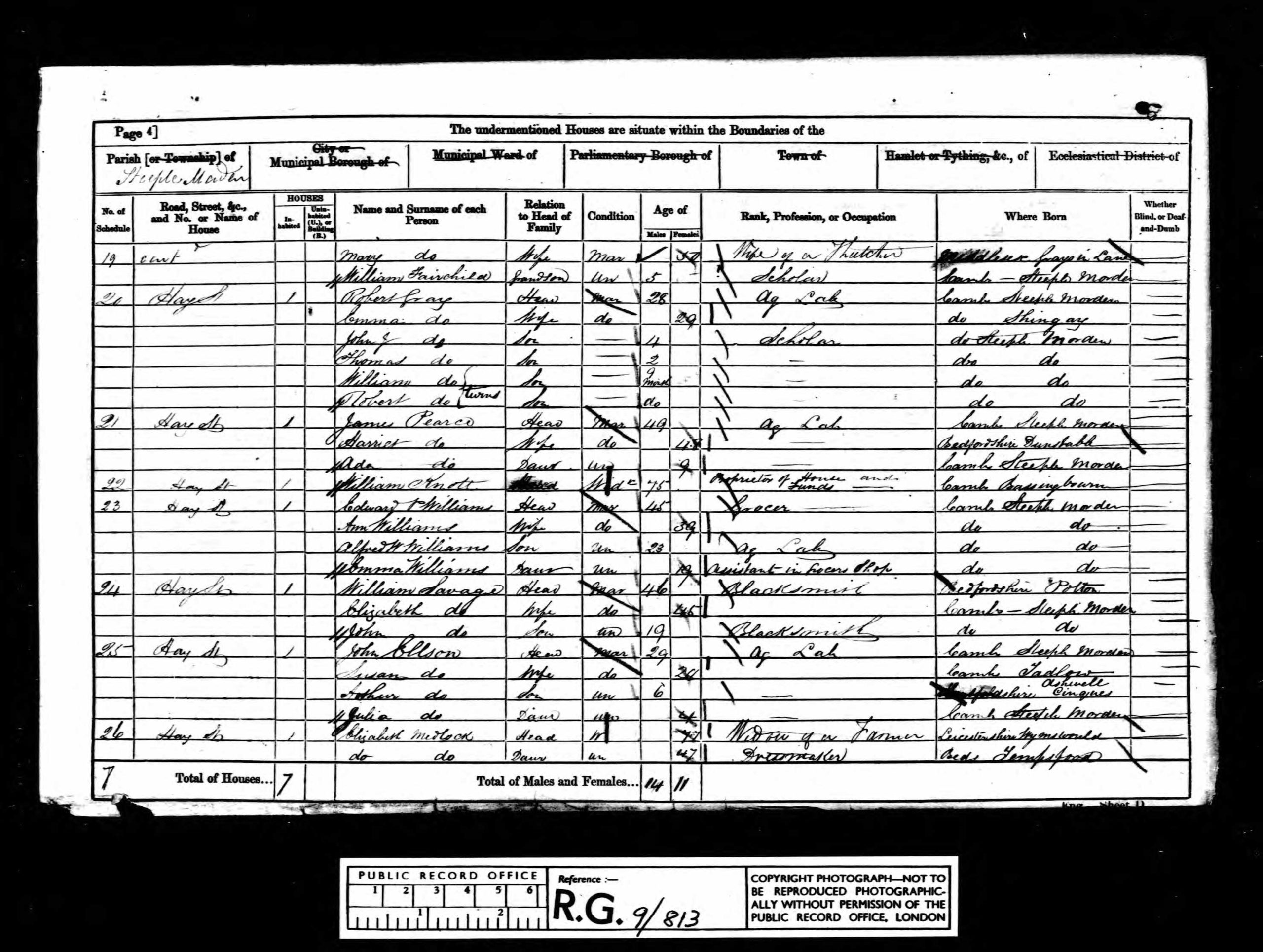
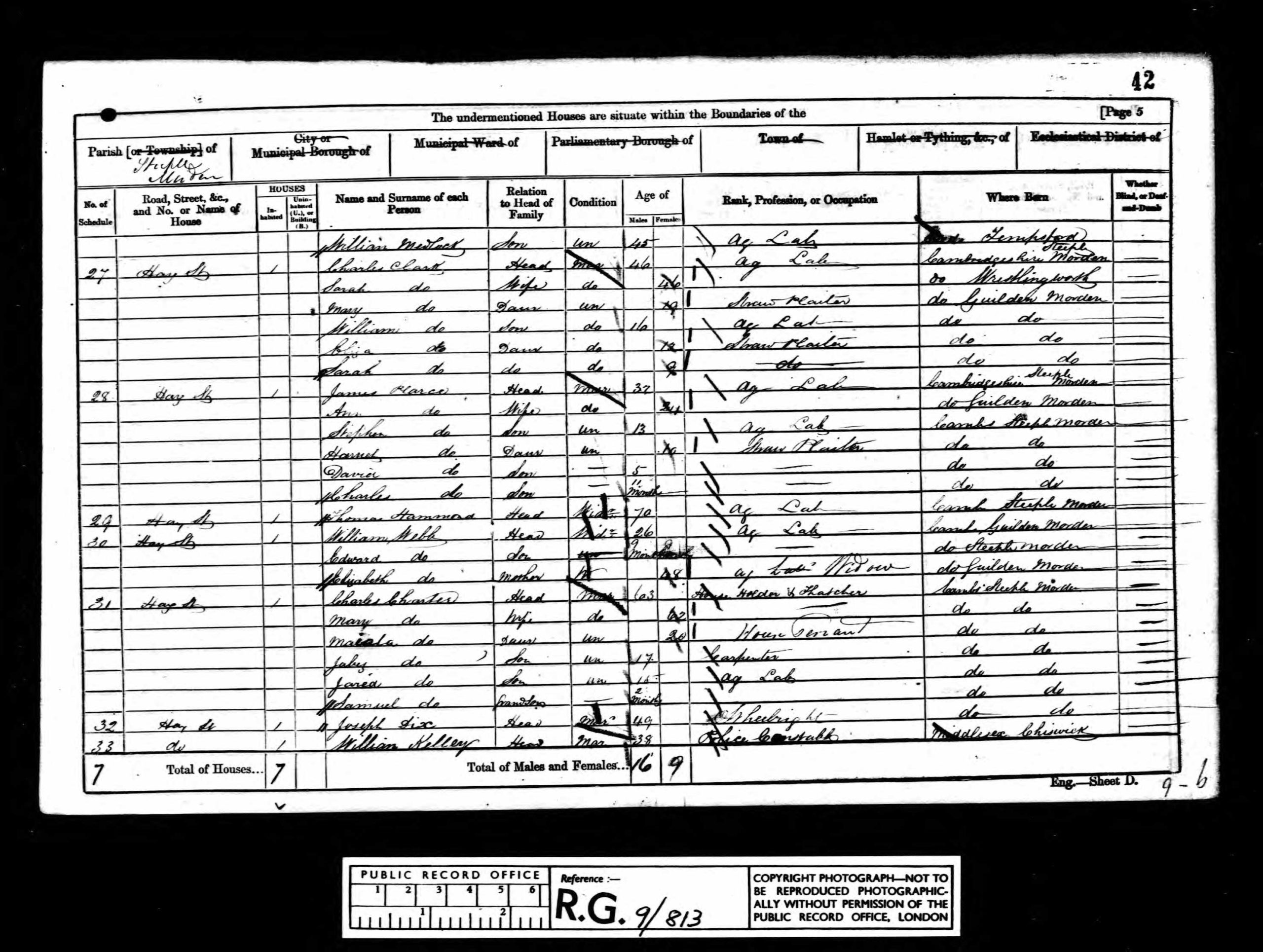
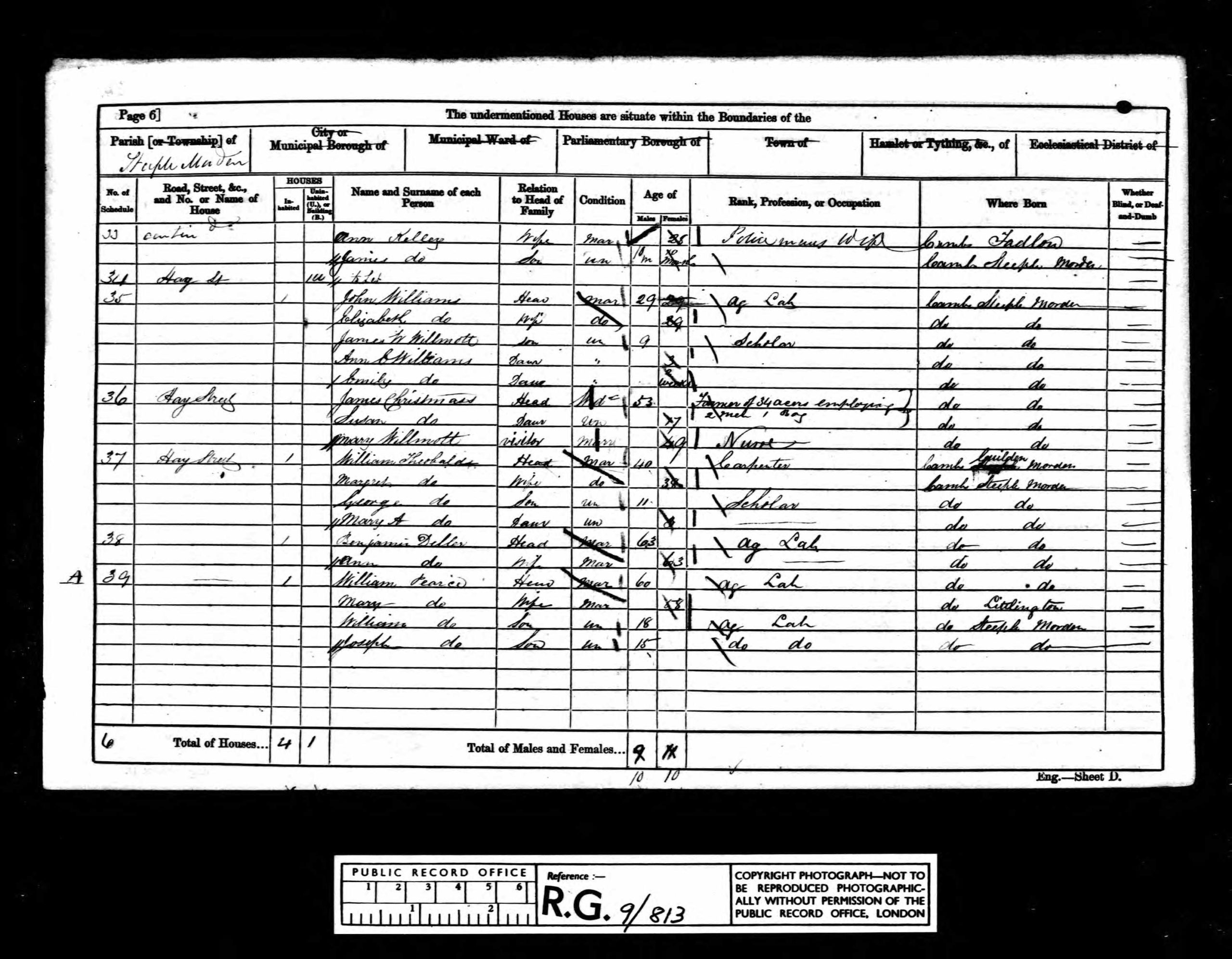
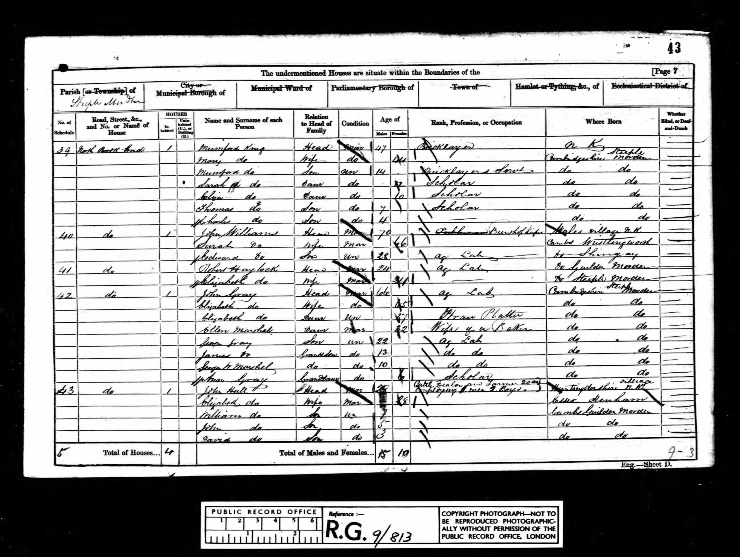
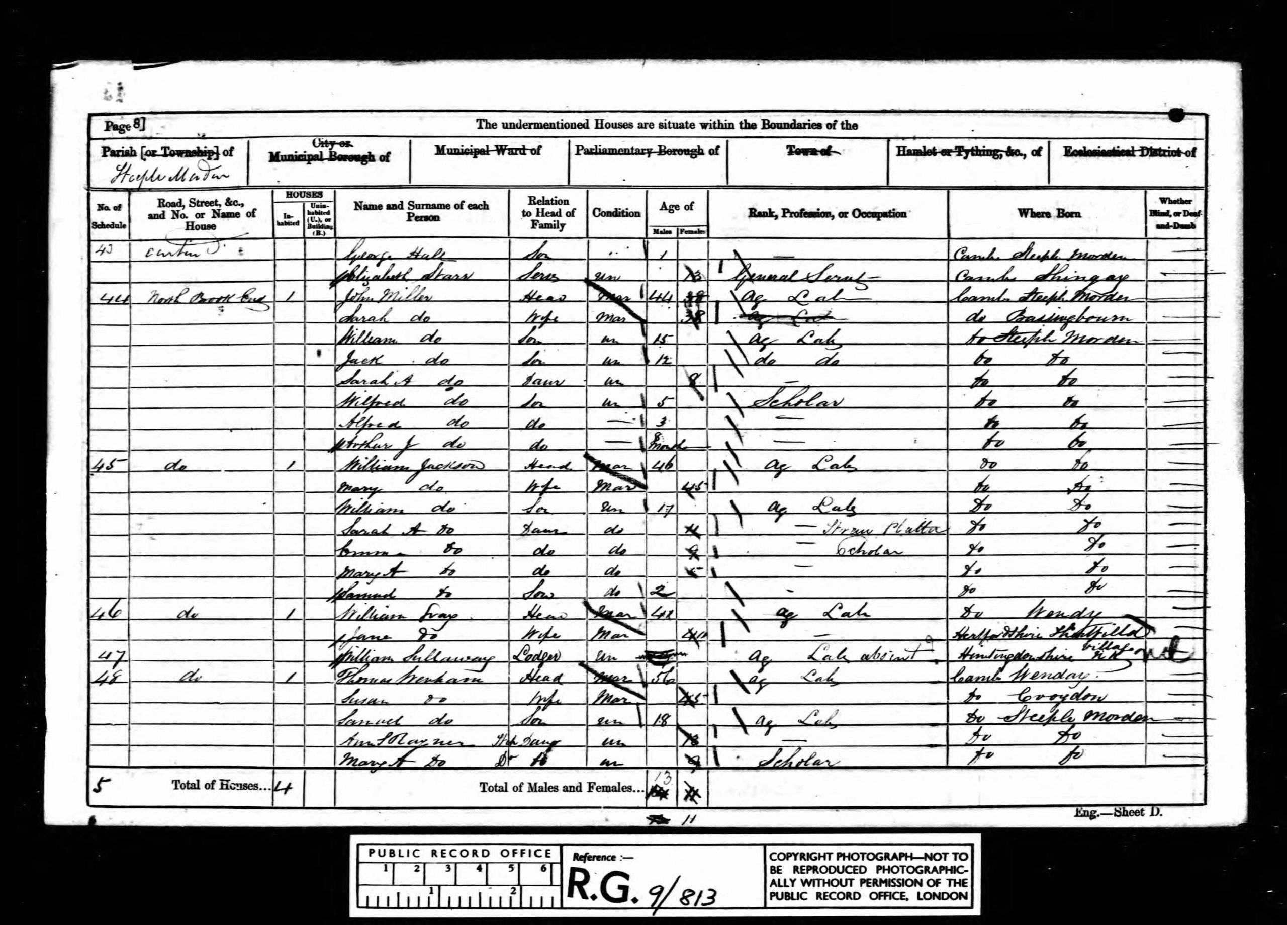
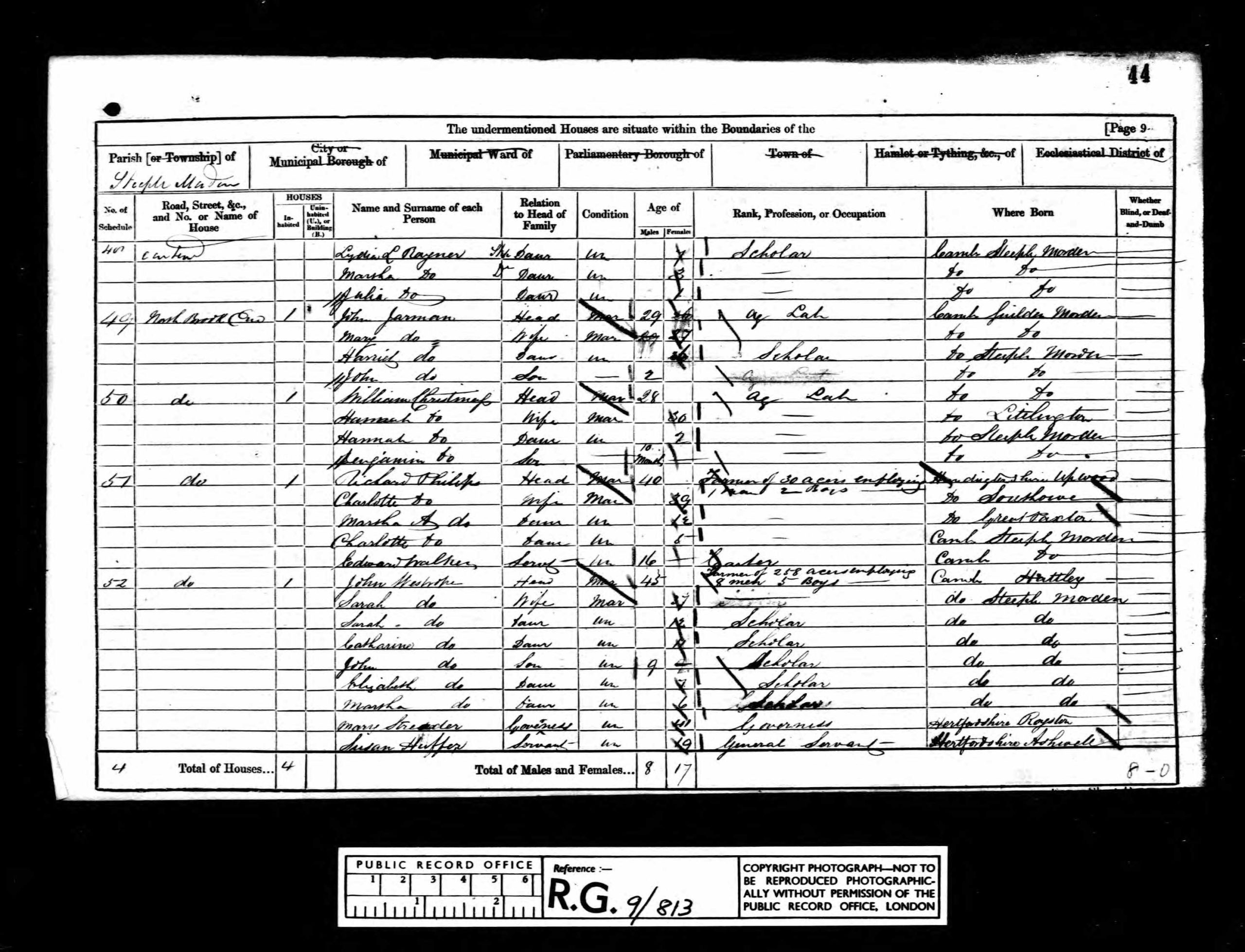
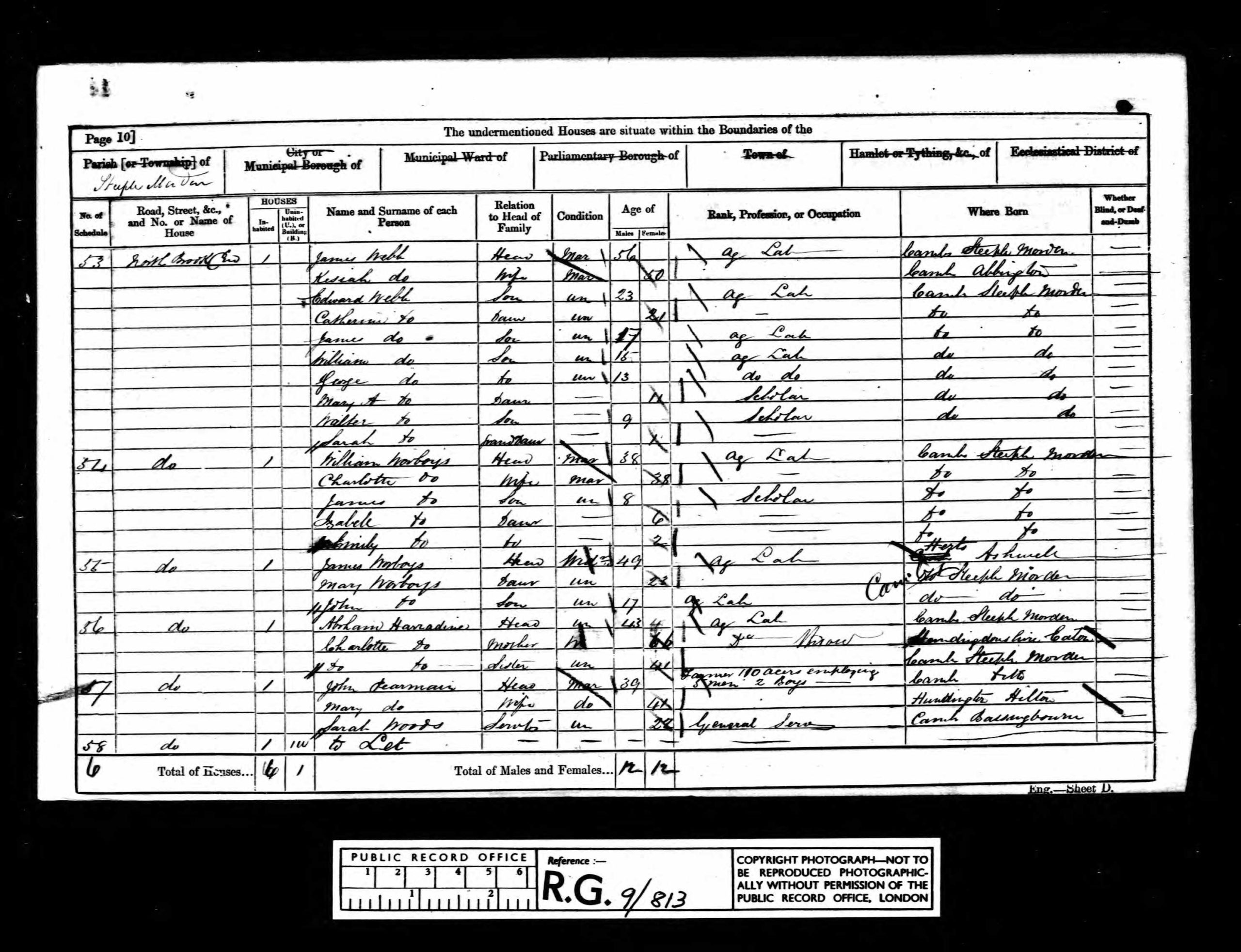
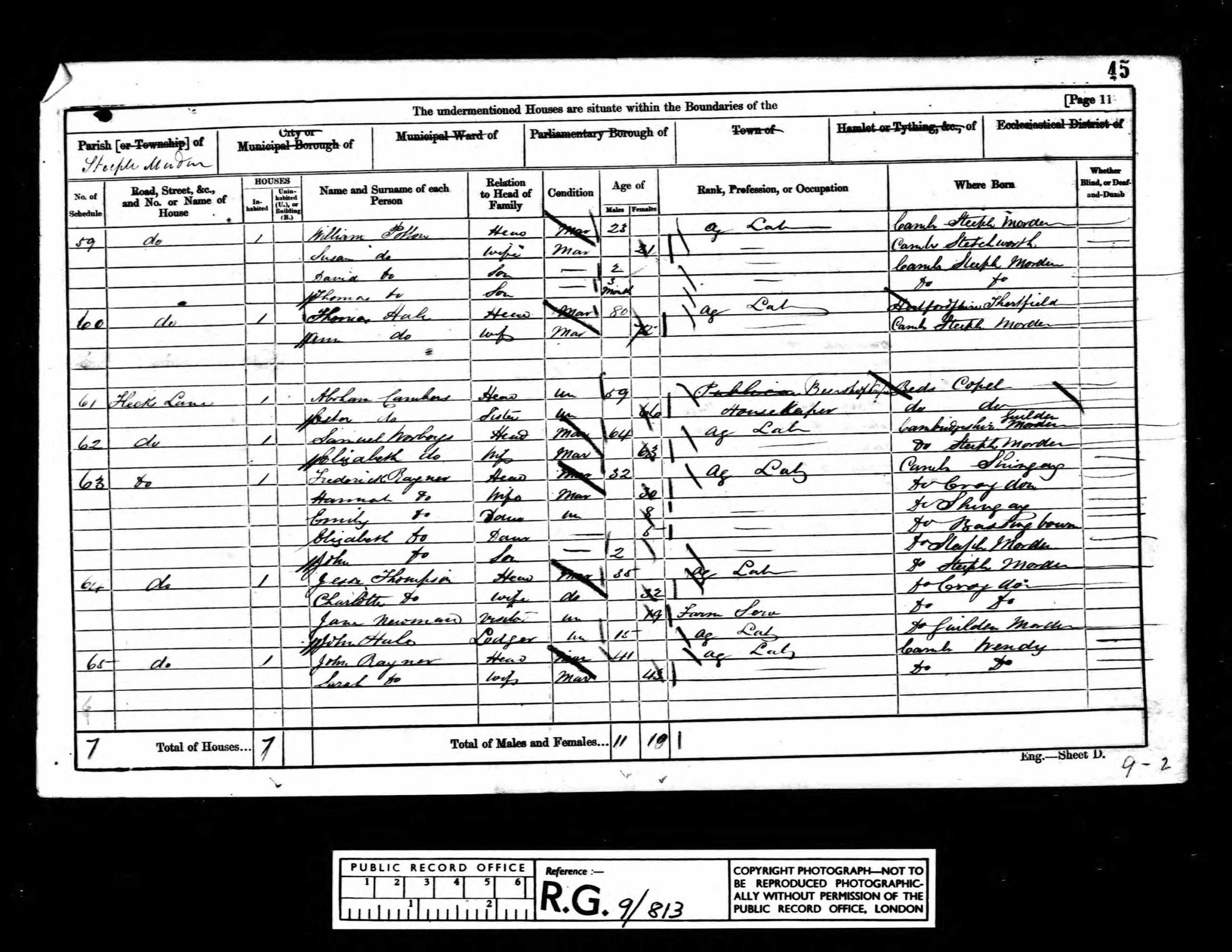
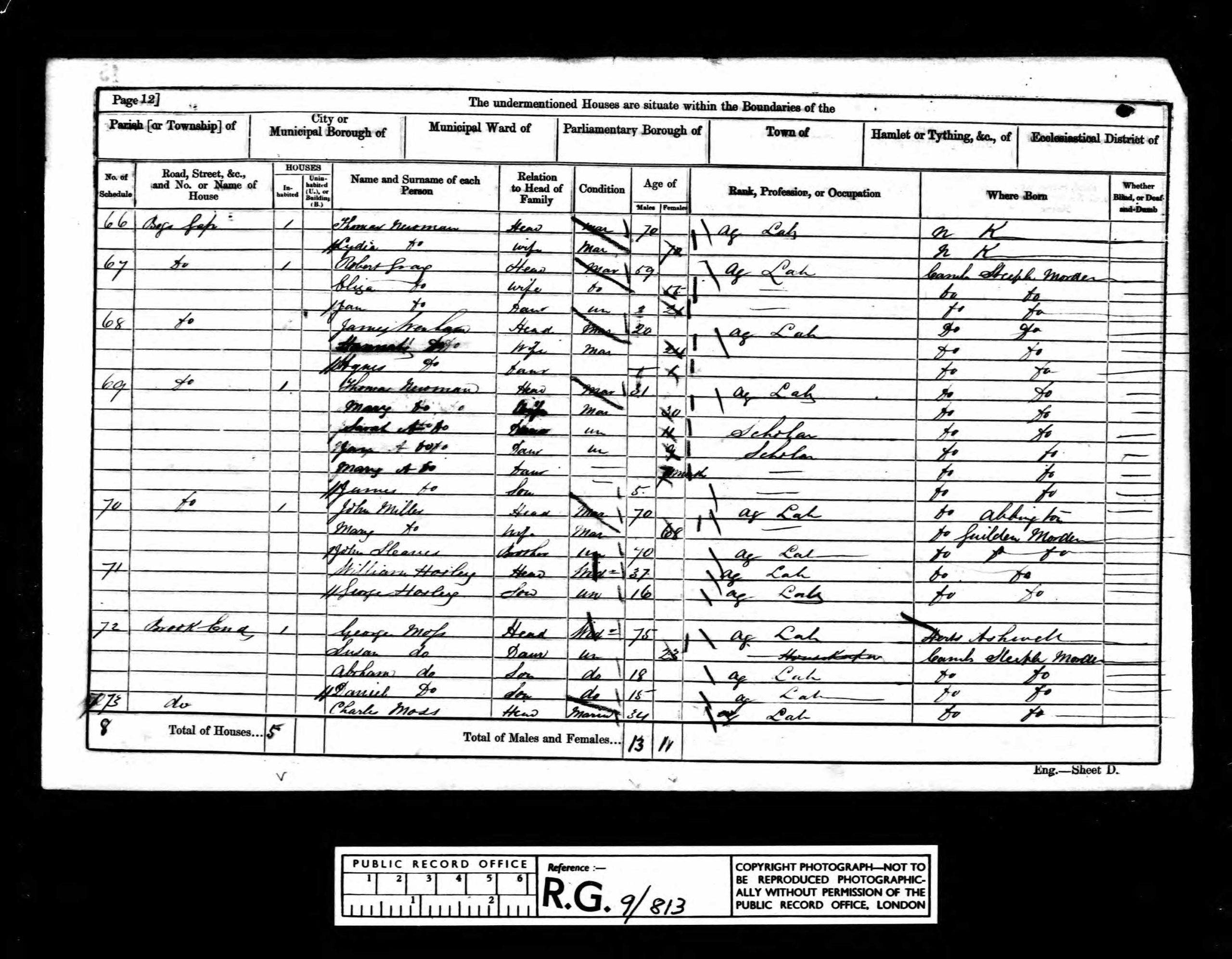
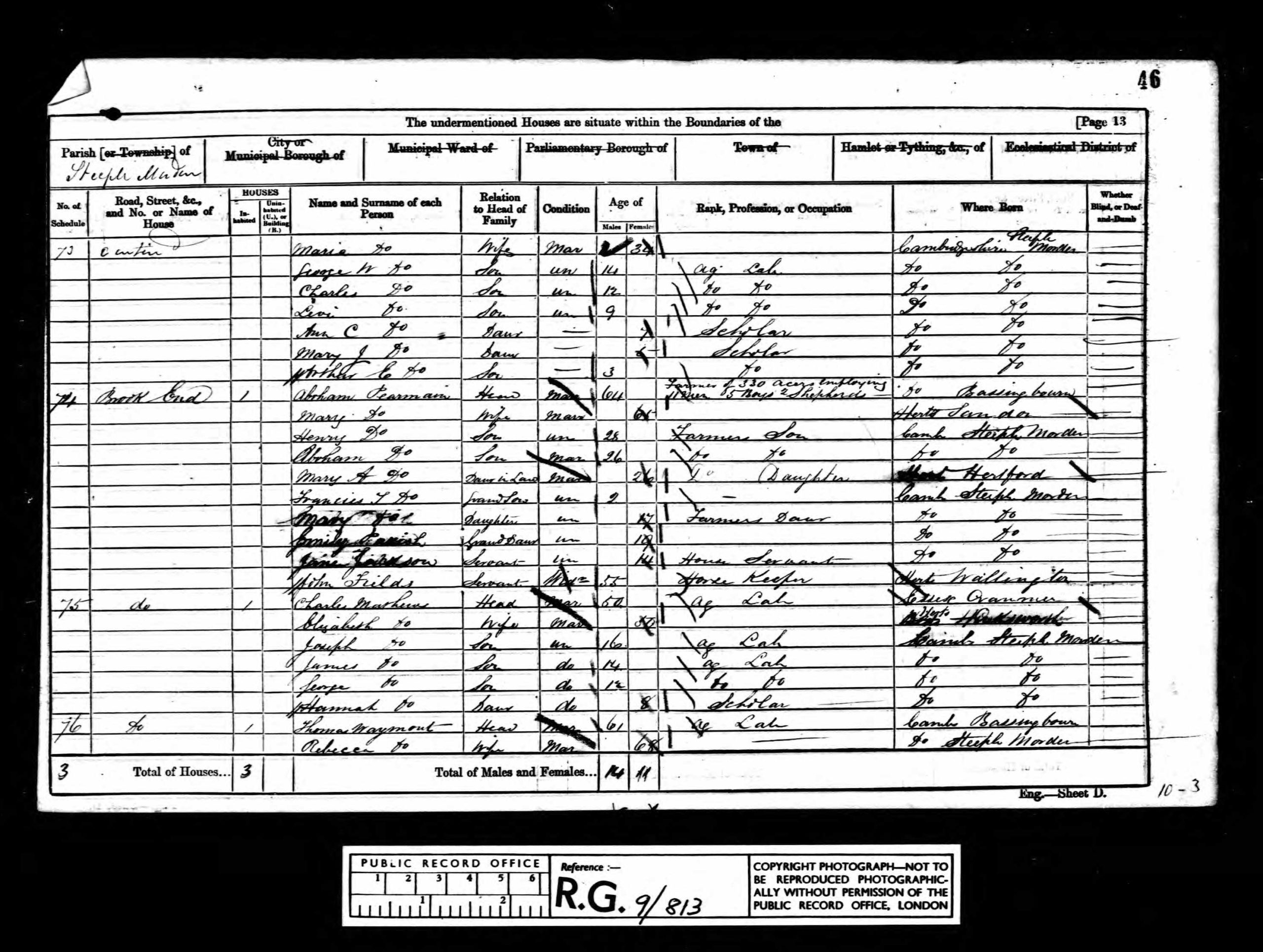
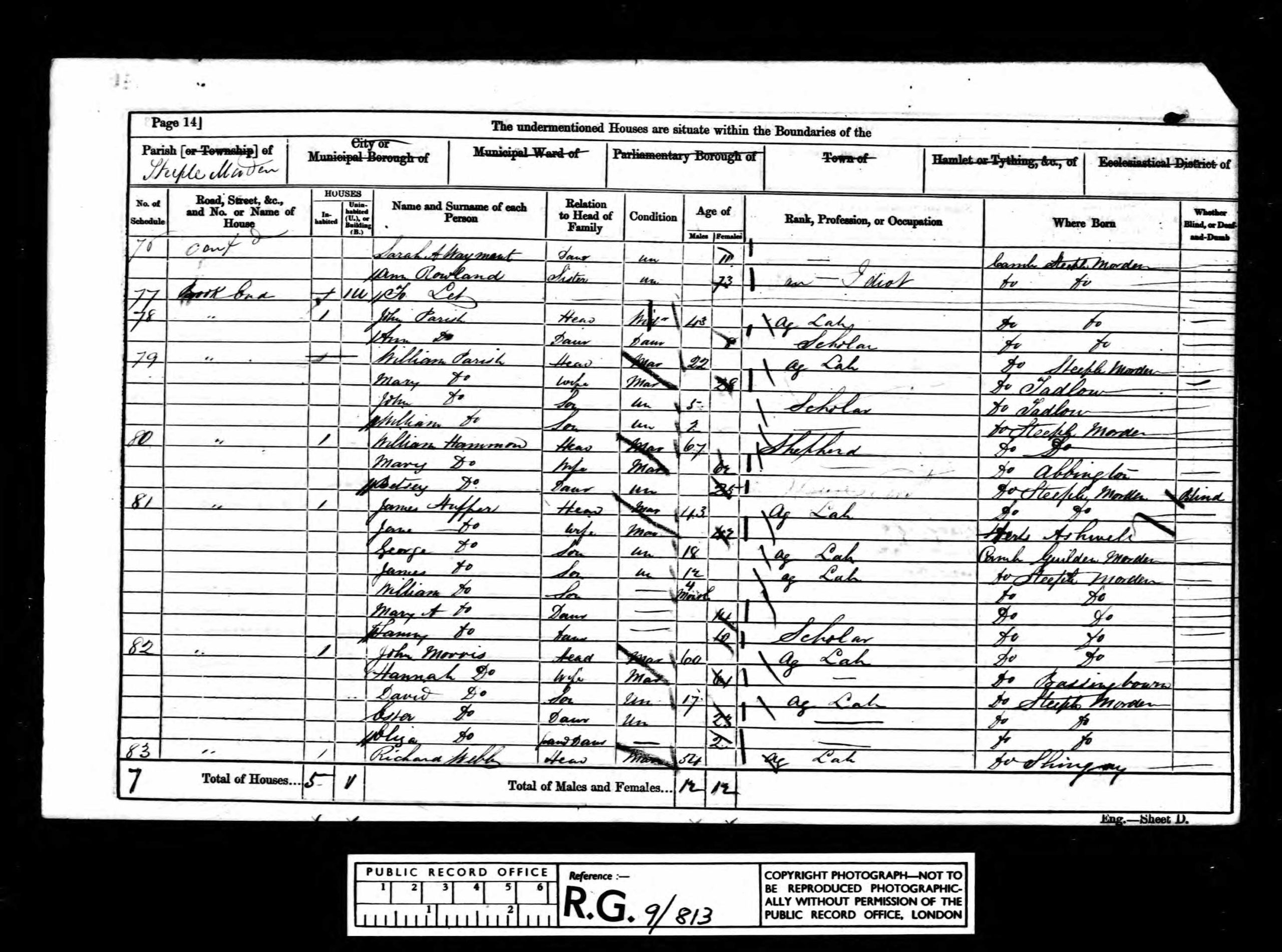
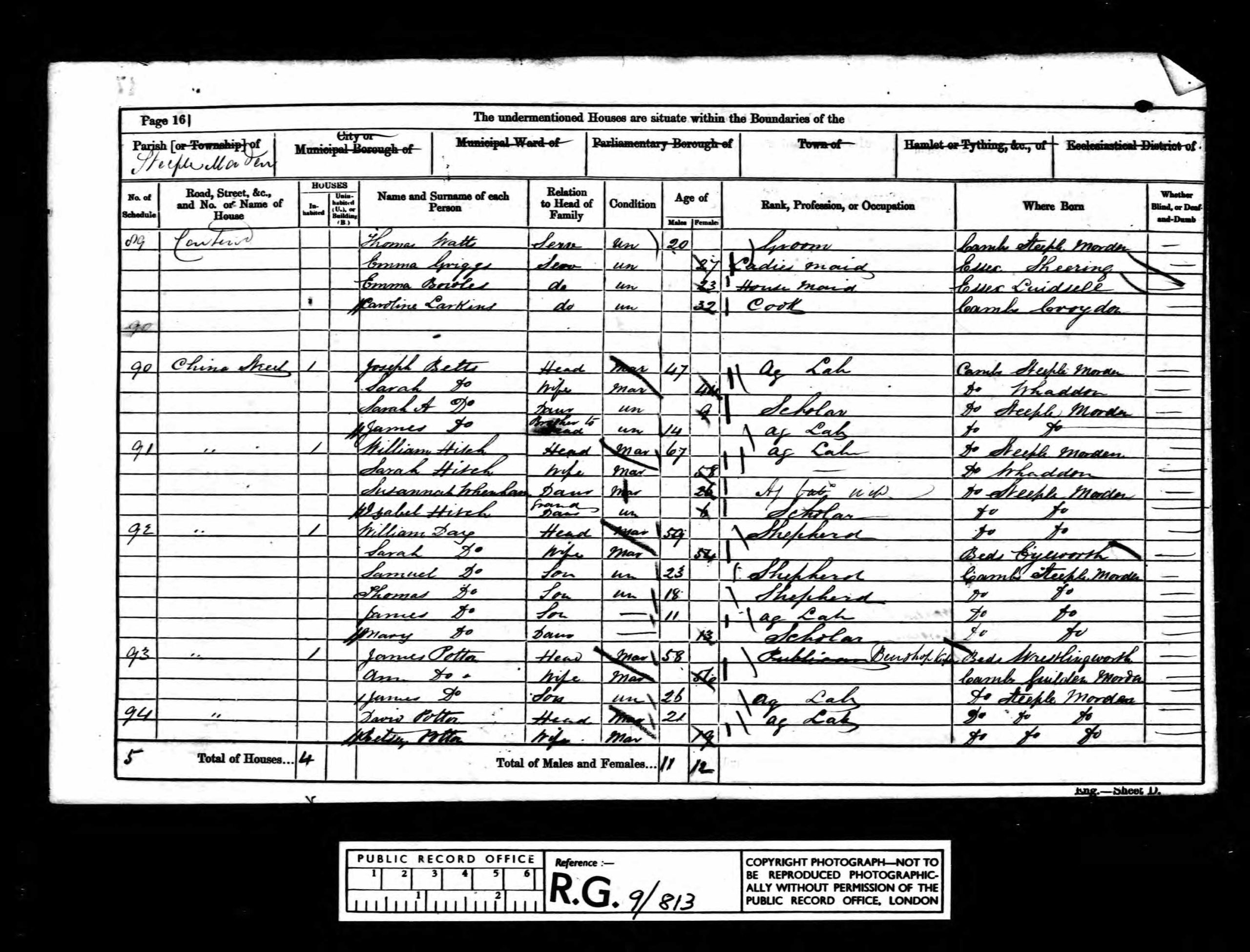
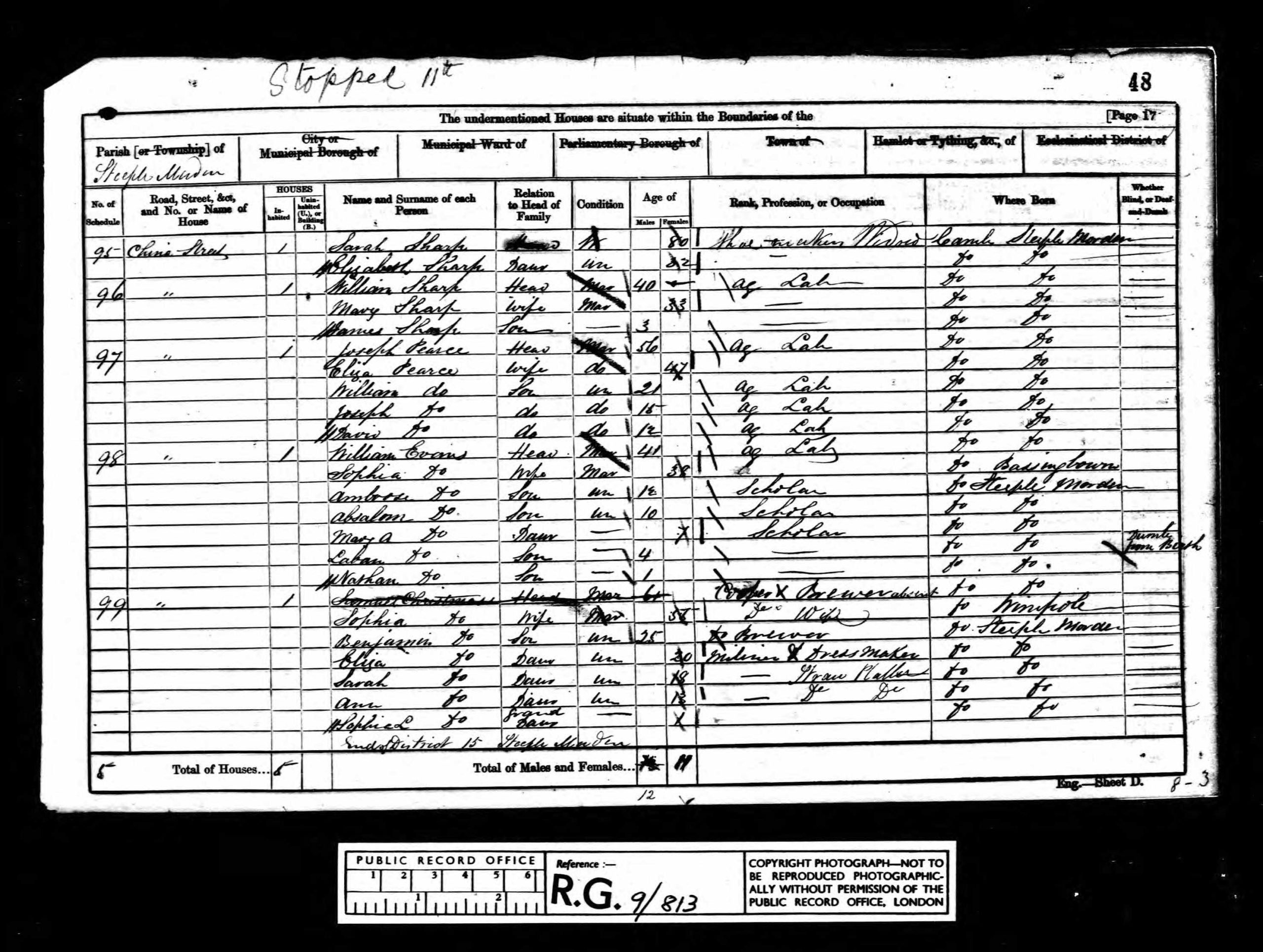
Census 1861
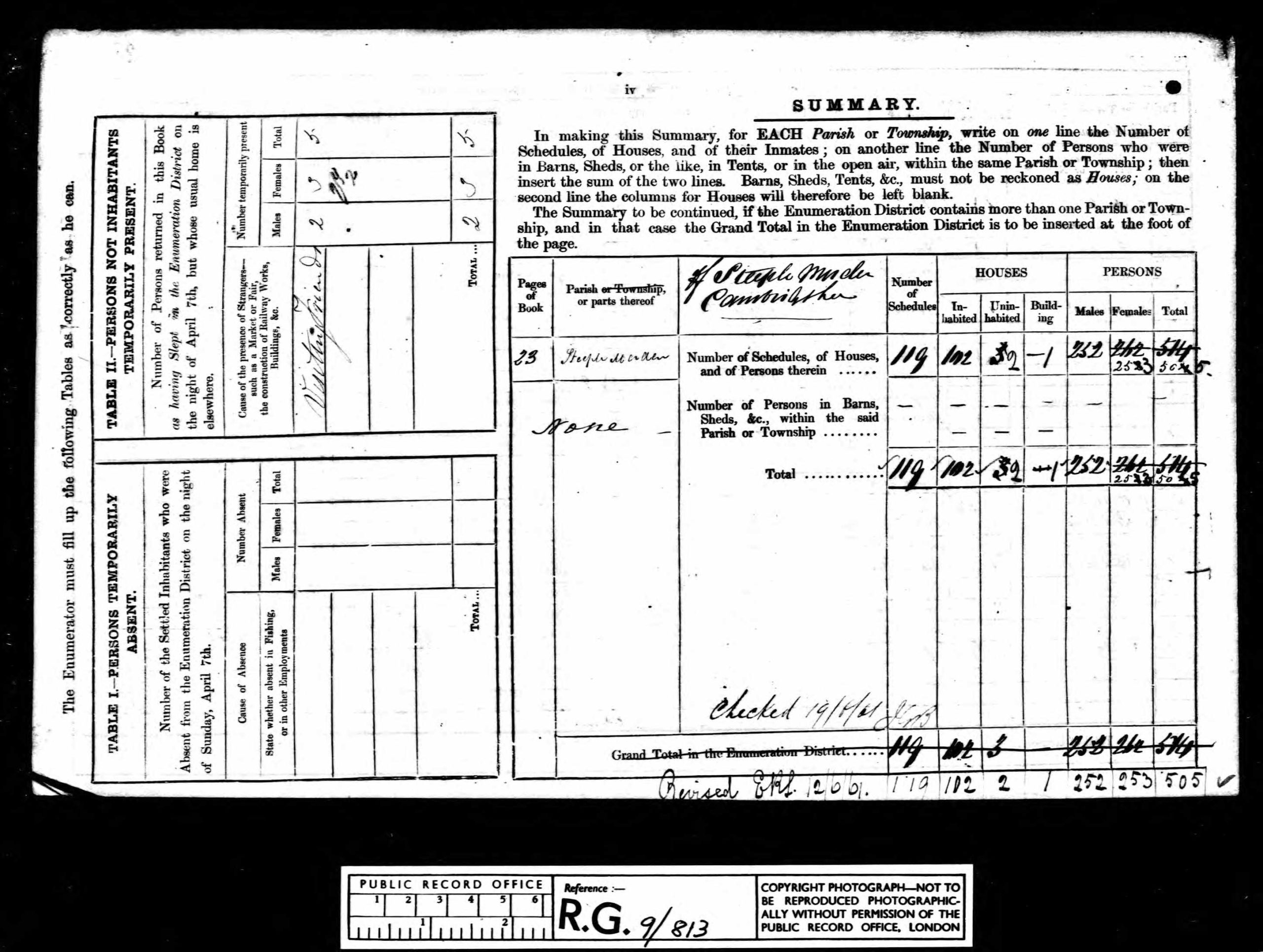
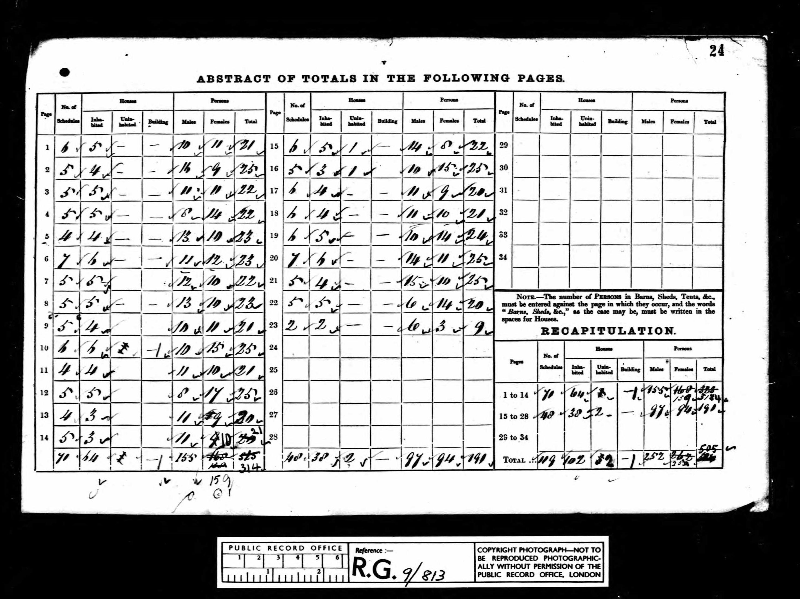
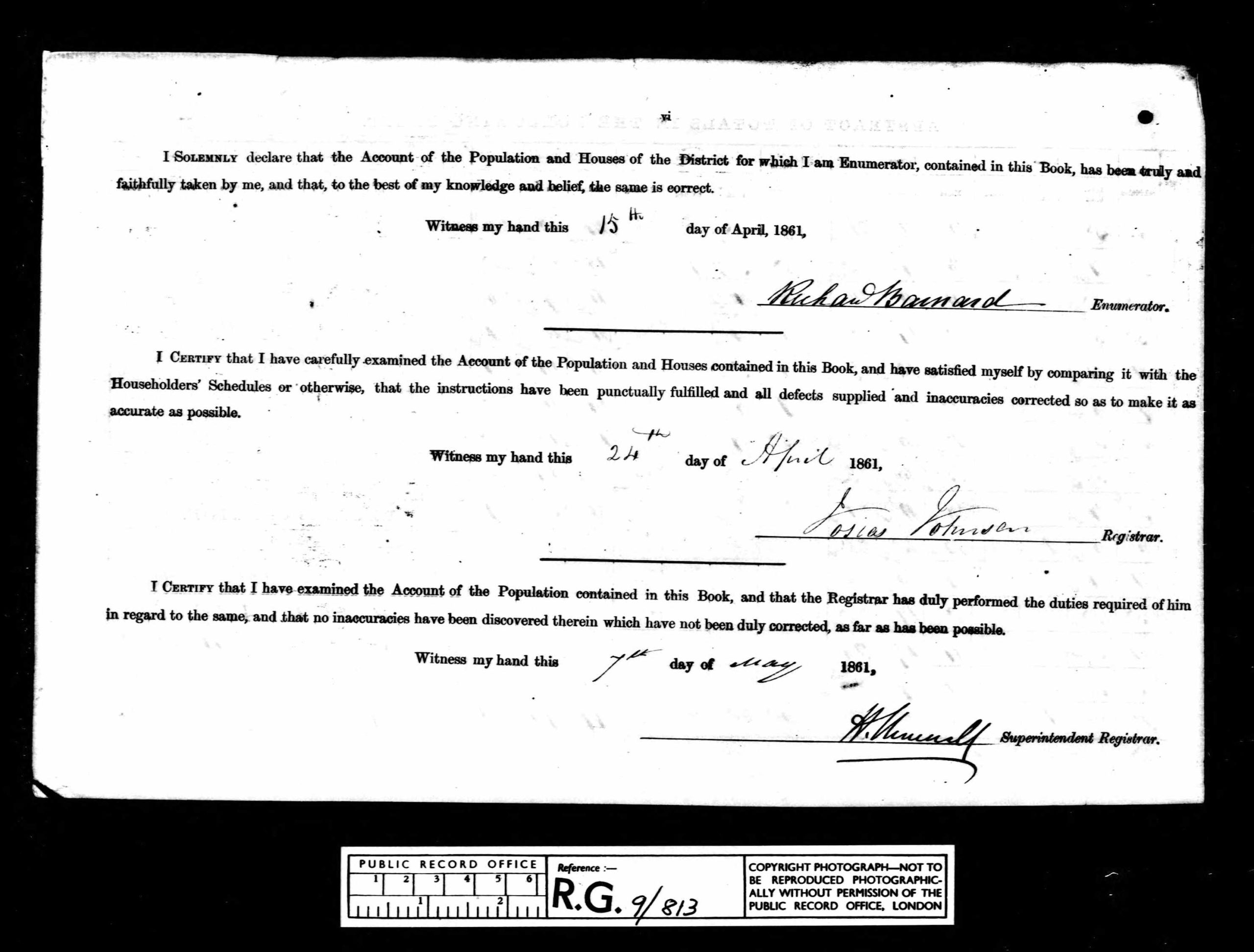
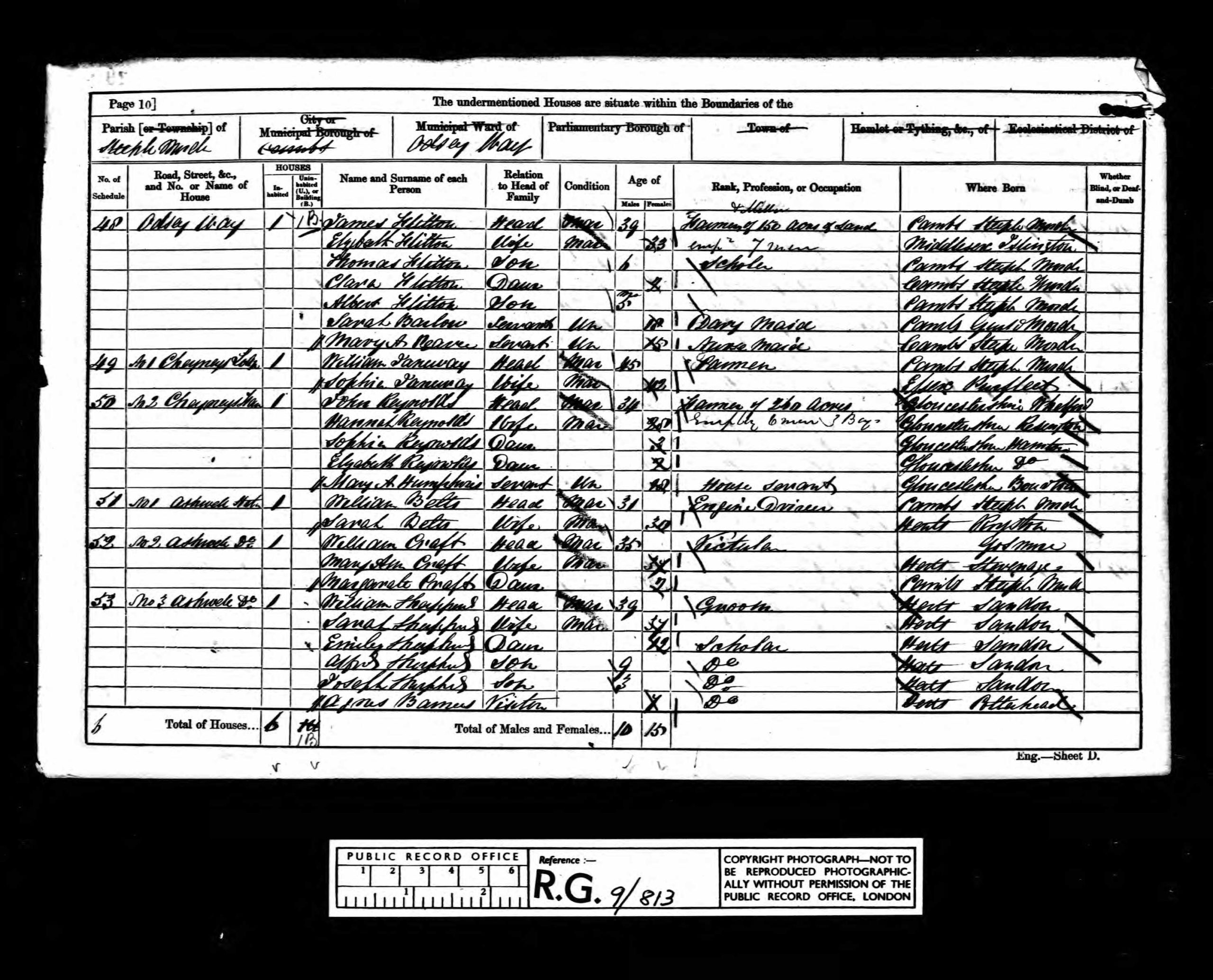
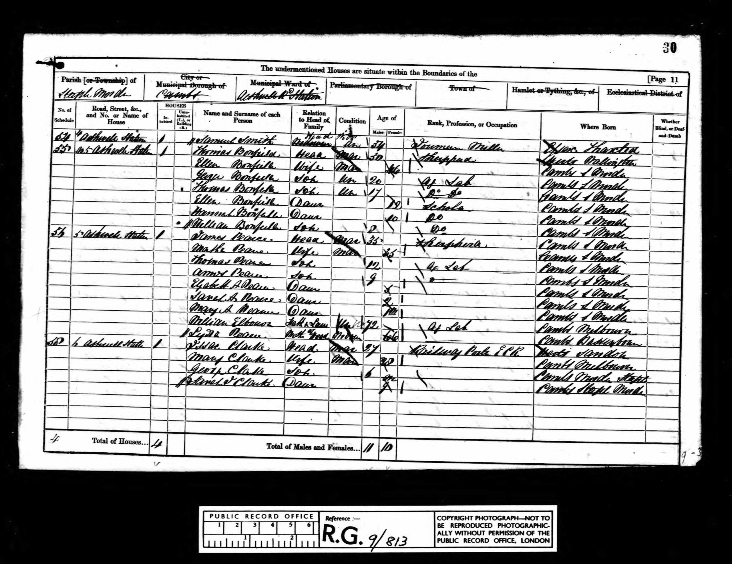
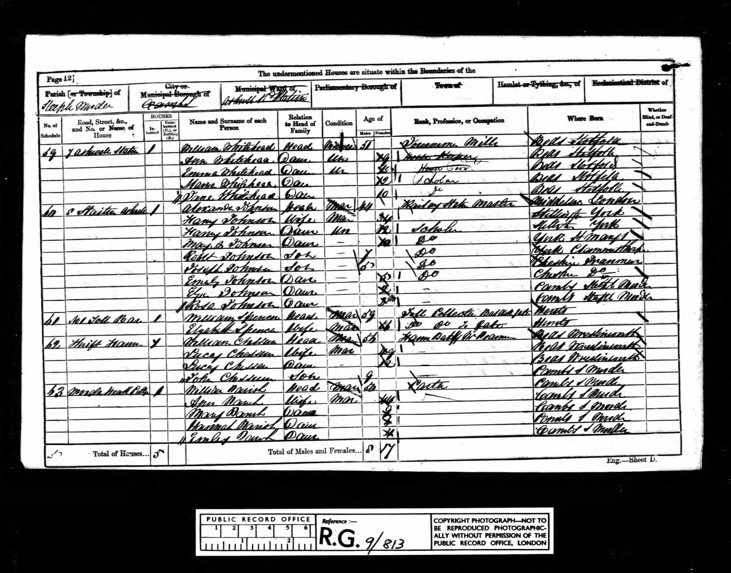
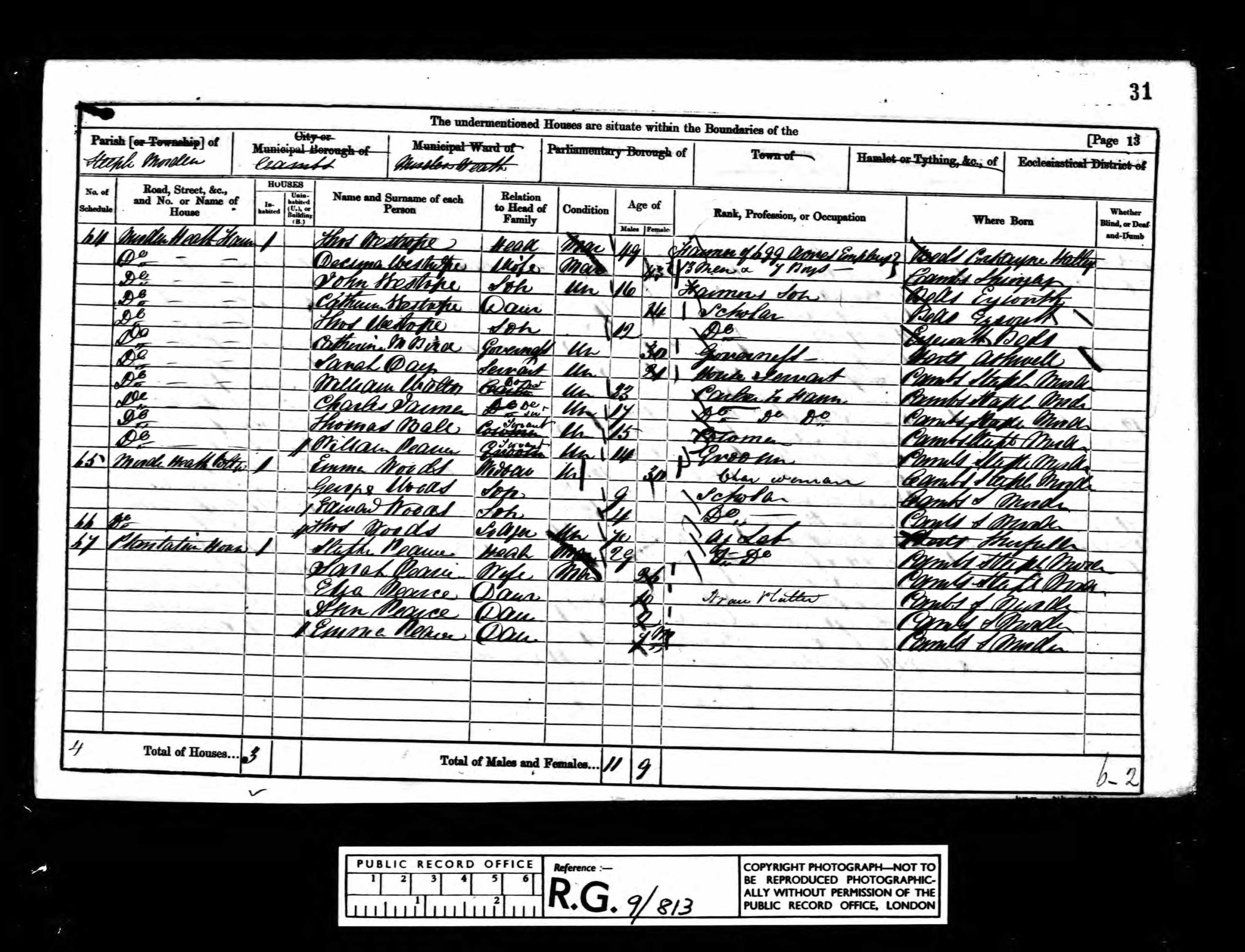
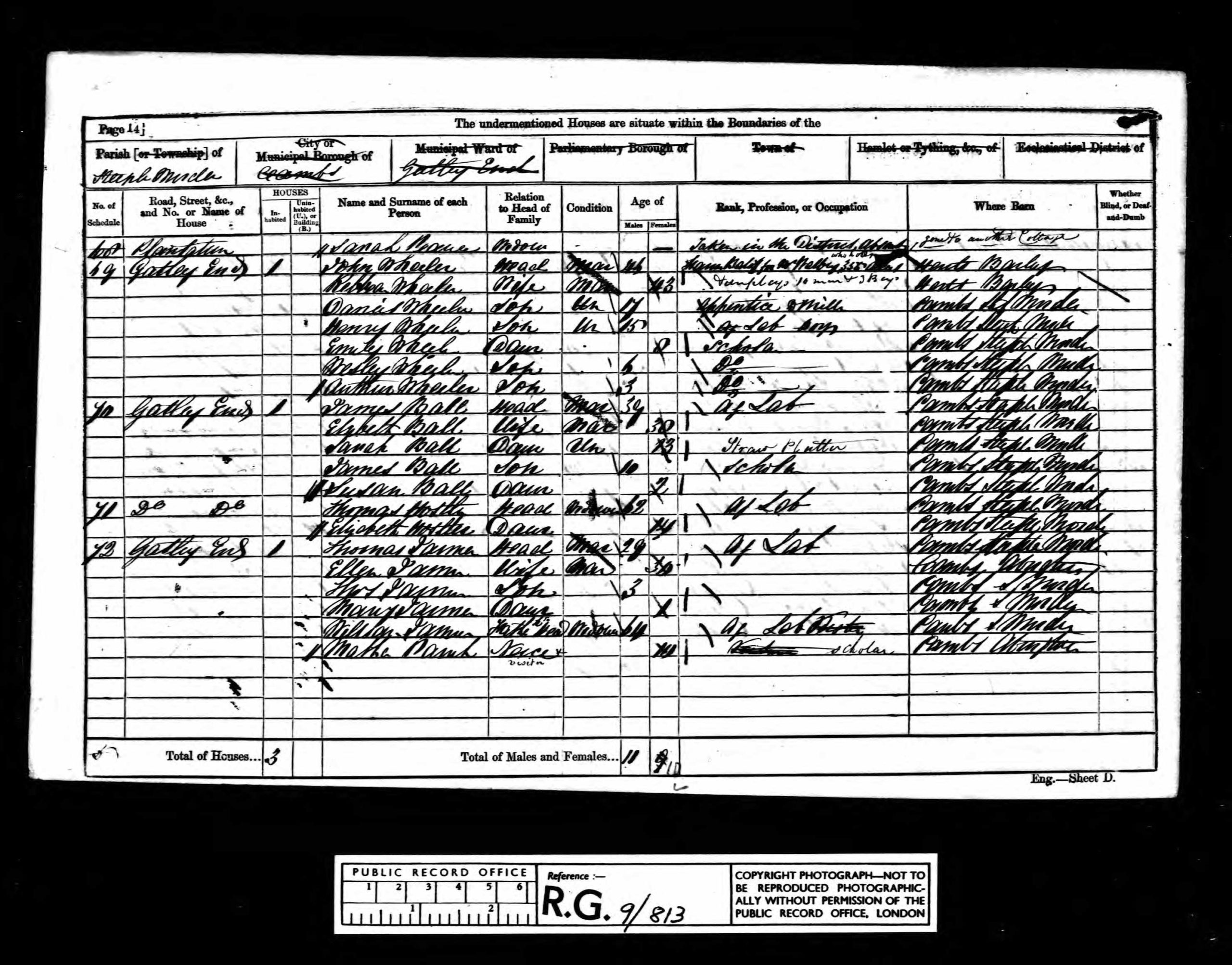
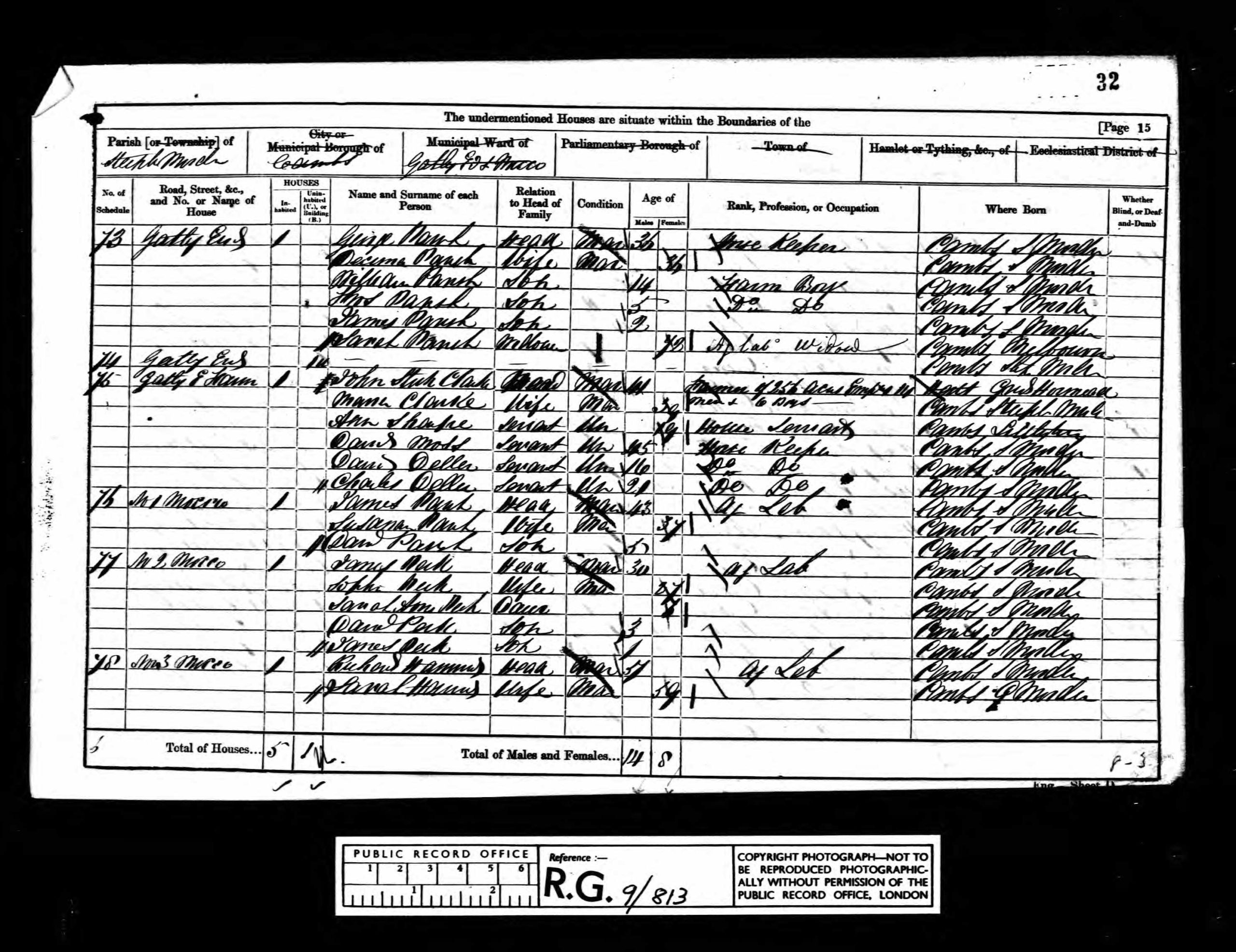
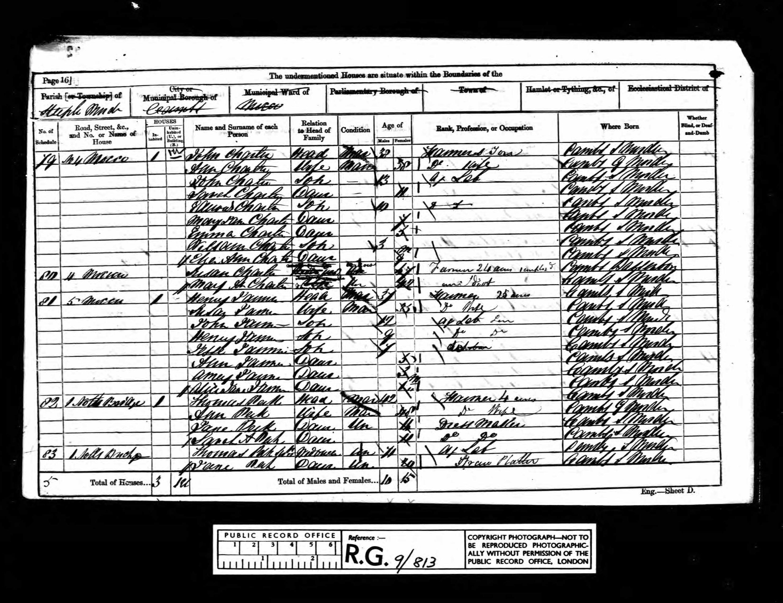
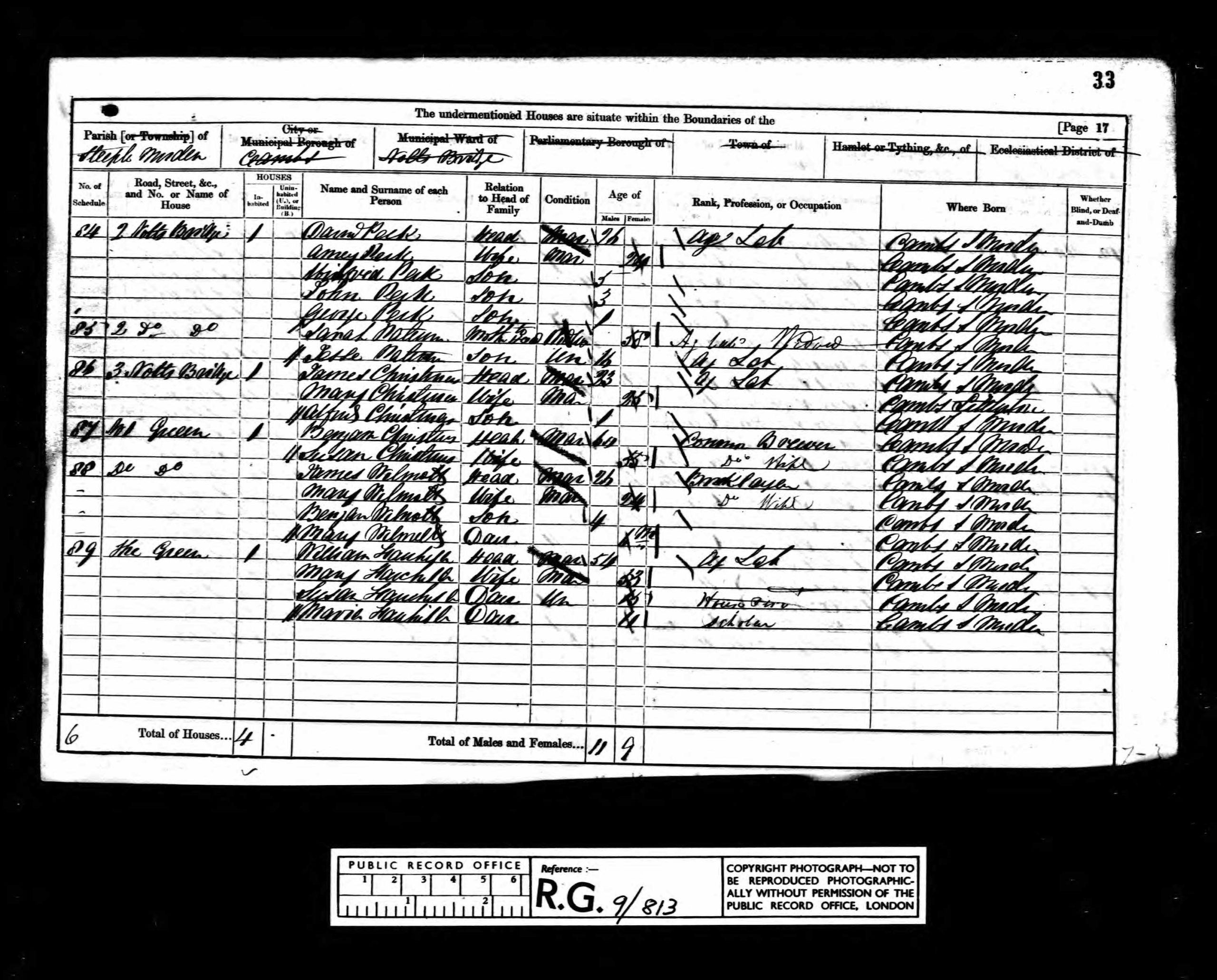
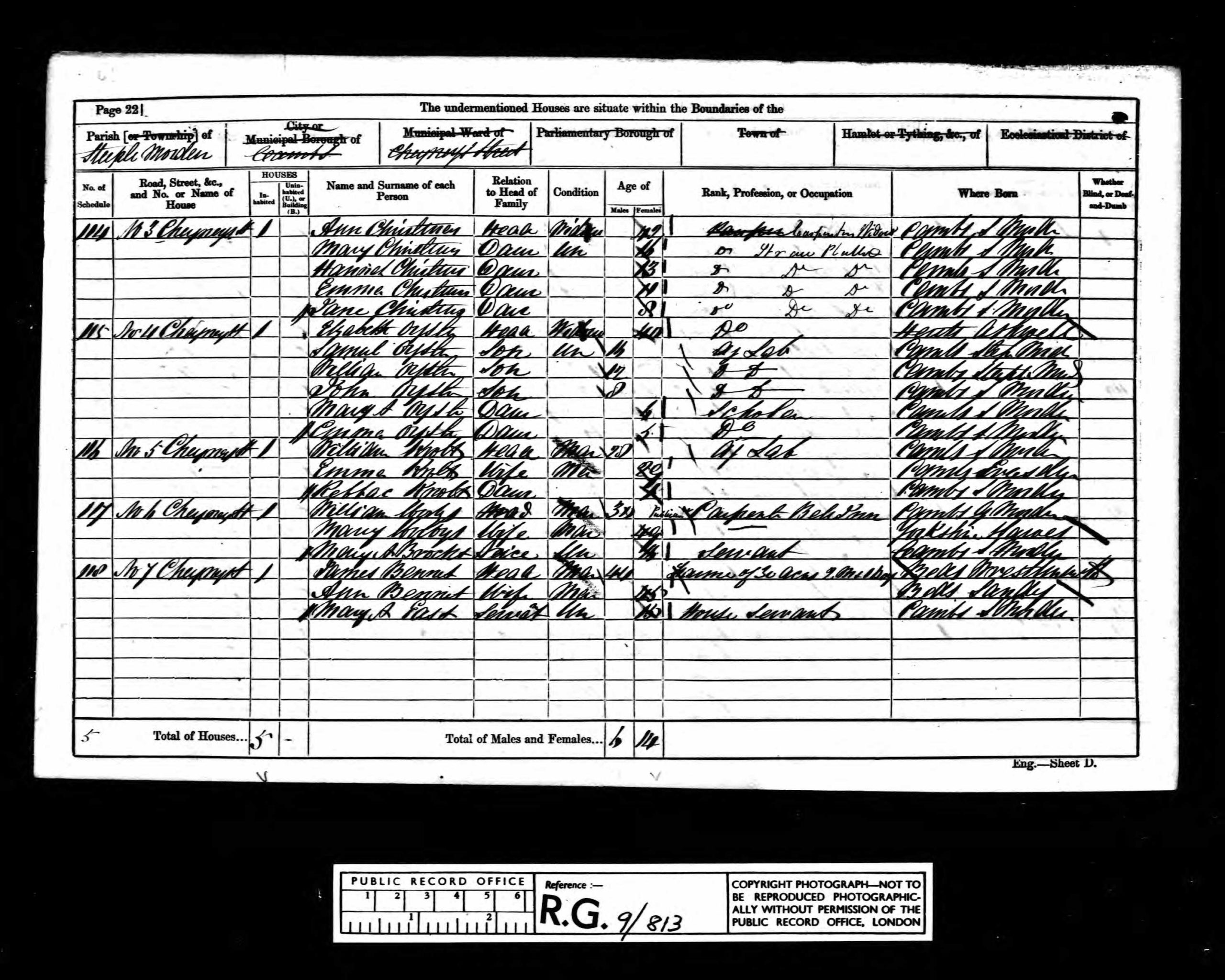
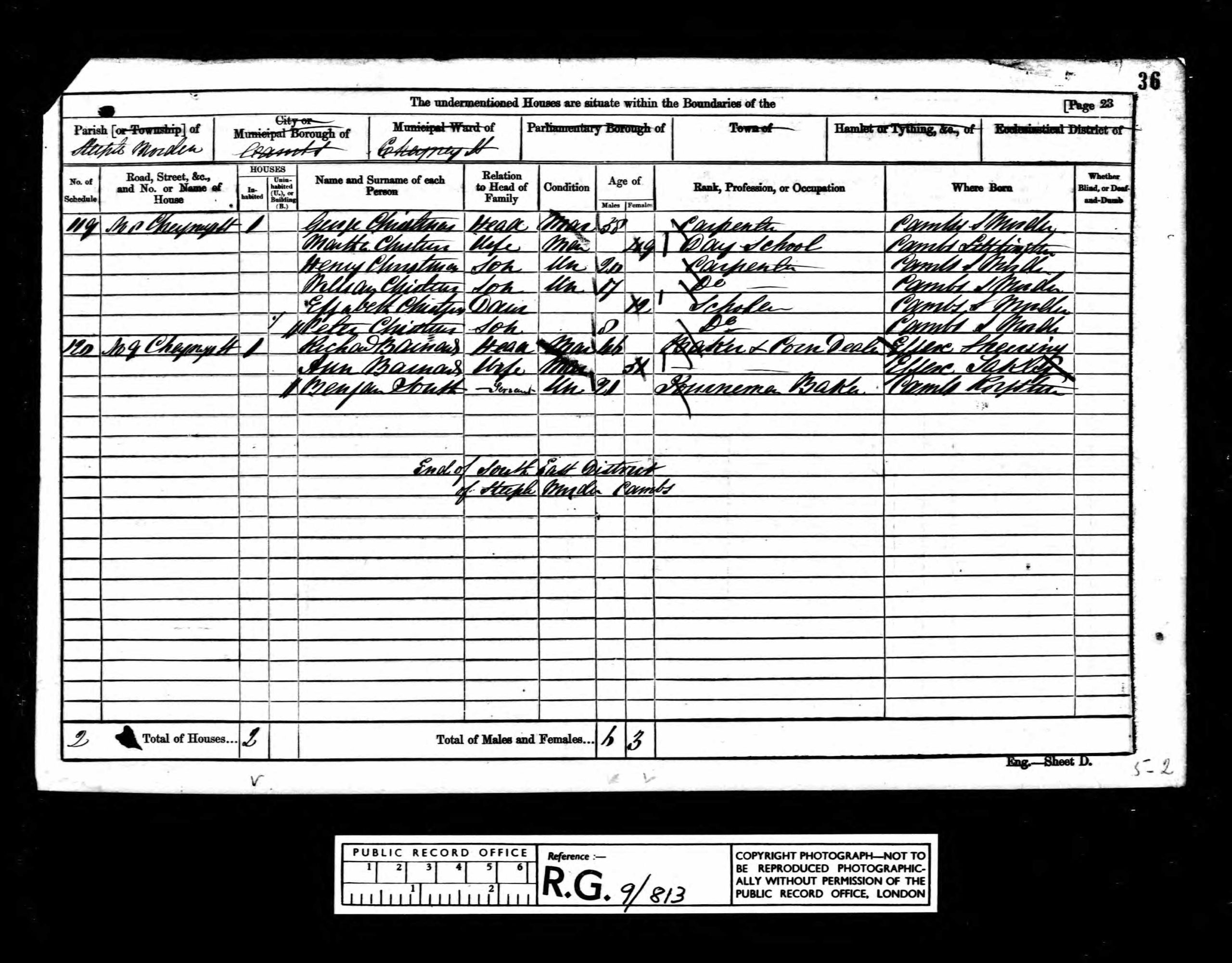
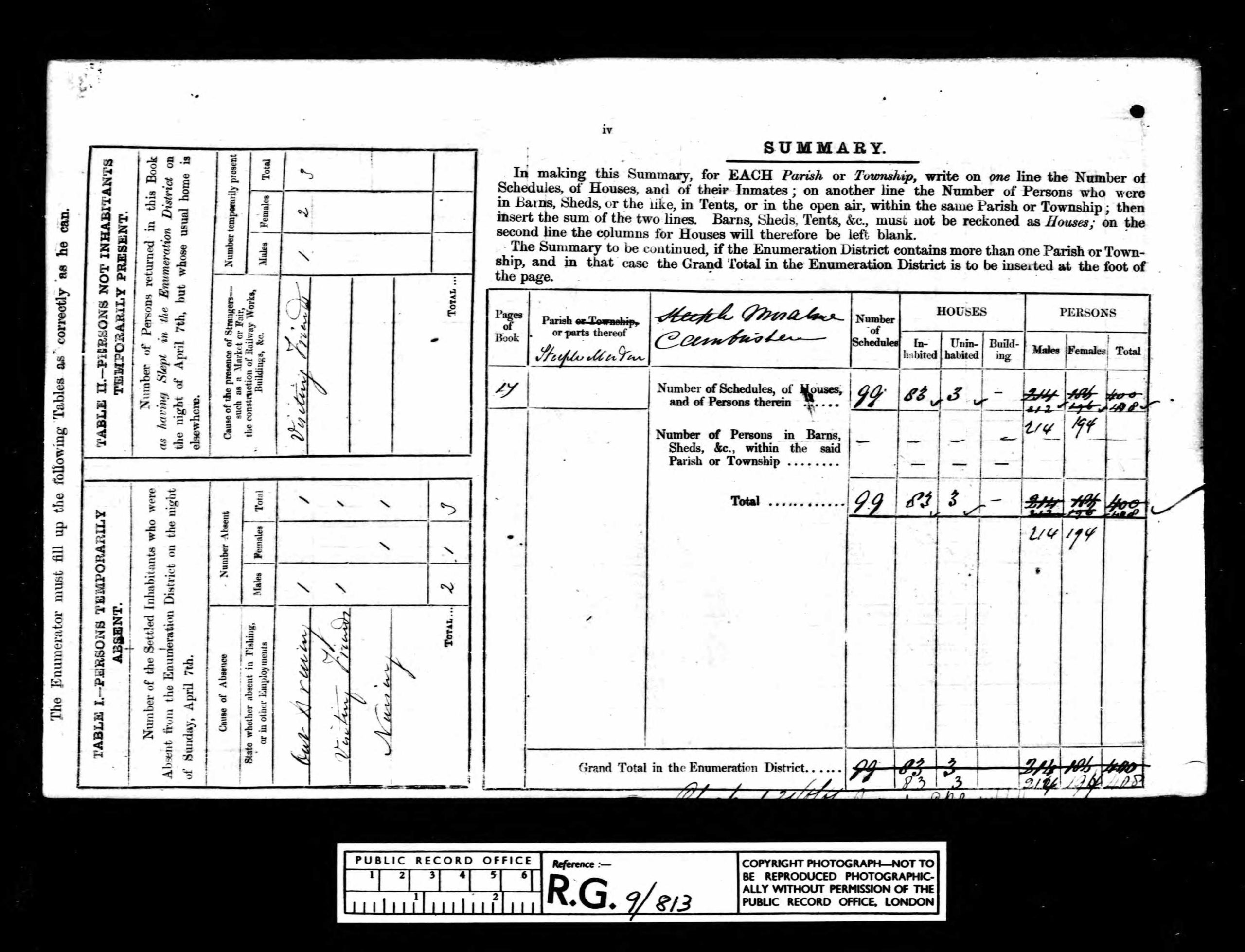
These are the actual enumerators’ schedules, completed after they had walked the parish recording all those in Steeple Morden on the night of Sunday, 7 April 1861.
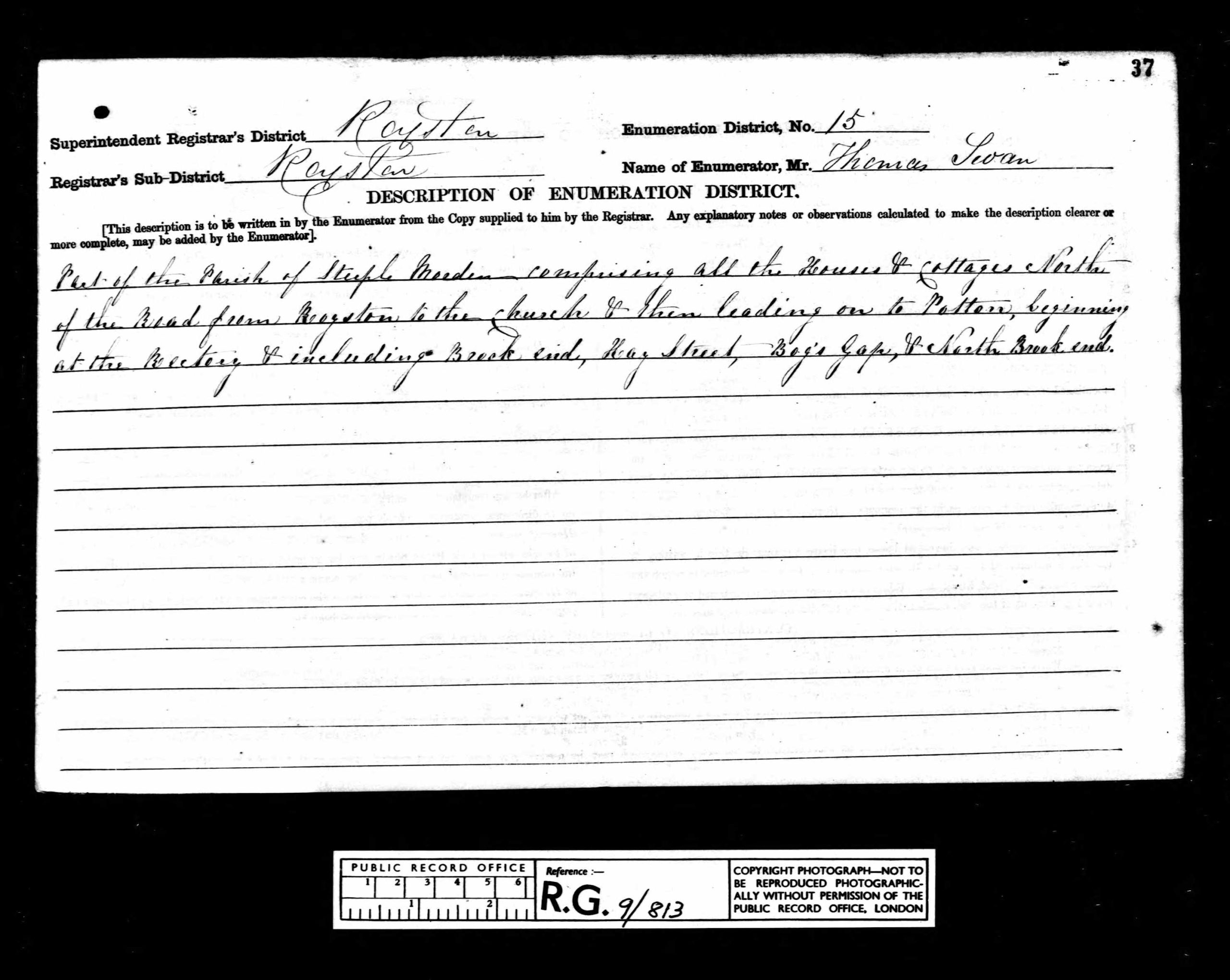
The parish was split into two parts, with an enumerator for each.
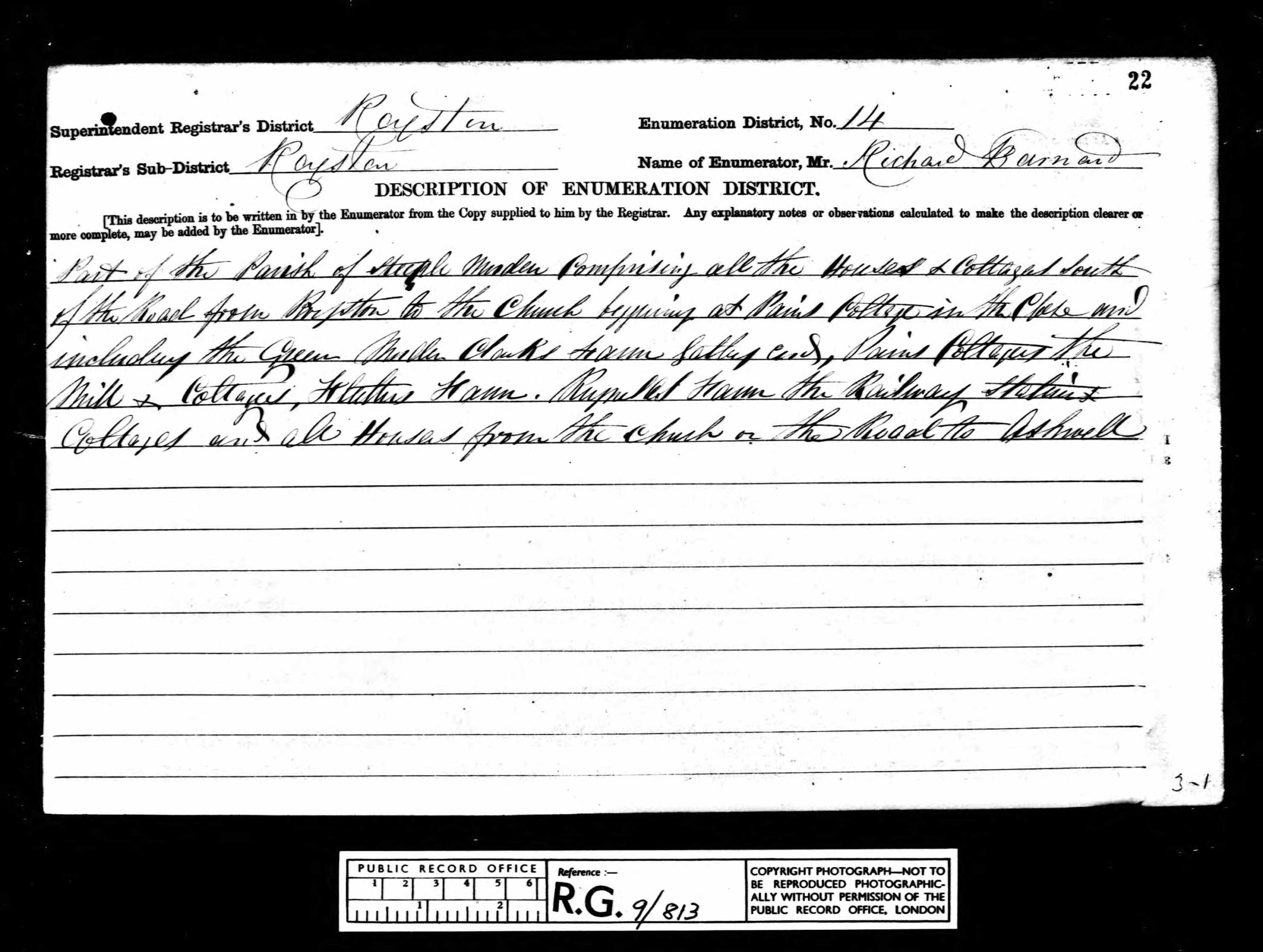
The first southern part was “Part of the Parish of Steeple Morden comprising all the Houses & Cottages South of the Road from Royston to the Church beginning at Pain’s Cottage in the Close and including the Green Mocco Clarks Farm Gatley End, Pain’s Cottages the Mill & Cottages, Flittons Farm Reynolds Farm the Railway Station & Cottages and all Houses from the Church on the Road to Ashwell”.
The second northern part was “Part of the Parish of Steeple Morden comprising all the Houses & Cottages North of the Road from Royston to the Church & then leading onto Potton beginning at the Rectory & including Brook End, Hay Street, Bogs Gap & North Brook End”.
Click on any image below to view. Click again to enlarge. Drag to view entire image.
The Schedules


Last Updated on January 27, 2024