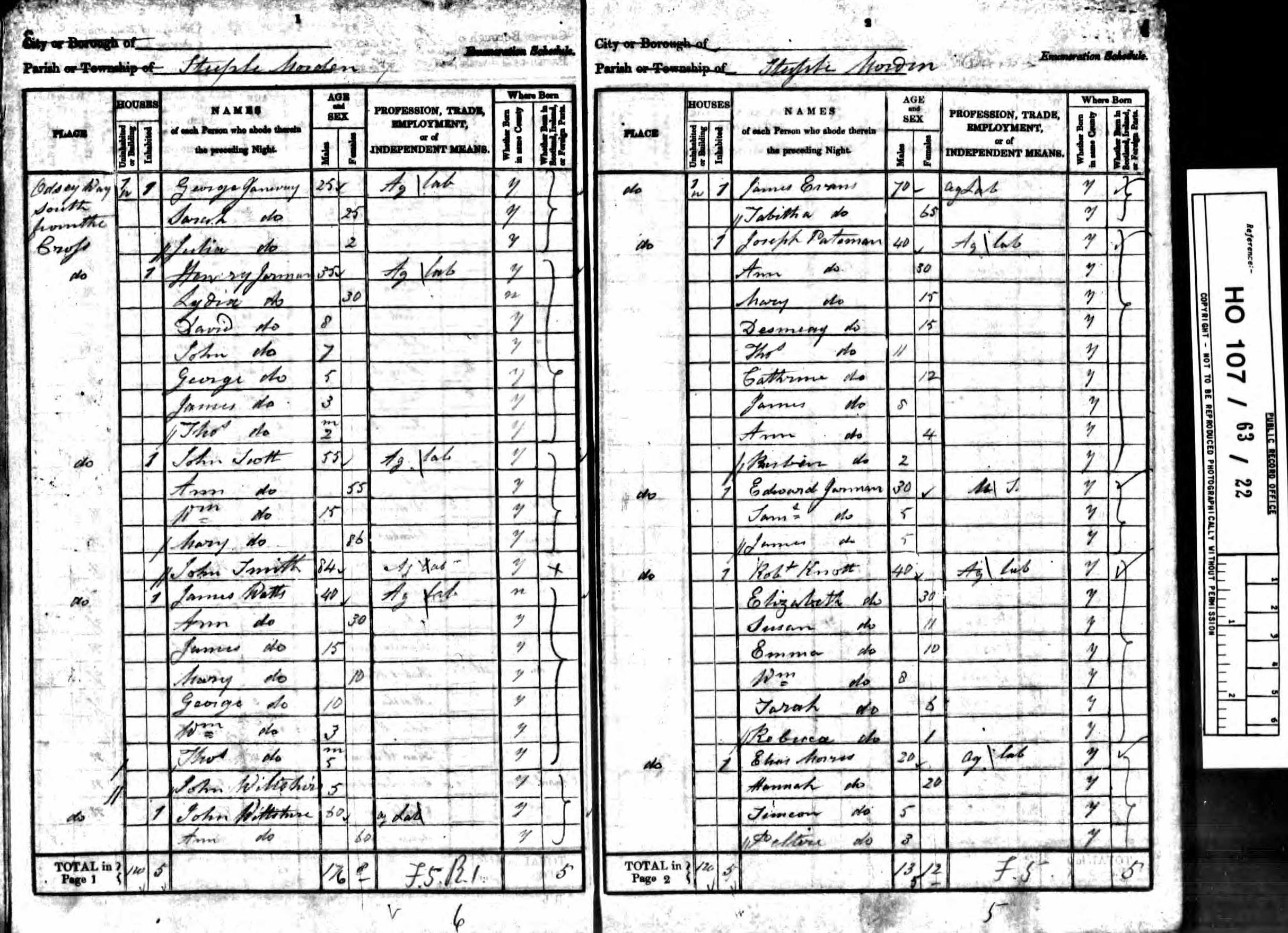
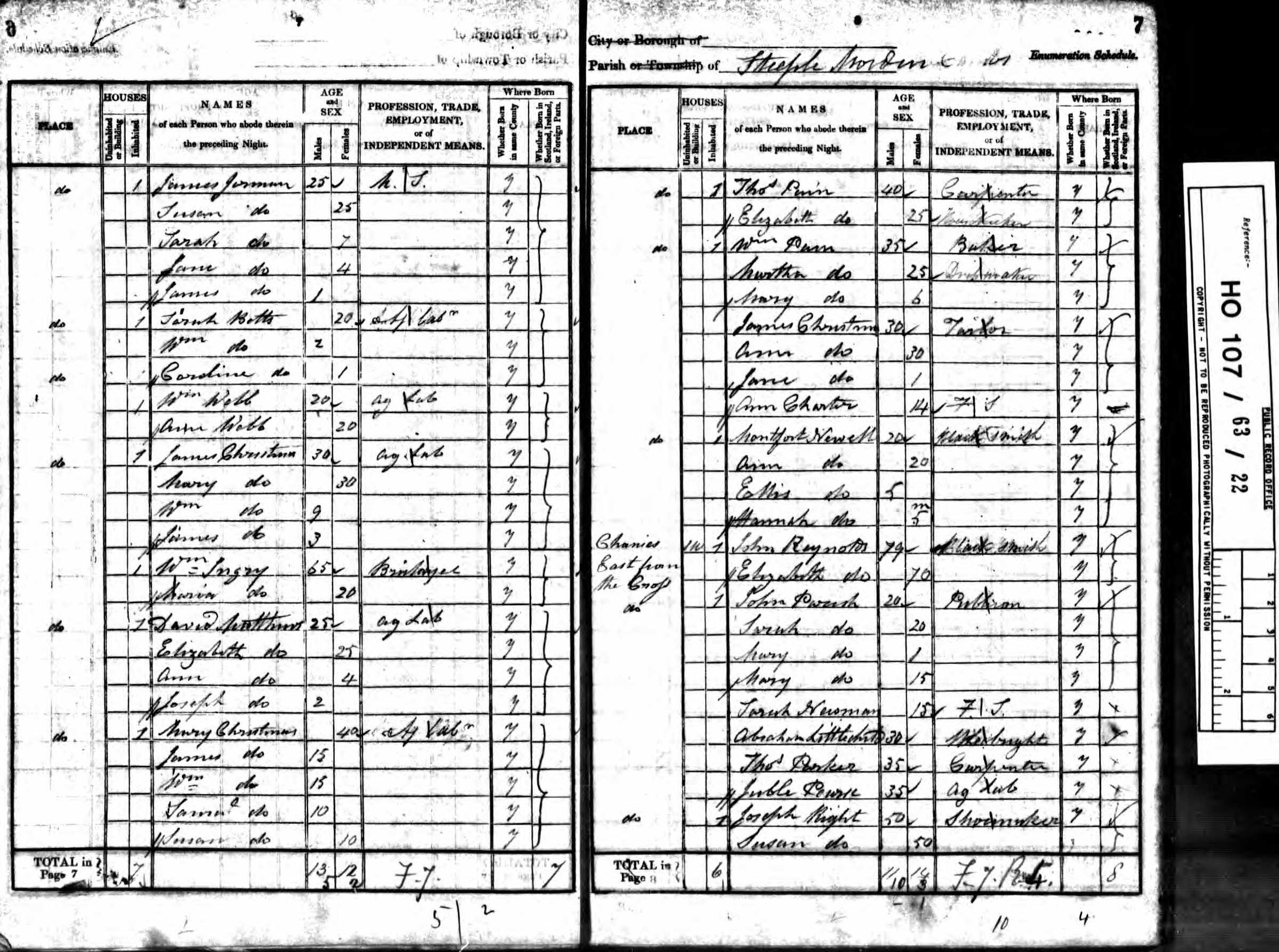
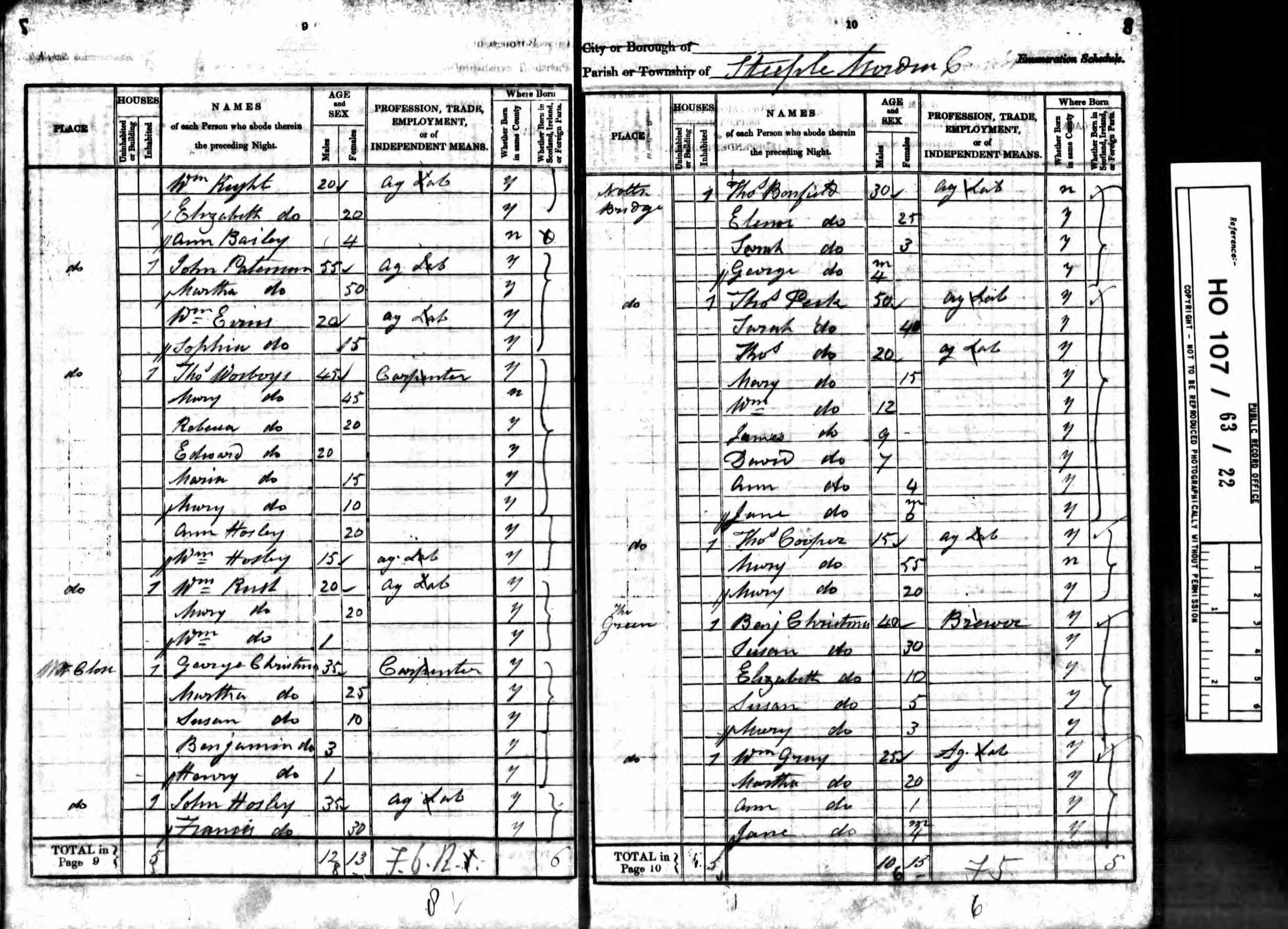
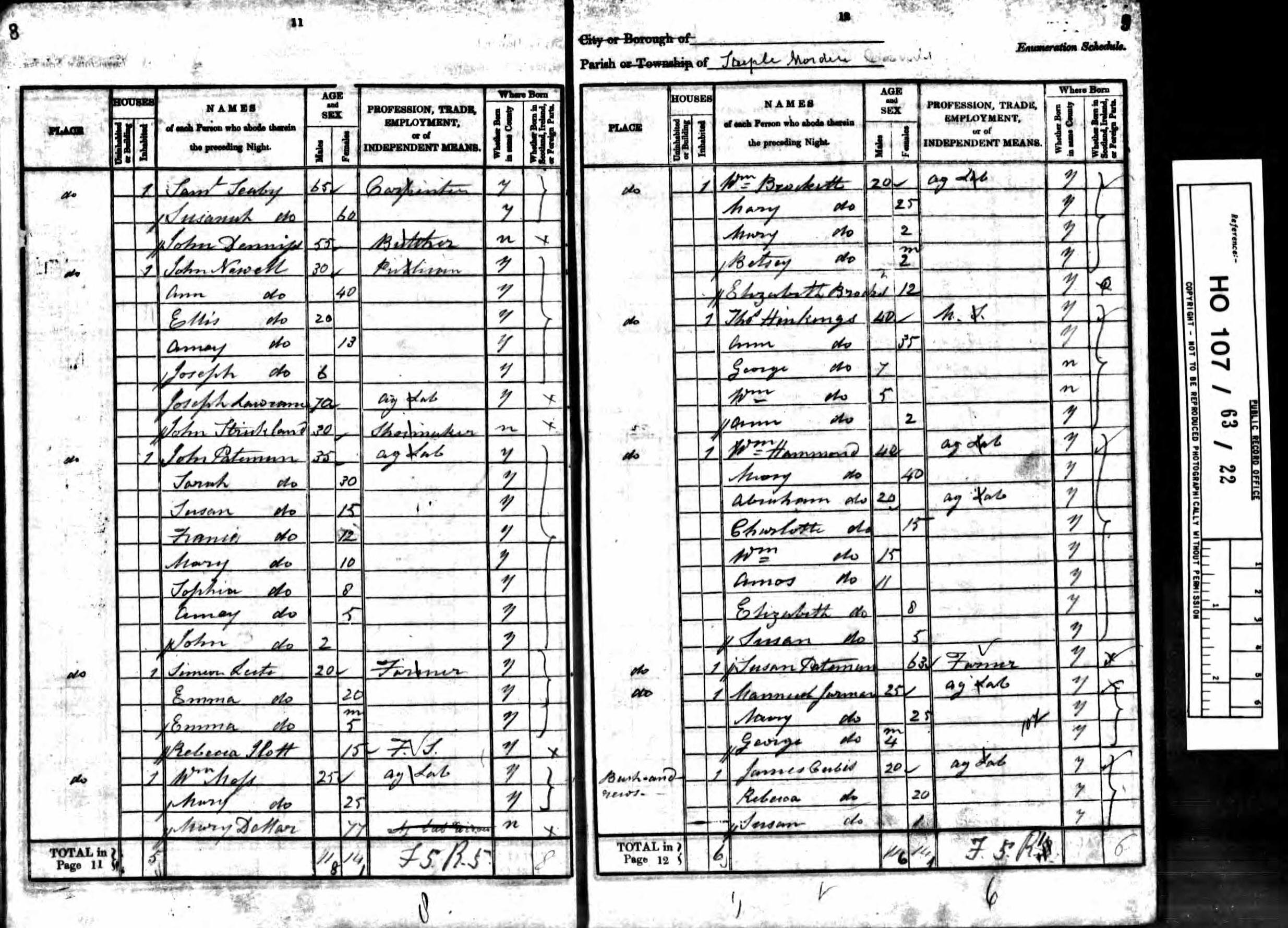
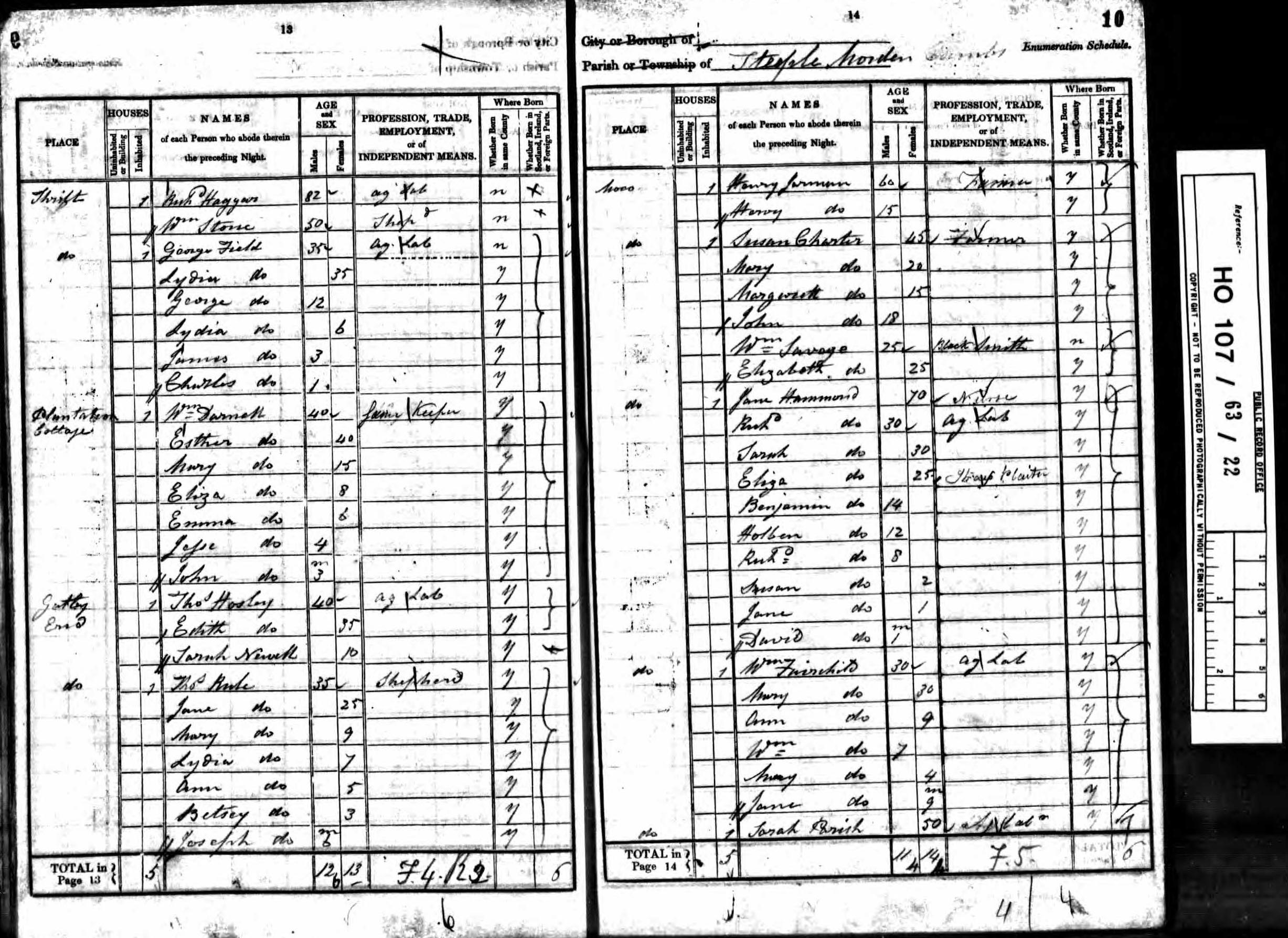
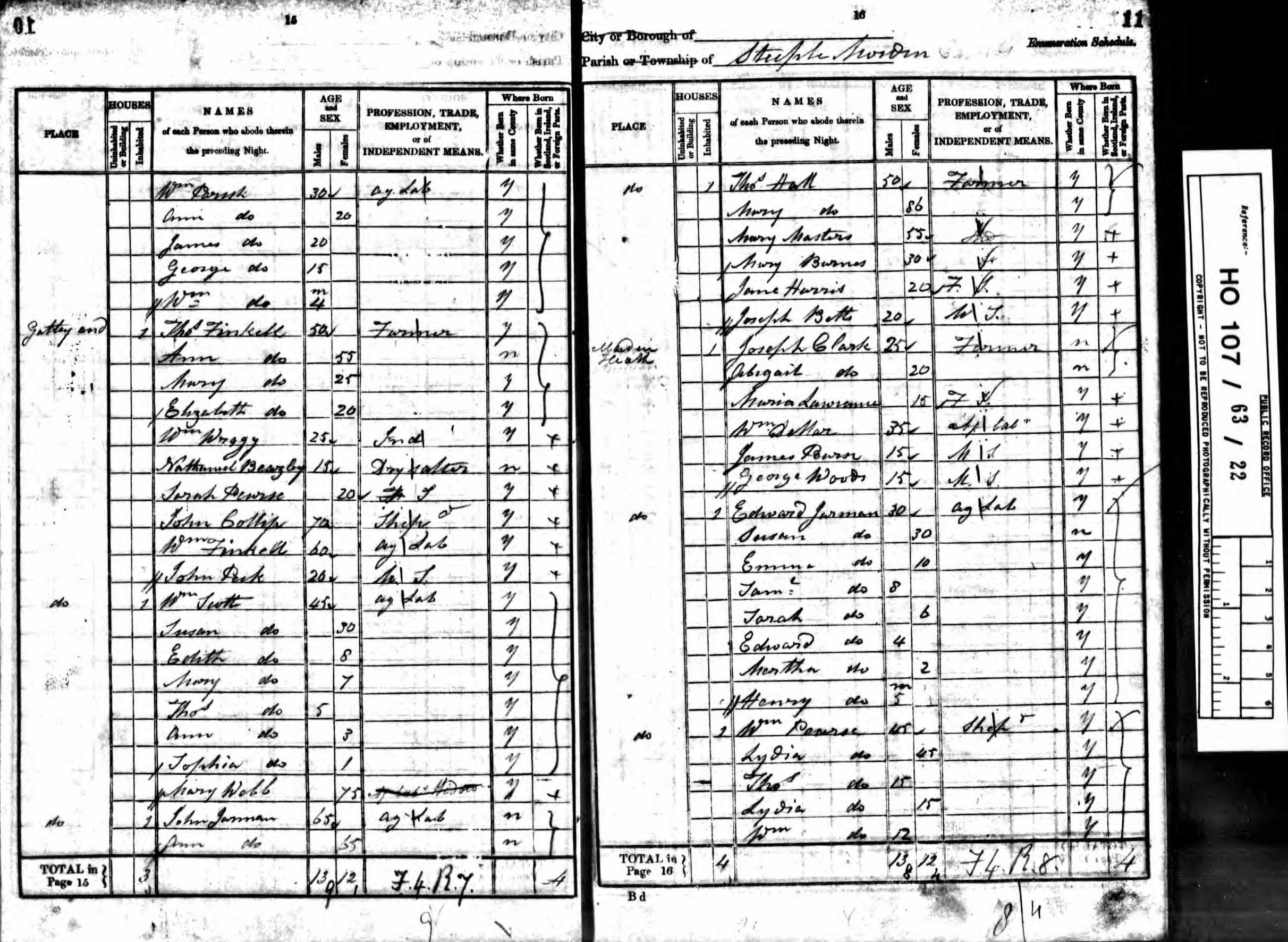
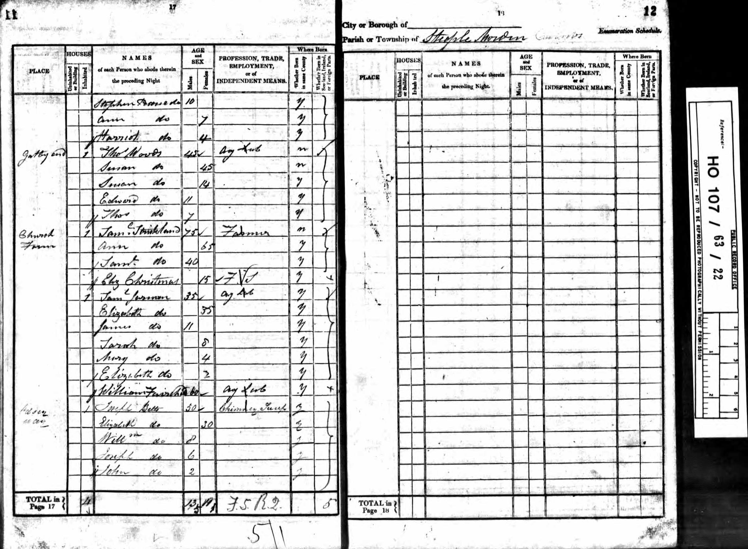
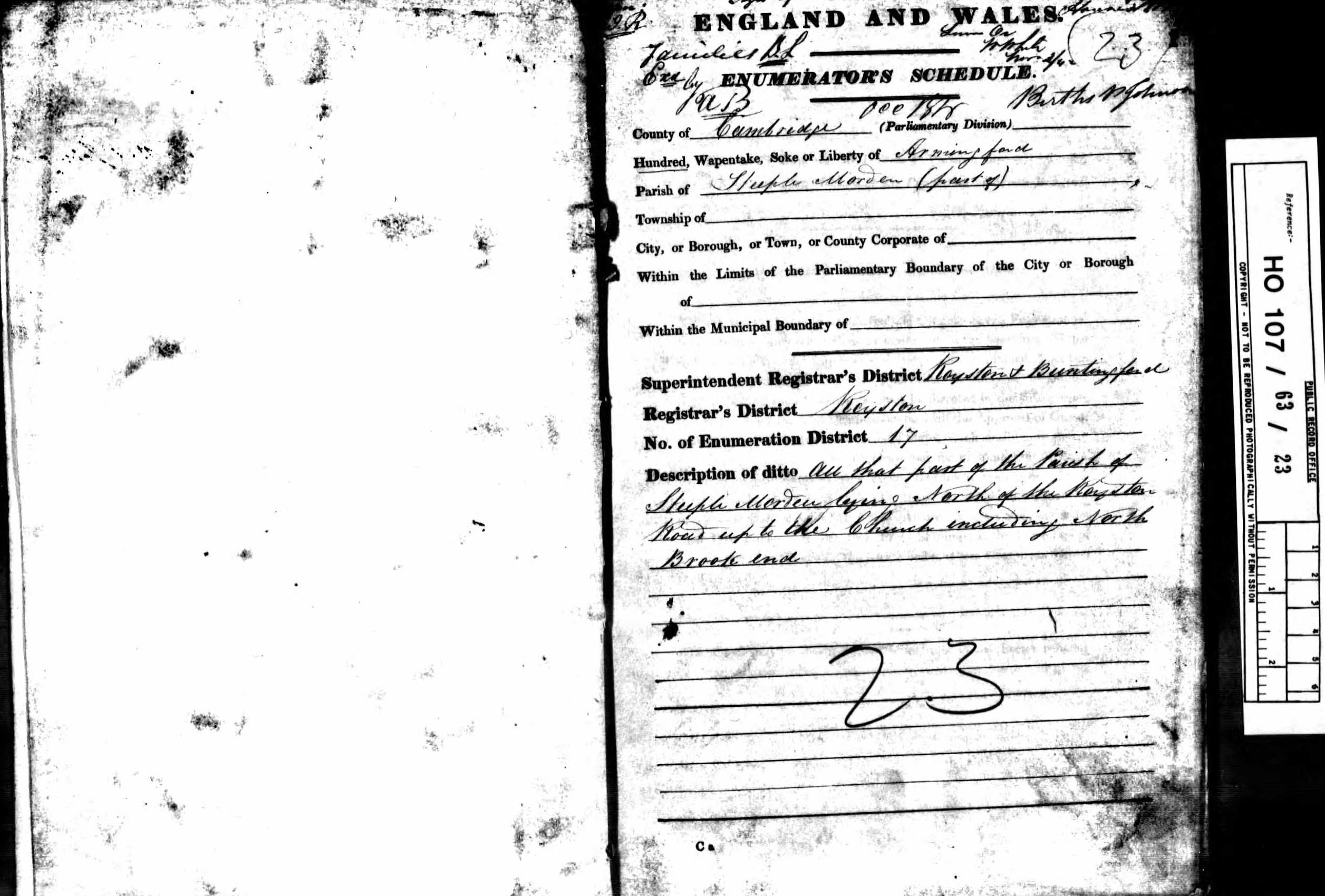
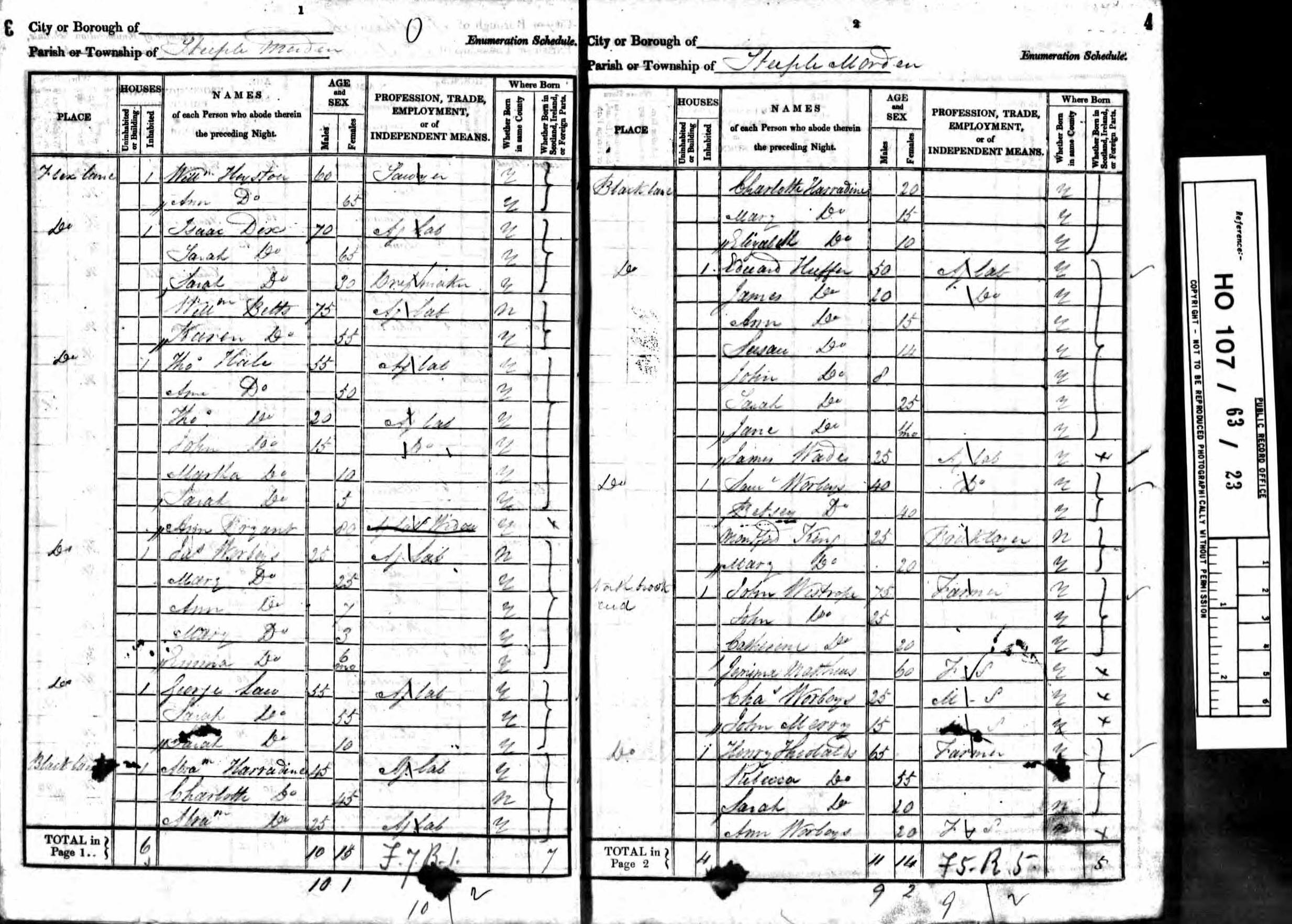
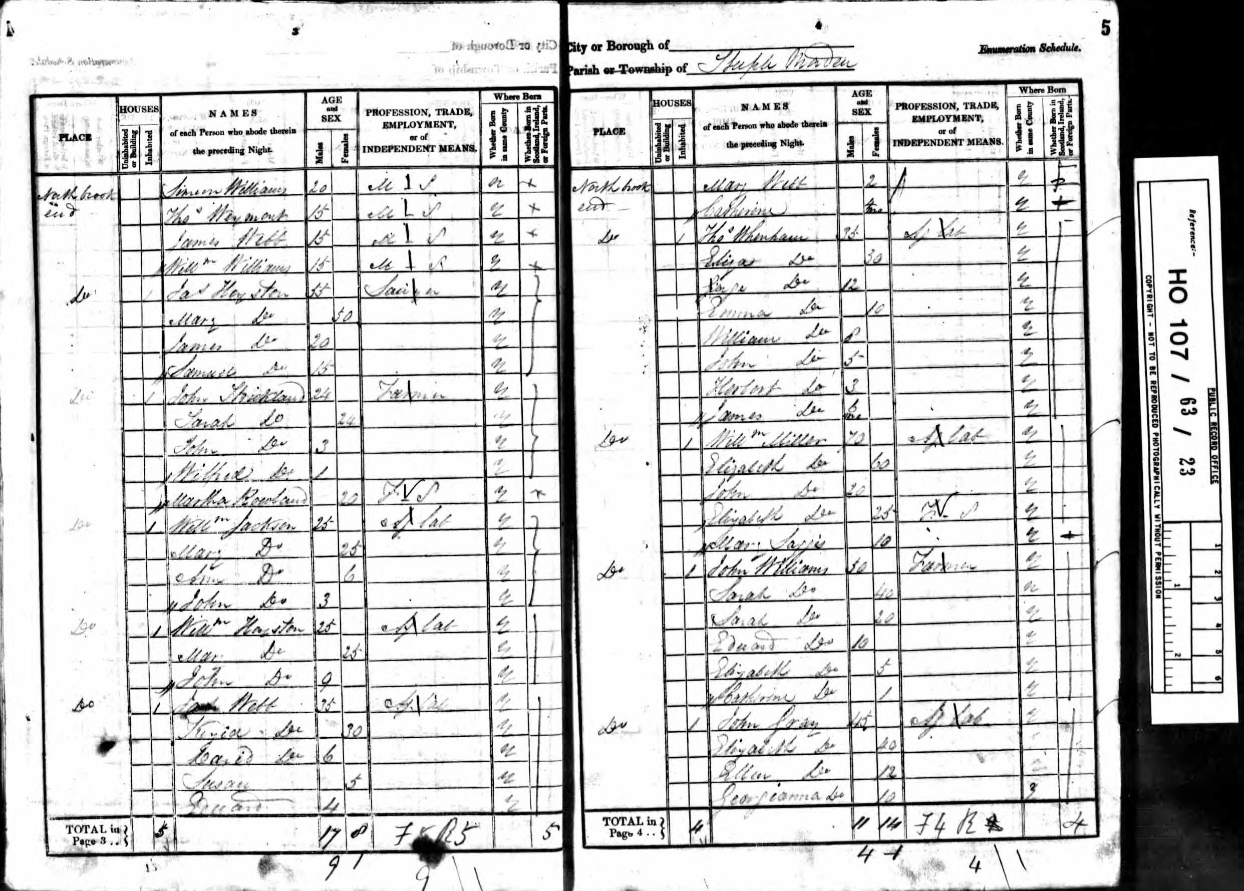
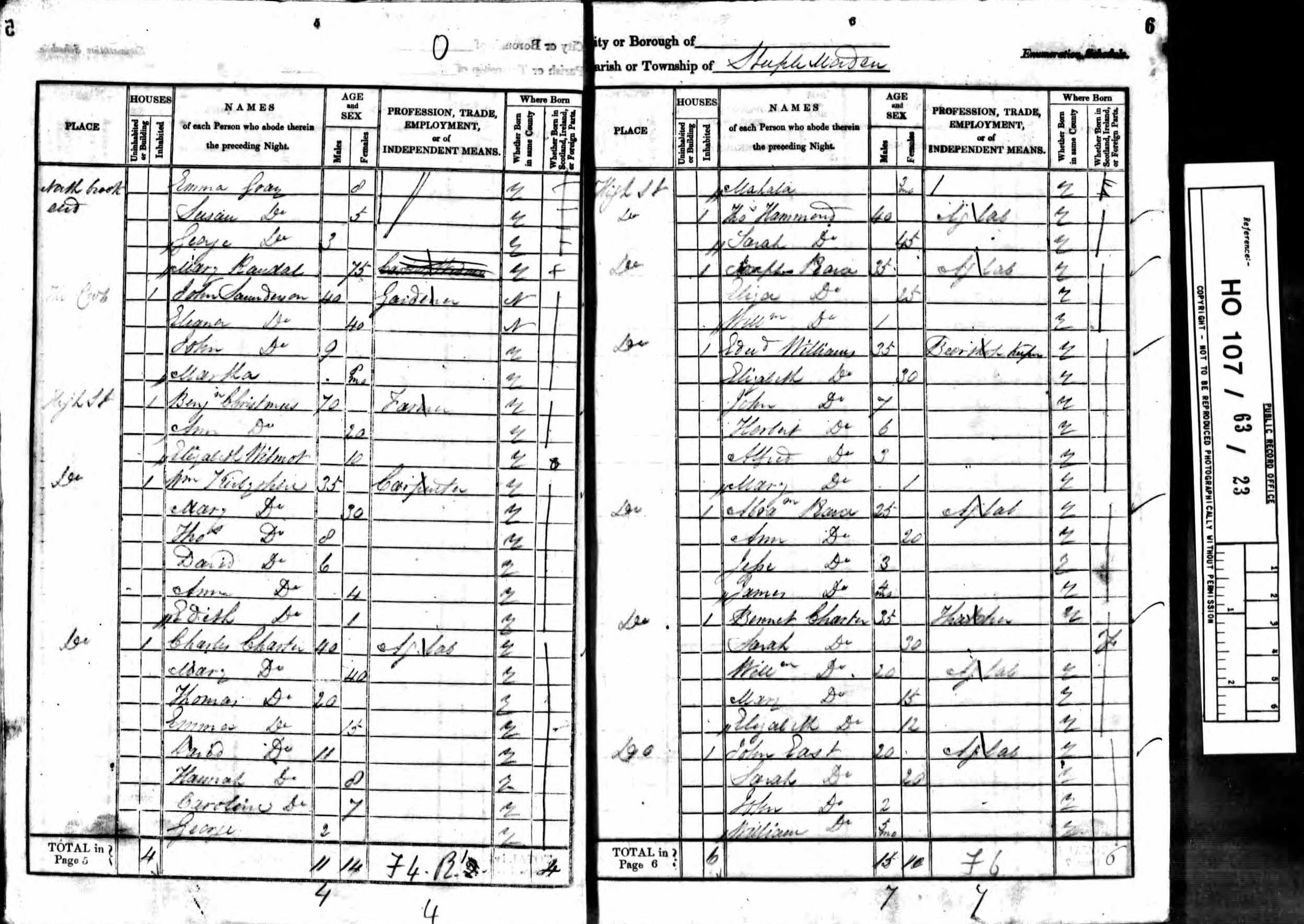
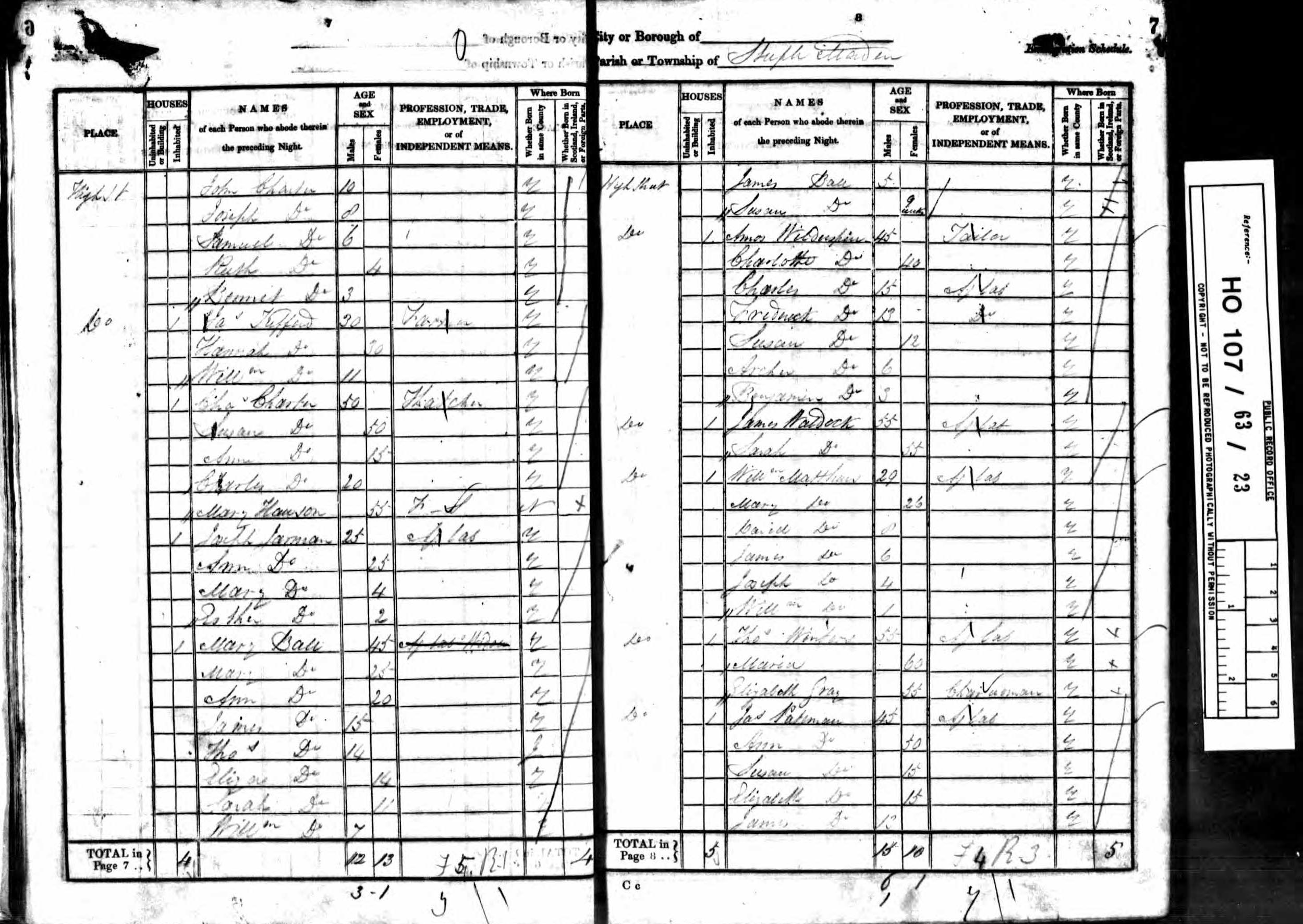
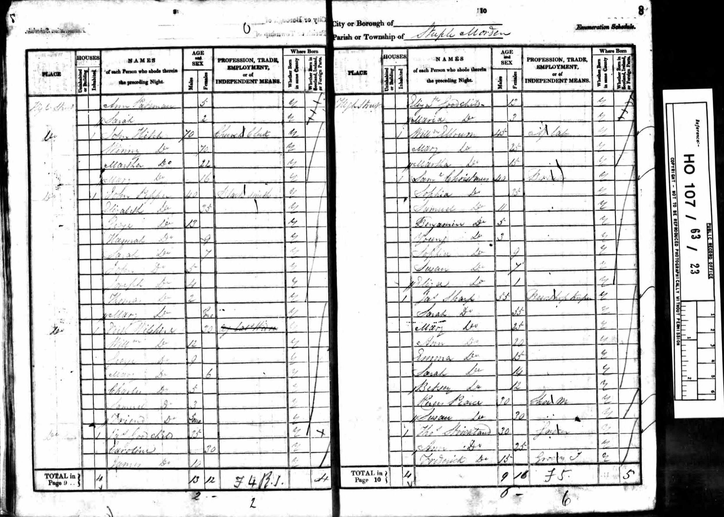
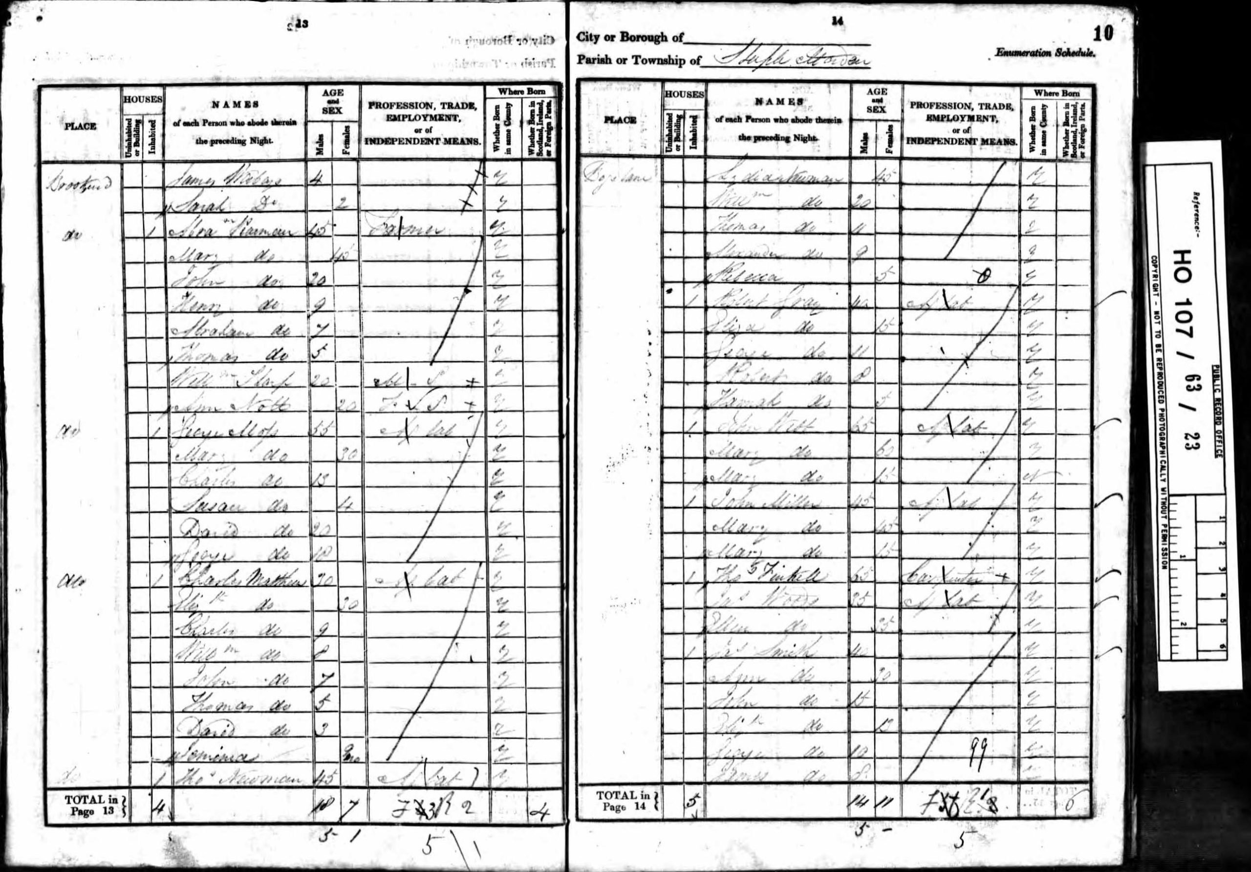
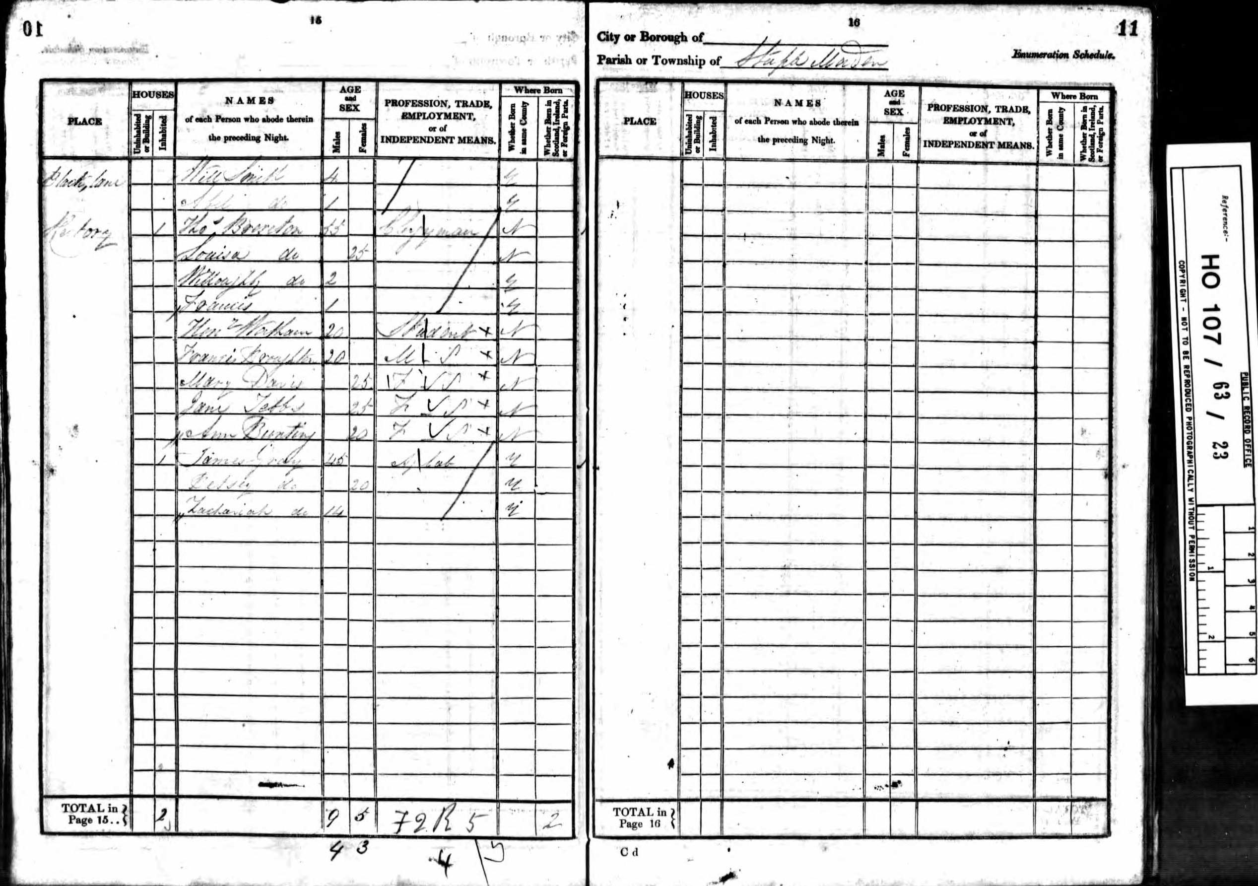
Census 1841
These are the actual enumerators’ schedules, completed after they had walked the parish recording all those in Steeple Morden on the night of 6 June 1841.
The parish was split into two parts, with an enumerator for each.
The first southern part described as “All that part of the Parish of Steeple Morden lying south of the Royston Road up to the Church and including Clark’s Farm and The Thrift”.
The second northern part described as “All that part of the Parish of Steeple Morden lying north of the Royston Road up to the Church including North Brook End”.
Click on any image below to view. Click again to enlarge. Drag to view entire image.
The Schedules


Last Updated on August 3, 2025