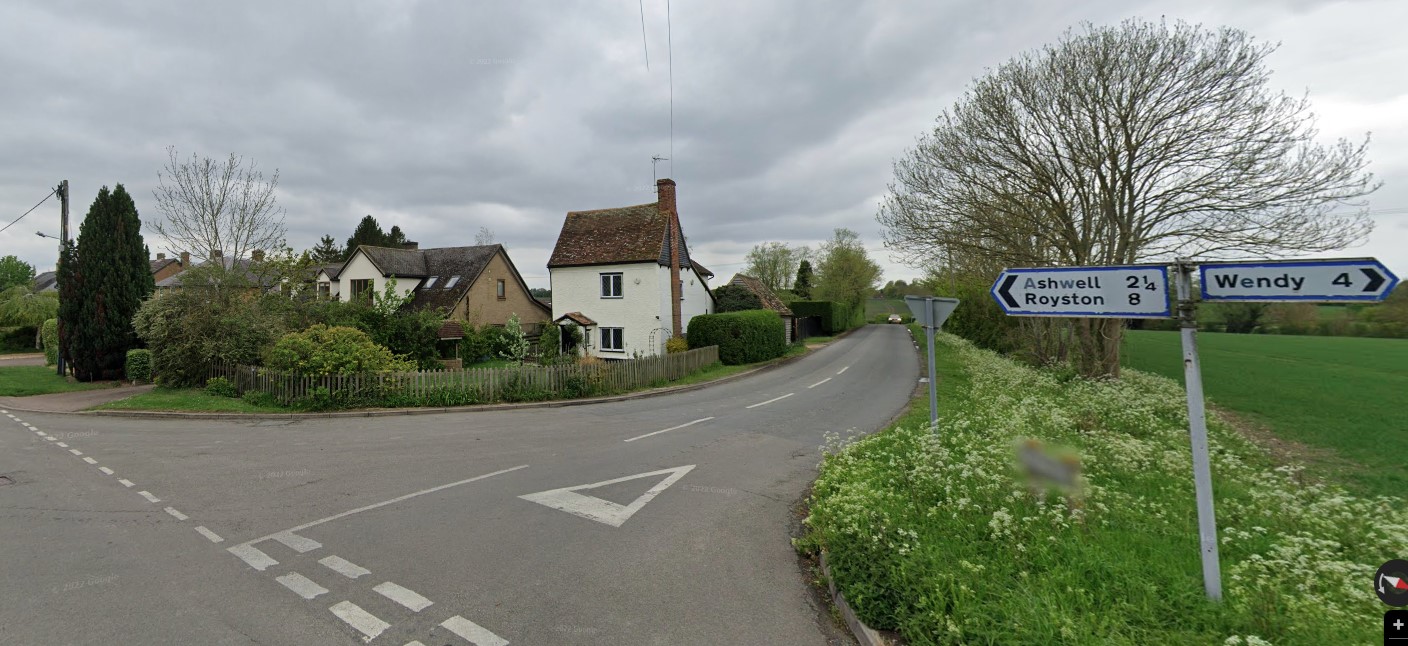
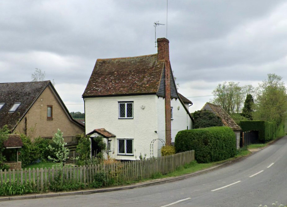
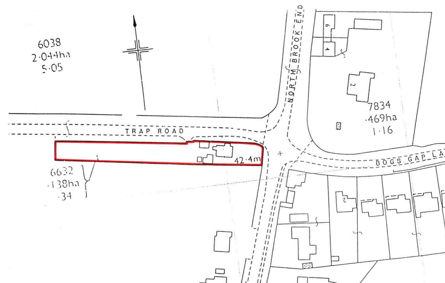
119 Hay Street, Ashcroft House
Standing on the corner of Hay Street and Trap Road, this house was numbered 75 Hay Street from 1969 to 1974 and 83 Hay Street 1975 to 1076 and 119 Hay Street from 1977 to the present day. Previously known as Hill House from at least 1851 to 1949, it is not certain when it became Ashcroft House. It should not be confused with Hill House in Cheyney Street or Hill House at North Brook End.
An interesting property, on a long and narrow plot of land, which originally ran the length of Trap Road from Hay Street to the parish boundary at West Brook. The dimensions of the plot suggest it was likely a land-grab from the adjoining highway or possibly from the agricultural land running alongside on the south, which was known as Lammas and later Hawkes. As the boundary on the north is immediately contiguous with the road, with little verge, it was likely land enclosed from the highway.
At some point, roughly half of the plot at its west end was absorbed into the adjoining agricultural land.
Structurally the house appears to date to the early 1700s, although record of its construction has not been found. It may be pure coincidence, but the Barefoot family arrived in the parish in the late 1600s as energetic yeoman farmers and it is possible they enclosed this plot and erected the house. There could be a line of descent through the Barefoots and then by marriage to the North or Wilson families. In 1802, Samuel Flitton a farmer from Bassingbourn, married a rather wealthy widow Mary Wilson, nee North and moved into St John’s Farm at Brook End. Certainly, around that time he became owner of this property and his recorded as such in the Enclosure Award, which was initially compiled in 1808.
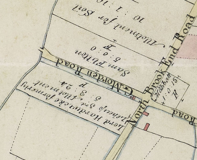
On the map below the plot is shown in blue with the house in pink at the east end and in the Award is described as ” an old inclosure of Samuel Flitton”. Samuel was also allotted a 5 acre plot of freehold land just the other side of Trap Road or G Morden Road as it is shown on the map. He received two much larger allotments adjoining Station Road to the south of the village. These allotments were in “lieu of freehold open field lands and rights of sheepwalk and common”.
Enclosure Map 1807-1816
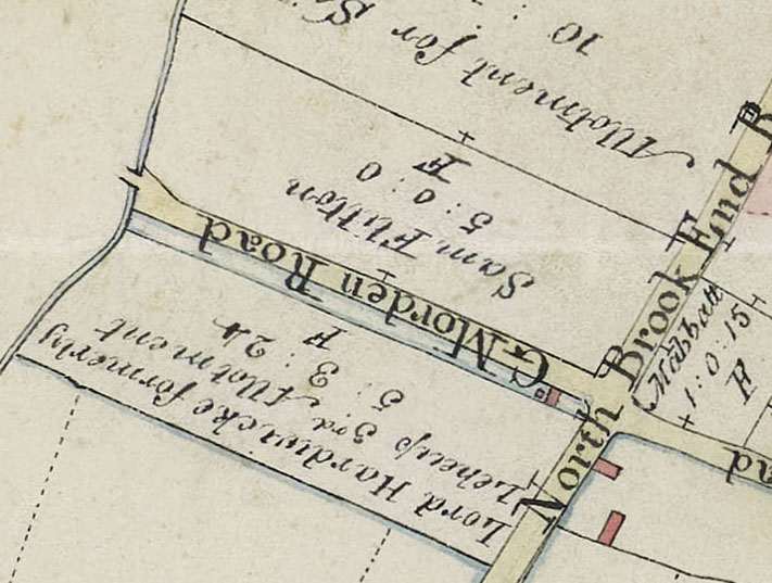
Blue strip alongside G Morden Road is the plot and the house is pink at the east end
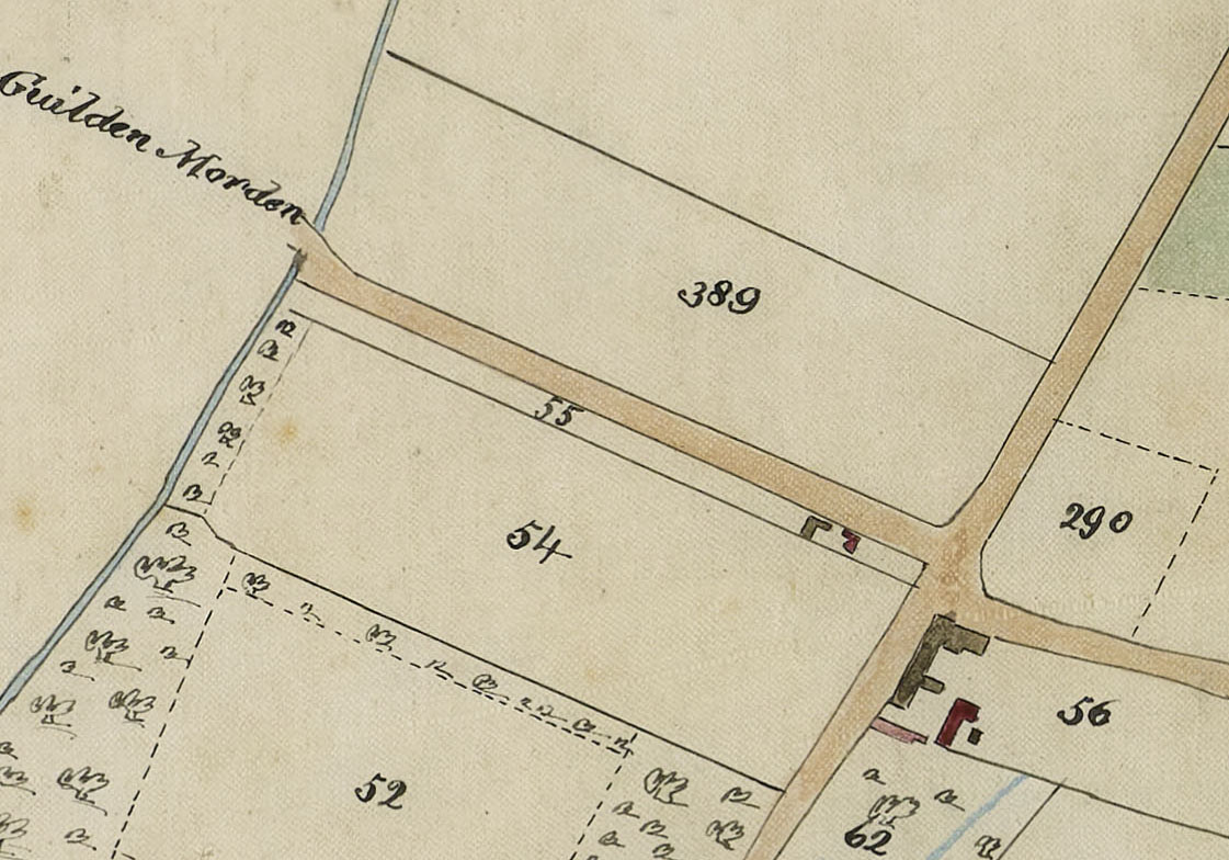
The next large scale map covering the parish was compiled in 1839 as part of the Tithe Apportionment and below plot 55 is Hill House, with the house and buildings shown in pink. It is described as house and garden 0a 2r 24p, owner Thomas Flitton and occupier John Saunders. The occupier’s name was actually Saunderson.
The 5 acre plot opposite was arable land in Tween Towns owned by Thomas Flitton and occupied by John Newell.
The Flitton family never resided in this property nor farmed the 5 acres of arable land. They were both always let to others.
Tithe Map 1839
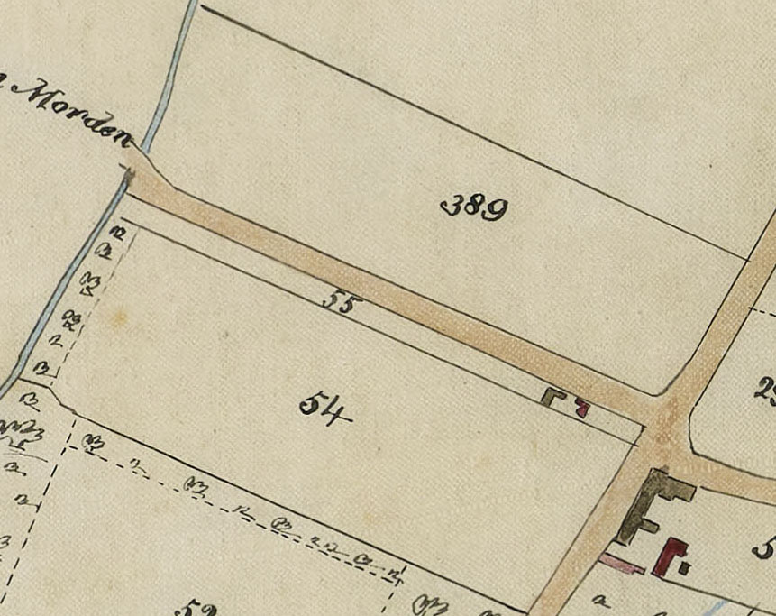
The house and outbuildings are shown at the east end of Plot 55, which continues down to West Brook
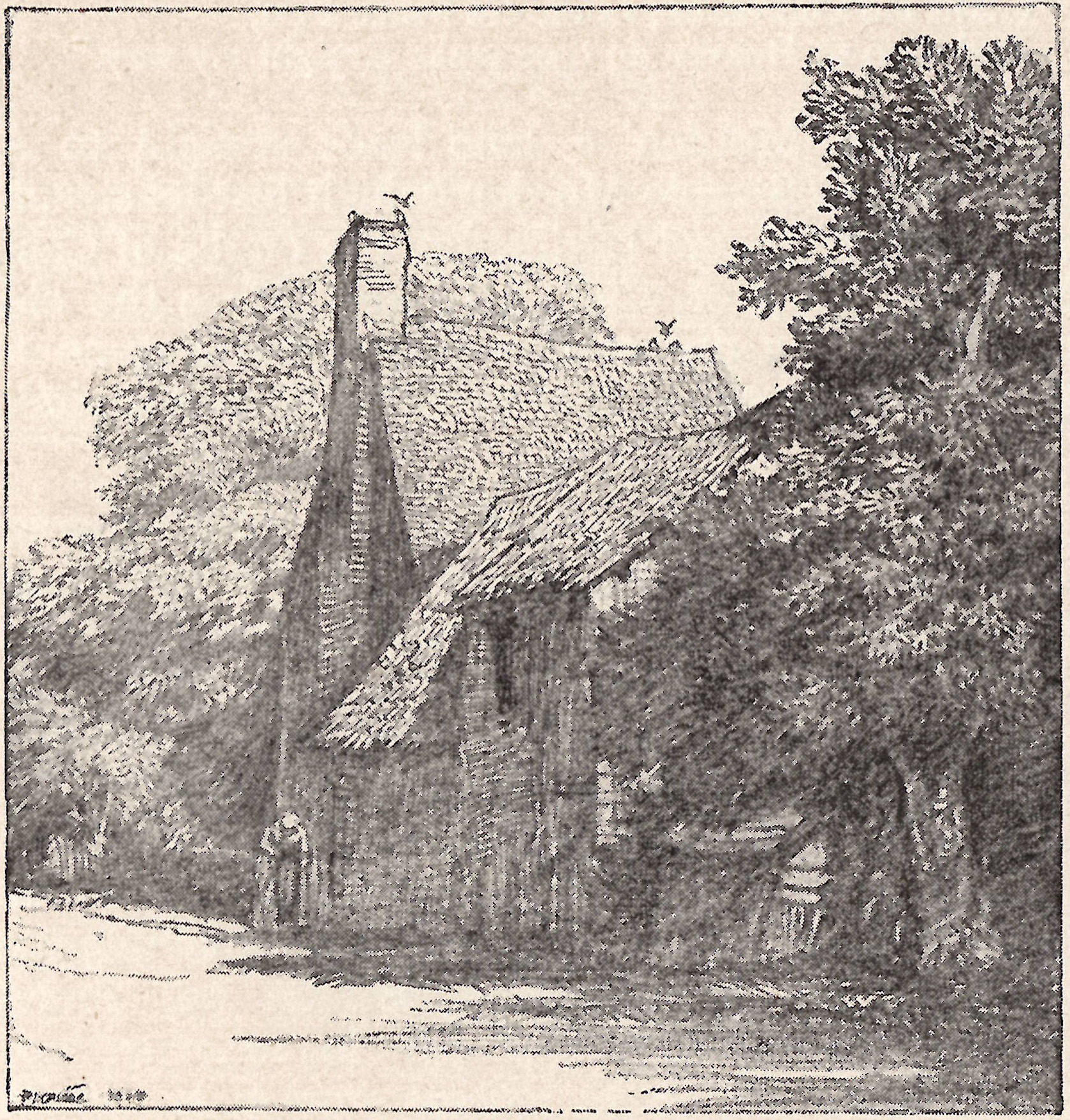
This drawing of a cottage at Steeple Morden, which depicts 119 Hay Street, was drawn by Frederick Landseer Griggs in 1909 to illustrate E Conybeare “Highways and Byways in Cambridge and Ely, published London 1910.
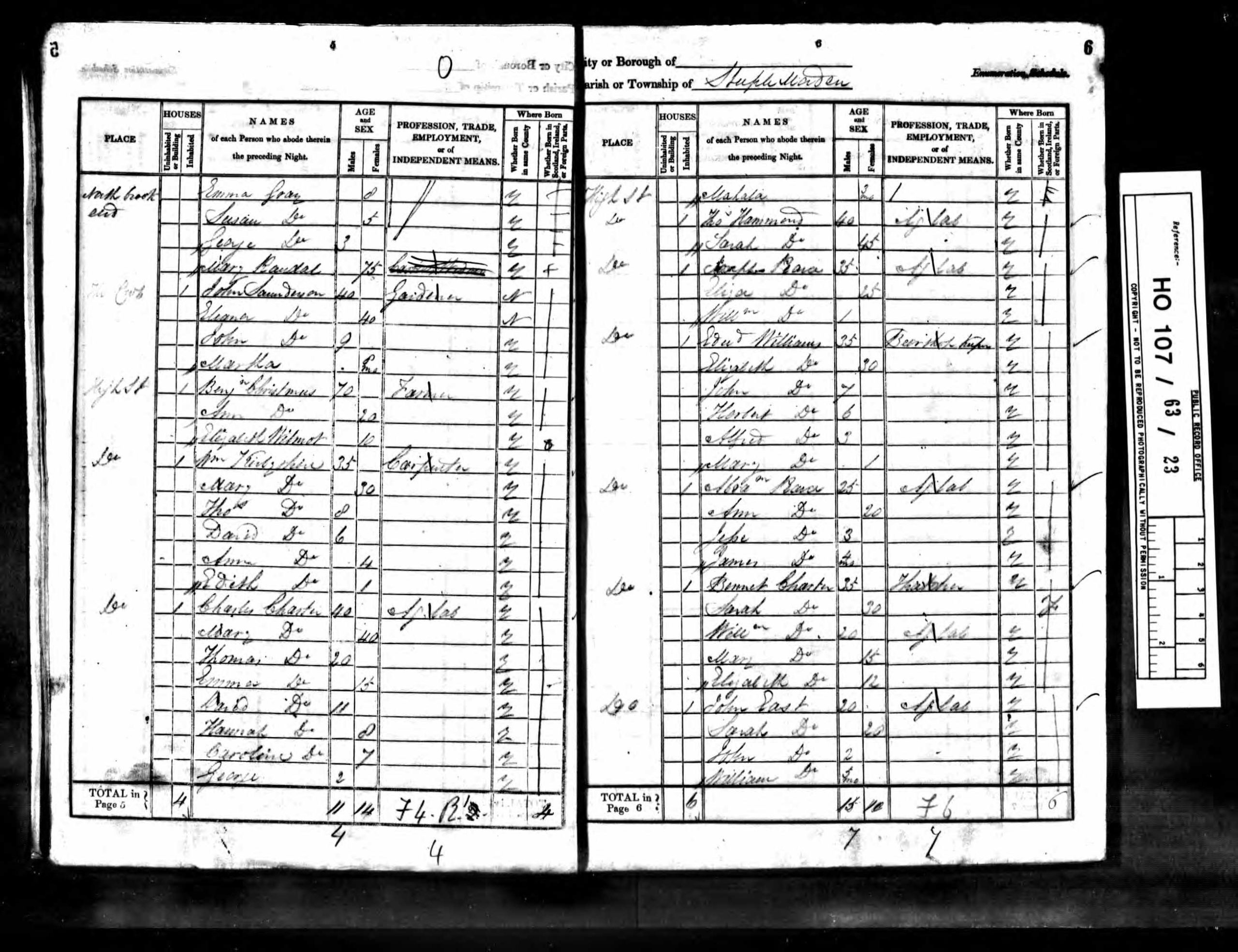
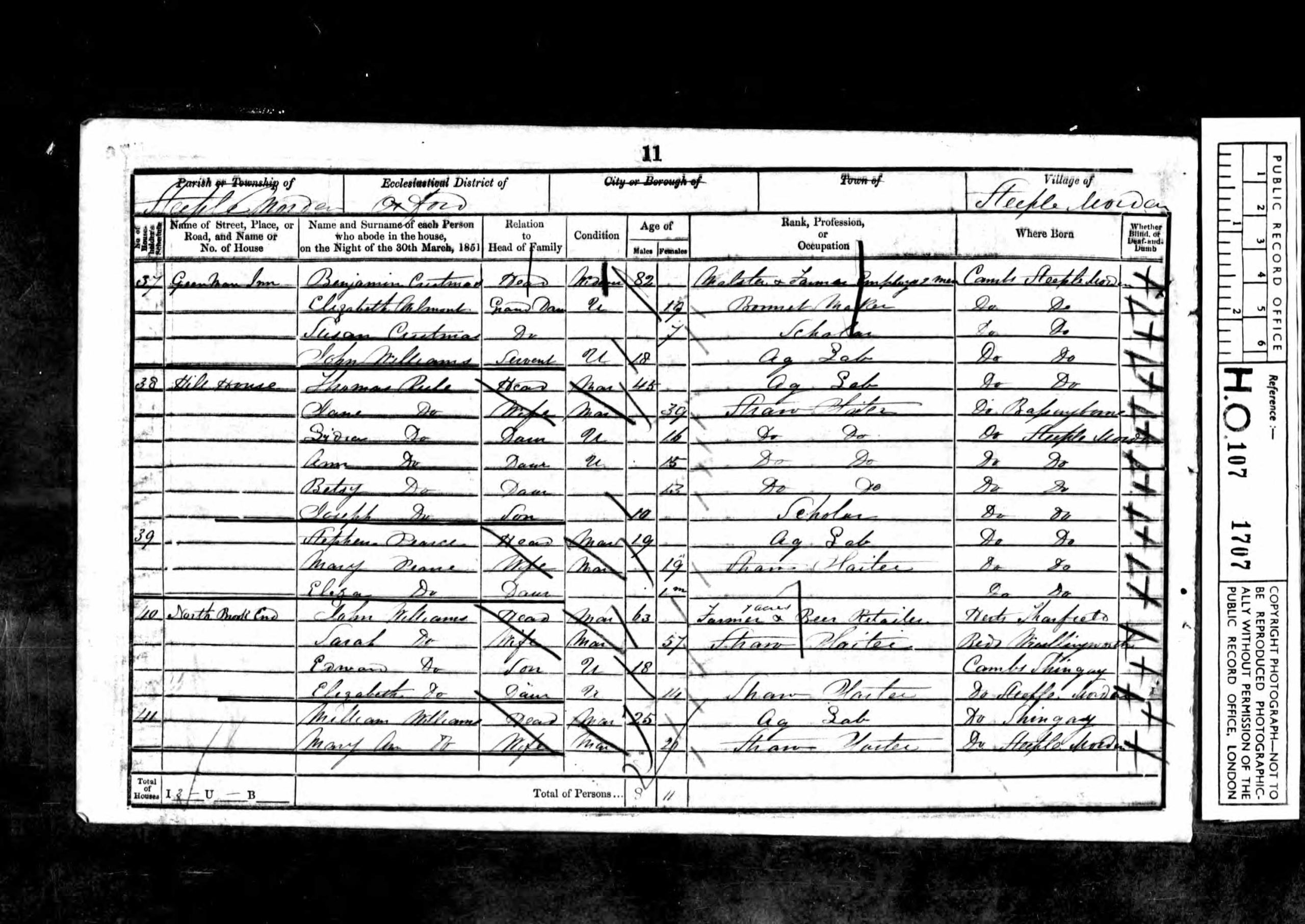
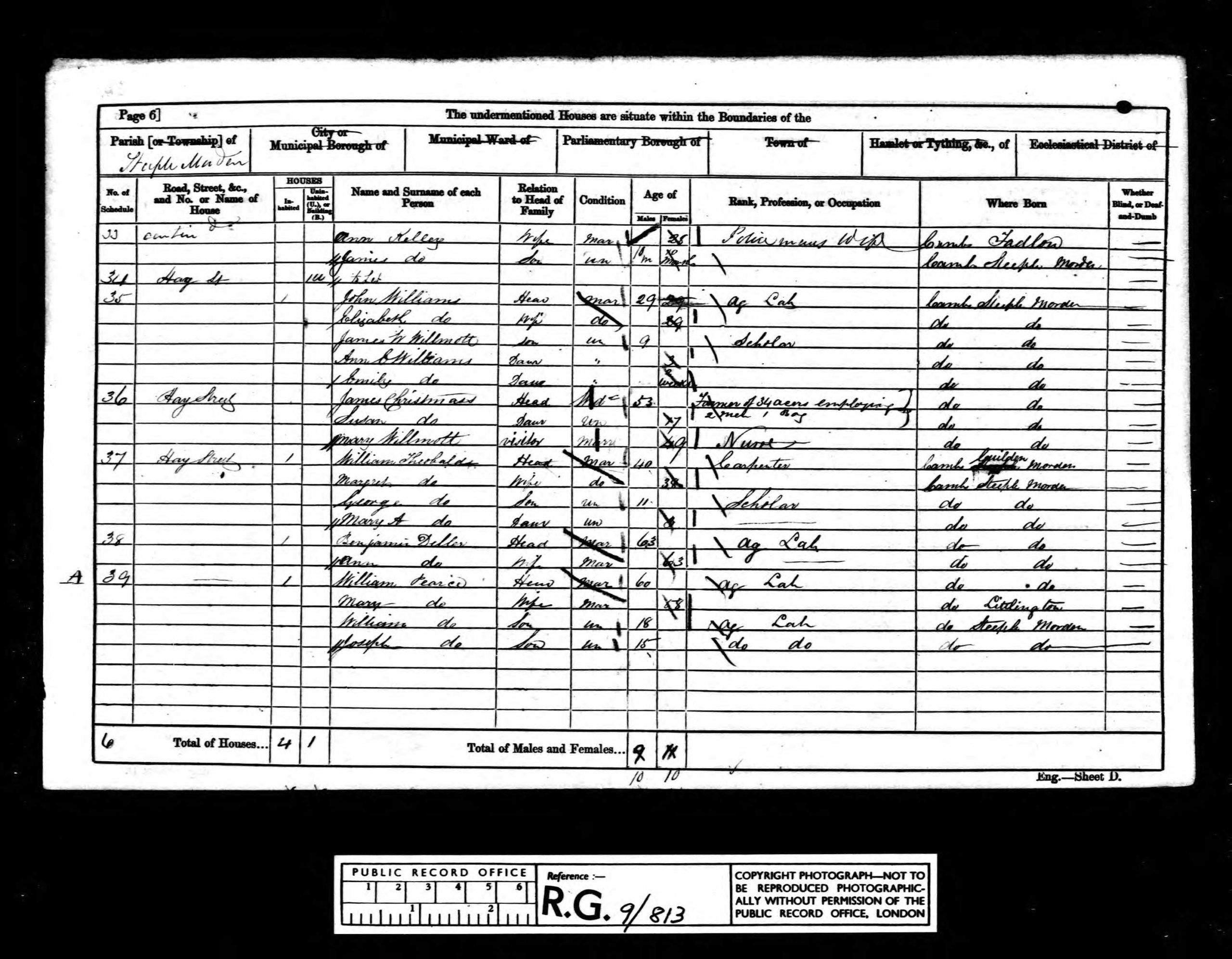
The original house is shown with extensions, which were added in the 1800s, probably from around 1830 or 40. In 1841 one family lived at this address and by 1851 it was two families and then in 1861 three, reducing back to two from 1871 to 1891. By 1901 one family was resident and this remained the norm thereafter.
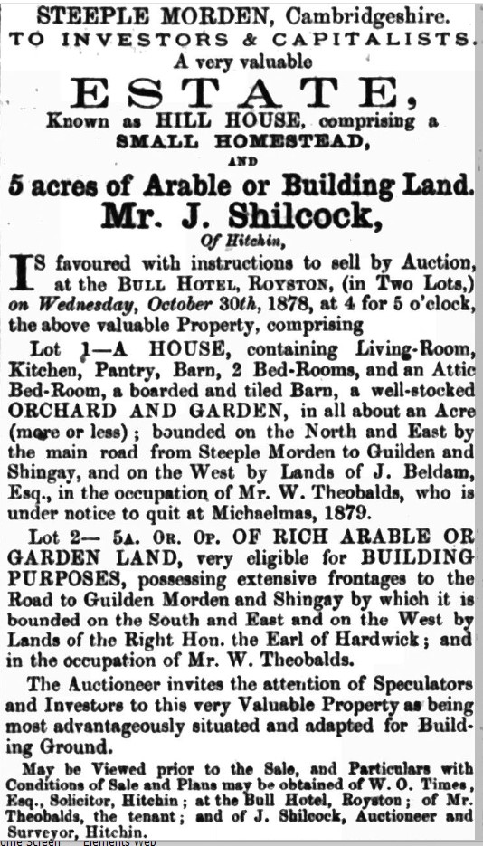
In the 1878 Sale Details it was described “Known as Hill House Lot 1 A House containing Living-Room, Kitchen, Pantry, Barn, 2 Bed-Rooms and an Attic Bed-Room, a boarded and tiled Barn, a well-stocked garden, in all about an Acre”.
Scroll down for listings of owners and occupiers over the years and a larger version of this drawing, plus maps and sale advertisements and finally all the census schedules 1841-1911 listing the residents every ten years.
Listed Building
Listing details: Grade II since 4 September 1986
House. Early C18. Timber-framed and roughcast rendered; painted brick. Red brick side stack to north gable. Plain tiled roof. Two storeys with rear outshut. One ground floor and one first floor casement window; panelled door to left hand with open porch. Coved eaves cornice.
Owners
Owner occupied from 1908
| Dates | Owners | Notes |
| 1720-1756 | Barefoot family | Possible not proven |
| 1756-1802 | Wilson family | Possible not proven |
| 1802-1833 | Samuel Flitton | Died 1833 |
| 1833-1853 | Thomas Flitton | Died 1853 |
| !853-1876 | Elizabeth Flitton | |
| 1876-1878 | Thomas Daniel Flitton | |
| 1878-1882 | Walter Gray | |
| 1883-1896 | Hale Wortham | |
| 1897-1908 | W Dainty | |
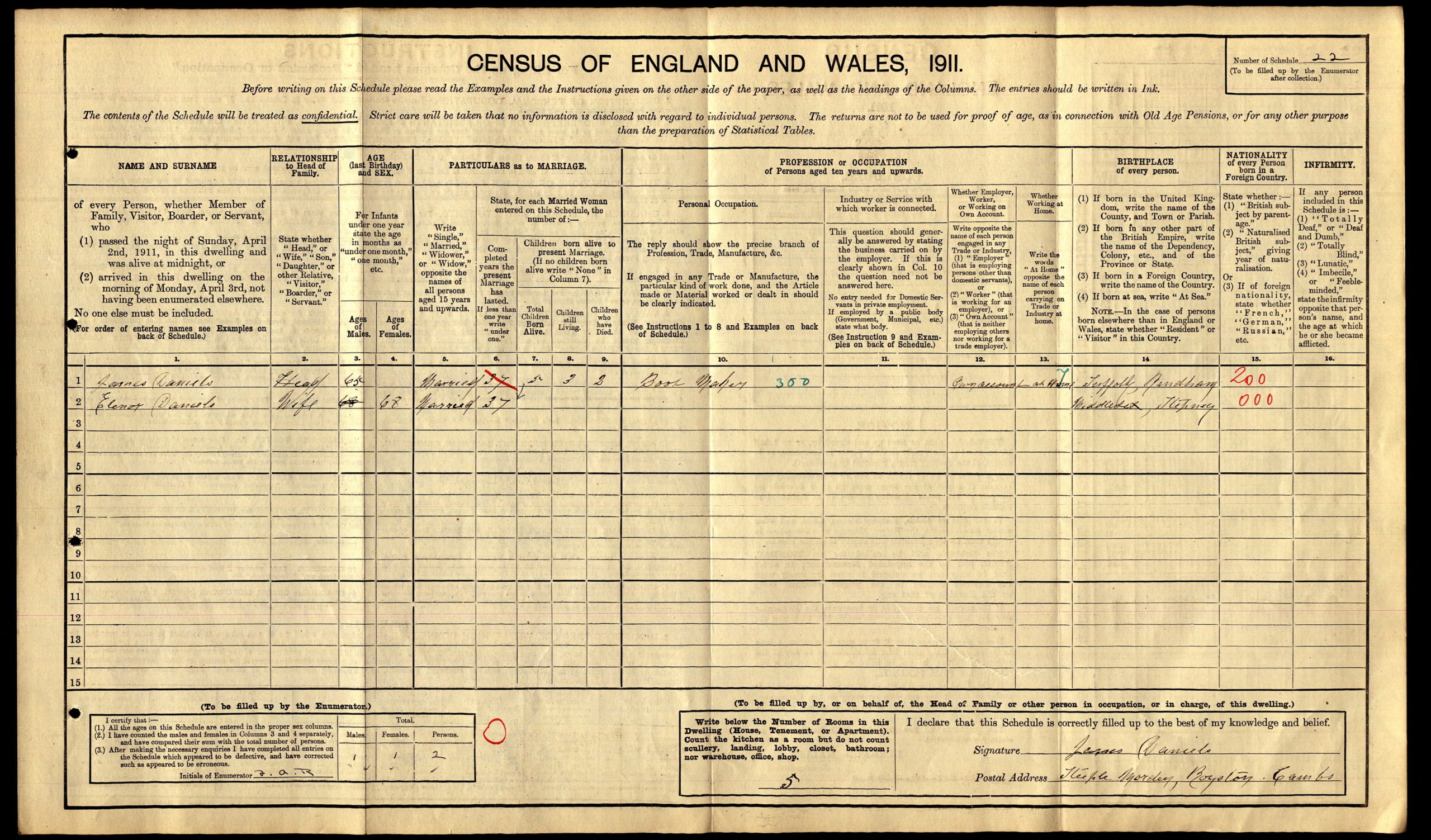
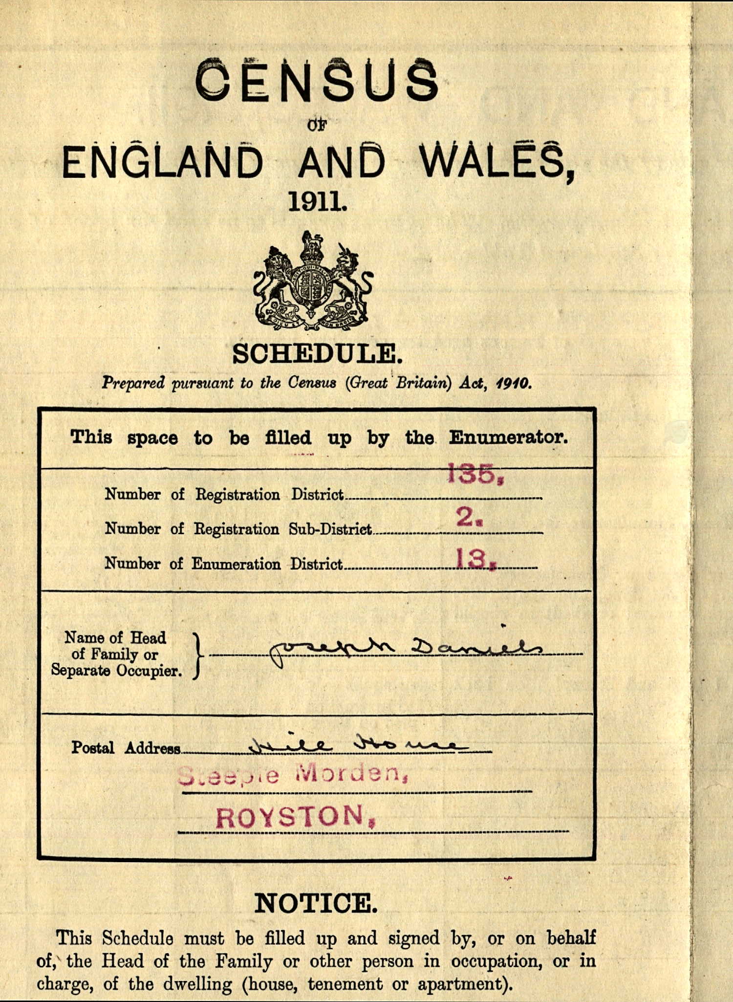
| 1908-1923 | James Daniels | Owner occupier |
| 1923-1948 | Herbert J Daniels | Son |
| 1948-1949 | Emily Daniels | Sister |
| 1950-1960 | Josef & Margrit Ehlert | Tenants? |
| 1961-1965 | Harold G Lucas & Mabel M Lucas | Ashcroft House |
| 1966-1968 | Mabel M Lucas | |
| 1968-1982 | Kenneth P Birrell & Maureen E Birrell | |
| 1983 | Clifford M Young & Patricia K Whitrow | |
| 1983-1987 | James B Smith & Betty Creighton-Smith | |
| 1988-1989 | ?????? | |
| 1990-1991 | Joan O Tidy | |
| 1992-1997 | Anthony B S Tidy & Joan O Tidy | |
| 1998-1999 | Mark Gould & Maria C Gould | |
| 2000-2004 | ?????? | |
| 2004-2011 | Stephen R Self & Jane A Bunton | Bought 6 Apr 2004 |
| 2011-Today | Richard John Willey and Susan Dorothy Willey | Bought 11 Nov 2011 |
Tenants and Occupiers
| Dates | Occupiers | Notes |
| 1720-1839 | Unknown | |
| 1830-1845? | John Saunderson | |
| 1845?-1851 | Thomas Rule & Stephen Pearce | |
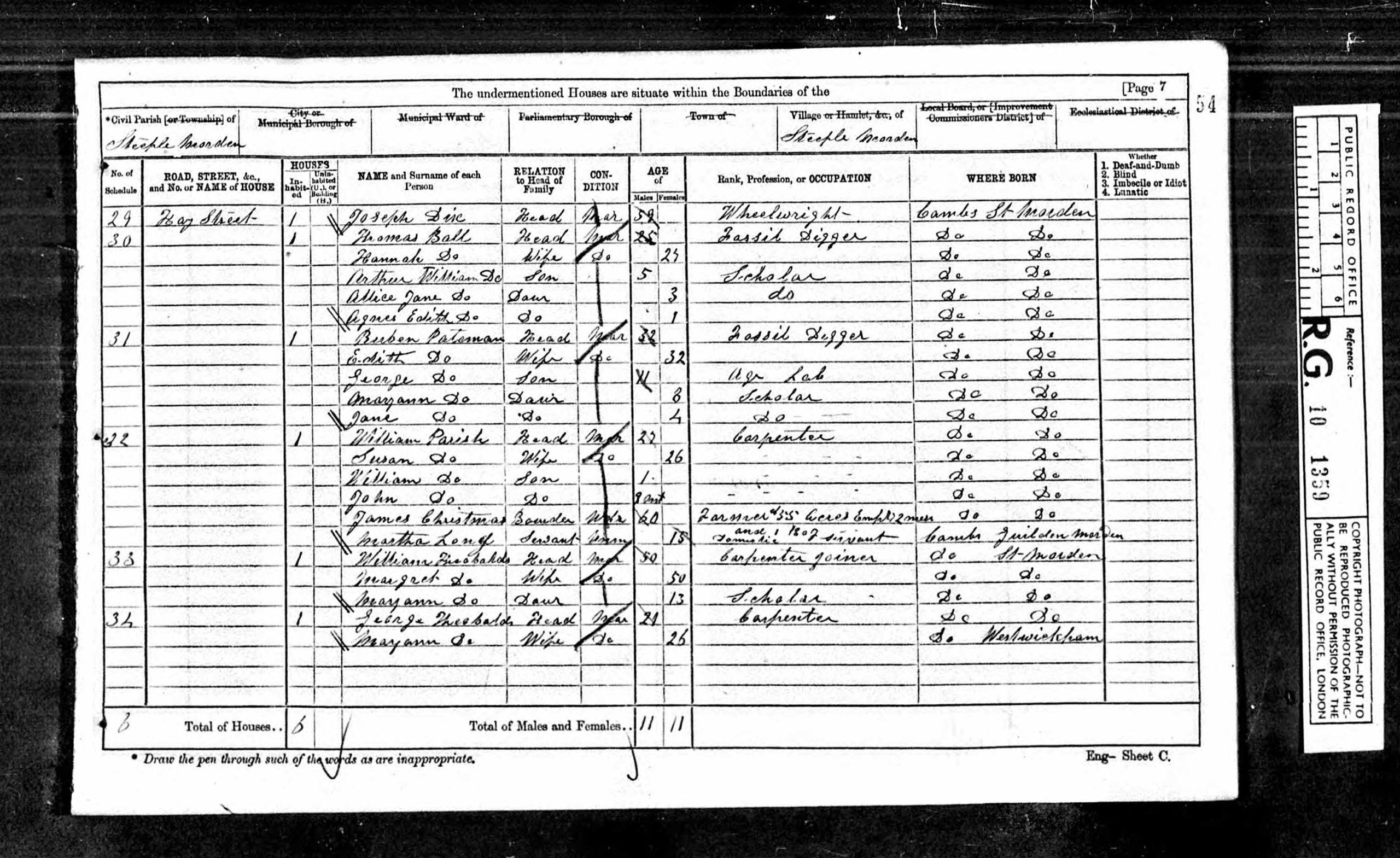
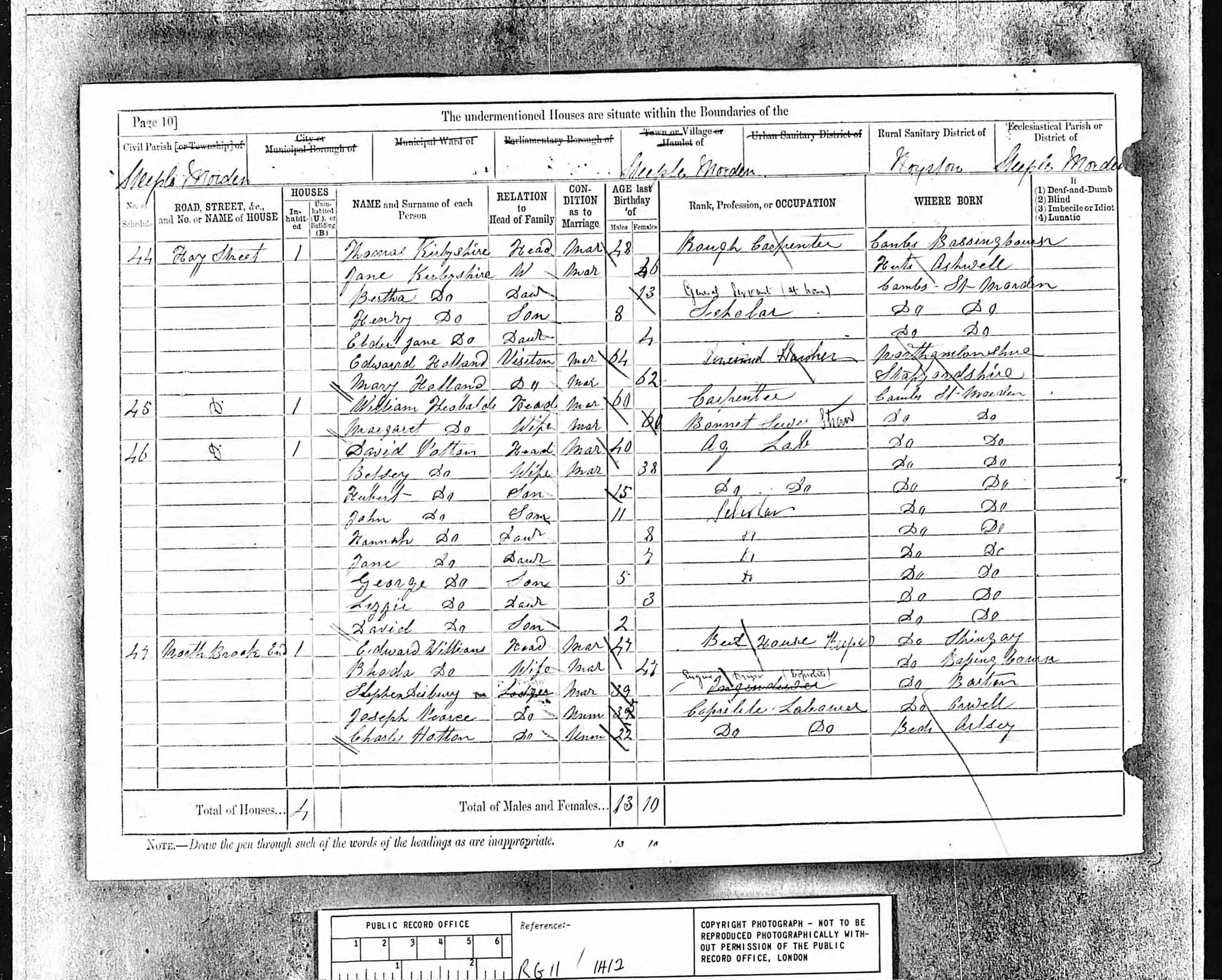
| 1861 | William Theobalds, Benjamin Dellar & William Pearce | |
| 1867-1871 | William Theobalds & George Theobalds | |
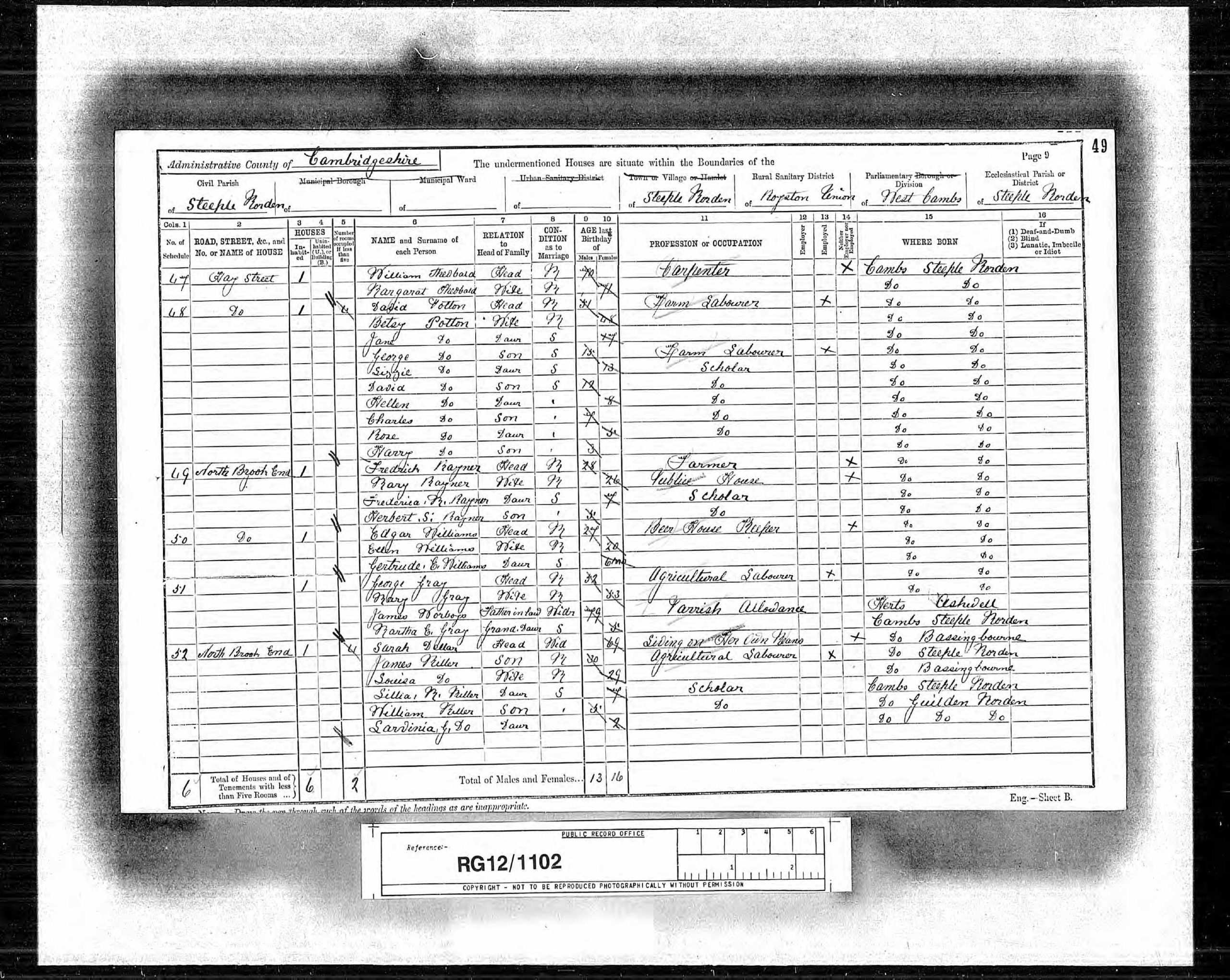
| 1881-1891 | William Theobalds & David Potton | |
| 1892 | Mrs Theobalds & David Potton | |
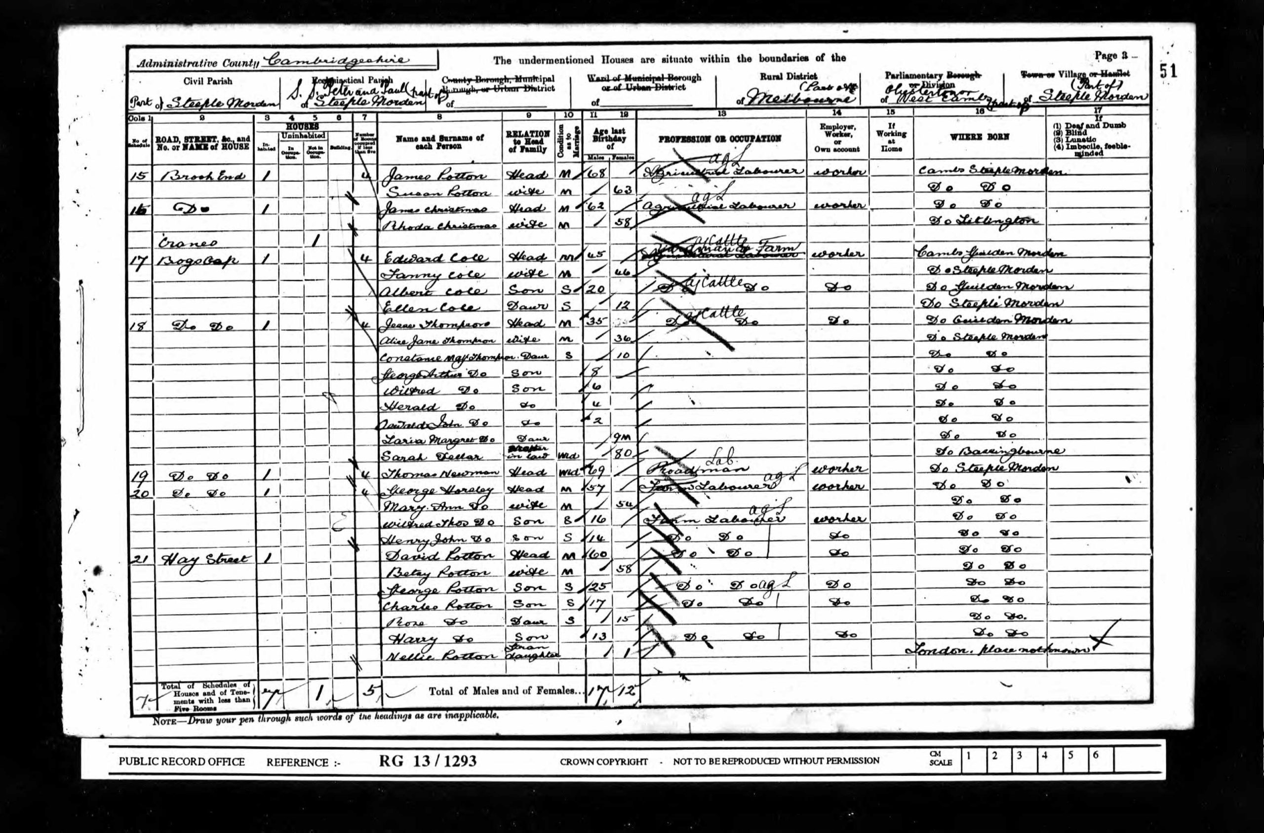
| 1893-1901 | David Potton | Sub-tenant? |
| 1893 | Benjamin South | Tenant? |
| 1894-1896 | ——- Humphrey | Tenant? |
| 1897-1898 | J W Wilson | |
| 1899-1901 | Charles Hammond | Tenant? |
| 1901-1903 | —- Wright | |
| 1903-1908 | James Daniels | |
| 1908 | James Daniels | Owner occupier |
The sequence of occupiers has some uncertainties. Benjamin South lived elsewhere, as did Charles Hammond (on The Green), so perhaps they were the prime tenant and sub-let to others?
Click on any image below to view. Click again to enlarge. Drag to view entire image.
Photographs & Newspapers
Maps
Census Schedules
Last Updated on July 21, 2025