Baldock to Royston Turnpike Trust
Background
Turnpike Trusts were established to take over road maintenance from local parishes, which could no longer handle the wear and tear of increasing traffic on the more major highways. Each Trust controlled a designated length of highway and users were charged tolls, with the revenues generated applied to maintain and improve road surfaces, build bridges and install milestones to mark distances.
At strategic points the Trusts installed turnpikes or toll gates, which blocked passage until a traveller paid a toll. The toll amount varied depending on the type of traveller:- pedestrian, horseback, carriage, cart etc. Usually a toll cottage or house would be built adjoining the toll gate to accommodate the toll collector, who would manage the barrier 24 hours a day.
Smaller gates known as bars were erected on some connecting minor roads, to prevent users from using local roads to avoid the main toll gates. Travellers going through a bar would pay a toll in similar manner to passing a gate.
The first turnpike in England was established by the Road Repair (Hertfordshire, Cambridgeshire and Huntingdonshire) Act 1663 covering a section of the Great North Road. The number of turnpike roads increased in the early 18th century and there was substantial growth between 1750 to 1775; a period of “turnpike mania”.
Steeple Morden and Turnpike
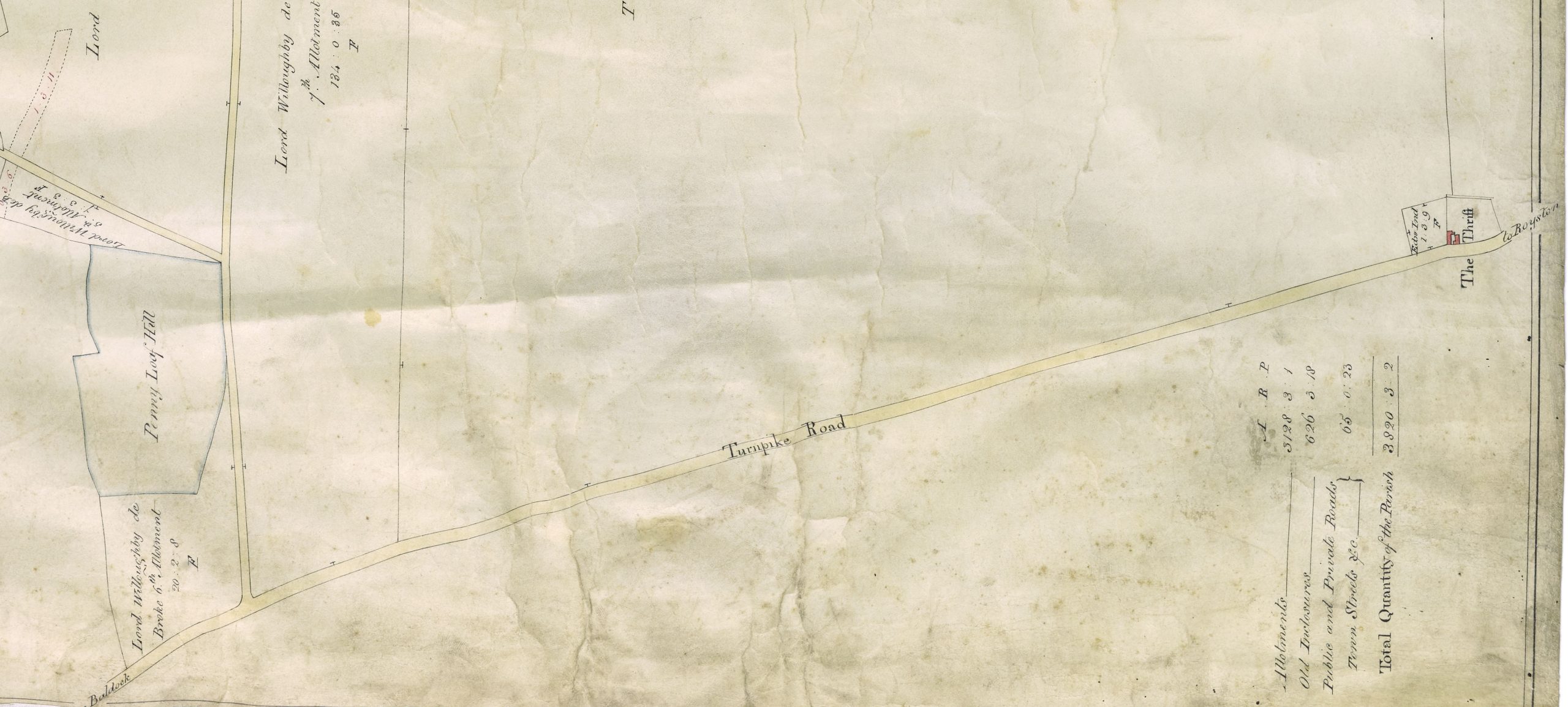
Steeple Morden had direct contact with only one turnpike road, which ran along its southern boundary and was part of the ancient highway known as the Icknield Way, a major east- west route. In 1769 the Stevenage and Biggleswade Turnpike Trust sought to take over, in conjunction with the Hitchin and Bedford Turnpike, a large part of the Icknield Way, but a separate Trust was established in that year to administer that road in two districts, from Tring to Baldock and from there via Royston to Bourn Bridge and though the trustees of the Stevenage and Biggleswade Turnpike were individually appointed to the new body it was legally and administratively distinct. The new Trust was established in 1769 by “An Act for repairing the Roads leading from the Turnpike Road in Tring… through Dunstable, Hitchin, Baldock and Royston, to the Turnpike Road at or near Bourn Bridge… “ (9 Geo. 3 . c . 69). Bourn Bridge was in the parish of Little Abington, Cambridgeshire and carried the Icknield way over the River Granta, also known as the Bourn(e).
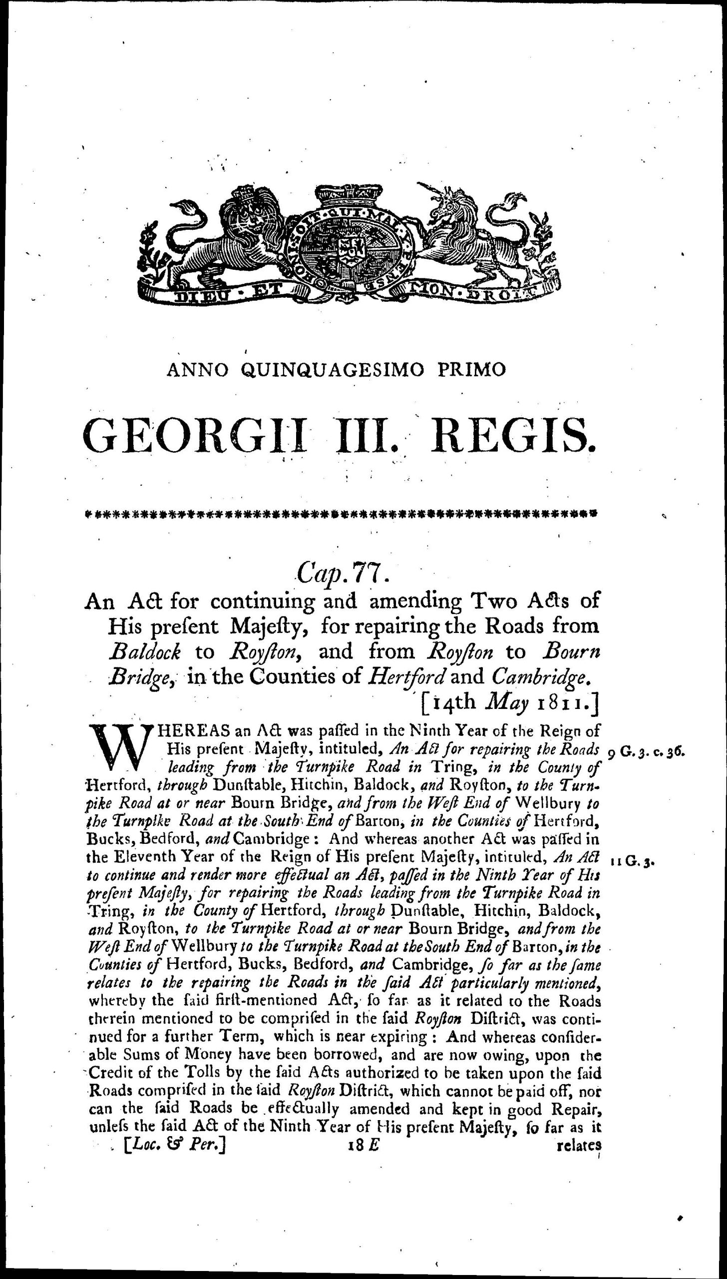
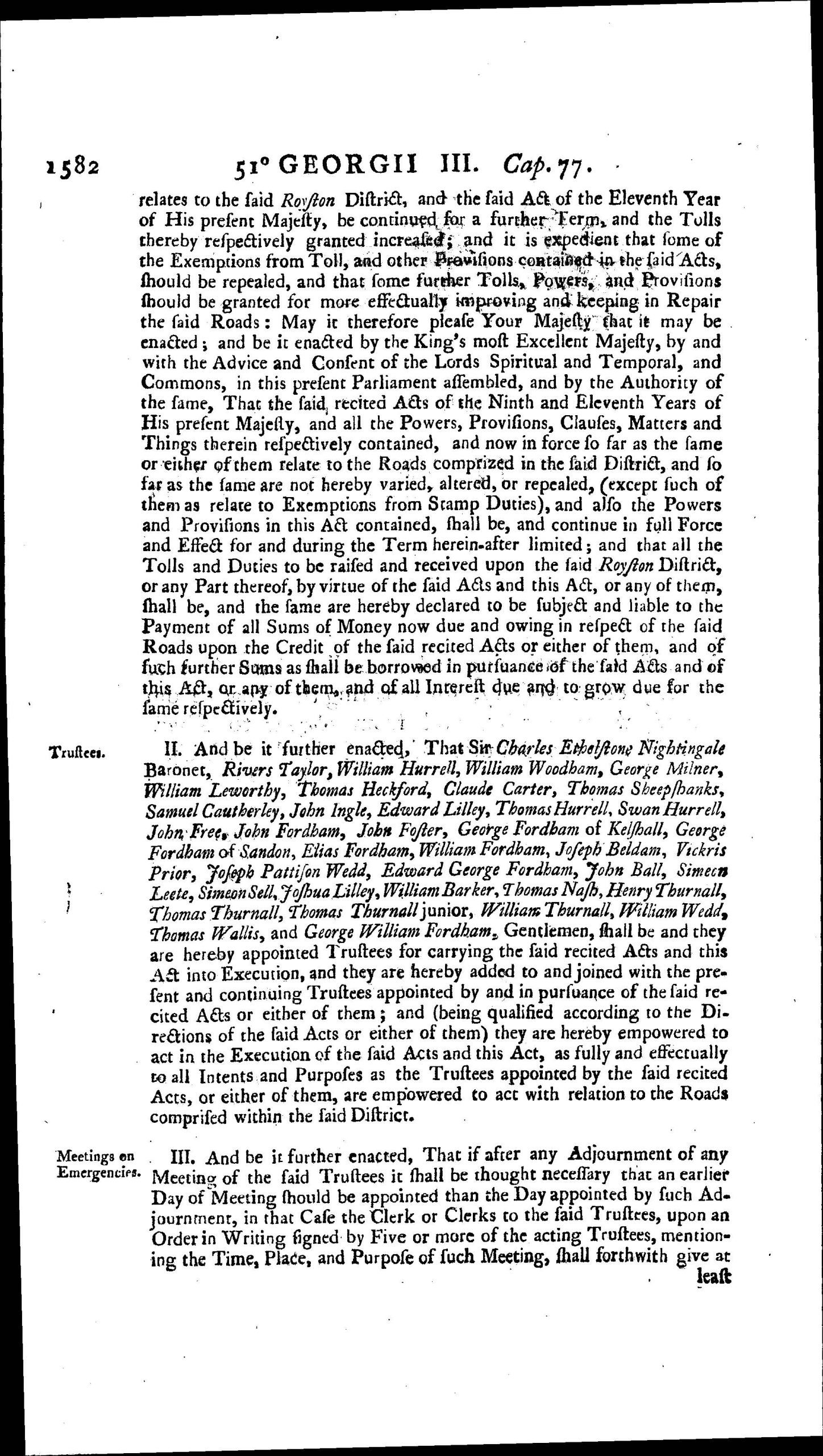
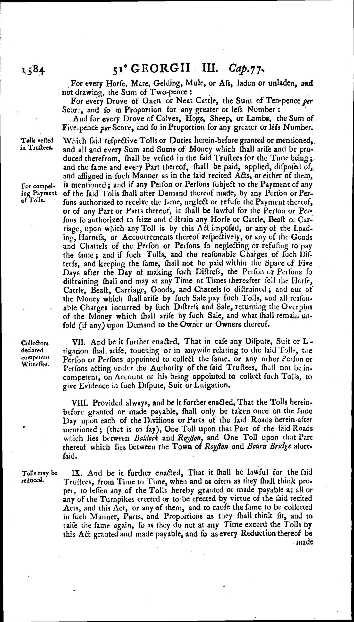
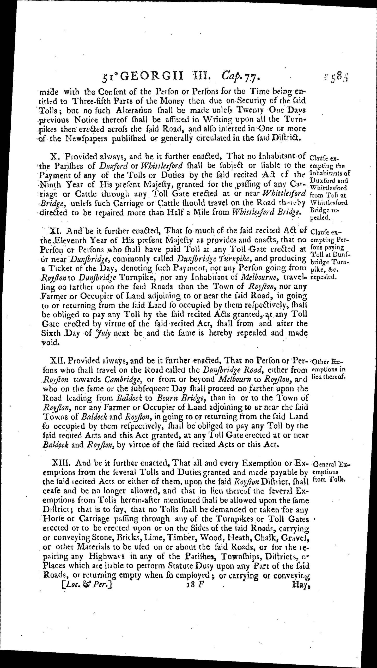
In 1790 it was decided that the Tring to Baldock stretch was not economic and this was returned to parish responsibility, leaving the Baldock, Royston and Bourn Bridge section to continue operating. A continuation Act “Baldock, Royston and Bourn Bridge Act (51 Geo. 3 c. 77) was passed 1811. There was a further similar Act in 1833 3 & 4 Wm IV . c. lx.
Competition from the railways reduced toll income and led to the winding up of Turnpike Trusts. The Baldock, Royston and Bourn Bridge Trust was wound up on 1 November 1874 and responsibility for maintenance and repair passed to the local highway authority. Today the road is the dual carriageway A505 and responsibility of the Hertfordshire County Council, although geographically much of it still lies in Cambridgeshire.
Local Operation of Turnpike
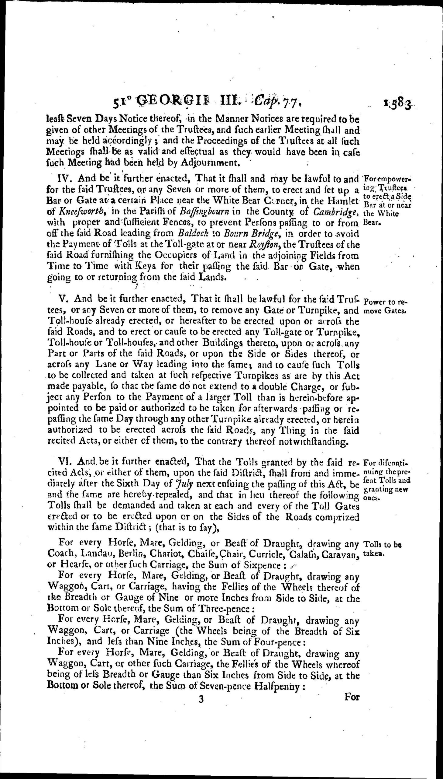
The two main toll gates were located on the eastern edge of Baldock and on the western edge of Royston (believed to have been on Baldock Road). These operated throughout the life of the Trust and one toll was payable on passing a gate for use of part or whole of the road between Baldock and Royston. In the 1811 Act the tolls set out (in summary) were:
Horse & Carriage 6d
Horse & Cart 3d
Horse & large Cart 4d
Horse & extra large Cart 7½d
Horse 2d
Cattle 10d per score
Pigs & Sheep 5d per score
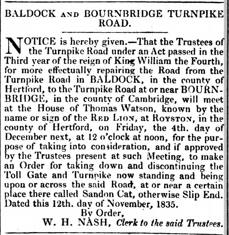
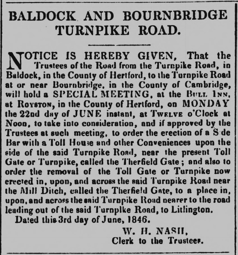
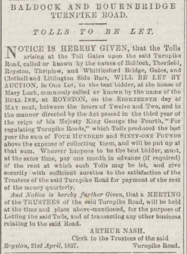
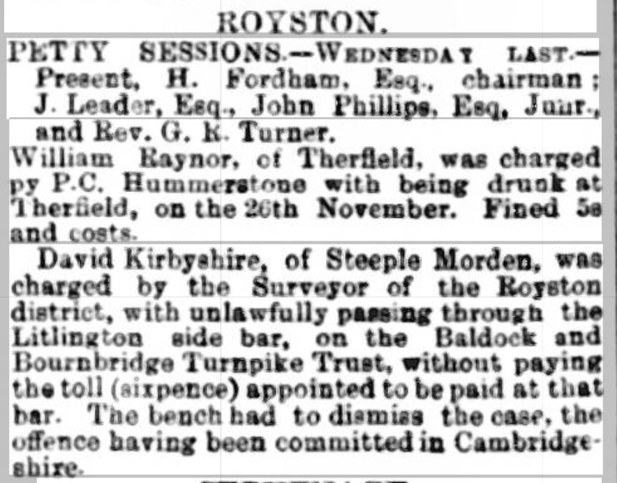
From newspaper reports and advertisements the following gates and bars are mentioned in the years noted below. Gates were being moved and new ones erected in the period 1830 to 1860? There were toll bars on the Clothall road (1811, 1839, 1840). Litlington road (1857, 1866, 1869, 1870). Sandon Cat or Slip End Gate (1835, 1846). Therfield Gate (1846, 1857).
Steeple Morden Toll Bar
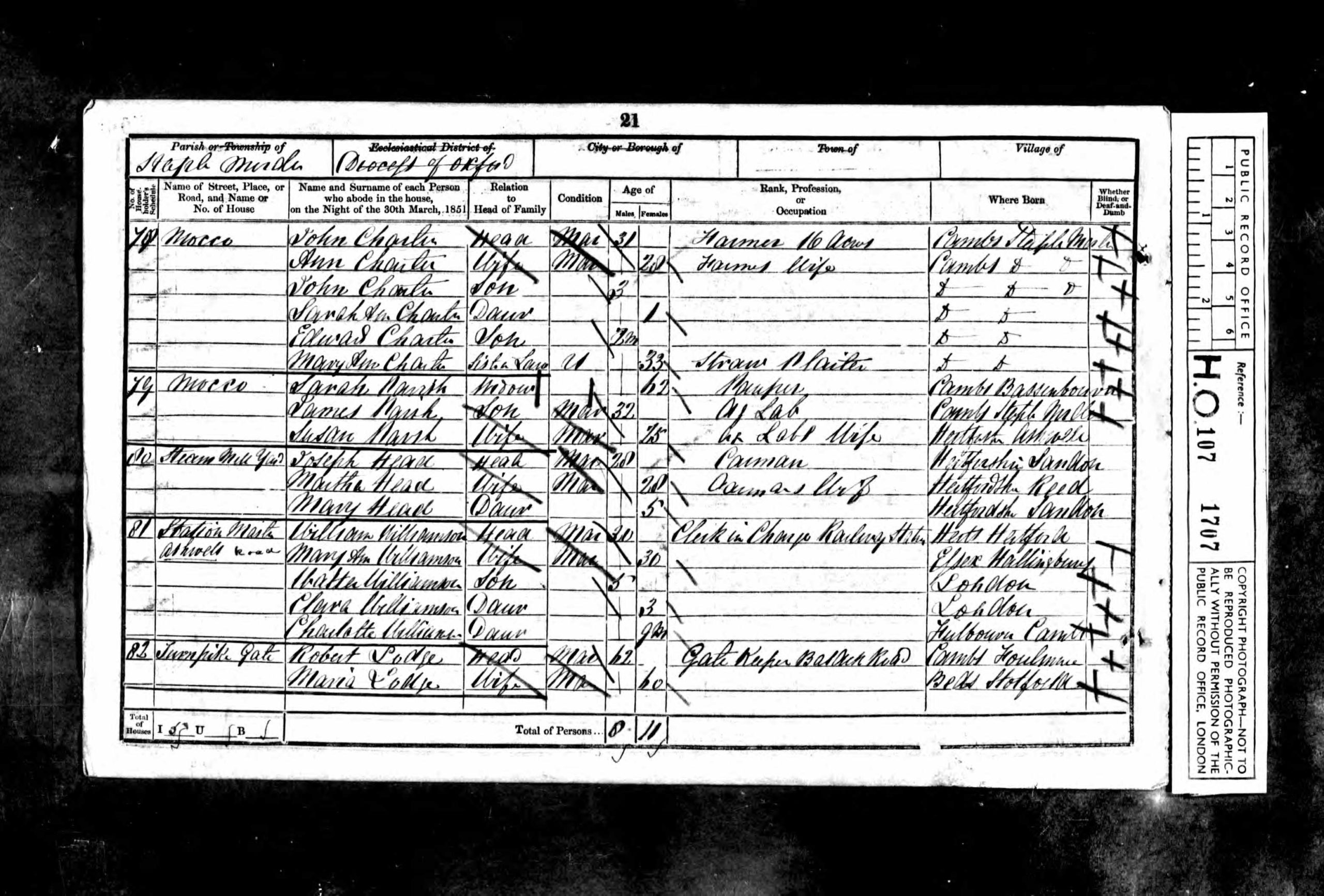
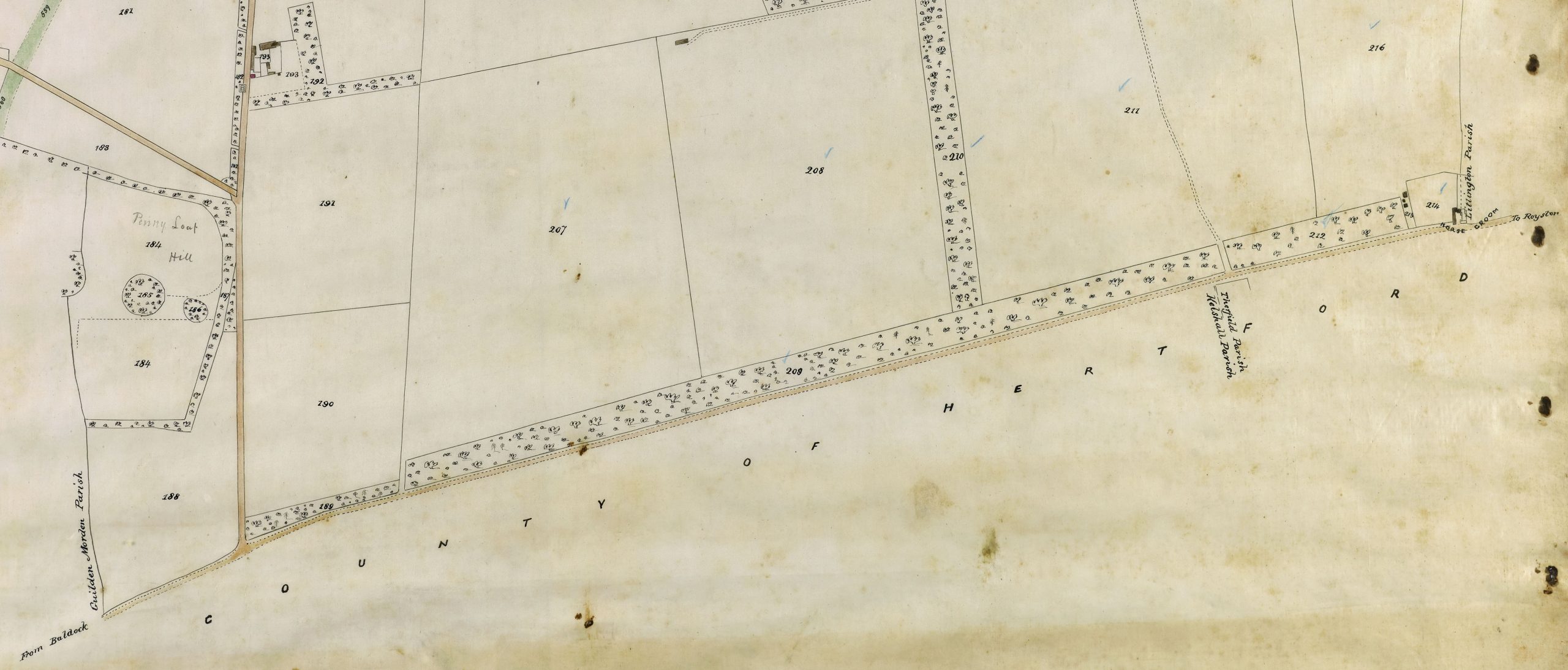
There was another gate or bar in Steeple Morden parish, of which the only mentions found are in the Steeple Morden Census schedules for 1851, 1861 and 1871. The 1841 Census does not mention a Toll Collector. Two cottages at Thrift are listed, although Thrift PH is included in the returns for Litlington. Morden Heath is included quite separately from Thrift. There is no railway.
In 1851 the Thrift PH is again included in Litlington parish returns and there is no mention of Thrift Farm or cottages. The schedule sequence goes from Station Master’s House to Turnpike Gate to Morden Heath and onto Gatley. The actual entry is Turnpike Gate Robert Lodge head mar 62 Gate Keeper Baldock Road born Foulmere, Cambs, with wife Maria Lodge mar 60 born Stotfold, Beds.
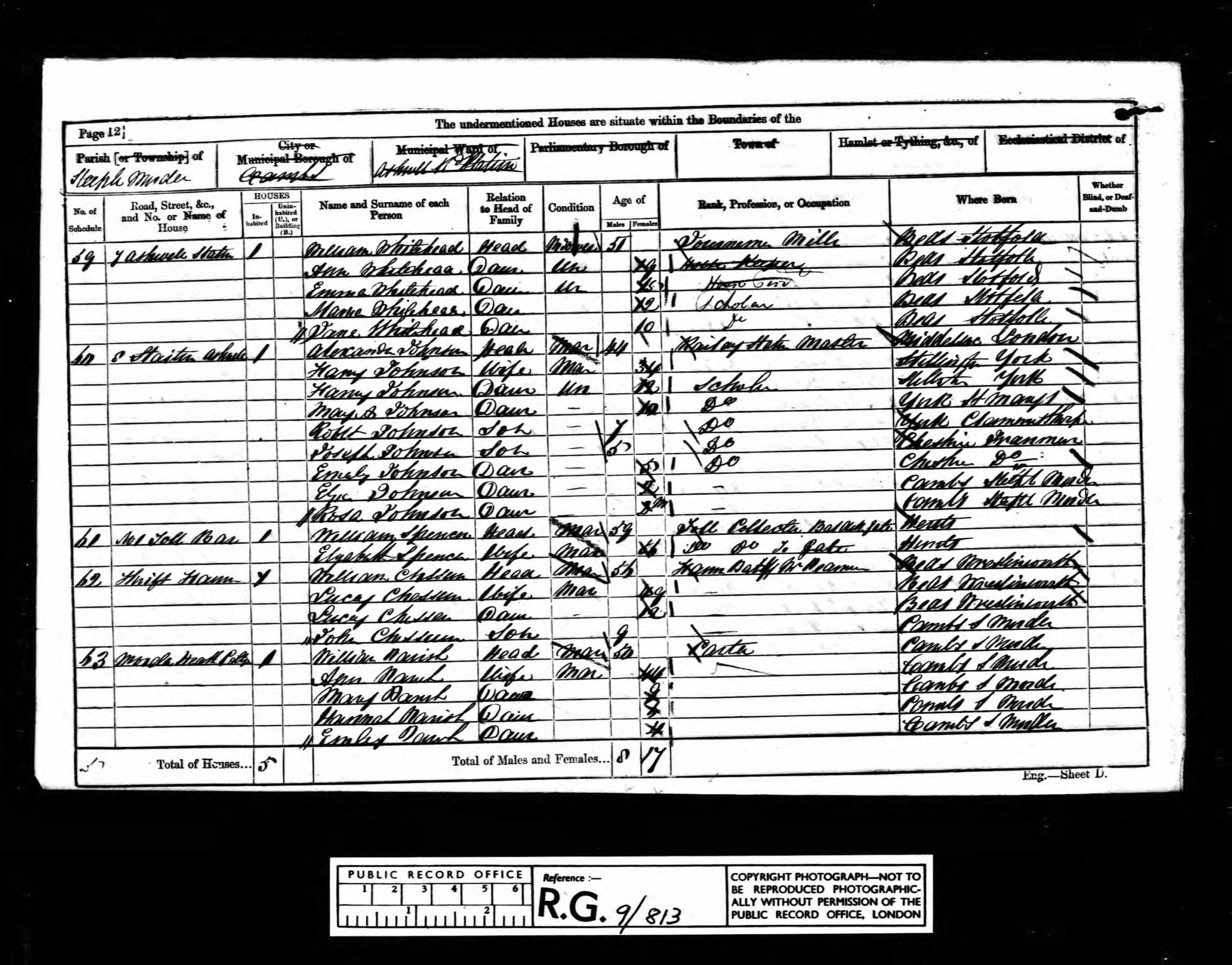
In 1861 the schedule goes from Ashwell Station to The Toll Bar to Thrift Farm to Morden Heath. The entry itself is Toll Bar William Spencer head mar 59 Toll Collector Baldock Gate born Herts and Elizabet Spencer wife mar 66 Toll Collector Baldock Gate born Hunts.
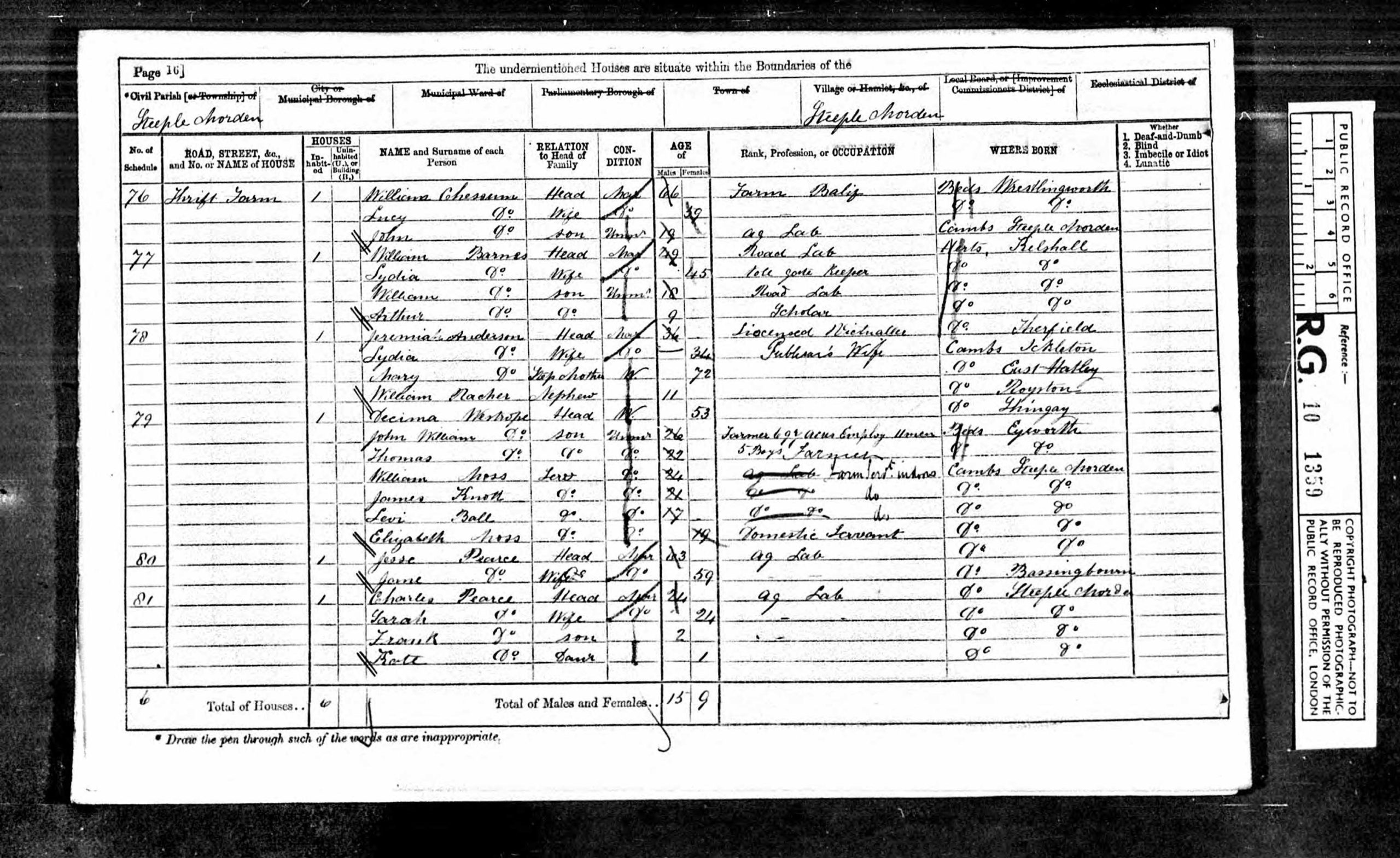
In 1871 the schedule goes from Ashwell Station to Thrift Farm to Toll Gate to Thrift PH to Morden Heath. The entry itself is [no place name] William Barnes head mar 49 Road Lab, born Kelshall, Herts., Lydia Barnes wife mar 45 Toll Gate Keeper, born Kelshall, Herts., plus two children.
In 1881 there is no mention of Toll Gate as the Turnpike Trust had been wound up in 1874.
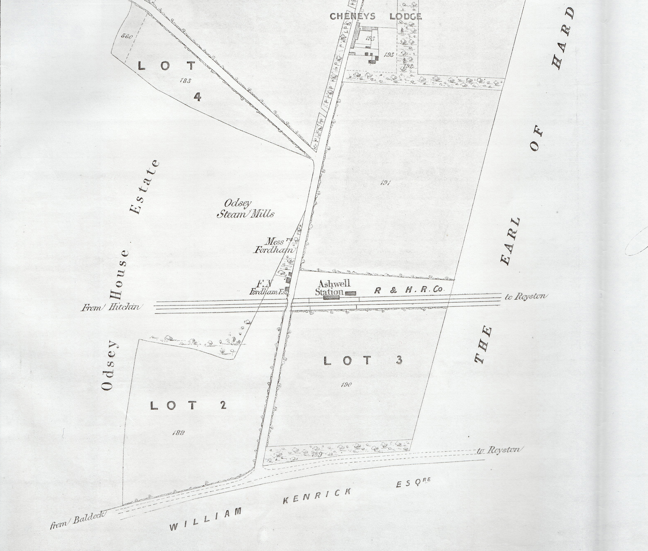
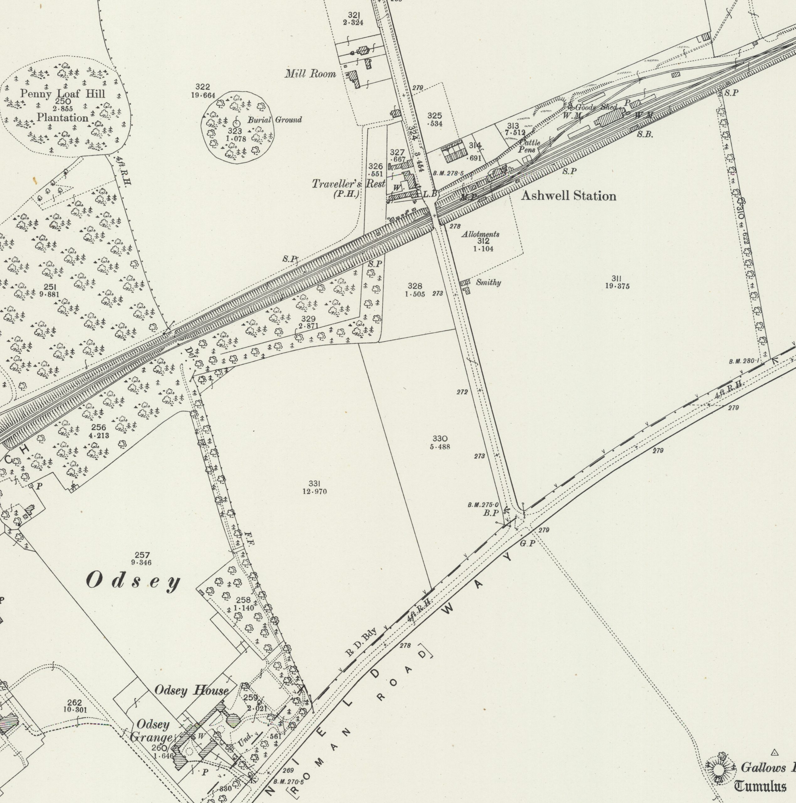
The Enclosure Map 1817 and Tithe Apportionment Map 1839 do not show a toll gate and nor does the Cheney Estate sale particulars 1859, which include a detailed map. The Cheyney Estate included that part of Odsey adjoining the Turnpike road.
Location of Steeple Morden Toll Bar
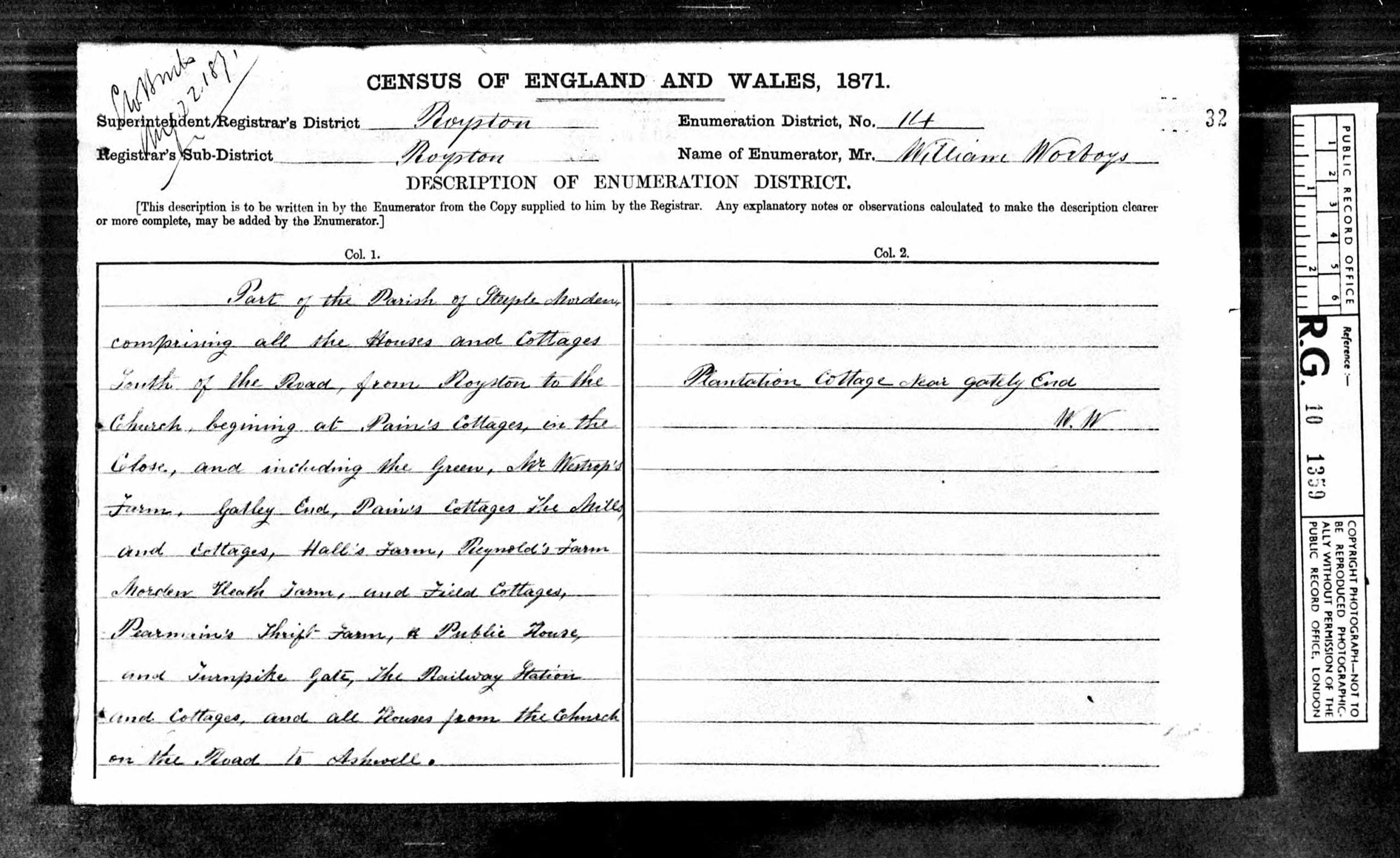
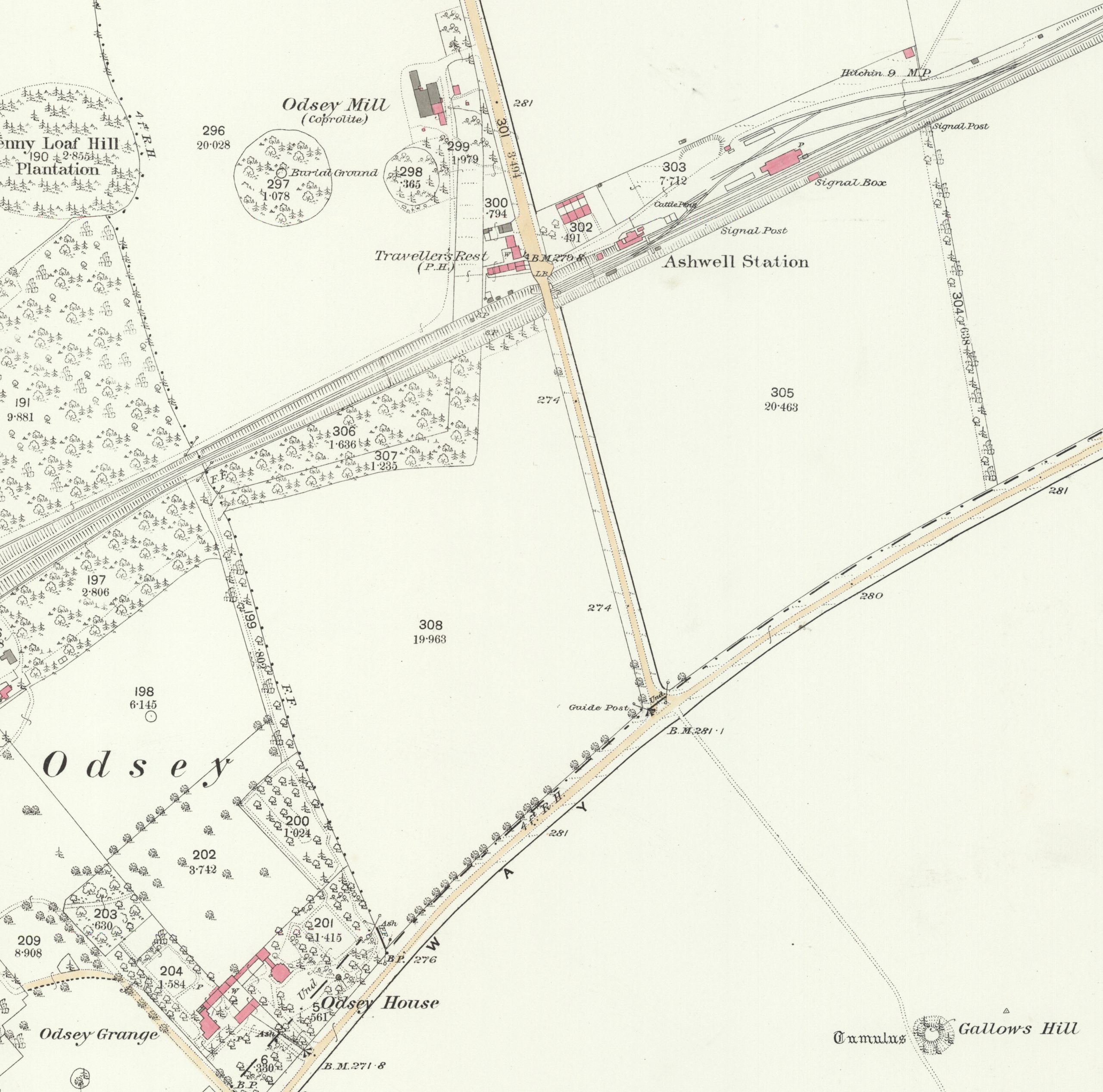
The location remains uncertain, although the 1851 and 1861 returns imply it was at Odsey, on the road from the railway station to the Turnpike. The 1871 return is more ambiguous and could imply that it was located adjoining the Thrift PH, but that seems unlikely as Steeple Morden was a side bar and would not be on the Turnpike itself? Rather it is likely the schedule listing is out of sequence, as by contrast the introductory page description of the area covered reads Morden Heath and Field Cottages, Pearman’s Thrift Farm & Public House and Turnpike Gate, The Railway Station and that better matches the expected sequence.
Based on the census data the most likely location is on the “Baldock road” between Ashwell Station and the Turnpike, although the exact spot has not been identified. The 25 inch OS map 1903 edition has a smithy marked along that stretch of road. Was that a conversion of the toll cottage? It is an isolated spot and no history identifying the origins of the smithy has been found.
As the earliest mention found is 1851, one wonders if the Steeple Morden Toll bar was erected after the railway was opened in 1850 to catch traffic heading to and from the new station, leaving and joining the Turnpike? There is a similar pattern with Litlington, with no mention of a Toll Gate in 1841 Census, but subsequent mentions in 1851, 1861 and 1871 census returns. No other mention has been found of either a Litlington or Steeple Morden gate prior to 1851, so erection after the arrival of the railway seems most likely.
Click on any image below to view. Click again to enlarge. Drag to view entire image.
Newspaper Reports and Census
Maps
Baldock Royston and Bourn Bridge Roads Act 1811
Last Updated on April 28, 2026