Home Farm
Summary
Home Farm was a small farmstead in Cheyney Street. The farmhouse is today detached from its land and is 10 Cheyney Street and known as Home Farmhouse or Home Farm.
As a farmstead the associated land extended to 88 acres and after Enclosure in 1816 the land lay in two blocks. One was accessed from Station Road and ran down to Ashwell Road. The other began at Ashwell Street and ran southwards on the east side of Odsey Way [Station Road], as far as the access road to what is now Omya.
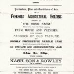
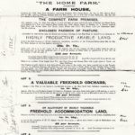
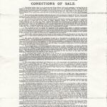
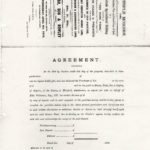
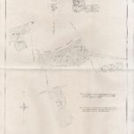
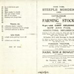
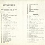
At a auction sale in 1919, Home Farm was sold split into two lots and as a result the Odsey Way land fell away having been bought by the Cambridgeshire County Council. The farm sale by the Executors of William Franklin deceased, held in in 1922 marked the end of Home Farm as a farming entity.
Today the Station Road/Ashwell Road land is owned and farmed by Wallington Farms. Previously, it was part of the Pepper/Clayton farming enterprise. In the recent past houses have been built on the Ashwell Road frontage. The Odsey Way land is now folded into Gatley End Farm
Owners
From at least 1791 Home Farm was owned by the Walbey family of Barley, Reed and nearby villages. It is not certain when they acquired it, although in the Enclosure Award the owners are stated as Samuel Walbey and his wife Eleanor, which suggests by the standards of the day that Eleanor had had a key role in bringing this property into the Walbey milieu. She was born a Foster and married Samuel Walbey at Royston 6 September 1776. Although no firm evidence has been found of her prior ownership of Home Farm, it seems likely, which would suggest it came into the hands of the Walbey family in 1776?
Eleanor died before Samuel, who died 1825, leaving his Morden estate to his son Samuel, who in turn appears to have left it to his son Samuel, who died in 1880. The property then descended by marriage through the Wilkersons and Wilkinsons of Barley and elsewhere, until Ellis Wilkerson in 1919 sold Home Farm, plus some other land and Cheyney Willows cottage, which had been acquired along the way. William Franklin bought the house and land in Cheyney Street and the Station Road/Ashwell Road field. He died 1922 and his widow Beatrice continued as owner until she died in 1943. She left everything to her brother Robert Rule, who lived at Home Farm for a while.
Occupiers and Tenants
| Period | Persons | Notes and Sources |
| 1839 | Samuel Walbey | Owner & occupier in 1839 Tithe Apportionment |
| 1841 | Unoccupied ? | Census 1841 |
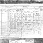
| 1851-1861 | James Bennet | Census 1851 and 1861 |
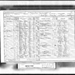
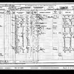
| 1869-1898 | George Duke | Census 1871, 1881 and 1891 |
| 1898-1904 | Herbert Duke | Census 1901 |
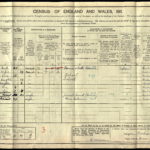
| 1911-1919 | Bertram Parrish | Census 1911, Sale 1919 |
| 1919-1922 | William Franklin | Purchaser at Sale 1919 |
| 1922-1943 | Beatrice Franklin | Widow of William |
| 1943- | Robert Rule | Brother and heir of Beatrice Franklin |
James Bennet (apparently he preferred one t) is recorded as farmer 30 acres 1 lab in 1851 and farmer 30 acres 2 men and 1 boy in 1861. It would seem he was only tenanting and farming the Station Road/Ashwell Road land. George Duke was farmer 86 acres 3 men and 1 boy in 1871, so farming both blocks of land, and by 1881 he was farmer 300 acres 10 men and 5 boys – he had taken additionally the tenancy of St John’s College farm in Brook End, but remained living at Home Farm. In 1891 he was farmer and cattle dealer. Acreage and labourers employed are not given in later Census returns, although Herbert Duke styled himself farmer and Bertram Parrish as farmer and cattle salesman.
The Farmhouse
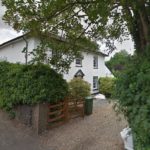
The farmhouse and small farmstead were in Cheyney Street in the centre of the village. The house stands today and is 10 Cheyney Street, known as Home Farmhouse or Home Farm. The farm yard and old barns no longer exist.
Listed Building
Listing details: Grade II since 4 September 1986
House. Early to mid C19. Possibly timber-framed with roughcast render. Slated hipped roof. Two gault brick stacks with octagonal shafts. Brick plinth. Two storeys with outshut to right hand of painted brick with pantiled roof. Central pedimented wooden doorcase and six-panelled door. Two ground floor sixteen-paned hung sash windows and three similar first floor windows.
The Farm Land
Historically, the land was in strips scattered across the various open fields and there were also grazing rights known as rights of sheep walk and common. As the result of Enclosure the owners of Home Farm found themselves with two large areas of land. One new field, shaped like an upside down L had access from Odsey Way [Station Road] and swung down as far as Ashwell Road. The other block ran, southward from Ashwell Street, alongside Odsey Way. These are the four allotments to Samuel Walbey and Eleanor his wife.
| Reason for Allotment | Location | Tenure | Extent |
| In lieu of freehold open field lands | In Church Field | Freehold | 12a 2r 0p |
| In lieu of freehold open field lands | Lying at Ashwell Street | Freehold | 9a 0r 20p |
| In lieu of copyhold open field lands and rights of sheepwalk and common | In Church Field | Copyhold of Cheyneys | 15a 1r 36p |
| In lieu of copyhold open field lands and rights of sheepwalk and common | In High Field | Copyhold of Steeple Morden | 48a 2r 15p |
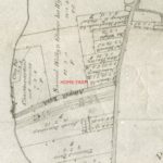
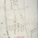
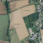
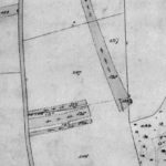
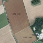
These four allotments may be seen on the two extracts below from the Enclosure Map 1816, with each labelled Home Farm in red.
When it came to the Tithe Apportionment in 1839 Samuel Walbey is listed as both owner and occupier, although no evidence has been found that the Walbeys ever lived in Steeple Morden. Perhaps the farm was in hand and managed by a resident bailiff? This is the record of the Walbey lands in the Tithe Apportionment:
| Plot No | Description | Use | Extent |
| 9 | House and Homestead etc | 0a 3r 12p | |
| 10 | Orchard | 0a 1r 38p | |
| 35 | Allotment | Arable | 27a 3r 30p |
| 196 | Allotment | Arable | 20a 3r 22p |
| 197 | Allotment | Arable | 14a 2r 29p |
| 198 | Allotment | Arable | 18a 1r 35p |
| Total | 83a 1r 6p | ||
| Plus | Non-tithable land | 4a 3r 5p | |
| Total | 88a 0r 11p |
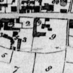
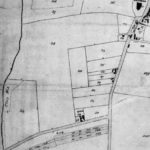
Each of these plots can be identified on the Tithe Maps extracts shown below, using the Plot Nos. The modern aerial views tie in as well and the Home Farm lands have been labelled to help with identification.
PAGE IN PREPARATION
Click on any image below to view. Click again to enlarge. Drag to view entire image.
Maps, Photographs and Sale Particulars
Census
Last Updated on October 27, 2024

